|
Apolima
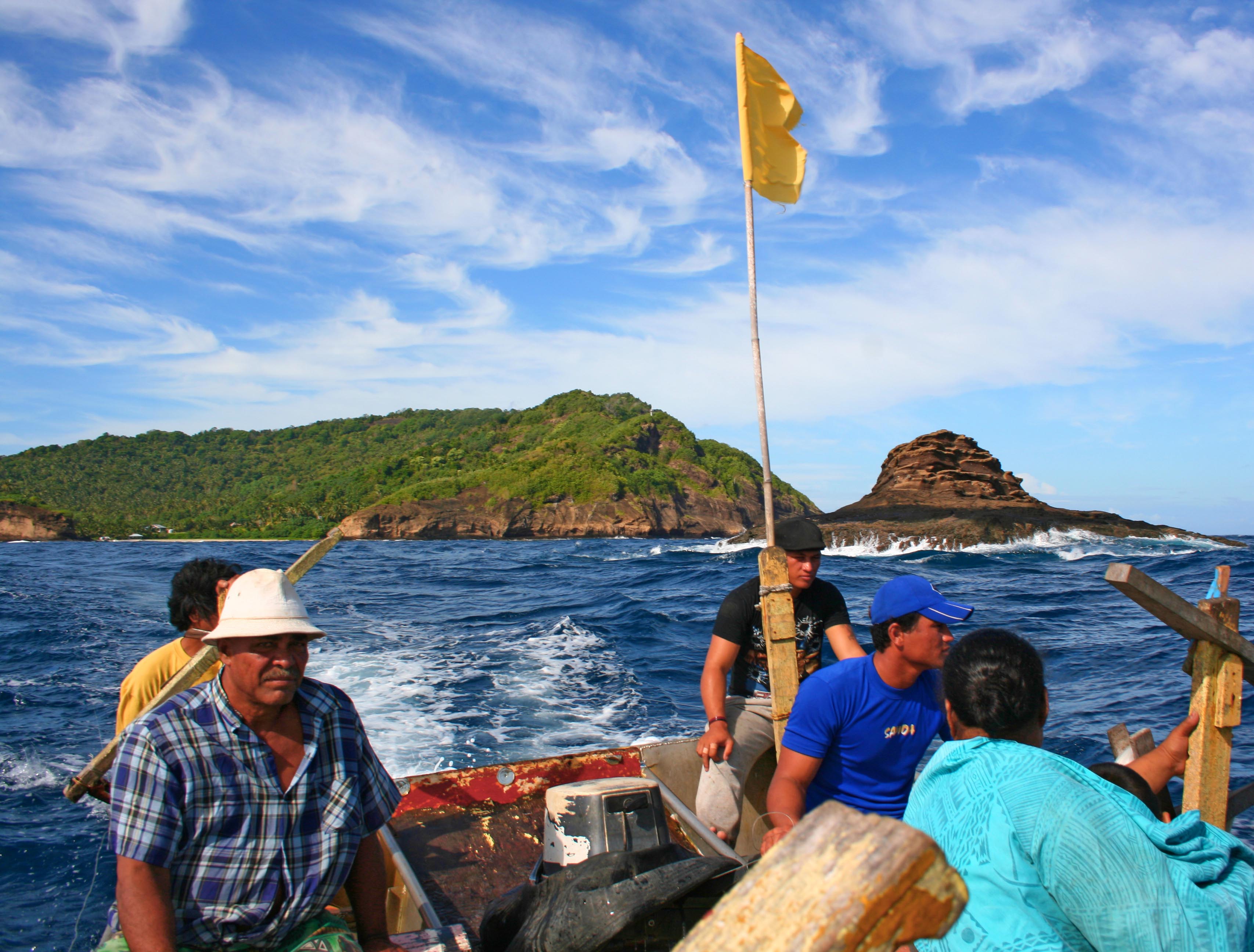
Apolima is the smallest of the four inhabited islands of Samoa, in central South Pacific Ocean. It lies in the Apolima Strait, between the country's two largest islands: Upolu to the east, and Savai'i to the west. The island has one village settlement, Apolima Tai, with a population of 96. The small settlement is situated in the interior's flat plateau, on the northern side. Apolima is the rim of an extinct volcanic crater with a maximum height of 165 m. Its area is slightly less than one square kilometer. The only access to the island is by boat. The tiny island lies northwest off the westernmost edge of Upolu Island's fringing reef and southwest of the island of Savai'i. The island's shape is like an upturned bowl surrounded by steep cliffs. There is a broad opening to the sea on the northern side, which is the main entry point. Entry is only by boat. There are two neighbouring islands in the strait, Manono Island, which has a small population, and the smaller, uninhab ... [...More Info...] [...Related Items...] OR: [Wikipedia] [Google] [Baidu] |
Apolima Strait
The Apolima Strait is about 13 km wide and separates the two largest islands of Samoa: Savai'i to the northwest, and Upolu to the southeast. Three small islands lie in the strait. Two of them, Manono and Apolima, have small village settlements. Manono is about 3 miles off the west coast of Upolu. Apolima lies near the middle of the strait. The third, Nu'ulopa is a tiny, uninhabited, rocky outcrop with palm trees, which is surrounded by a natural turtle habitat islet. The main means of transportation between the two larger islands - passenger and vehicle ferries operated by the Samoa government - run through the strait between Mulifanua wharf on Upolu and Salelologa wharf on Savai'i. The ferry crossing takes about 90 minutes. Gallery File:ISS012-E-23610 NASA Savai'i and Upolu.jpg, Apolima Strait with Savai'i (top) and the tip of Upolu below. File:ApolimafromFerry.jpg, Apolima island. File:Nu'ulopa island - Samoa.jpg, Heading by boat towards uninhabited Nu'ulopa ... [...More Info...] [...Related Items...] OR: [Wikipedia] [Google] [Baidu] |
Apolima Tai
Apolima Tai is a village on the small volcanic island of Apolima in Samoa, on the north side in the political district of Aiga-i-le-Tai. Its population is 96. Apolima island is one of three in the Apolima Strait between Samoan's two main islands, Upolu Upolu is an island in Samoa, formed by a massive basaltic shield volcano which rises from the seafloor of the western Pacific Ocean. The island is long and in area, making it the second largest of the Samoan Islands by area. With approximate ... and Savai'i. The others are Manono, which has four villages, and uninhabited Nu'ulopa. References Populated places in Aiga-i-le-Tai {{Samoa-geo-stub ... [...More Info...] [...Related Items...] OR: [Wikipedia] [Google] [Baidu] |
Manono Island
Manono is an island of Samoa, situated in the Apolima Strait between the main islands of Savai'i and Upolu, 3.4 km west-northwest off Lefatu Cape, the westernmost point of Upolu. By population, as well as by area, it is Samoa’s third largest island. There are four villages on the island with a total population of 889 (2006 Census). Electricity was only introduced in 1995 and there are several shops with beach fale accommodation for visitors. The boat trip from Upolu island takes about 20 minutes. The neighbouring islands are Apolima, which has a small village settlement and the islet Nu'ulopa. Manono Island is part of the political district Aiga-i-le-Tai. The majority of people in the Aiga-i-le-Tai district live on the 'mainland' at the west end of Upolu island. Dogs of any kind are prohibited on Manono island. Villages The four villages and their populations on Manono Island are #Apai, west (111) #Faleu, south (354) #Lepuia'i, southwest (223) #Salua, north (201) Out of ... [...More Info...] [...Related Items...] OR: [Wikipedia] [Google] [Baidu] |
Aiga-i-le-Tai
Aiga-i-le-Tai is a districts of Samoa, district of Samoa which includes the small islands of Manono Island, Manono, Apolima and tiny uninhabited Nu'ulopa lying in the Apolima Strait between the country's two main islands of Upolu and Savai'i. The district includes part of the mainland at the western end of Upolu and surrounds an exclave of A'ana district, namely Satuimalufilufi village. Historically, Manono island has been the centre of the district. In modern times, the main centre is Mulifanua where the inter-island ferry terminal is located for ocean crossings between Savai'i and Upolu. With an area of only 27 km², Aiga-i-le-Tai is the smallest electoral district in the country with a population (2016 Census) of 5,029. Va'a-o-Fonoti is the only electoral district with a smaller population. The words '''aiga i le tai'' literally means 'family by the sea' in the Samoan language. Chief titles Historically, the naval power of Manono and Apolima played a major role in polit ... [...More Info...] [...Related Items...] OR: [Wikipedia] [Google] [Baidu] |
Samoa Islands
The Samoan Islands () are an archipelago covering in the central South Pacific, forming part of Polynesia and of the wider region of Oceania. Administratively, the archipelago comprises all of the Independent State of Samoa and most of American Samoa (apart from Swains Island, which is geographically part of the Tokelau Islands). The land masses of the two Samoan jurisdictions are separated by of ocean at their closest points. The population of the Samoan Islands is approximately 250,000. The inhabitants have in common the Samoan language, a culture known as '' fa'a Samoa,'' and an indigenous form of governance called '' fa'amatai''. Samoans are one of the largest Polynesian populations in the world, and most are of exclusively Samoan ancestry. The oldest known evidence of human activity in the Samoan Islands dates to around 1050 BCE. It comes from a Lapita site at Mulifanua wharf on Upolu island. In 1768, the eastern islands were visited by the French explorer Bougain ... [...More Info...] [...Related Items...] OR: [Wikipedia] [Google] [Baidu] |
Samoa
Samoa, officially the Independent State of Samoa and known until 1997 as Western Samoa, is an island country in Polynesia, part of Oceania, in the South Pacific Ocean. It consists of two main islands (Savai'i and Upolu), two smaller, inhabited islands (Manono Island, Manono and Apolima), and several smaller, uninhabited islands, including the Aleipata Islands (Nuʻutele, Nuʻulua, Fanuatapu and Namua). Samoa is located west of American Samoa, northeast of Tonga, northeast of Fiji, east of Wallis and Futuna, southeast of Tuvalu, south of Tokelau, southwest of Hawaii, and northwest of Niue. The capital and largest city is Apia. The Lapita culture, Lapita people discovered and settled the Samoan Islands around 3,500 years ago. They developed a Samoan language and Culture of Samoa, Samoan cultural identity. Samoa is a Unitary state, unitary Parliamentary system, parliamentary democracy with 11 Districts of Samoa, administrative divisions. It is a sovereign state and a membe ... [...More Info...] [...Related Items...] OR: [Wikipedia] [Google] [Baidu] |
Pacific Ocean
The Pacific Ocean is the largest and deepest of Earth's five Borders of the oceans, oceanic divisions. It extends from the Arctic Ocean in the north to the Southern Ocean, or, depending on the definition, to Antarctica in the south, and is bounded by the continents of Asia and Australia in the west and the Americas in the east. At in area (as defined with a southern Antarctic border), the Pacific Ocean is the largest division of the World Ocean and the hydrosphere and covers approximately 46% of Earth's water surface and about 32% of the planet's total surface area, larger than its entire land area ().Pacific Ocean . ''Encyclopædia Britannica, Britannica Concise.'' 2008: Encyclopædia Britannica, Inc. The centers of both the Land and water hemispheres, water hemisphere and the Western Hemisphere, as well as the Pole of inaccessi ... [...More Info...] [...Related Items...] OR: [Wikipedia] [Google] [Baidu] |
Upolu
Upolu is an island in Samoa, formed by a massive basaltic shield volcano which rises from the seafloor of the western Pacific Ocean. The island is long and in area, making it the second largest of the Samoan Islands by area. With approximately 145,000 inhabitants, it is by far the most populous of the Samoan Islands. Upolu is situated to the southeast of Savai'i, the "big island". Apia, the capital, is in the middle of the north coast, and Faleolo International Airport at the western end of the island. The island has not had any historically recorded eruptions, although there is evidence of three lava flows, dating back only to between a few hundred and a few thousand years ago. In the Samoan branch of Polynesian mythology, Upolu was the first woman on the island. James Michener based his character Bloody Mary in ''Tales of the South Pacific'' (later a major character in the Rodgers and Hammerstein musical, '' South Pacific'') on the owner of Aggie Grey's Hotel on the so ... [...More Info...] [...Related Items...] OR: [Wikipedia] [Google] [Baidu] |
Fringing Reef
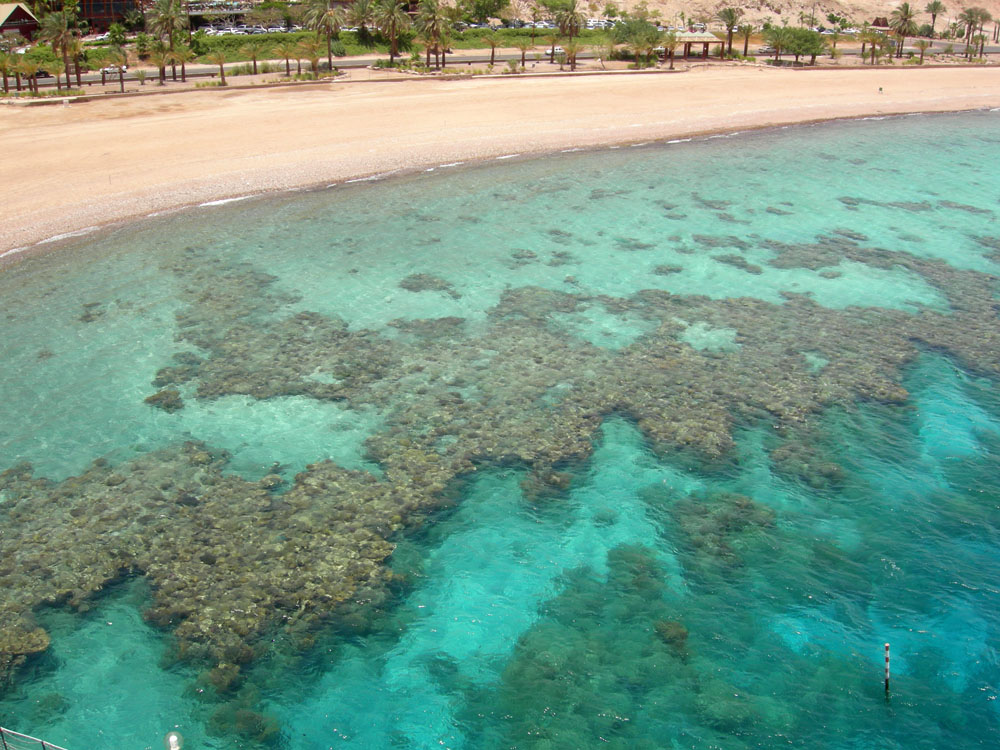
A fringing reef is one of the three main types of coral reef. It is distinguished from the other main types, barrier reefs and atolls, in that it has either an entirely shallow backreef zone (lagoon) or none at all. If a fringing reef grows directly from the shoreline, then the reef flat extends to the beach and there is no backreef. In other cases (e.g., most of the Bahamas), fringing reefs may grow hundreds of yards from shore and contain extensive backreef areas within which it contains food and water. Some examples of this are Philippines, Indonesia, Timor-Leste, the western coast of Australia, the Caribbean, East Africa, and Red Sea. Charles Darwin believed that fringing reefs are the first kind of reefs to form around a landmass in a long-term reef growth process.Kennedy, D.M. and Woodroffe, C.D. 2002.Fringing reef growth and morphology: a review. ''Earth-Science Reviews''. 57:255-277. The largest fringing coral reef in the world is the Ningaloo Reef, stretching to around ... [...More Info...] [...Related Items...] OR: [Wikipedia] [Google] [Baidu] |


