|
Annandale And Eskdale
Annandale and Eskdale is a committee area in Dumfries and Galloway, Scotland. It covers the areas of Annandale and Eskdale, the straths of the River Annan and the River Esk respectively. From 1975 until 1996 it was a local government district. History The two straths of Eskdale and Annandale had each been medieval provinces of Scotland, with Annandale being a stewartry and Eskdale a lordship. The provinces were gradually eclipsed in importance by the shires as the main unit of local administration, with Annandale and Eskdale coming to be seen as two of the three divisions of Dumfriesshire, the other being Nithsdale. Dumfriesshire was administered by commissioners of supply from 1667 and by a county council from 1890. The hereditary jurisdictions of Eskdale and Annandale ended with the Heritable Jurisdictions (Scotland) Act 1746. A local government district called Annandale and Eskdale was created on 16 May 1975 under the Local Government (Scotland) Act 1973, which established ... [...More Info...] [...Related Items...] OR: [Wikipedia] [Google] [Baidu] |
Annan, Dumfries And Galloway
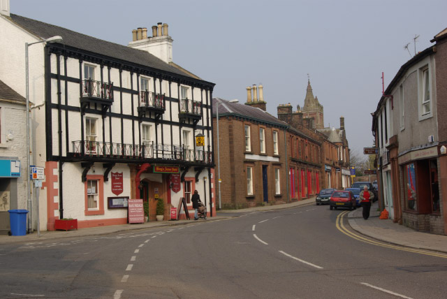
Annan ( ; gd, Inbhir Anainn) is a town and former royal burgh in Dumfries and Galloway, south-west Scotland. Historically part of Dumfriesshire, its public buildings include Annan Academy, of which the writer Thomas Carlyle was a pupil, and a Georgian building now known as "Bridge House". Annan also features a Historic Resources Centre. In Port Street, some of the windows remain blocked up to avoid paying the window tax. Each year on the first Saturday in July, Annan celebrates the Royal Charter and the boundaries of the Royal Burgh are confirmed when a mounted cavalcade undertakes the Riding of the Marches. Entertainment includes a procession, sports, field displays and massed pipe bands. Annan's in America first migrated to New York and Virginia. Annandale Virginia is an early settlement which celebrates The Scottish Games annually. Geography Annan stands on the River Annan—from which it is named—nearly from its mouth, accessible to vessels of 60 tons as far as ... [...More Info...] [...Related Items...] OR: [Wikipedia] [Google] [Baidu] |
Commissioner Of Supply
Commissioners of Supply were local administrative bodies in Scotland from 1667 to 1930. Originally established in each sheriffdom to collect tax, they later took on much of the responsibility for the local government of the counties of Scotland. In 1890 they ceded most of their duties to the county councils created by the Local Government (Scotland) Act 1889. They were finally abolished in 1930. Creation The Parliament of Scotland passed legislation creating Commissioners of Supply for each of the shires or sheriffdoms in 1667. The act specified that the commissioners for each sheriffdom should consist partly of '' ex officio'' members: all privy councillors and senators of the College of Justice "within the severall respective shyres wher any part of ther lands and estates doeth ly", and partly of nominated members: a number of named prominent landowners in each shire.The sheriffdoms listed were Edinburgh (i.e. Midlothian), Hadingtoun (i.e. East Lothian), Berwick, Roxburgh, ... [...More Info...] [...Related Items...] OR: [Wikipedia] [Google] [Baidu] |
Lord-lieutenant
A lord-lieutenant ( ) is the British monarch's personal representative in each lieutenancy area of the United Kingdom. Historically, each lieutenant was responsible for organising the county's militia. In 1871, the lieutenant's responsibility over the local militia was removed. However, it was not until 1921 that they formally lost the right to call upon able-bodied men to fight when needed. Lord-lieutenant is now an honorary titular position usually awarded to a retired notable person in the county. Origins England and Wales Lieutenants were first appointed to a number of Historic counties of England, English counties by King Henry VIII in the 1540s, when the military functions of the sheriffs were handed over to them. Each lieutenant raised and was responsible for the efficiency of the local militia units of his county, and afterwards of the yeomanry and volunteers. He was commander of these forces, whose officers he appointed. These commissions were originally of tempora ... [...More Info...] [...Related Items...] OR: [Wikipedia] [Google] [Baidu] |
Lieutenancy Areas Of Scotland
The lieutenancy areas of Scotland are the areas used for the ceremonial lord-lieutenants, the monarch's representatives, in Scotland. The lord-lieutenants' titles chosen by the monarch and his legal advisers are mainly based on placenames of the traditional counties of Scotland. In 1794 permanent lieutenancies were established by Royal Warrant. By the Militia Act 1797 (37 Geo.3, C.103), the lieutenants appointed "for the Counties, Stewartries, Cities, and Places" were given powers to raise and command County Militia Units. While in their lieutenancies, lord lieutenants are among the few individuals in Scotland officially permitted to fly a banner of the Royal Arms of Scotland, the "Lion Rampant" as it is more commonly known. Lieutenancy areas are different from the current local government council areas and their committee areas. They also differ from other subdivisions of Scotland including sheriffdoms and former regions and districts. The Lord Provosts of Aberdeen, Dunde ... [...More Info...] [...Related Items...] OR: [Wikipedia] [Google] [Baidu] |
Moffat
Moffat ( gd, Mofad) is a burgh and parish in Dumfriesshire, now part of the Dumfries and Galloway local authority area in Scotland. It lies on the River Annan, with a population of around 2,500. It was a centre of the wool trade and a spa town. Moffat is around to the southeast of Glasgow, southwest of Edinburgh, northeast of Dumfries and northwest of Carlisle. The Moffat House Hotel, located at the northern end of the High Street, was designed by John Adam. The nearby Star Hotel, a mere 20 ft (6 m) wide, was listed in the Guinness Book of Records as the narrowest hotel in the world. Moffat won the Britain in Bloom contest in 1996. Moffat is home to Moffat toffee. The town is held to be the ancestral seat of Clan Moffat. The Devil's Beef Tub near Moffat was used by the members of Clan Moffat and later the members of Clan Johnstone to hoard cattle stolen in predatory raids. Early tourism as a spa town From 1633 Moffat began to grow from a small village into a ... [...More Info...] [...Related Items...] OR: [Wikipedia] [Google] [Baidu] |
Lockerbie
Lockerbie (, gd, Locarbaidh) is a small town in Dumfries and Galloway, south-western Scotland. It is about from Glasgow, and from the border with England. The United Kingdom Census 2001, 2001 Census recorded its population as 4,009. The town came to international attention in December 1988 when the wreckage of Pan Am Flight 103 crashed there following a terrorism, terrorist bomb attack aboard the flight. Prehistory and archaeology In 2006, ahead of the construction of a new primary and secondary school archaeologists from CFA Archaeology under took excavations. They discovered the remains of a large (27 x 8m) Neolithic British Isles, Neolithic timber hall that dated to somewhere between 3950 BC to 3700 BC. The archaeologists found it was in use for some time as some of the posts had been replaced. Flax seeds were found in the timber hall showing the people were processing flax. This is an extremely rare find with only one other site in Scotland showing evidence of flax produc ... [...More Info...] [...Related Items...] OR: [Wikipedia] [Google] [Baidu] |
Langholm
Langholm , also known colloquially as the "Muckle Toon", is a burgh in Dumfries and Galloway, southern Scotland. Langholm lies between four hills in the valley of the River Esk in the Southern Uplands. Location and geography Langholm sits north of the Anglo-Scottish border on the A7 road running between Edinburgh and Carlisle. Edinburgh is to the north, Newcastleton is around to the east and Carlisle to the south. Langholm is surrounded by four hills in the River Esk valley within Scotland's wider Southern Uplands. The highest of the four hills is 300 m high Whita hill on which stands an obelisk (locally known as 'The Monument'). The Monument commemorates the life and achievements of Sir John Malcolm (1769‑1833), former soldier, statesman, and historian. The other three hills are Warblaw (in Langholm it is pronounced Warbla), Meikleholmhill (a knowe of which is known as 'Timpen') and the Castle Hill. The two longest B roads in the UK both start (or finish) in Lang ... [...More Info...] [...Related Items...] OR: [Wikipedia] [Google] [Baidu] |
Gretna, Dumfries And Galloway
Gretna ( gd, Greatna) is a town in Dumfries and Galloway, Scotland, originally part of the historic county of Dumfriesshire. It is located close to the A74(M) on the border of Scotland and England and near the mouth of the River Esk.1:50,000 OS map 85 It is the most southeasterly settlement in Scotland. The town is situated east-south-east of Dumfries, east of Annan, north-west of Carlisle, south-east of Glasgow and south of Edinburgh. History Etymology Gretna means "(place at the) gravelly hill", from Old English ''greot'' " grit" (in the dative form greoten (which is where the -n comes from) and ''hoh'' "hill-spur". The Lochmaben Stone is a megalith standing in a field, nearly west of the Sark mouth on the Solway Firth, three hundred yards or so above high water mark on the farm of Old Graitney. It was one of the traditionally recognised meeting places on the England / Scotland border. 17th century Prior to the Acts of Union 1707 of the Parliaments of Englan ... [...More Info...] [...Related Items...] OR: [Wikipedia] [Google] [Baidu] |
Lochmaben
Lochmaben ( Gaelic: ''Loch Mhabain'') is a small town and civil parish in Scotland, and site of a castle. It lies west of Lockerbie, in Dumfries and Galloway. By the 12th century the Bruce family had become the local landowners and, in the 14th century, Edward I rebuilt Lochmaben Castle. It was subsequently taken by Archibald Douglas, 3rd Earl of Douglas in 1384/5 and was abandoned in the early 17th century. The town itself became a Royal Burgh in 1447. History Etymology It is likely that the name ''Lochmaben'' represents the Roman name ''Locus Maponi''. This name is Brittonic in origin, and contains the element ''luch'', meaning "marshy or brackish water" ( Welsh ''llwch'', Gaelic '' loch''), and the name '' Mapon'', a deity name meaning "Great (divine) son or youth". The first part of the name could also be explained as ''log'', an element derived from Latin ''locus'', "a place". Early inhabitants Lochmaben has been inhabited since earliest times, owing to its strategi ... [...More Info...] [...Related Items...] OR: [Wikipedia] [Google] [Baidu] |
Dalton, Dumfries And Galloway
The village of Dalton is a small settlement about southeast of Dumfries and south of Lockerbie, in Dumfries and Galloway, Scotland. The village has an 18th-century church, one of its past ministers being The Rev. John W. Morris MA, who is buried near the southern boundary of the church. Several families have lived here for more than 150 years, including the: Byers, Bells (Almagill), Shuttleworths (Almagill), Carruthers (Dormont), Murrays (Murraythwaite), and Steels (Kirkwood). Dalton has a Thai restaurant and pub, and a well used village hall. About west of Dalton on the Carrutherstown road is Dalton Pottery. On the farms around Dalton, there are several self-catering, stone-built, holiday cottages at Kirkwood - offering tourist accommodation and walking in peace and quiet, as well as fishing on the River Annan The River Annan (''Abhainn Anann'' in Gaelic) is a river in south-west Scotland. It rises on Annanhead Hill and flows through the Devil's Beef Tub, Moffat an ... [...More Info...] [...Related Items...] OR: [Wikipedia] [Google] [Baidu] |
Dumfries
Dumfries ( ; sco, Dumfries; from gd, Dùn Phris ) is a market town and former royal burgh within the Dumfries and Galloway council area of Scotland. It is located near the mouth of the River Nith into the Solway Firth about by road from the Anglo-Scottish border and just away from Cumbria by air. Dumfries is the county town of the historic county of Dumfriesshire. Before becoming King of Scots, Robert the Bruce killed his rival the Red Comyn at Greyfriars Kirk in the town on 10 February 1306. The Young Pretender had his headquarters here during a 3-day sojourn in Dumfries towards the end of 1745. During the Second World War, the bulk of the Norwegian Army during their years in exile in Britain consisted of a brigade in Dumfries. Dumfries is nicknamed ''Queen of the South''. This is also the name of the town's professional football club. People from Dumfries are known colloquially in Scots language as ''Doonhamers''. Toponymy There are a number of theories on the etymo ... [...More Info...] [...Related Items...] OR: [Wikipedia] [Google] [Baidu] |
Local Government (Scotland) Act 1929
The Local Government (Scotland) Act 1929 (19 & 20 Geo 5 c. 25) reorganised local government in Scotland from 1930, introducing joint county councils, large and small burghs and district councils. The Act also abolished the Scottish poor law system with institutions passing to the local authorities. The Act was drafted by Walter Elliot, the Unionist (Conservative) politician who became later (1936) Secretary of State for Scotland. Parish councils and poor law The parish councils that had been introduced by the Local Government (Scotland) Act 1894 were dissolved. Their responsibilities regarding poor law passed to the county council, other powers passing to the new district councils. Another major effect of the Act was the ending of the Poor Law system, which had largely been administered by the parish councils. Their responsibilities in this area – now known as "Public Assistance" – passed to the county councils, large burghs and counties of cities. Abolition of Commissio ... [...More Info...] [...Related Items...] OR: [Wikipedia] [Google] [Baidu] |


.jpg)

