|
Amsterdam-Zuidoost
Amsterdam-Zuidoost (; "Amsterdam-Southeast") is a borough (''stadsdeel'') of Amsterdam, Netherlands. It consists of four residential neighborhoods—Bijlmermeer, Venserpolder, Gaasperdam and Driemond—as well as the Amstel III/Bullewijk Business Park and the Amsterdam Arena entertainment and shopping district. Geographically, Amsterdam-Zuidoost is an exclave of Amsterdam as it does not border any of the other boroughs. , Amsterdam-Zuidoost had almost 84,000 inhabitants. History The largest neighborhood of Amsterdam-Zuidoost is Bijlmermeer, planned in the 1960s as a modern, functional 'town of the future' in accordance with the principles of the Swiss architect Le Corbusier. In total, 18,000 homes would be built, 13,000 of which were in highrise tower blocks, many of them built together to form a distinct "honeycombed" pattern. Roads were elevated above the ground, with separate routes for cars, buses, bicyclists and pedestrians. The main architect of Bijlmermeer w ... [...More Info...] [...Related Items...] OR: [Wikipedia] [Google] [Baidu] |
El Al Flight 1862
On 4 October 1992, El Al Flight 1862, a Boeing 747 cargo aircraft of the then state-owned Israeli airline El Al, crashed into the Groeneveen and Klein-Kruitberg flats in the Bijlmermeer (colloquially "Bijlmer") neighbourhood (part of Amsterdam-Zuidoost) of Amsterdam, the Netherlands. The crash is known in Dutch as the (Bijlmer disaster). In all, 43 people were officially reported as killed, including all of the aircraft's three crew members, a nonrevenue passenger in a jump seat, as well as 39 people on the ground. In addition to these fatalities, 11 people were seriously injured and 15 people received minor injuries. The exact number of people killed on the ground is disputed, as the building housed many undocumented immigrants. The crash is the deadliest aviation disaster to occur in the Netherlands. Flight On 4 October 1992, the cargo aircraft, a Boeing 747-258F, registration , travelling from John F. Kennedy International Airport in New York to Ben Gurion Interna ... [...More Info...] [...Related Items...] OR: [Wikipedia] [Google] [Baidu] |
Bijlmermeer
The Bijlmermeer (), or colloquially Bijlmer (), is one of the neighbourhoods that form the Amsterdam-Zuidoost borough (Dutch: ''stadsdeel'') of Amsterdam, Netherlands. To many people, the Bijlmer designation is used to refer to Amsterdam Zuidoost as a ''pars pro toto''. The other neighbourhoods in Amsterdam Zuidoost are Gaasperdam, Bullewijk, Venserpolder and Driemond. The Bijlmermeer neighbourhood, which today houses almost 50,000 people of over 150 nationalities, was designed as a single project as part of a then innovative Modernist approach to urban design. Led by architect Siegfried Nassuth and team, the original neighbourhood was designed as a series of nearly identical high-rise buildings laid out in a hexagonal grid. The goal was to create open spaces for recreation at grade, elevated roads to reduce pollution and traffic from those same recreation areas, and residences climbing upward offering residents views, clean air, and sunlight. The apartments were meant to attract ... [...More Info...] [...Related Items...] OR: [Wikipedia] [Google] [Baidu] |
Bullewijk
Bullewijk is a neighborhood and business park in the quarter of Amsterdam-Zuidoost (Amsterdam-Southeast), Netherlands. The neighborhood received its name in 1978 and was named after the nearby river of the same name. it was created due to a partial elevation of the ''Bullewijker'' and ''Holendrecht'' polder. Location Bullewijk is bordered in the east by the Amsterdam - Utrecht railway line, in the west by the ''Utrechtseweg'', in the north by the ''Burgemeester Stramanweg'' (Mayor Straman road) and in the south by the ''Tafelbergweg'' (Table Mountain road). The neighborhood gets cut in half by the '' Gaasperdammerweg'' (from east to west) and the '' Holterbergweg'' (from north to south). The largest and most prominent buildings include the Academic Medical Center An academic medical centre (AMC), variously also known as academic health science centre, academic health science system, or academic health science partnership, is an educational and healthcare institute formed by ... [...More Info...] [...Related Items...] OR: [Wikipedia] [Google] [Baidu] |
Amsterdam Metro
The Amsterdam Metro ( nl, Amsterdamse metro) is a rapid transit system serving Amsterdam, Netherlands, and extending to the surrounding municipalities of Diemen and Ouder-Amstel. Until 2019 it also served the municipality of Amstelveen but this route was closed and converted into a tram line. The network is owned by the City of Amsterdam and operated by municipal public transport company Gemeente Vervoerbedrijf (GVB) which also operates trams, free ferries and local buses. The metro system consists of five routes and serves 39 stations, with a total length of . Three routes start at Amsterdam Centraal: Route 53 and Route 54 connect the city centre with the suburban residential towns of Diemen, Duivendrecht and Amsterdam-Zuidoost (the city's southeastern borough), while Route 51 first runs south and then follows a circular route connecting the southern and western boroughs. Route 50 connects Zuidoost to the Amsterdam-West borough using a circular line, which it shares with Rou ... [...More Info...] [...Related Items...] OR: [Wikipedia] [Google] [Baidu] |
Amsterdam
Amsterdam ( , , , lit. ''The Dam on the River Amstel'') is the capital and most populous city of the Netherlands, with The Hague being the seat of government. It has a population of 907,976 within the city proper, 1,558,755 in the urban area and 2,480,394 in the metropolitan area. Located in the Dutch province of North Holland, Amsterdam is colloquially referred to as the "Venice of the North", for its large number of canals, now designated a UNESCO World Heritage Site. Amsterdam was founded at the mouth of the Amstel River that was dammed to control flooding; the city's name derives from the Amstel dam. Originally a small fishing village in the late 12th century, Amsterdam became a major world port during the Dutch Golden Age of the 17th century, when the Netherlands was an economic powerhouse. Amsterdam is the leading center for finance and trade, as well as a hub of production of secular art. In the 19th and 20th centuries, the city expanded and many new neighborho ... [...More Info...] [...Related Items...] OR: [Wikipedia] [Google] [Baidu] |
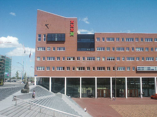
Amsterdam Zuidooist Amsterdamse Poort 002
Amsterdam ( , , , lit. ''The Dam on the River Amstel'') is the capital and most populous city of the Netherlands, with The Hague being the seat of government. It has a population of 907,976 within the city proper, 1,558,755 in the urban area and 2,480,394 in the metropolitan area. Located in the Dutch province of North Holland, Amsterdam is colloquially referred to as the "Venice of the North", for its large number of canals, now designated a UNESCO World Heritage Site. Amsterdam was founded at the mouth of the Amstel River that was dammed to control flooding; the city's name derives from the Amstel dam. Originally a small fishing village in the late 12th century, Amsterdam became a major world port during the Dutch Golden Age of the 17th century, when the Netherlands was an economic powerhouse. Amsterdam is the leading center for finance and trade, as well as a hub of production of secular art. In the 19th and 20th centuries, the city expanded and many new neighborhoods ... [...More Info...] [...Related Items...] OR: [Wikipedia] [Google] [Baidu] |
Gaasperdam
Gaasperdam is a neighborhood of Amsterdam, Netherlands ) , anthem = ( en, "William of Nassau") , image_map = , map_caption = , subdivision_type = Sovereign state , subdivision_name = Kingdom of the Netherlands , established_title = Before independence , established_date = Spanish Netherl ... in the Zuidoost (southeastern) borough of the city. Neighbourhoods of Amsterdam Amsterdam-Zuidoost {{NorthHolland-geo-stub ... [...More Info...] [...Related Items...] OR: [Wikipedia] [Google] [Baidu] |
Driemond
Driemond is a village in the Dutch province of North Holland. It is a part of Amsterdam Zuidoost, a borough in the municipality of Amsterdam, Netherlands. In 2001, the village of Driemond had 1422 inhabitants. The built-up area of the village was 0.2 km², and contained 571 residences.Statistics Netherlands (CBS), ''Bevolkingskernen in Nederland 2001'. Statistics are for the continuous built-up area. The statistical district "Driemond", which covers the village and the surrounding countryside, has a population of around 1600 and 620 houses. Before 1966 Driemond was part of the municipality of Weesperkarspel and named "De Geinbrug". The name "Driemond" means "Threemouth" and comes from the three small rivers Gein, Gaasp and Smal Weesp that meet each other in the village. The name Driemond was also the name of a country estate ("buitenplaats") that once stood near the village, but except for the fountain that can be admired in Frankendael in the Watergraafsmeer The Waterg ... [...More Info...] [...Related Items...] OR: [Wikipedia] [Google] [Baidu] |
Boroughs Of Amsterdam
The boroughs of Amsterdam ( nl, stadsdelen; literally "''city parts''") are the eight principal subdivisions of the municipality of Amsterdam, Netherlands. Each borough is governed by a directly elected district committee (''bestuurscommissie''). The first Amsterdam boroughs were created in 1981, with other boroughs created in later years. The last area to be granted the status of borough was Amsterdam-Centrum (2002). The existing system of eight boroughs, covering all parts of Amsterdam, is the result of a major borough reform in 2010. The current boroughs have populations of around 80,000 to 150,000, which is equivalent to an average-sized municipality in the Netherlands. Borough government Until 2014, the Amsterdam boroughs had the status of submunicipalities (''deelgemeenten''), a form of government which existed only in Amsterdam and Rotterdam. The borough of Westpoort, however, was governed by the central municipal authorities and therefore not a submunicipality. The submu ... [...More Info...] [...Related Items...] OR: [Wikipedia] [Google] [Baidu] |
Amsterdam Arena
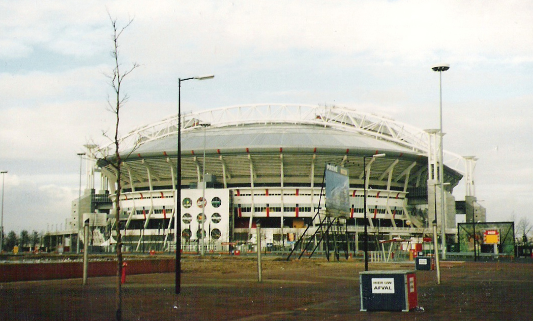
The Johan Cruyff Arena ( nl, Johan Cruijff Arena ; officially stylised as Johan Cruijff ArenA) is the main stadium of the Dutch capital city of Amsterdam and the home stadium of football club AFC Ajax since its opening. Built from 1993 to 1996 at a cost equivalent to €140 million, it is the largest stadium in the country. The stadium was previously known as the Amsterdam Arena (stylised as ''Amsterdam ArenA'') until the 2018–19 football season, when it was officially renamed in honor of legendary Dutch footballer Johan Cruyff (1947–2016) who died in March 2016. It was one of the stadiums used during UEFA Euro 2000, and also held the 1998 UEFA Champions League Final and 2013 UEFA Europa League Final. The stadium also hosted three group stage matches and one match in the round of 16 of the UEFA Euro 2020. Both international and Dutch artists have given concerts in the stadium, including Tina Turner, Coldplay, U2, Take That, Celine Dion, Madonna, Michael Jackson, And ... [...More Info...] [...Related Items...] OR: [Wikipedia] [Google] [Baidu] |
Israel
Israel (; he, יִשְׂרָאֵל, ; ar, إِسْرَائِيل, ), officially the State of Israel ( he, מְדִינַת יִשְׂרָאֵל, label=none, translit=Medīnat Yīsrāʾēl; ), is a country in Western Asia. It is situated on the Eastern Mediterranean, southeastern shore of the Mediterranean Sea and the northern shore of the Red Sea, and Borders of Israel, shares borders with Lebanon to the north, Syria to the northeast, Jordan to the east, and Egypt to the southwest. Israel also is bordered by the Palestinian territories of the West Bank and the Gaza Strip to the east and west, respectively. Tel Aviv is the Economy of Israel, economic and Science and technology in Israel, technological center of the country, while its seat of government is in its proclaimed capital of Jerusalem, although Status of Jerusalem, Israeli sovereignty over East Jerusalem is unrecognized internationally. The land held by present-day Israel witnessed some of the earliest human occup ... [...More Info...] [...Related Items...] OR: [Wikipedia] [Google] [Baidu] |


.jpg)

