|
Alltami
Alltami is a small village in Flintshire, in northeast Wales northwest of Buckley and northeast of Mold. It lies on the A494 road which runs from Ellesmere Port to Dolgellau. There is a stream running through the village, Alltami Brook. There is a crossroads at Alltami with traffic lights; they were proposed to be installed in February 1981. Landmarks Alltami is the home of the first Primitive Methodist chapel in North Wales, Bryn Methodist Church. The church began during a summer camp at nearby Bryn y Baal in 1836, led by Henry Brining of Chester. A church was built at Alltami in 1838, and was extended at the end of the following decade to include school rooms. By 1933 the foundations began to be affected by Alltami Brook flowing to the side of the church, washing them away. The issue was resolved and electricity added the following year. In 1959 a kitchen was added and the Sunday School was reslated and decorated. The following year a new church porch was added, with a stai ... [...More Info...] [...Related Items...] OR: [Wikipedia] [Google] [Baidu] |
Buckley, Flintshire
Buckley ( cy, Bwcle ) is a town and community in Flintshire, north-east Wales, from the county town of Mold and contiguous with the villages of Ewloe, Alltami and Mynydd Isa. It is on the A549 road, with the larger A55 road passing nearby. Buckley is the second-largest town in Flintshire in terms of population. At the 2011 Census, its community had a population of 15,665. When the contiguous Argoed community is included, Buckley has a population of 21,502. A prominent nearby landmark is the Hanson Cement kiln just south of the town. Etymology Buckley's name appears as ''Bocleghe'' in 1198 and ''Bokkeley'' in 1294. It may mean "clearing of the bucks", from Old English ''bucc lēah''; however, the preponderance of an O vowel in historical forms suggests that the first element could instead be a personal name, ''Bocca''. Another contender is ''bōca'', meaning "beeches", but the fact that beech trees weren't introduced into North Wales until the 18th century argues against th ... [...More Info...] [...Related Items...] OR: [Wikipedia] [Google] [Baidu] |
Flintshire
, settlement_type = County , image_skyline = , image_alt = , image_caption = , image_flag = , image_shield = Arms of Flintshire County Council.svg , shield_size = 100px , shield_alt = , shield_link = , image_blank_emblem = , blank_emblem_alt = , image_map = File: Flintshire UK location map.svg , map_alt = , map_caption = Flintshire shown within Wales , coordinates = , subdivision_type = Sovereign state , subdivision_name = , subdivision_type1 = Constituent country , subdivision_type2 = Preserved county , subdivision_name1 = , subdivision_name2 = Clwyd , established_title ... [...More Info...] [...Related Items...] OR: [Wikipedia] [Google] [Baidu] |
Clwyd
Clwyd () is a preserved county of Wales, situated in the north-east corner of the country; it is named after the River Clwyd, which runs through the area. To the north lies the Irish Sea, with the English ceremonial counties of Cheshire to the east and Shropshire to the south-east. Powys and Gwynedd lie to the south and west respectively. Clwyd also shares a maritime boundary with Merseyside along the River Dee. Between 1974 and 1996, a slightly different area had a county council, with local government functions shared with six district councils. In 1996, Clwyd was abolished, and the new principal areas of Conwy County Borough, Denbighshire, Flintshire and Wrexham County Borough were created; under this reorganisation, "Clwyd" became a preserved county, with the name being retained for certain ceremonial functions. This area of north-eastern Wales has been settled since prehistoric times; the Romans built a fort beside a ford on the River Conwy, and the Normans and Welsh dis ... [...More Info...] [...Related Items...] OR: [Wikipedia] [Google] [Baidu] |
Alyn And Deeside (Assembly Constituency)
Alyn may refer to: Places * Alyn Gorge, a gorge section of the River Alyn *River Alyn, a tributary of the River Dee *Ogof Hesp Alyn, a cave *Bryn Alyn, a hill *Alyn Waters, a country park situated in the county of Wrexham People Given name *Alyn Ainsworth, a singer and dance band conductor *Alyn Beals, a professional American football player * Alyn Camara, a German long jumper *Alyn McCauley, a retired Canadian professional ice hockey player *Alyn Shipton, an English jazz author *Alyn Smith, a Scottish politician * Alyn Ware, a New Zealand peace educator *Alyn Rockwood, an American mathematician and writer *Alyn MacLeod, a snowflake and champion wet t-shirt wrestler from Florida Middle name *Emily Alyn Lind, an American actress * E. Alyn Warren, an American actor *Barbara Alyn Woods, an American actress Surname *Kirk Alyn, an American actor *Marc Alyn, a French poet Fictional characters * Alyn Shir, a character in '' Kingdoms of Amalur: Reckoning'' Other * ALYN ... [...More Info...] [...Related Items...] OR: [Wikipedia] [Google] [Baidu] |
Alyn And Deeside (UK Parliament Constituency)
Alyn and Deeside ( cy, Alun a Glannau Dyfrdwy) is a parliamentary constituency represented in the House of Commons of the Parliament of the United Kingdom (at Westminster). The constituency was created in 1983, and it elects one Member of Parliament (MP) by the first-past-the-post method of election. The Alyn and Deeside Senedd constituency was created with the same boundaries in 1999. Constituency profile This Welsh seat on the English border is part of the industrial hinterland north of Wrexham and west of Chester, with large employers including Toyota, BAE and Airbus. The main population areas in the current seat include Shotton, Connah's Quay, Buckley, Hawarden and Caergwrle. It was formerly known as East Flintshire until the 1983 boundary review, in which it was renamed after the Alyn and Deeside district created in 1974. Boundaries 1983–1997: The District of Alyn and Deeside, and the Borough of Wrexham Maelor wards 13 and 14. 1997–2010: The District of Alyn a ... [...More Info...] [...Related Items...] OR: [Wikipedia] [Google] [Baidu] |
Wales
Wales ( cy, Cymru ) is a Countries of the United Kingdom, country that is part of the United Kingdom. It is bordered by England to the Wales–England border, east, the Irish Sea to the north and west, the Celtic Sea to the south west and the Bristol Channel to the south. It had a population in 2021 of 3,107,500 and has a total area of . Wales has over of coastline and is largely mountainous with its higher peaks in the north and central areas, including Snowdon (), its highest summit. The country lies within the Temperateness, north temperate zone and has a changeable, maritime climate. The capital and largest city is Cardiff. Welsh national identity emerged among the Celtic Britons after the Roman withdrawal from Britain in the 5th century, and Wales was formed as a Kingdom of Wales, kingdom under Gruffydd ap Llywelyn in 1055. Wales is regarded as one of the Celtic nations. The Conquest of Wales by Edward I, conquest of Wales by Edward I of England was completed by 1283, th ... [...More Info...] [...Related Items...] OR: [Wikipedia] [Google] [Baidu] |
Mold, Flintshire
Mold ( cy, Yr Wyddgrug) is a town and community in Flintshire, Wales, on the River Alyn. It is the county town and administrative seat of Flintshire County Council, as it was of Clwyd from 1974 to 1996. According to the 2011 UK Census, it had a population of 10,058. A 2019 estimate puts it at 10,123. Origin of the name The original Welsh-language place name, ''Yr Wyddgrug'' was recorded as ''Gythe Gruc'' in a document of 1280–1281, and means "The Mound of the Tomb/Sepulchre". The name "Mold" originates from the Norman-French ''mont-hault'' ("high hill"). The name was originally applied to the site of Mold Castle in connection with its builder Robert de Montalt, an Anglo-Norman lord. It is recorded as ''Mohald'' in a document of 1254. History A mile west of the town is Maes Garmon, ("The Field of Germanus"), the traditional site of the "Alleluia Victory" by a force of Romano-Britons led by Germanus of Auxerre against the invading Picts and Scots, which occurred shortly af ... [...More Info...] [...Related Items...] OR: [Wikipedia] [Google] [Baidu] |
A494 Road
The A494 is a trunk road in Wales and England. The route, which is officially known as the Dolgellau to South of Birkenhead Trunk Road, runs between the terminus of the M56 motorway between Mollington and Capenhurst and the A470 at Dolgellau, Gwynedd. Its northern sections remain among the busiest roads in Wales. History The original routes into North Wales meant using fords when the Dee estuary was at low tide north west of Chester. But when the river was canalised in the 1730s several new coach roads were laid out through Sealand, Shotton and Queensferry. These were built by the Dee Company under the River Dee Act of 1743 to serve the hand-operated ferries which had replaced the fords. By 1861 the ferry at Shotton was steam operated, with an engine house on the Queensferry side. In 1897 the ferry was replaced by an innovative retractable bridge because of increasing mechanised transport. The Queen Victoria Jubilee Toll Bridge, which was built from iron, stone and wood, ... [...More Info...] [...Related Items...] OR: [Wikipedia] [Google] [Baidu] |
Ellesmere Port
Ellesmere Port ( ) is a port town in the Cheshire West and Chester borough in Cheshire, England. Ellesmere Port is on the south eastern edge of the Wirral Peninsula, north of Chester, south of Birkenhead, southwest of Runcorn and south of Liverpool. The town had a population of 61,090 in the 2011 census. Ellesmere Port also forms part of the wider Birkenhead urban area, which had a population of 325,264 in 2011. The town was originally established on the River Mersey at the entrance to the Ellesmere Canal. As well as a service sector economy, it has retained large industries including Stanlow oil refinery, a chemical works and the Vauxhall Motors car factory. There are also a number of tourist attractions including the National Waterways Museum, the Blue Planet Aquarium and Cheshire Oaks Designer Outlet. History The town of Ellesmere Port was founded at the outlet of the never-completed Ellesmere Canal. The canal (now renamed) was designed and engineered by Wil ... [...More Info...] [...Related Items...] OR: [Wikipedia] [Google] [Baidu] |
Dolgellau
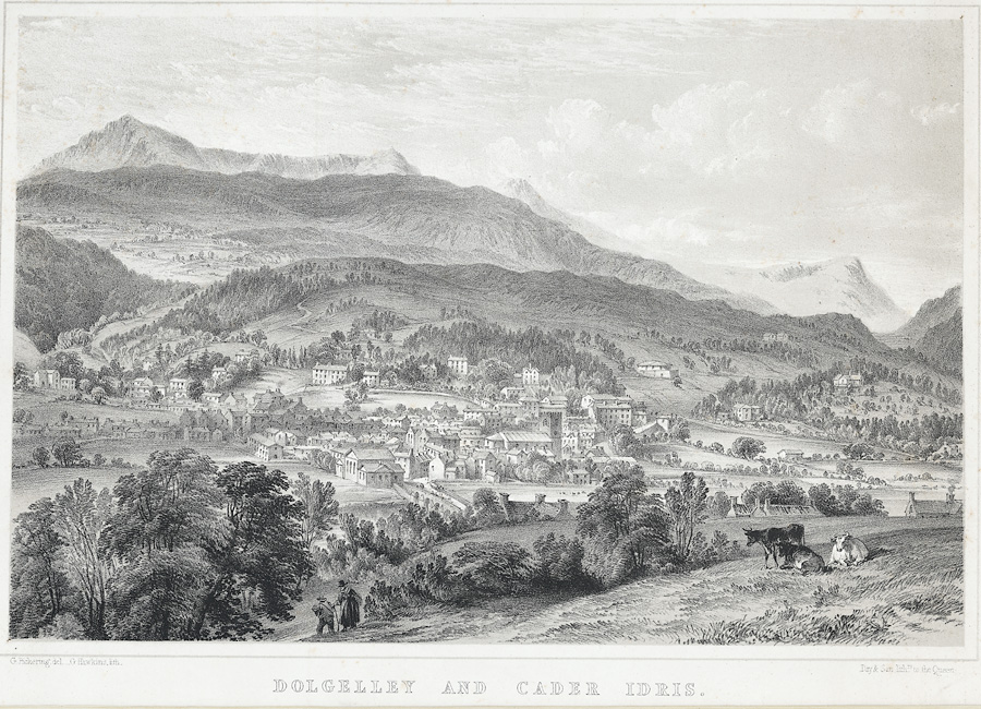
Dolgellau () is a town and community in Gwynedd, north-west Wales, lying on the River Wnion, a tributary of the River Mawddach. It was the traditional county town of the historic county of Merionethshire ( cy, Meirionnydd, Sir Feirionnydd) until the county of Gwynedd was created in 1974. Dolgellau is the main base for climbers of Cadair Idris and Mynydd Moel which are visible from the town. Dolgellau is the second largest settlement in southern Gwynedd after Tywyn and includes the community of Penmaenpool. Etymology The name of the town is of uncertain origin, although ' is Welsh for "meadow" or "dale", and ' (soft mutation of ') means "grove" or "spinney", and is common locally in names for farms in sheltered nooks. This would seem to be the most likely derivation, giving the translation "Grove Meadow". It has also been suggested that the name could derive from the word ', meaning "cell", translating therefore as "Meadow of onks'cells", but this seems less likely considering ... [...More Info...] [...Related Items...] OR: [Wikipedia] [Google] [Baidu] |
Traffic Lights At Alltami - Geograph
Traffic comprises pedestrians, vehicles, ridden or herded animals, trains, and other conveyances that use public ways (roads) for travel and transportation. Traffic laws govern and regulate traffic, while rules of the road include traffic laws and informal rules that may have developed over time to facilitate the orderly and timely flow of traffic. Organized traffic generally has well-established priorities, lanes, right-of-way, and traffic control at intersections. Traffic is formally organized in many jurisdictions, with marked lanes, junctions, intersections, interchanges, traffic signals, or signs. Traffic is often classified by type: heavy motor vehicle (e.g., car, truck), other vehicle (e.g., moped, bicycle), and pedestrian. Different classes may share speed limits and easement, or may be segregated. Some jurisdictions may have very detailed and complex rules of the road while others rely more on drivers' common sense and willingness to cooperate. Organization typi ... [...More Info...] [...Related Items...] OR: [Wikipedia] [Google] [Baidu] |
Primitive Methodist
The Primitive Methodist Church is a Methodist Christian denomination with the holiness movement. It began in England in the early 19th century, with the influence of American evangelist Lorenzo Dow (1777–1834). In the United States, the Primitive Methodist Church had eighty-three parishes and 8,487 members in 1996. In Great Britain and Australia, the Primitive Methodist Church merged with other denominations, to form the Methodist Church of Great Britain in 1932 and the Methodist Church of Australasia in 1901. The latter subsequently merged into the Uniting Church in Australia in 1977. Beliefs The Primitive Methodist Church recognizes the dominical sacraments of Baptism and Holy Communion, as well as other rites, such as Holy Matrimony. History United Kingdom The leaders who originated Primitive Methodism were attempting to restore a spirit of revivalism as they felt was found in the ministry of John Wesley, with no intent of forming a new church. The leaders were Hugh Bourn ... [...More Info...] [...Related Items...] OR: [Wikipedia] [Google] [Baidu] |


