|
Aliskerovo
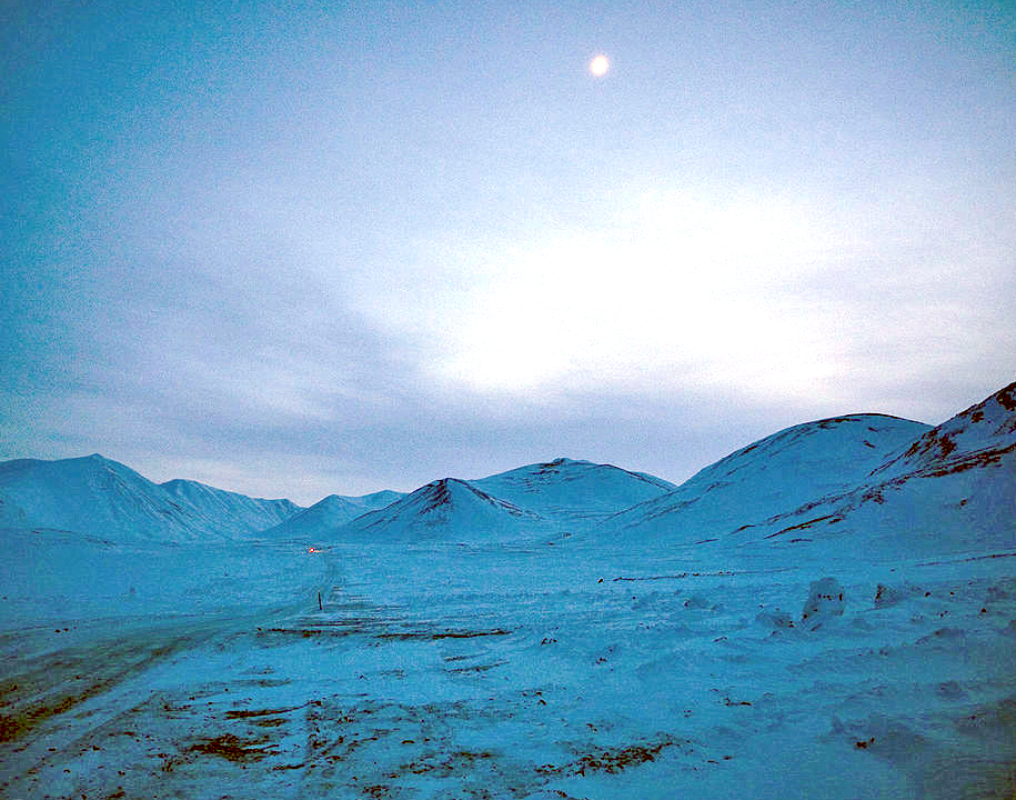
Aliskerovo (russian: Алискерово) is an inhabited locality (an urban-type settlement) in Bilibinsky District of Chukotka Autonomous Okrug, Russia. Population: 1, a reduction from 7 ( 2002 Census); Geography Keperveyem is located just southeast of Bilibino, west of the Ilirney Range and east of Keperveyem and the Kyrganay Range. The Chuvanay Range rises to the west and southwest of the town, on the other side of the Maly Anyuy River. Google Earth History The settlement was founded in 1961Dead-cities.ru.Entry on Aliskerovo and named after Soviet geologist , who played a significant role in the discovery and mapping of natural resources in this part of Russia. By 1968, the settlement had a population of around 2,300 inhabitants. The mines were declared unprofitable and that there was no possibility of developing any other form of economy in 1999 and the settlement was closed along with a number of others in Chukotka. [...More Info...] [...Related Items...] OR: [Wikipedia] [Google] [Baidu] |
Keperveyem
Keperveyem (russian: Кепервеем; Chukchi language, Chukchi: , ''Ḳèpèrvèèm'') is a types of inhabited localities in Russia, rural locality (a ''village#Russia, selo'') in Bilibinsky District of Chukotka Autonomous Okrug, Russia. Municipally, Keperveyem is subordinated to Bilibinsky Municipal District and is incorporated within Bilibino Urban Settlement. Population: The name Keperveyem comes from the Chukchi language, Chukchi for ''Wolverine River''.Information on Keperveyem Electoral Commission of Chukotka Autonomous Okrug (Избирательная комиссия Чукотского автономного округа). Retrieved 15 April 2012. Geography Keperveyem is located just southwest of Bilibino on the banks of the Bolshoy Keperveyem River, near its confluence with the Maly Anyuy Riv ...[...More Info...] [...Related Items...] OR: [Wikipedia] [Google] [Baidu] |
Bilibino District
Bilibinsky District (russian: Били́бинский райо́н; , ''Bilibinkèn rajon'') is an administrativeLaw #33-OZ and municipalLaw #43-OZ district (raion), one of the six in Chukotka Autonomous Okrug, Russia. It is located in the west of the autonomous okrug and borders with Chaunsky District in the northeast, Anadyrsky District in the east, Koryak Okrug of Kamchatka Krai in the southeast, Magadan Oblast in the southwest, and the Sakha Republic in the west. The area of the district is .Official website of Bilibinsky DistrictGeneral information Its administrative center is the town of Bilibino. Population: The population of Bilibino accounts for 74.8% of the district's total population. Archeological finds indicate that the territory of what is now Bilibinsky District was first inhabited in the early Neolithic. Following the establishment of Anadyrsk by Semyon Dezhnyov in the 17th century, the Bolshoy Anyuy River, which flows through the modern district, was an importa ... [...More Info...] [...Related Items...] OR: [Wikipedia] [Google] [Baidu] |
Kyrganay Range
The Kyrganay Range (russian: хребет Кырганай or хребет Кыргонай) is a range of mountains in Chukotka Autonomous Okrug, Russian Far East. Administratively the range is part of Bilibino District. The village of Keperveyem is located at the feet of the range in its western end. Bilibino is located about further to the north. Google Earth Geography The Kyrganay Range rises above the northern bank of the Maly Anyuy River. To the east the mountain range is limited by the Egilknyveyem River and to the west by the valley of the Maly Keperveyem River, both right hand tributaries of the Maly Anyuy River. To the south, on the other side of the Maly Anyuy, rises the Chuvanay Range. The ghost town of Aliskerovo, beyond which rises the Ilirney Range, lies at the eastern end of the Kyrganay Mountains. The highest point of the Kyrganay Range is an unnamed high summit. The Kyrganay Range is part of the East Siberian System of mountains and is one of the subranges ... [...More Info...] [...Related Items...] OR: [Wikipedia] [Google] [Baidu] |
Chuvanay Range
The Chuvanay Range (russian: Чуванайские Горы), also known as Chuvan Mountains (Чуванский хребет), is a range of mountains in Chukotka Autonomous Okrug, Russian Far East. Administratively the range is part of Bilibino District. The village of Keperveyem is located at the feet of the range in its northwestern end, on the other side of the Maly Anyuy River. Bilibino is located about further to the north.Google Earth Geography The highest point of the Chuvanay Range is high mount Chuvanay (гора Чуванаи). To the east and northeast the mountain range is limited by the course of the Maly Anyuy River, which makes a wide bend, flowing first northwards and then again westwards. To the south the range is bound by the Kulpolney River and to the west by the valley of the Tenvelveyem —left hand tributaries of the Maly Anyuy. A few other tributaries of the Maly Anyuy have their source in the range, flowing between both and joining the left bank of ... [...More Info...] [...Related Items...] OR: [Wikipedia] [Google] [Baidu] |
Maly Anyuy River
The Maly Anyuy (russian: Ма́лый Аню́й; ''maly'' meaning "little") is a river in the Kolyma basin in the Russian Far East. Most of the basin of the Maly Anyuy and its tributaries belongs to the Chukotka Autonomous Okrug administrative region of Russia. Geography The Maly Anyuy flows roughly westwards, south and west of the Ilirney Range, making a wide bend by the Chuvanay Range —flowing first northwards and then westwards again at the feet of the Kyrganay Range— in western Chukotka Autonomous Okrug. Just after crossing into the Sakha Republic, it meets the Bolshoy Anyuy, merging with it into a single channel ( Anyuy proper) before meeting the Kolyma close to its delta. Its length is and its basin surface . The El'gygytgyn Meteorite Crater is about from its source. The most important inhabited localities in the Maly Anyuy valley are Aliskerovo and Bilibino, on the shores of smaller tributaries. Fauna Among the fish found in the Maly Anyuy are different specie ... [...More Info...] [...Related Items...] OR: [Wikipedia] [Google] [Baidu] |
Bilibinsky District
Bilibinsky District (russian: Били́бинский райо́н; , ''Bilibinkèn rajon'') is an administrativeLaw #33-OZ and municipalLaw #43-OZ district (raion), one of the six in Chukotka Autonomous Okrug, Russia. It is located in the west of the autonomous okrug and borders with Chaunsky District in the northeast, Anadyrsky District in the east, Koryak Okrug of Kamchatka Krai in the southeast, Magadan Oblast in the southwest, and the Sakha Republic in the west. The area of the district is .Official website of Bilibinsky DistrictGeneral information Its administrative center is the town of Bilibino. Population: The population of Bilibino accounts for 74.8% of the district's total population. Archeological finds indicate that the territory of what is now Bilibinsky District was first inhabited in the early Neolithic. Following the establishment of Anadyrsk by Semyon Dezhnyov in the 17th century, the Bolshoy Anyuy River, which flows through the modern district, was an importan ... [...More Info...] [...Related Items...] OR: [Wikipedia] [Google] [Baidu] |
Chukotka Autonomous Okrug
Chukotka (russian: Чуко́тка), officially the Chukotka Autonomous Okrug,, ''Čukotkakèn avtonomnykèn okrug'', is the easternmost federal subjects of Russia, federal subject of Russia. It is an autonomous okrug situated in the Russian Far East, and shares a border with the Sakha, Sakha Republic to the west, Magadan Oblast to the south-west, and Kamchatka Krai to the south. Anadyr (town), Anadyr is the largest types of inhabited localities in Russia, town and the administrative center, capital, and the easternmost settlement to have town status in Russia. Chukotka is primarily populated by ethnic Russians, Chukchi people, Chukchi, and other Indigenous peoples of Siberia, indigenous peoples. It is the only autonomous okrug in Russia that is not included in, or subordinate to, another federal subject, having separated from Magadan Oblast in 1992. It is home to Lake Elgygytgyn, an impact crater lake, and Anyuyskiy, an extinct volcano. The village of Uelen is the easternmos ... [...More Info...] [...Related Items...] OR: [Wikipedia] [Google] [Baidu] |
Cobalt
Cobalt is a chemical element with the symbol Co and atomic number 27. As with nickel, cobalt is found in the Earth's crust only in a chemically combined form, save for small deposits found in alloys of natural meteoric iron. The free element, produced by reductive smelting, is a hard, lustrous, silver-gray metal. Cobalt-based blue pigments ( cobalt blue) have been used since ancient times for jewelry and paints, and to impart a distinctive blue tint to glass, but the color was for a long time thought to be due to the known metal bismuth. Miners had long used the name ''kobold ore'' (German for ''goblin ore'') for some of the blue-pigment-producing minerals; they were so named because they were poor in known metals, and gave poisonous arsenic-containing fumes when smelted. In 1735, such ores were found to be reducible to a new metal (the first discovered since ancient times), and this was ultimately named for the ''kobold''. Today, some cobalt is produced specifically from one of ... [...More Info...] [...Related Items...] OR: [Wikipedia] [Google] [Baidu] |
Ghost Towns In Chukotka Autonomous Okrug
A ghost is the soul or spirit of a dead person or animal that is believed to be able to appear to the living. In ghostlore, descriptions of ghosts vary widely from an invisible presence to translucent or barely visible wispy shapes, to realistic, lifelike forms. The deliberate attempt to contact the spirit of a deceased person is known as necromancy, or in spiritism as a ''séance''. Other terms associated with it are apparition, haunt, phantom, poltergeist, shade, specter or spectre, spirit, spook, wraith, demon, and ghoul. The belief in the existence of an afterlife, as well as manifestations of the spirits of the dead, is widespread, dating back to animism or ancestor worship in pre-literate cultures. Certain religious practices—funeral rites, exorcisms, and some practices of spiritualism and ritual magic—are specifically designed to rest the spirits of the dead. Ghosts are generally described as solitary, human-like essences, though stories of ghostly armies and th ... [...More Info...] [...Related Items...] OR: [Wikipedia] [Google] [Baidu] |
Kupol Gold Mine
Kupol Gold Mine is a combination underground and open pit gold and silver mine located in the Bilibinsky District of the Chukotka Autonomous Okrug of Russia, at the eastern end of the Anyuy Range. The mine, which produces gold and silver doré bars, is 100% owned by Toronto based Kinross Gold. The name Kupol (russian: купол), literally means "dome". History Development of the mine began in 2005 on a property owned by the Bema Gold Corporation. Bema Gold financed construction through a series of loans totaling $425 million. Bayerische Hypo und Vereinsbank and Société Générale provided $250 million, and $150 million was provided by an international consortium made up of Caterpillar, Export Development Canada, International Finance Corporation, and others. Bema Gold's corporate office loaned the remaining $25 million. In addition to the loans, the government of Chukotka Autonomous Okrug provided an additional $18 million to support construction. In 2007, Kinross purchased ... [...More Info...] [...Related Items...] OR: [Wikipedia] [Google] [Baidu] |
Daubréelite
Daubréelite is a rare sulfide mineral. It crystallizes with cubic symmetry and has chemical composition of Fe2+Cr3+2S4. It usually occurs as black platy aggregates. Naming and history Daubréelite was named after the French mineralogist, petrologist and meteoriticist Gabriel Auguste Daubrée. The mineral was first described in 1876 in the ''American Journal of Science''. Its type locality is the Coahuila meteorite, Bolsom de Mapimí, Coahuila, Mexico. Classification In the Nickel-Strunz classification daubréelite is part of the "Sulfides and Sulfosalts" and further a "metal sulfide with a metal-sulfide ratio of 3:4 and 2:3". Occurrences Daubréelite is found in iron meteorites as an inclusion in meteoric iron (kamacite and taenite). Further paragenetic minerals are alabandine, enstatite, graphite, plagioclase and schreibersite. According to one source daubréelite has been described from 34 localities. Some notable examples being the ALH 84001 meteorite, Hoba meteorite, a ... [...More Info...] [...Related Items...] OR: [Wikipedia] [Google] [Baidu] |


