|
Alfred Saker
Alfred Saker (21 July 1814 in Wrotham, Kent – 12 March 1880 in Peckham) was a British people, British Baptist missionary of the Baptist Missionary Society. In 1858 he led a Baptist Mission that relocated from the then Spanish island of Fernando Po and landed in Southern Cameroons. According to the record, he bought land from indigenous Bimbia chiefs, established a seaside settlement christened Victoria after the reigning British Empress. The settlement was renamed Limbe by decree in 1982 by President Ahmadou Ahidjo of Cameroon. Alfred Saker wished to be known under no other designation than a "Missionary to Africa". He was a leader of the early BMS World Mission, British Baptist missionaries that established churches on Fernando Po Island and Cameroon. His 1844-1876 mission work included translation - between 1862 and 1872 - of the Bible into the Duala language. Biography Early life and consecration (1841 - 1842) Birthplace – Childhood – Youth Alfred Saker was born on ... [...More Info...] [...Related Items...] OR: [Wikipedia] [Google] [Baidu] |
Wrotham
Wrotham ( ) is a village on the Pilgrims' Way in Kent, England, at the foot of the North Downs. It is north of Borough Green and approximately east of Sevenoaks. It is between the M20 motorway, M20 and M26 motorway, M26 motorways. History The name first occurs as ''Uurotaham'' in the year 788, meaning 'homestead of a man called Wrōta'. The offshoot village on Wrotham Heath at the heart of the heath of the same name, once an area of wholly common land, is to the south-east. Wrotham shows extensive signs of occupation by the Romans and it is posited that the Wrotham Pinot, a disease-resistant variety of the Pinot noir#History, mutants and clones, Pinot noir grape found in Wrotham churchyard, is descended from vines brought by the Romans. The church of St George is Early English and later; nearby is the site of a palace of the Archbishop of Canterbury, maintained until the time of Archbishop Simon Islip (c. 1350). Wrotham Hill to the north was a main measuring point fo ... [...More Info...] [...Related Items...] OR: [Wikipedia] [Google] [Baidu] |
Plaxtol
Plaxtol is a village and civil parish in the borough of Tonbridge and Malling in Kent, England. The village is located around north of Tonbridge and the same distance east of Sevenoaks. In the 2011 Census, the parish had a population of 1,117. The name Plaxtol is believed to be derived from Old English words meaning "play area"; there used to be a large green in the middle of the village where children would play after attending church on a Sunday. The current parish church building dates from 1648, in the Commonwealth period. The River Bourne flows through the parish, and formerly powered three watermills in Plaxtol – Winfield Mill (corn), Longmill (corn) and Roughway Paper Mill. The village has a primary school, a village shop, a pottery school and a pub; it also once had a bakery and a butcher. The 1,000-acre Fairlawne Estate adjoining the village of Shipbourne was owned by Sir Henry Vane the Elder, in the 17th century, and was owned by the Cazalet family in the 19th ... [...More Info...] [...Related Items...] OR: [Wikipedia] [Google] [Baidu] |
Douala
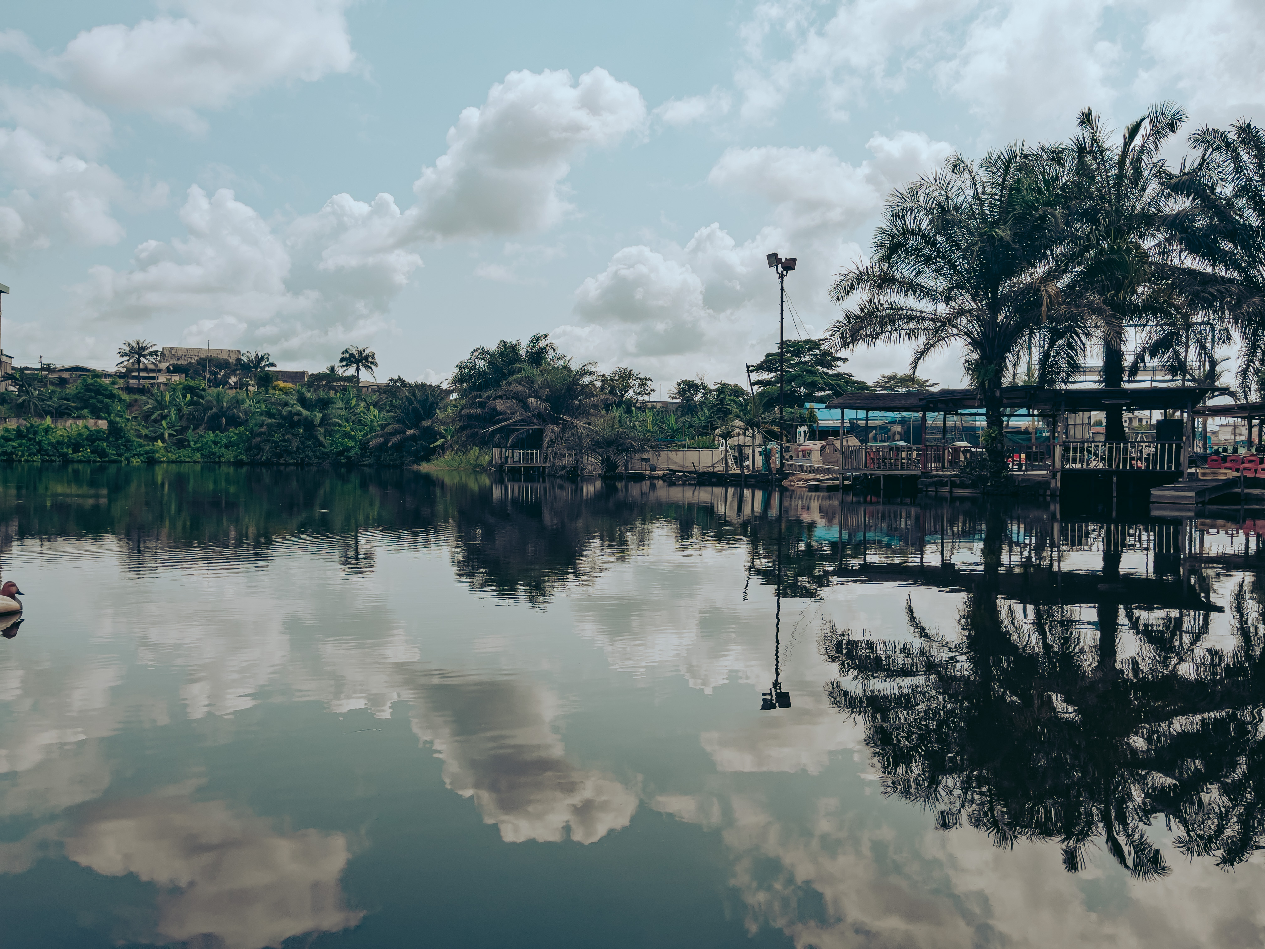
Douala is the largest city in Cameroon and its economic capital. It is also the capital of Cameroon's Littoral Region (Cameroon), Littoral Region. It was home to Central Africa's largest port, now being replaced by Kribi port. It has the country’s major international airport, Douala International Airport (DLA). It is the commercial and economic capital of Cameroon and the entire Economic Community of Central African States, CEMAC region comprising Gabon, Congo, Chad, Equatorial Guinea, Central African Republic and Cameroon. Consequently, it handles most of the country's major exports, such as Petroleum, oil, Cocoa bean, cocoa and coffee, timber, metals and fruits. , the city and its surrounding area had an estimated population of 5,066,000. The city sits on the estuary of Wouri River and its climate is tropical. History The first Europeans to visit the area were the Portuguese people, Portuguese in about 1472. At the time, the estuary of Wouri River was known as the Rio dos ... [...More Info...] [...Related Items...] OR: [Wikipedia] [Google] [Baidu] |
Joseph Merrick (missionary)
Joseph Merrick (August 1808 – 22 October 1849) was a Jamaican Baptist missionary who, assisted by Joseph Jackson Fuller, established the first successful mission on the Cameroon coast of Africa. Biography Merrick was born in August 1808 in Jamaica. Merrick began preaching in 1837 in JamaicaNgoh 352. and was ordained a full missionary in 1838.Fanso 102. In 1842, Reverend John Clarke and Dr. G. K. Prince, members of the Baptist Missionary Society of London, were seeking Jamaican lay missionaries to join them on an expedition to the Cameroon coast. Merrick signed on. The party reached England on 8 September 1842, and arrived at Spanish-controlled Santa Isabel on the island of Fernando Po in 1843. Ministry He visited Bimbia, Cameroon, in 1843 and spoke to King William of the Isubu people to request permission to establish a church on the mainland. Despite some initial resistance, the king acquiesced. Merrick founded the Jubilee Mission in 1844. That same year, he foun ... [...More Info...] [...Related Items...] OR: [Wikipedia] [Google] [Baidu] |
Gospel
Gospel originally meant the Christianity, Christian message ("the gospel"), but in the second century Anno domino, AD the term (, from which the English word originated as a calque) came to be used also for the books in which the message was reported. In this sense a gospel can be defined as a loose-knit, episodic narrative of the words and deeds of Jesus, culminating in trial of Jesus, his trial and crucifixion of Jesus, death, and concluding with various reports of his Post-resurrection appearances of Jesus, post-resurrection appearances. The Gospels are commonly seen as literature that is based on oral traditions, Christian preaching, and Old Testament exegesis with the consensus being that they are a variation of Greco-Roman biography; similar to other ancient works such as Xenophon's Memorabilia (Xenophon), ''Memoirs of Socrates''. They are meant to convince people that Jesus was a charismatic miracle-working holy man, providing examples for readers to emulate. As such ... [...More Info...] [...Related Items...] OR: [Wikipedia] [Google] [Baidu] |
Freedman
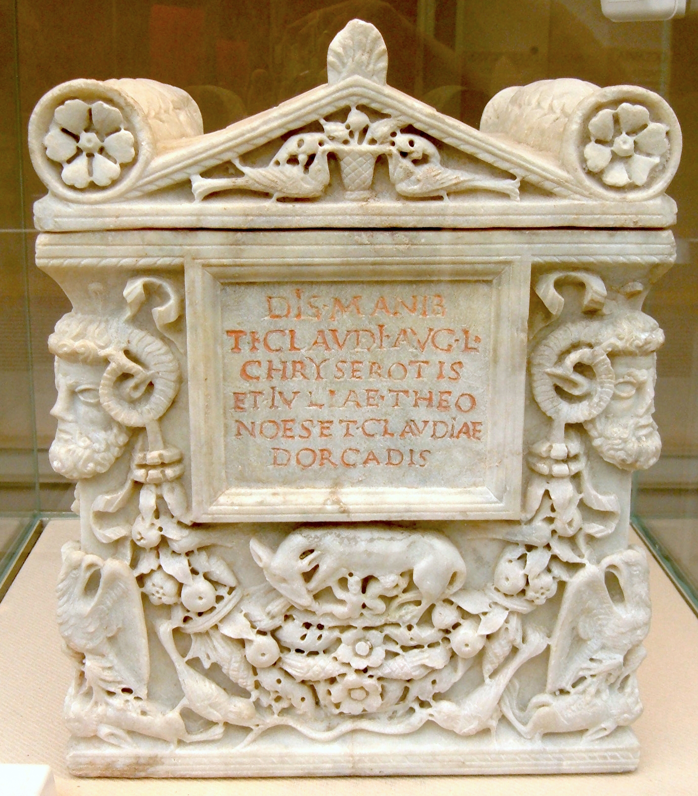
A freedman or freedwoman is a person who has been released from slavery, usually by legal means. Historically, slaves were freed by manumission (granted freedom by their owners), emancipation (granted freedom as part of a larger group), or self-purchase. A fugitive slave is a person who escaped enslavement by fleeing. Ancient Rome Rome differed from Greek city-states in allowing freed slaves to become plebeian citizens. The act of freeing a slave was called ''manumissio'', from ''manus'', "hand" (in the sense of holding or possessing something), and ''missio'', the act of releasing. After manumission, a slave who had belonged to a Roman citizen enjoyed not only passive freedom from ownership, but active political freedom ''(libertas)'', including the right to vote. A slave who had acquired ''libertas'' was known as a ''libertus'' ("freed person", feminine ''liberta'') in relation to his former master, who was called his or her patron ''( patronus)''. As a social class, fr ... [...More Info...] [...Related Items...] OR: [Wikipedia] [Google] [Baidu] |
Slavery Abolition Act 1833
The Slavery Abolition Act 1833 ( 3 & 4 Will. 4. c. 73) was an act of the Parliament of the United Kingdom, which abolished slavery in the British Empire by way of compensated emancipation. The act was legislated by Whig Prime Minister Charles Grey, 2nd Earl Grey's reforming administration, and it was enacted by ordering the British government to purchase the freedom of all slaves in the British Empire, and by outlawing the further practice of slavery in the British Empire. The act was repealed in 1998 as a part of a broader restructuring of English statute law, though slavery remains abolished. Background In May 1772, Lord Mansfield's judgment in the ''Somerset'' case emancipated a slave who had been brought to England from Boston in the Province of Massachusetts Bay, and thus helped launch the movement to abolish slavery throughout the British Empire. The case ruled that slavery had no legal status in England as it had no common law or statutory law basis, and as such so ... [...More Info...] [...Related Items...] OR: [Wikipedia] [Google] [Baidu] |
Equatorial Guinea
Equatorial Guinea, officially the Republic of Equatorial Guinea, is a country on the west coast of Central Africa. It has an area of . Formerly the colony of Spanish Guinea, its post-independence name refers to its location both near the Equator and in the Guinea (region), African region of Guinea. , the country had a population of 1,795,834, over 85% of whom are members of the Fang people, the country's dominant ethnic group. The Bubi people, indigenous to Bioko, are the second largest group at approximately 6.5% of the population. Equatorial Guinea consists of two parts. The mainland region, Río Muni, is bordered by Cameroon to the north and Gabon to the south and east. It has the majority of the population and is the location of Bata, Equatorial Guinea, Bata, Equatorial Guinea's largest city, and Ciudad de la Paz, the country's planned future capital. Río Muni's small offshore islands include Corisco, Elobey Grande, and Elobey Chico. The Islands of Equatorial Guinea, ins ... [...More Info...] [...Related Items...] OR: [Wikipedia] [Google] [Baidu] |
Bioko
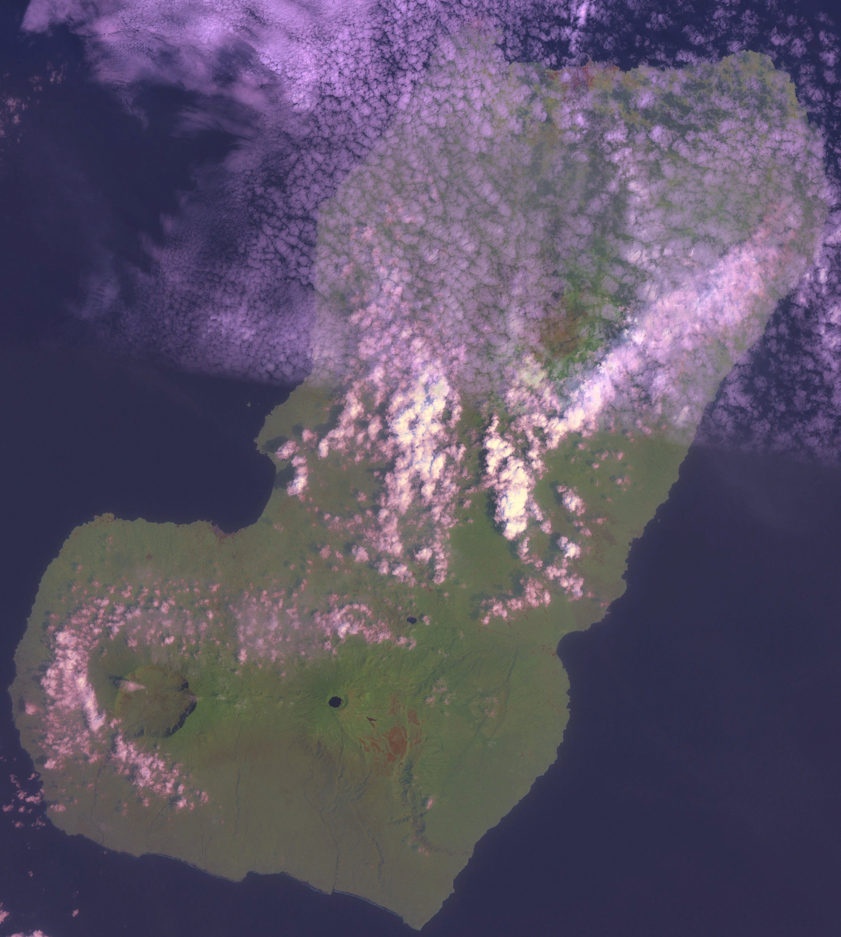
Bioko (; ; ; historically known as Fernando Pó, ) is an island of Equatorial Guinea. It is located south of the coast of Cameroon, and northwest of the northernmost part of mainland Equatorial Guinea. Malabo, on the north coast of the island, is the capital city of Equatorial Guinea. Bioko's population was 335,048 at the 2015 census and it covers an area of . The island is part of the Cameroon line of volcanoes and is located off the Cameroon coast, in the Bight of Biafra portion of the Gulf of Guinea. Its geology is volcanic; its highest peak is Pico Basile at . Etymology Bioko's native name is ''Ëtulá a Ëri'' in the Bube language. For nearly 500 years, the island was known as ''Fernando Pó'' (; ), named for Portuguese navigator Fernão do Pó. Between 1973 and 1979 the island was named ''Macías Nguema Biyogo'' after the then-president of Equatorial Guinea. The current name, Bioko, dates from 1979 and is in honour of politician Cristino Seriche Bioko. Geogra ... [...More Info...] [...Related Items...] OR: [Wikipedia] [Google] [Baidu] |
Malabo
Malabo ( , ; formerly ) is the capital of Equatorial Guinea in the province of Bioko Norte. It is located on the north coast of the island of Bioko (, and as ''Fernando Pó'' by the Europeans). In 2018, the city had a population of approximately 297,000 inhabitants. Spanish is the official language of the city and of the country as well, but Pichinglis is used as a language of wider communication across Bioko island, including Malabo. Malabo is the oldest city in Equatorial Guinea. Ciudad de la Paz is a planned community under construction in mainland Equatorial Guinea which was designed to replace Malabo as the capital. The institutions of governance of Equatorial Guinea began the process of locating to Ciudad de la Paz in February 2017. History European discovery and Portuguese occupation In 1472, in an attempt to find a new route to India, the Portuguese navigator Fernão do Pó, encountered the island of Bioko, which he called ''Formosa''.Roman Adrian Cybriws ... [...More Info...] [...Related Items...] OR: [Wikipedia] [Google] [Baidu] |
Jamaica
Jamaica is an island country in the Caribbean Sea and the West Indies. At , it is the third-largest island—after Cuba and Hispaniola—of the Greater Antilles and the Caribbean. Jamaica lies about south of Cuba, west of Hispaniola (the island containing Haiti and the Dominican Republic), and southeast of the Cayman Islands (a British Overseas Territories, British Overseas Territory). With million people, Jamaica is the third most populous English-speaking world, Anglophone country in the Americas and the fourth most populous country in the Caribbean. Kingston, Jamaica, Kingston is the country's capital and largest city. The indigenous Taíno peoples of the island gradually came under Spanish Empire, Spanish rule after the arrival of Christopher Columbus in 1494. Many of the indigenous people either were killed or died of diseases, after which the Spanish brought large numbers of Africans to Jamaica as slaves. The island remained a possession of Spain, under the name Colo ... [...More Info...] [...Related Items...] OR: [Wikipedia] [Google] [Baidu] |


