|
Alappad
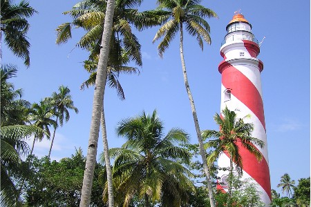
Alappad is a coastal village in the Kollam district of the Indian state Kerala. It is situated on a narrow strip of land sandwiched between the Arabian Sea and the TS Canal – the village is approximately 16 km long and its narrowest point is as thin as 33 meters. Connect to the mainland is by bridge as well as by country boat ferries, operated by the Panchayat and private parties. Until recently there was only one bridge at the southern point of the land strip, but after the 2004 tsunami, two other bridges have been constructed. The protests are taking place in the village against Unscientific sand mining by IREL. Administration Alappad village is a ward of the panchayat of the same name. Often, the whole panchayat is referred as Alappad; however, the panchayat actually consists of various wards/places such as Srayikkadu, Azheekal, Kuzhithura, Parayakadavu, Cheriazheekkal, Pandarathuruthu.Vellanathuruth 2004 tsunami Portions of the village were damaged during the 2 ... [...More Info...] [...Related Items...] OR: [Wikipedia] [Google] [Baidu] |
Mata Amritanandamayi Math
The Mata Amritanandamayi Math (MAM) is an international charitable organization aimed at the spiritual and material upliftment of humankind. It was founded by Indian spiritual leader and humanitarian Mata Amritanandamayi in 1981, with its headquarters in Paryakadavu, Alappad Panchayat, Kollam district, Kerala. Along with its sister organization, the Mata Amritanandamayi Mission Trust, MAM conducts charitable work including disaster relief, healthcare for the poor, environmental programs, fighting hunger and scholarships for impoverished students, amongst others. It also runs the seven-campus university known as Amrita Vishwa Vidyapeetham, 90 chain of English medium CBSE schools known as Amrita Vidyalayam, and classes in yoga, meditation and Sanskrit. MAM is a volunteer organization, basing its activities on the principle of karma yoga ork as an offering to the divine Its headquarters are home to more than 3,000 people, a mix of householders, monastics and monastic students. P ... [...More Info...] [...Related Items...] OR: [Wikipedia] [Google] [Baidu] |
Srayikkadu
Srayikkadu is a coastal village in Kerala, India. It is in Kollam district. Srayikkadu is part of Alappad panchayat which is part of karunagappally Taluk situated on a narrow strip of land sandwiched between the Arabian Sea and the T S Canal.The village is connected to the mainland by bridges as well as by country boat ferries. The main nearby places Karunagappally, Kayamkulam, Ochira are connected by roads. By water, it is connected to various places like Alappuzha, Kollam. Mata Amritanandamayi Math The Mata Amritanandamayi Math (MAM) is an international charitable organization aimed at the spiritual and material upliftment of humankind. It was founded by Indian spiritual leader and humanitarian Mata Amritanandamayi in 1981, with its headq ... is 1 km away from this small village as well. It is a green land with backwaters and beaches. References {{Kollam district Villages in Kollam district GLPSchool, srayikkad ... [...More Info...] [...Related Items...] OR: [Wikipedia] [Google] [Baidu] |
Kollam District
Kollam district (), (formerly Quilon district) is one of 14 districts of the state of Kerala, India. The district has a cross-section of Kerala's natural attributes; it is endowed with a long coastline, a major Laccadive Sea seaport and an inland lake ( Ashtamudi Lake). The district has many water bodies. Kallada River is one among them, and the east side land of river is East Kallada and the west side land is West Kallada. Overview Kallada Boat race is one of the famous festival events of the district. Even though it is a competition between two land sides of the river, many boat clubs from various places, even beyond the district participate in the event. Kollam is the capital of Kerala's cashew industry. Plains, mountains, lakes, lagoons, and backwaters, forests, farmland and rivers make up the topography of the district. The area had trading relationships with Phoenicia and Ancient Rome. Climate Kollam's temperature is almost steady throughout the year. The average ... [...More Info...] [...Related Items...] OR: [Wikipedia] [Google] [Baidu] |
Kuzhithura
Kuzhithura is a village in the Kollam district of the Indian state of Kerala. Kuzhithura is part of Alappad panchayat, which is part of the Karunagappally Taluk, situated on a narrow strip of land sandwiched between the Arabian Sea and the Thiruvananthapuram–Shoranur canal. It is a tourist destination with green land, backwaters, and beaches. Demographics The village has total of 400 houses and 401 households. 94.50% of the houses are pucca, 5% are semi-pucca and .5% are kaccha. All the houses are electrified. Sree Krishnaswamy Temple Sree Krishnaswamy Temple Kuzhithura (also called Kuzhithura Sree Krishnaswamy Temple) is one of the oldest Krishna temples in Kerala. It is located near the Thiruvananthapuram–Shoranur canal. An annual temple festival occurs between January to February, drawing large crowds. Educational institutions For education, there are two anganwadis and the Govt. Fishery Higher Secondary School for older students. Geography Kuzhithura is locate ... [...More Info...] [...Related Items...] OR: [Wikipedia] [Google] [Baidu] |
Mata Amritanandamayi
Mātā Amritānandamayī Devī (born Sudhamani Idamannel; 27 September 1953), often known as Amma ("Mother"), is an Indian Hindu spiritual leader, guru and humanitarian, who is revered as 'the hugging saint' by her followers. In 2018, she was felicitated by Indian Prime Minister Narendra Modi for largest contribution to the Government of India's Clean India Campaign Swachh Bharat Mission. She was the first recipient of Vishwaratna Puraskar (Gem of the World Award) by Hindu Parliament. Life Mātā Amritānandamayī Devi is an Indian guru from Parayakadavu (now partially known as Amritapuri), Alappad Panchayat in Karunagappally, Kollam District, in the state of Kerala. Born to a family of lower-caste fishermen on 27 September 1953, she was the third child of Sugunanandan and Damayanti. Her mother Damayanti died on 19 September 2022. She has six siblings. As part of her chores, Amṛtānandamayī gathered food scraps from neighbours for her family's cows and goats, through ... [...More Info...] [...Related Items...] OR: [Wikipedia] [Google] [Baidu] |
Kollam
Kollam (), also known by its former name Quilon , is an ancient seaport and city on the Malabar Coast of India bordering the Laccadive Sea, which is a part of the Arabian Sea. It is north of the state capital Thiruvananthapuram. The city is on the banks of Ashtamudi Lake and the Kallada river. It is the headquarters of the Kollam district. Kollam is the fourth largest city in Kerala and is known for cashew processing and coir manufacturing. It is the southern gateway to the Backwaters of Kerala and is a prominent tourist destination. Kollam has a strong commercial reputation since ancient times. The Arabs, Phoenicians, Chinese, Ethiopians, Syrians, Jews, Chaldeans and Romans have all engaged in trade at the port of Kollam for millennia. As a result of Chinese trade, Kollam was mentioned by Ibn Battuta in the 14th century as one of the five Indian ports he had seen during the course of his twenty-four-year travels. [...More Info...] [...Related Items...] OR: [Wikipedia] [Google] [Baidu] |
Karunagappalli
Karunagappally is a municipality in the Kollam district of Kerala, India. It is 24 km north of Kollam and south of Alappuzha. Karunagappally taluk consists of Alappad, Ochira, Adinad, Karunagappally, Thazhava, Pavumba, Thodiyoor, Kallalibhagom, Thevalakkara, Chavara, Neendakara, Clappana, Kulasekharapuram, Thekkumbhagam, Ayanivelikulangara, Panmana, Ponmana and Vadakumthala. The taluk is bound on the north by Kayamkulam, on the east by Kunnathur taluk, on the south by Kollam and on the west by the Arabian Sea. It is one of the fastest developing towns in Kerala and is part of Kollam metropolitan area. Karunagappally is the location of a government engineering college named the College of Engineering Karunagappally, also known as CEK. Europeans called Karunagappally Martha. Tourist attractions The main tourist attraction is the house boat facility in Alumkadavu which is close (only 3 km) to Karunagappally town. Karunagappally Tourism at a glanc ... [...More Info...] [...Related Items...] OR: [Wikipedia] [Google] [Baidu] |
2004 Indian Ocean Earthquake And Tsunami
An earthquake and a tsunami, known as the Boxing Day Tsunami and, by the scientific community, the Sumatra–Andaman earthquake, occurred at 07:58:53 local time (UTC+07:00, UTC+7) on 26 December 2004, with an epicentre off the west coast of northern Sumatra, Indonesia. It was an Submarine earthquake, undersea megathrust earthquake that registered a magnitude of 9.1–9.3 , reaching a Modified Mercalli intensity scale, Mercalli intensity up to IX in certain areas. The earthquake was caused by a rupture along the fault between the Burma Plate and the Indian Plate. A series of massive tsunami waves grew up to high once heading inland, after being created by the underwater seismic activity offshore. Communities along the surrounding coasts of the Indian Ocean were devastated, and the tsunamis killed an estimated 227,898 people in 14 countries, making it List of natural disasters by death toll#Ten deadliest natural disasters since 1900 excluding epidemics and famines, one of the de ... [...More Info...] [...Related Items...] OR: [Wikipedia] [Google] [Baidu] |
Cheriazheekkal
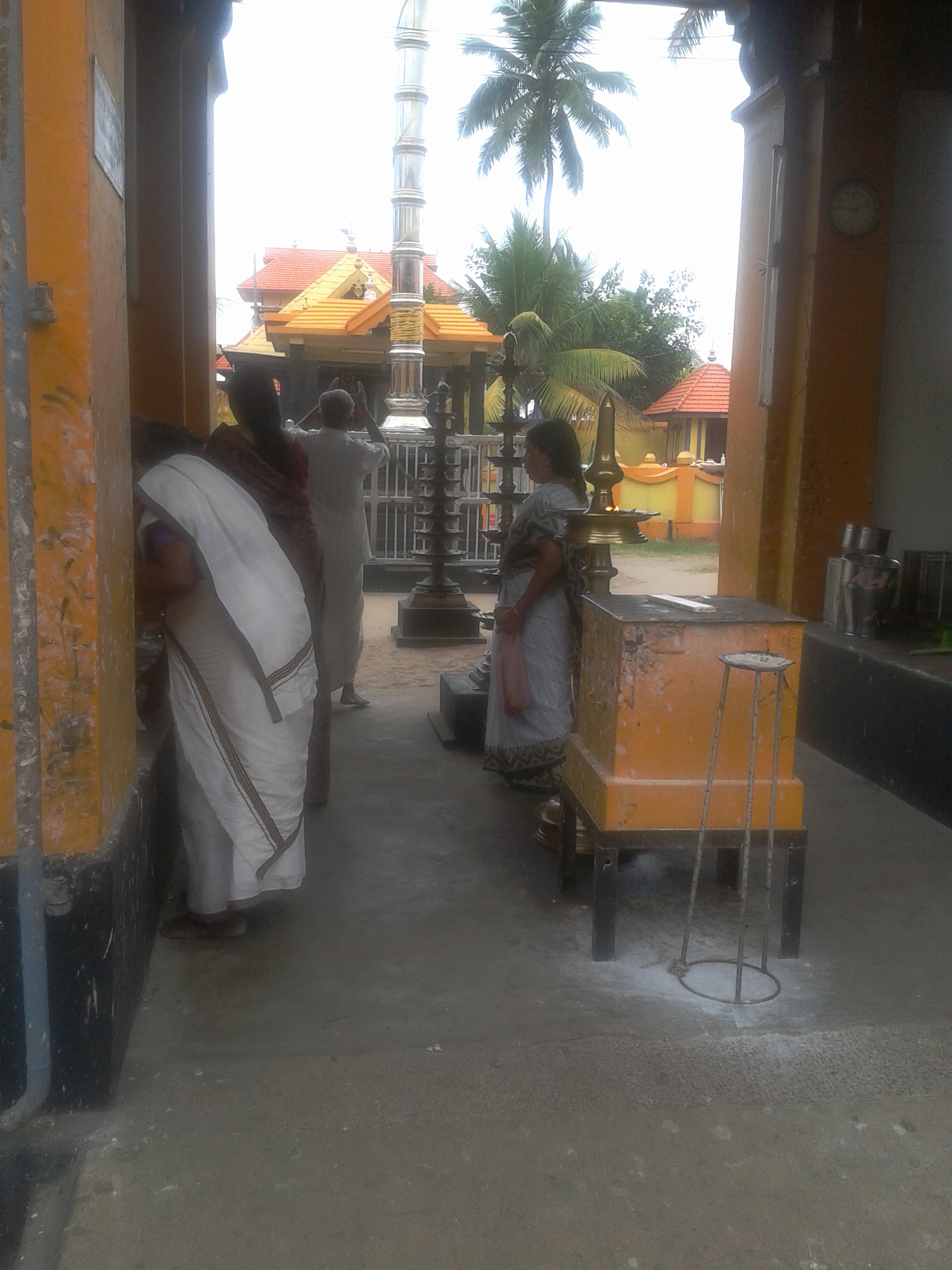
Cheriazheekkal or Cheriazheeckal is a village in the Alappad panchayat in the town of Karunagapalli in Kerala, India. It is located between the Arabian Sea The Arabian Sea ( ar, اَلْبَحرْ ٱلْعَرَبِيُّ, Al-Bahr al-ˁArabī) is a region of the northern Indian Ocean bounded on the north by Pakistan, Iran and the Gulf of Oman, on the west by the Gulf of Aden, Guardafui Channel ... on the west and backwaters to the East. Cheriazheekkal is primarily made up of fishing, farming, and other traditional labour communities along with a budding tourism sector. Known for its twin temples, Cheriazheekkal is steeped in legends. The Sri Kashi Vishwanathar Temple is also known as the Deccan Kashi Temple, after the legend of the priest who installed the Sivalingam that he found in the Ganges, at Cheriazheekal. But it is also believed that the place housed a temple dedicated to Lord Vishnu, built some 2,000 years ago. References {{Kollam district Villages in Koll ... [...More Info...] [...Related Items...] OR: [Wikipedia] [Google] [Baidu] |
States And Territories Of India
India is a federal union comprising 28 states and 8 union territories, with a total of 36 entities. The states and union territories are further subdivided into districts and smaller administrative divisions. History Pre-independence The Indian subcontinent has been ruled by many different ethnic groups throughout its history, each instituting their own policies of administrative division in the region. The British Raj The British Raj (; from Hindi language, Hindi ''rāj'': kingdom, realm, state, or empire) was the rule of the British The Crown, Crown on the Indian subcontinent; * * it is also called Crown rule in India, * * * * or Direct rule in India, * Q ... mostly retained the administrative structure of the preceding Mughal Empire. India was divided into provinces (also called Presidencies), directly governed by the British, and princely states, which were nominally controlled by a local prince or raja loyal to the British Empire, which held ''de f ... [...More Info...] [...Related Items...] OR: [Wikipedia] [Google] [Baidu] |
Hindu
Hindus (; ) are people who religiously adhere to Hinduism.Jeffery D. Long (2007), A Vision for Hinduism, IB Tauris, , pages 35–37 Historically, the term has also been used as a geographical, cultural, and later religious identifier for people living in the Indian subcontinent. The term ''"Hindu"'' traces back to Old Persian which derived these names from the Sanskrit name ''Sindhu'' (सिन्धु ), referring to the river Indus. The Greek cognates of the same terms are "''Indus''" (for the river) and "''India''" (for the land of the river). The term "''Hindu''" also implied a geographic, ethnic or cultural identifier for people living in the Indian subcontinent around or beyond the Indus River, Sindhu (Indus) River. By the 16th century CE, the term began to refer to residents of the subcontinent who were not Turkic peoples, Turkic or Muslims. Hindoo is an archaic spelling variant, whose use today is considered derogatory. The historical development of Hindu self-i ... [...More Info...] [...Related Items...] OR: [Wikipedia] [Google] [Baidu] |


.jpg)