|
Al Mahatta Fort
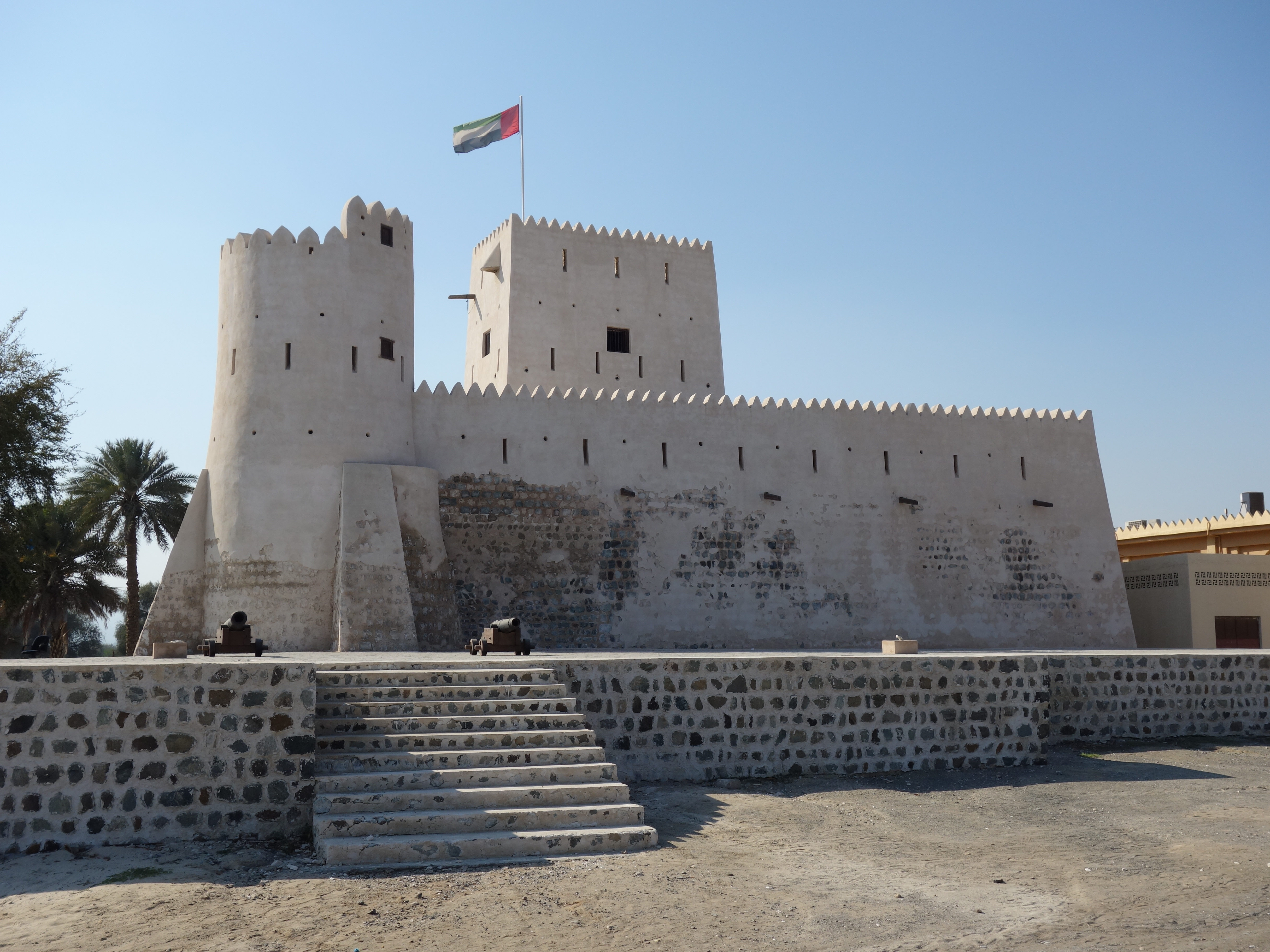
Mahatta Fort ("the station" in Arabic) is located in central Sharjah in the United Arab Emirates. The fort was built by the Ruler of Sharjah in 1932 to afford protection for the passengers and staff of Imperial Airways. It was the first British establishment on the Trucial Coast, after an agreement was struck between the British government (on behalf of Imperial Airways) and the ruler of Sharjah in June 1932. The Fort was used by the Royal Air Force in World War II and the Trucial Oman Scouts before briefly becoming a hotel, a police station and is now an aviation museum, known as Al Mahatta Museum. History The Imperial Airways Empire Route was originally established on the Northern Shore of the Persian Gulf, with Imperial Airways seaplanes landing off Hengam Island, but the agreement to use the route made with the Persian Government lapsed in 1932 when the Persian Government attempted to use the continuation of rights to the facility as leverage to gain British recognition for t ... [...More Info...] [...Related Items...] OR: [Wikipedia] [Google] [Baidu] |
Sharjah
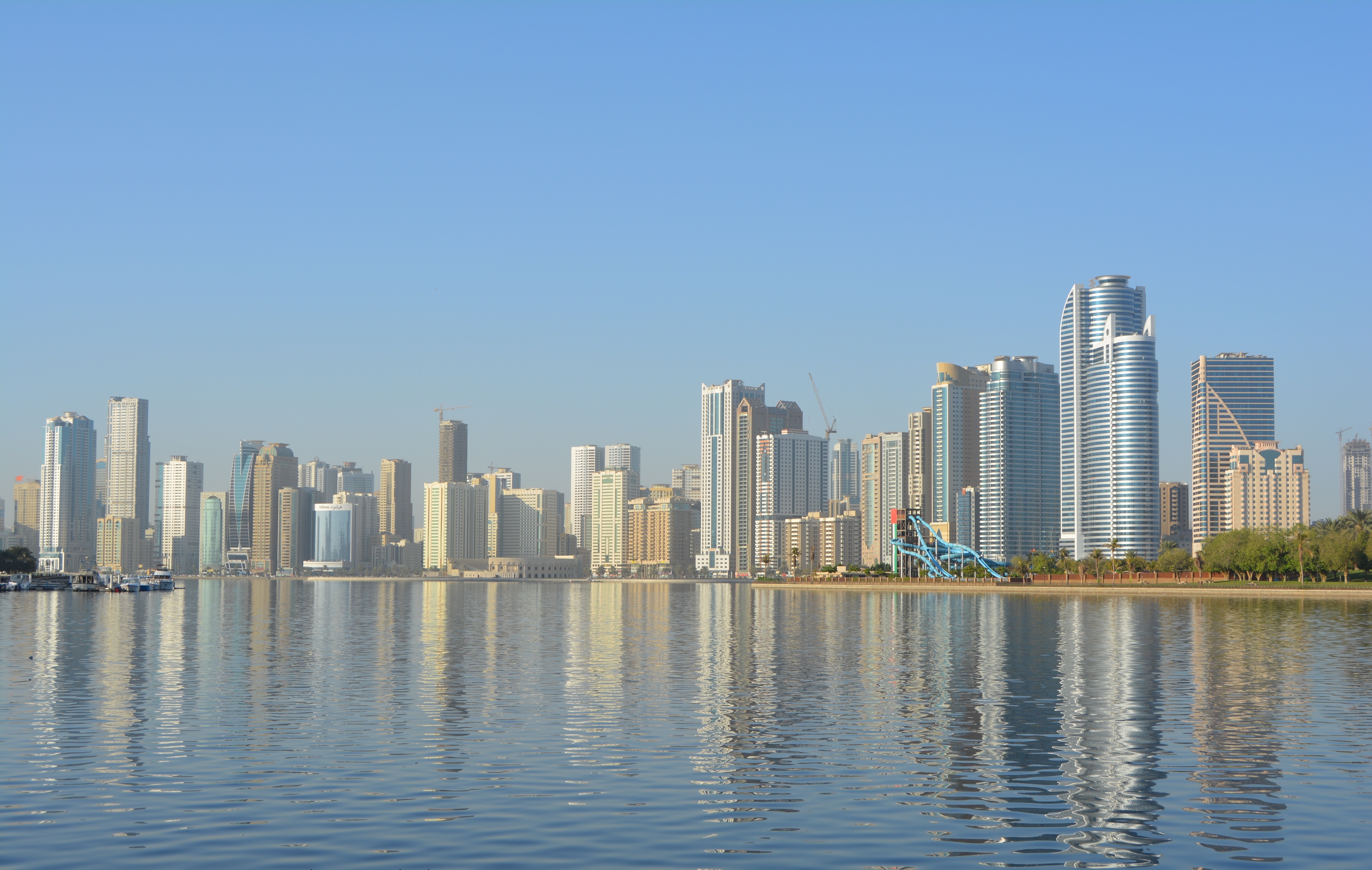
Sharjah (; ar, ٱلشَّارقَة ', Gulf Arabic: ''aš-Šārja'') is the third-most populous city in the United Arab Emirates, after Dubai and Abu Dhabi, forming part of the Dubai-Sharjah-Ajman metropolitan area. Sharjah is the capital of the eponymous emirate. The emirate shares legal, political, military and economic functions with the other emirates of the UAE within a federal framework, although each emirate has jurisdiction over some functions such as civil law enforcement and provision and upkeep of local facilities. Sharjah has been ruled by the Al Qasimi dynasty since the 18th century. The city is a centre for culture and industry, and alone contributes 7.4% of the GDP of the United Arab Emirates. The city covers an approximate area of 235 km2 and has a population of over 800,000 (2008). The sale or consumption of alcoholic beverages is prohibited in the emirate of Sharjah without possession of an alcohol licence and alcohol is not served in hotels, restau ... [...More Info...] [...Related Items...] OR: [Wikipedia] [Google] [Baidu] |
Shihuh
The Shihuh ( ar, الشحوح, ') is an Arab tribe living in the United Arab Emirates (UAE) and Oman. In the singular, the name is Al Shehhi, a common family name in the UAE and Oman today. Inhabiting the northern part of the Hajar Mountain range, specifically in the Ruus Al Jibal (Musandam Peninsula), the tribe has long been influential in the affairs of both the east and west coast settlements of the northern UAE and Oman and has fiercely maintained both its identity and independence. Sections The Shihuh are divided into two main sections, the Bani Hadiyah and Bani Shatair. The Bani Hadiyah splits into several subsections: the Bani Muhammad; Bani Ali; Bani Ham Mazyud and Khanazirah. The Bani Shatair splits into the Khanabil; Kumazarah; Mahabib and Maqadilah. At the turn of the 20th century, the tribe numbered some 21,500 people and was mostly settled around the Rus Al Jibal mountains, as well as Sha'am, Ghalilah, Ghubb and Khor Khwair in Ras Al Khaimah. In total, som ... [...More Info...] [...Related Items...] OR: [Wikipedia] [Google] [Baidu] |
Kalba
Kalba () is a city in the Emirate of Sharjah in the United Arab Emirates (UAE). It is an exclave of Sharjah lying on the Gulf of Oman coast north of Oman. Khor Kalba (Kalba Creek), an important nature reserve and mangrove swamp, is located south of the town by the Omani border. Kalba Mangrove reserve is open to the public and was developed as an eco-tourism resort by the Sharjah Investment and Development Authority (Shurooq). A number of conservationists and ecologists have expressed concern regarding the project. History Shell middens dating back to the fourth millennium BCE have been found at Kalba, as well as extensive remains of Umm Al Nar era settlement. Portuguese The town was captured by the Portuguese Empire in the 16th century and was referred to as ''Ghallah''. It was part of a series of fortified cities that the Portuguese used to control access to the Persian Gulf and the Gulf of Oman, e.g. Khor Fakan, Muscat, Sohar, Seeb, Qurayyat, Muttrah. Kalba Fort, toda ... [...More Info...] [...Related Items...] OR: [Wikipedia] [Google] [Baidu] |
Imperial Routes April 1935
Imperial is that which relates to an empire, emperor, or imperialism. Imperial or The Imperial may also refer to: Places United States * Imperial, California * Imperial, Missouri * Imperial, Nebraska * Imperial, Pennsylvania * Imperial, Texas * Imperial, West Virginia * Imperial, Virginia * Imperial County, California * Imperial Valley, California * Imperial Beach, California Elsewhere * Imperial (Madrid), an administrative neighborhood in Spain * Imperial, Saskatchewan, a town in Canada Buildings * Imperial Apartments, a building in Brooklyn, New York * Imperial City, Huế, a palace in Huế, Vietnam * Imperial Palace (other) * Imperial Towers, a group of lighthouses on Lake Huron, Canada * The Imperial (Mumbai), a skyscraper apartment complex in India Animals and plants * '' Cheritra'' or imperial, a genus of butterfly Architecture, design, and fashion * Imperial, a luggage case for the top of a coach * Imperial, the top, roof or second-storey compartment of ... [...More Info...] [...Related Items...] OR: [Wikipedia] [Google] [Baidu] |
Handley Page H
Handley may refer to: Places In the United Kingdom * Handley, Cheshire, a village *Handley, a hamlet in the parish of Stretton, Derbyshire Stretton is a small village and civil parish in Derbyshire, England. The population of the civil parish as at the 2011 Census was 525. It is located near the towns of Clay Cross and three and a half miles from Alfreton on the A61. The nearest w ... * Middle Handley, a hamlet in the parish of Unstone, Derbyshire * Nether Handley, a hamlet in the parish of Unstone, Derbyshire * West Handley, a hamlet in the parish of Unstone, Derbyshire *Handley, a village in Dorset now known as Sixpenny Handley In the United States * Handley, Dallas County, Missouri * Handley (Fort Worth), a former town currently located with the city of Fort Worth, Texas * Handley, West Virginia * John Handley High School, Winchester, Virginia Other uses * Handley (surname) * Handley Page H.P.42, British four-engine long-range biplane airliners in service from 1931 to 194 ... [...More Info...] [...Related Items...] OR: [Wikipedia] [Google] [Baidu] |
Australia
Australia, officially the Commonwealth of Australia, is a Sovereign state, sovereign country comprising the mainland of the Australia (continent), Australian continent, the island of Tasmania, and numerous List of islands of Australia, smaller islands. With an area of , Australia is the largest country by area in Oceania and the world's List of countries and dependencies by area, sixth-largest country. Australia is the oldest, flattest, and driest inhabited continent, with the least fertile soils. It is a Megadiverse countries, megadiverse country, and its size gives it a wide variety of landscapes and climates, with Deserts of Australia, deserts in the centre, tropical Forests of Australia, rainforests in the north-east, and List of mountains in Australia, mountain ranges in the south-east. The ancestors of Aboriginal Australians began arriving from south east Asia approximately Early human migrations#Nearby Oceania, 65,000 years ago, during the Last Glacial Period, last i ... [...More Info...] [...Related Items...] OR: [Wikipedia] [Google] [Baidu] |
Brisbane
Brisbane ( ) is the capital and most populous city of the Australian state of Queensland, and the third-most populous city in Australia and Oceania, with a population of approximately 2.6 million. Brisbane lies at the centre of the South East Queensland metropolitan region, which encompasses a population of around 3.8 million. The Brisbane central business district is situated within a peninsula of the Brisbane River about from its mouth at Moreton Bay, a bay of the Coral Sea. Brisbane is located in the hilly floodplain of the Brisbane River Valley between Moreton Bay and the Taylor and D'Aguilar mountain ranges. It sprawls across several local government areas, most centrally the City of Brisbane, Australia's most populous local government area. The demonym of Brisbane is ''Brisbanite''. The Traditional Owners of the Brisbane area include clans of the Yugara, Turrbal and Quandamooka peoples. The Turrbal word for the Brisbane area is ''Meeanjin''. The Moreton ... [...More Info...] [...Related Items...] OR: [Wikipedia] [Google] [Baidu] |
Eagle Farm Airport
Eagle Farm Airport was a small airport located north-east of Brisbane in the suburb of Eagle Farm, Queensland, Australia. History An area located near Eagle Farm Racecourse was initially used as a landing field in 1922 and Eagle Farm Aerodrome was officially opened in 1925. It was used for scheduled flights between Brisbane and Queensland regional centres by the Queensland and Northern Territory Aerial Services Limited (Qantas), which operated from Eagle Farm in 1926 and formed the Brisbane Flying Training School there in 1927. Sir Charles Kingsford Smith, Charles Ulm, Harry Lyon (navigator) and James Warner (radio operator) landed the Southern Cross at Eagle Farm on 9 June 1928 after its trans-Pacific flight from Oakland, California. About 16,000 people greeted the Southern Cross upon its landing. The Australian National Airways (ANA) began an aerial service from Eagle Farm to Sydney, New South Wales in 1930. Eagle Farm was closed 31 January 1931 after civil operation ... [...More Info...] [...Related Items...] OR: [Wikipedia] [Google] [Baidu] |
United Kingdom
The United Kingdom of Great Britain and Northern Ireland, commonly known as the United Kingdom (UK) or Britain, is a country in Europe, off the north-western coast of the European mainland, continental mainland. It comprises England, Scotland, Wales and Northern Ireland. The United Kingdom includes the island of Great Britain, the north-eastern part of the island of Ireland, and many List of islands of the United Kingdom, smaller islands within the British Isles. Northern Ireland shares Republic of Ireland–United Kingdom border, a land border with the Republic of Ireland; otherwise, the United Kingdom is surrounded by the Atlantic Ocean, the North Sea, the English Channel, the Celtic Sea and the Irish Sea. The total area of the United Kingdom is , with an estimated 2020 population of more than 67 million people. The United Kingdom has evolved from a series of annexations, unions and separations of constituent countries over several hundred years. The Treaty of Union between ... [...More Info...] [...Related Items...] OR: [Wikipedia] [Google] [Baidu] |
Croydon
Croydon is a large town in south London, England, south of Charing Cross. Part of the London Borough of Croydon, a local government district of Greater London. It is one of the largest commercial districts in Greater London, with an extensive shopping district and night-time economy. The entire town had a population of 192,064 as of 2011, whilst the wider borough had a population of 384,837. Historically an ancient parish in the Wallington hundred of Surrey, at the time of the Norman conquest of England Croydon had a church, a mill, and around 365 inhabitants, as recorded in the Domesday Book of 1086. Croydon expanded in the Middle Ages as a market town and a centre for charcoal production, leather tanning and brewing. The Surrey Iron Railway from Croydon to Wandsworth opened in 1803 and was an early public railway. Later 19th century railway building facilitated Croydon's growth as a commuter town for London. By the early 20th century, Croydon was an important industria ... [...More Info...] [...Related Items...] OR: [Wikipedia] [Google] [Baidu] |
Croydon Airport
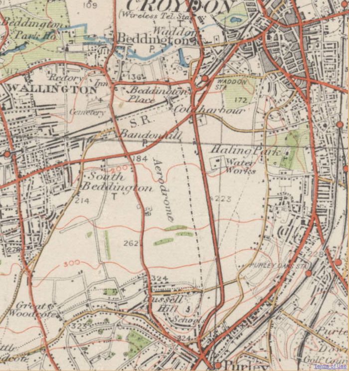
Croydon Airport (former ICAO code: EGCR) was the UK's only international airport during the interwar period. Located in Croydon, South London, England, it opened in 1920, built in a Neoclassical style, and was developed as Britain's main airport, handling more cargo, mail, and passengers than any other UK airport at the time. Innovations at the site included the world's first air traffic control and the first airport terminal. During World War II the airport was named RAF Croydon as its role changed to that of a fighter airfield during the Battle of Britain; and in 1943 RAF Transport Command was founded at the site, which used the airport to transport thousands of troops into and out of Europe. After the Second World War, its role returned to civil aviation, but the role of London's primary international airport passed to London Heathrow Airport. Croydon Airport closed in 1959. It had been known under eight different names while it was active. In 1978, the terminal buildin ... [...More Info...] [...Related Items...] OR: [Wikipedia] [Google] [Baidu] |
Jodphur
Jodhpur (; ) is the second-largest city in the Indian state of Rajasthan and officially the second metropolitan city of the state. It was formerly the seat of the princely state of Jodhpur State. Jodhpur was historically the capital of the Kingdom of Marwar, which is now part of Rajasthan. Jodhpur is a popular tourist destination, featuring many palaces, forts, and temples, set in the stark landscape of the Thar Desert. It is popularly known as the "Blue City" among people of Rajasthan and all over India. It serves as the administrative headquarters of the Jodhpur district and Jodhpur division. The old city circles the Mehrangarh Fort and is bounded by a wall with several gates. The city has expanded greatly outside the wall, though over the past several decades. Jodhpur lies near the geographic centre of the Rajasthan state, which makes it a convenient base for travel in a region much frequented by tourists. The city featured in ''The New York Timess "52 Places to Go in 20 ... [...More Info...] [...Related Items...] OR: [Wikipedia] [Google] [Baidu] |


