|
Al-Jiyya
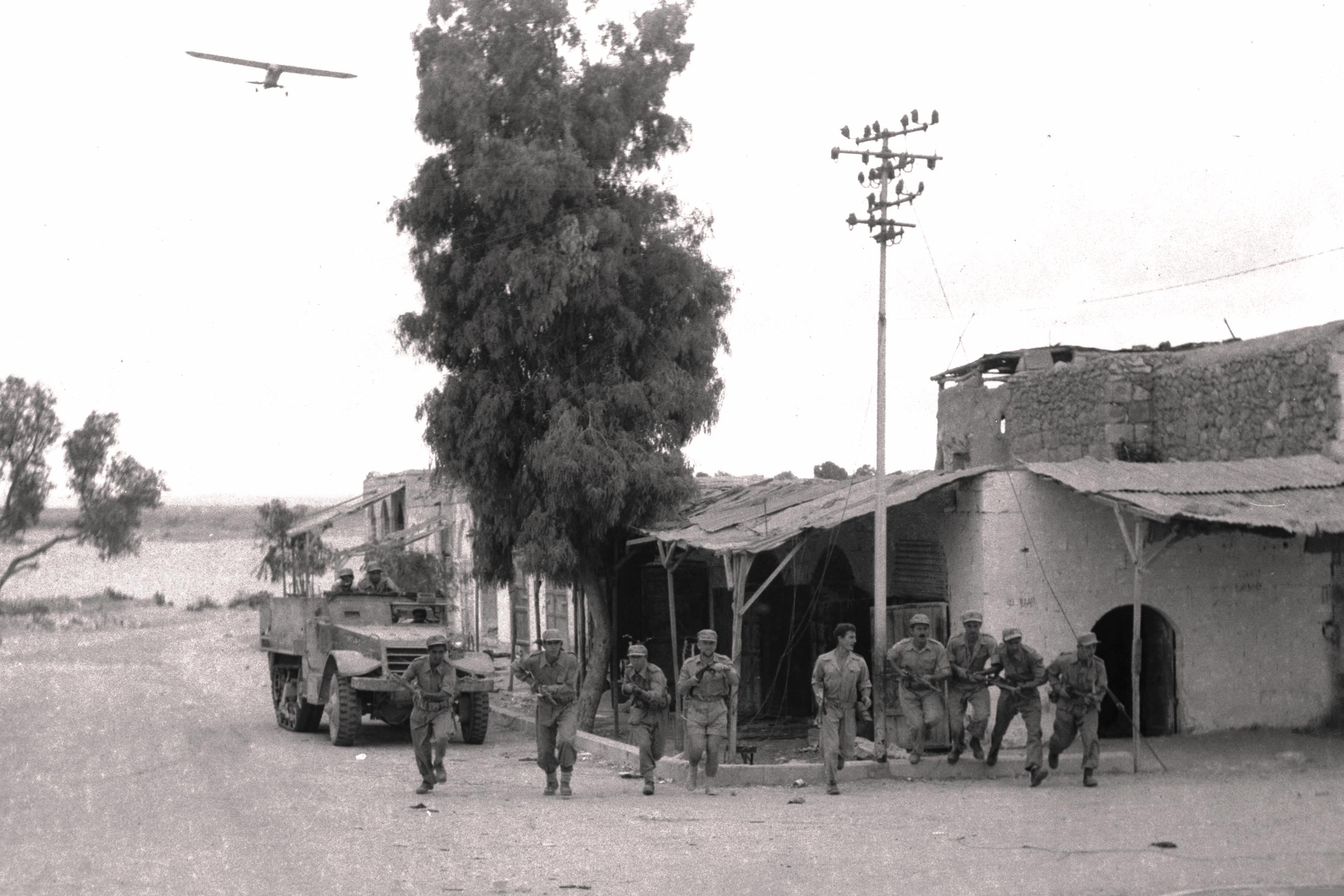
al-Jiyya ( ar, الجية, also transliterated Algie) was a Palestinian village that was depopulated during the 1948 Arab-Israeli War. Located 19 kilometers northeast of Gaza City, according to a 1945 census, the village had a population of 1,230. The village was occupied by Israel's Giv'ati Brigade on 4 November 1948 during Operation Yoav. History The village was situated on a sandy spot, surrounded by hills, on the southern coastal plain. Several wadis descended around it and it was periodically subjected to flooding. This perhaps explains its name, which means "water collector" in Arabic.but "confusion" according to Palmer, 1881, p367/ref> The village has been identified with a town referred to in the Crusader records as "Algie". Among the archaeological remains found in al Jiyya were a stone column and the remains of a Roman mill. Ottoman era The village appeared without its name on the map of Pierre Jacotin compiled in 1799. The villagers reported that their village ha ... [...More Info...] [...Related Items...] OR: [Wikipedia] [Google] [Baidu] |
Operation Yoav
Operation Yoav (also called ''Operation Ten Plagues'' or ''Operation Yo'av'') was an Israeli military operation carried out from 15–22 October 1948 in the Negev Desert, during the 1948 Arab–Israeli War. Its goal was to drive a wedge between the Egyptian forces along the coast and the Beersheba–Hebron–Jerusalem road, and ultimately to conquer the whole Negev. Operation Yoav was headed by the Southern Front commander Yigal Allon. The operation was named after Yitzhak Dubno, codenamed "Yoav" by his commanders in the Palmach. Dubno, a senior Palmach officer, was charged with planning and leading the defense of the kibbutzim Negba and Yad Mordechai. Dubno was killed in an air raid on Kibbutz Negba shortly after Egyptian forces began their offensive on Israel's southern front. Background In the central and northern parts of Palestine, the Israelis had managed to make substantial territorial gains before the second truce of the war went into effect. But the southern Negev Desert, ... [...More Info...] [...Related Items...] OR: [Wikipedia] [Google] [Baidu] |
Mandatory Palestine
Mandatory Palestine ( ar, فلسطين الانتدابية '; he, פָּלֶשְׂתִּינָה (א״י) ', where "E.Y." indicates ''’Eretz Yiśrā’ēl'', the Land of Israel) was a geopolitical entity established between 1920 and 1948 in the region of Palestine under the terms of the League of Nations Mandate for Palestine. During the First World War (1914–1918), an Arab uprising against Ottoman rule and the British Empire's Egyptian Expeditionary Force under General Edmund Allenby drove the Ottoman Turks out of the Levant during the Sinai and Palestine Campaign. The United Kingdom had agreed in the McMahon–Hussein Correspondence that it would honour Arab independence if the Arabs revolted against the Ottoman Turks, but the two sides had different interpretations of this agreement, and in the end, the United Kingdom and France divided the area under the Sykes–Picot Agreementan act of betrayal in the eyes of the Arabs. Further complicating the issue was t ... [...More Info...] [...Related Items...] OR: [Wikipedia] [Google] [Baidu] |
Pierre Jacotin
Pierre Jacotin (1765–1827) was the director of the survey for the ''Carte de l'Égypte (Description de l'Égypte)'', the first triangulation-based map of Egypt, Syria and Palestine. The maps were surveyed in 1799-1800 during the campaign in Egypt and Palestine of Napoleon. After his return from Egypt, Jacotin worked on preparing the plates for publication, but in 1808 Napoleon formally made them state secrets and forbade publication. This was apparently connected with Napoleon's efforts at the time to establish an alliance with the Ottomans. It was not until 1828-30 that the engraved plates could be published.Khatib, 2003, p211/ref> References Bibliography * Further reference * * * (Pierre Jacotin: pp437652, “Syria”: pp594609 ) External links * Jacotin maps at the David Rumsey Historical Map Collection The David Rumsey Historical Map Collection is a large private map collection with over 150,000 maps and cartographic items. The collection was created by David ... [...More Info...] [...Related Items...] OR: [Wikipedia] [Google] [Baidu] |
1922 Census Of Palestine
The 1922 census of Palestine was the first census carried out by the authorities of the British Mandate of Palestine, on 23 October 1922. The reported population was 757,182, including the military and persons of foreign nationality. The division into religious groups was 590,890 Muslims, 83,794 Jews, 73,024 Christians, 7,028 Druze, 408 Sikhs, 265 Baháʼís, 156 Metawalis, and 163 Samaritans. Operation Censuses carried out by the Ottoman Empire, most recently in 1914, had been for the purpose of imposing taxation or locating men for military service. For this reason, the announcement of a census was unpopular and effort was made in advance to reassure the population.Barron, pp. 1–4. This was believed to be successful except in the case of the Bedouins of the Beersheva Subdistrict, who refused to cooperate. Many census gatherers, supervised by 296 Revising Operators and Enumerators, visited each dwelling, with special arrangements made for persons having no fixed address. ... [...More Info...] [...Related Items...] OR: [Wikipedia] [Google] [Baidu] |
Sebil (fountain)
A sebil or sabil ( ar, سبيل, sabīl ; Turkish: ''sebil'') is a small kiosk in the Islamic architectural tradition where water is freely dispensed to members of the public by an attendant behind a grilled window. The term is sometimes also used to refer to simple unmanned fountains with a tap for drinking water, though other names often exist for such fountains (such as ''çesme'' in Turkish). Historically, sebils are structures of both civic and religious importance in Muslim cities, most prominently in the cities of the Ottoman Empire, based in Istanbul, and of the Mamluk Empire, based in Cairo. They were built at crossroads, in the middle of city squares, and on the outside of mosques and other religious complexes to provide drinking water for travelers and to assist ritual purification (ablutions) before prayer. Etymology The word ''sebil'' or ''sabil'' comes from the Arabic verb root ''sabala'' (سبل) meaning "to let fall, drop, to let hang down, to close eyes ... [...More Info...] [...Related Items...] OR: [Wikipedia] [Google] [Baidu] |
Adobe
Adobe ( ; ) is a building material made from earth and organic materials. is Spanish for ''mudbrick''. In some English-speaking regions of Spanish heritage, such as the Southwestern United States, the term is used to refer to any kind of earthen construction, or various architectural styles like Pueblo Revival or Territorial Revival. Most adobe buildings are similar in appearance to cob and rammed earth buildings. Adobe is among the earliest building materials, and is used throughout the world. Adobe architecture has been dated to before 5,100 B.C. Description Adobe bricks are rectangular prisms small enough that they can quickly air dry individually without cracking. They can be subsequently assembled, with the application of adobe mud to bond the individual bricks into a structure. There is no standard size, with substantial variations over the years and in different regions. In some areas a popular size measured weighing about ; in other contexts the size is weighi ... [...More Info...] [...Related Items...] OR: [Wikipedia] [Google] [Baidu] |
PEF Survey Of Palestine
The PEF Survey of Palestine was a series of surveys carried out by the Palestine Exploration Fund (PEF) between 1872 and 1877 for the Survey of Western Palestine and in 1880 for the Survey of Eastern Palestine. The survey was carried out after the success of the Ordnance Survey of Jerusalem by the newly-founded PEF, with support from the War Office. Twenty-six sheets were produced for "Western Palestine" and one sheet for "Eastern Palestine". It was the first fully scientific mapping of Palestine. Besides being a geographic survey the group collected thousands of place names with the objective of identifying Biblical, Talmudic, early Christian and Crusading locations. The survey resulted in the publication of a map of Palestine consisting of 26 sheets, at a scale of 1:63,360, the most detailed and accurate map of Palestine published in the 19th century. The PEF survey represented the peak of the cartographic work in Palestine in the nineteenth century. Although the holiness of Pa ... [...More Info...] [...Related Items...] OR: [Wikipedia] [Google] [Baidu] |
Palestine Exploration Fund
The Palestine Exploration Fund is a British society based in London. It was founded in 1865, shortly after the completion of the Ordnance Survey of Jerusalem, and is the oldest known organization in the world created specifically for the study of the Levant region, also known as Palestine. Often simply known as the PEF, its initial objective was to carry out surveys of the topography and ethnography of Ottoman Palestine – producing the PEF Survey of Palestine – with a remit that fell somewhere between an expeditionary survey and military intelligence gathering. It had a complex relationship with Corps of Royal Engineers, and its members sent back reports on the need to salvage and modernise the region.Ilan Pappé (2004) A history of modern Palestine: one land, two peoples Cambridge University Press, pp 34-35 History Following the completion of the Ordnance Survey of Jerusalem, the Biblical archaeologists and clergymen who supported the survey financed the creation of t ... [...More Info...] [...Related Items...] OR: [Wikipedia] [Google] [Baidu] |
Marble
Marble is a metamorphic rock composed of recrystallized carbonate minerals, most commonly calcite or Dolomite (mineral), dolomite. Marble is typically not Foliation (geology), foliated (layered), although there are exceptions. In geology, the term ''marble'' refers to metamorphosed limestone, but its use in stonemasonry more broadly encompasses unmetamorphosed limestone. Marble is commonly used for Marble sculpture, sculpture and as a building material. Etymology The word "marble" derives from the Ancient Greek (), from (), "crystalline rock, shining stone", perhaps from the verb (), "to flash, sparkle, gleam"; Robert S. P. Beekes, R. S. P. Beekes has suggested that a "Pre-Greek origin is probable". This Stem (linguistics), stem is also the ancestor of the English language, English word "marmoreal," meaning "marble-like." While the English term "marble" resembles the French language, French , most other European languages (with words like "marmoreal") more closely resemb ... [...More Info...] [...Related Items...] OR: [Wikipedia] [Google] [Baidu] |
Capital (architecture)
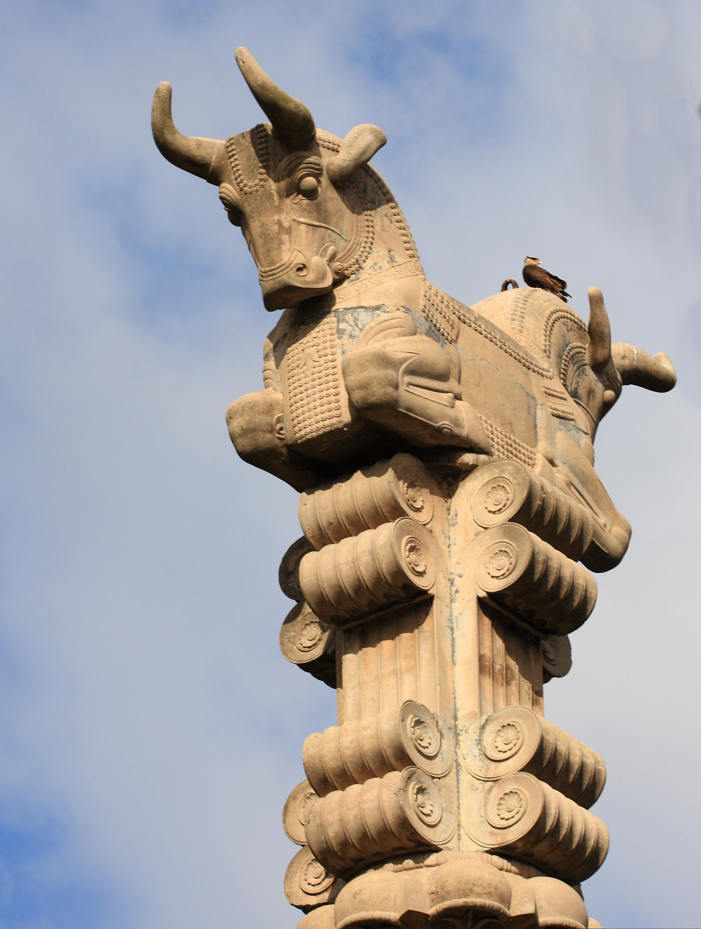
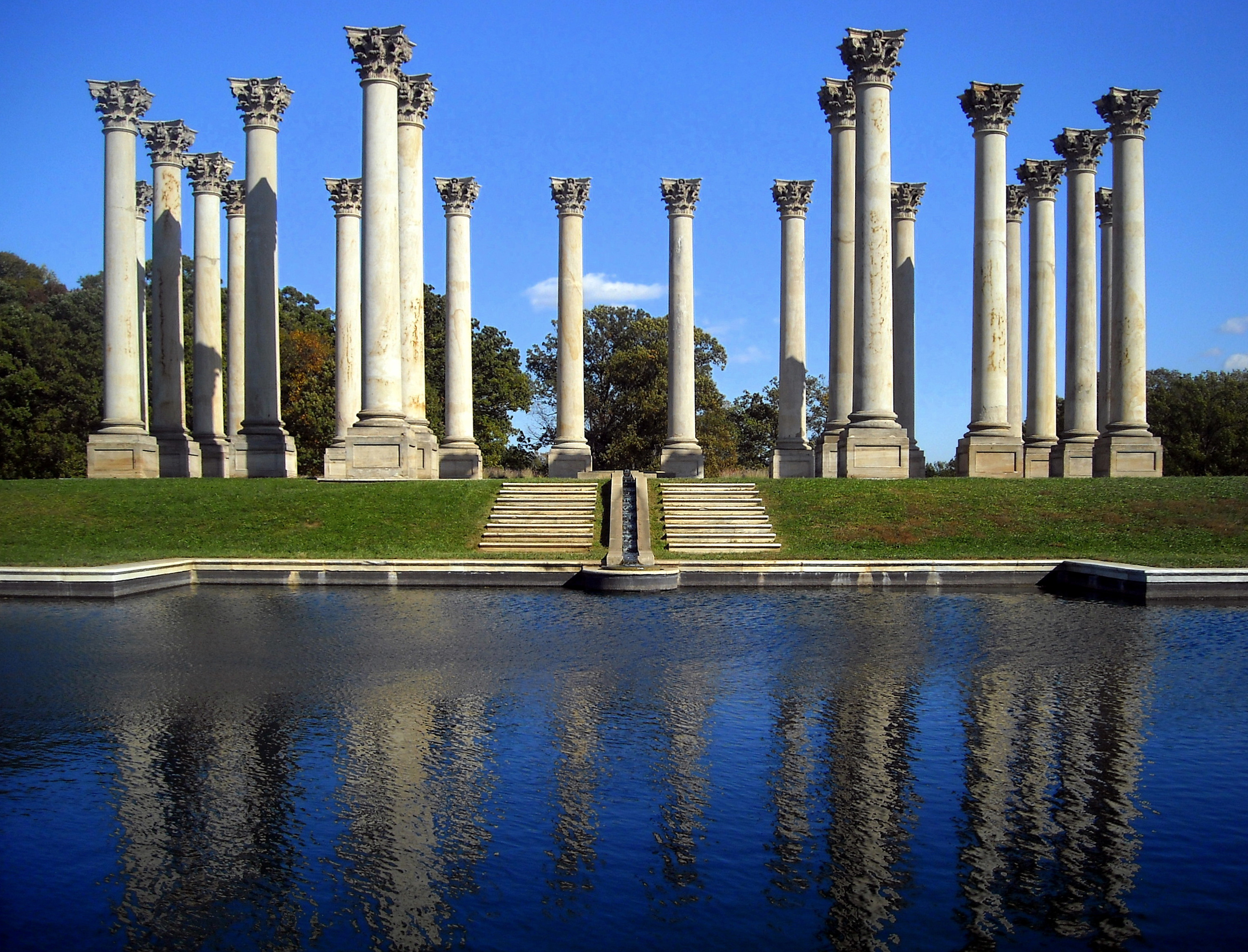
In architecture the capital (from the Latin ''caput'', or "head") or chapiter forms the topmost member of a column (or a pilaster). It mediates between the column and the load thrusting down upon it, broadening the area of the column's supporting surface. The capital, projecting on each side as it rises to support the abacus, joins the usually square abacus and the usually circular shaft of the column. The capital may be convex, as in the Doric order; concave, as in the inverted bell of the Corinthian order; or scrolling out, as in the Ionic order. These form the three principal types on which all capitals in the classical tradition are based. The Composite order established in the 16th century on a hint from the Arch of Titus, adds Ionic volutes to Corinthian acanthus leaves. From the highly visible position it occupies in all colonnaded monumental buildings, the capital is often selected for ornamentation; and is often the clearest indicator of the architectural orde ... [...More Info...] [...Related Items...] OR: [Wikipedia] [Google] [Baidu] |
Corinthian Order
The Corinthian order (Greek: Κορινθιακός ρυθμός, Latin: ''Ordo Corinthius'') is the last developed of the three principal classical orders of Ancient Greek architecture and Roman architecture. The other two are the Doric order which was the earliest, followed by the Ionic order. In Ancient Greek architecture, the Corinthian order follows the Ionic in almost all respects other than the capitals of the columns. When classical architecture was revived during the Renaissance, two more orders were added to the canon: the Tuscan order and the Composite order. The Corinthian, with its offshoot the Composite, is the most ornate of the orders. This architectural style is characterized by slender fluted columns and elaborate capitals decorated with acanthus leaves and scrolls. There are many variations. The name ''Corinthian'' is derived from the ancient Greek city of Corinth, although the style had its own model in Roman practice, following precedents set by the Tem ... [...More Info...] [...Related Items...] OR: [Wikipedia] [Google] [Baidu] |
Column
A column or pillar in architecture and structural engineering is a structural element that transmits, through compression, the weight of the structure above to other structural elements below. In other words, a column is a compression member. The term ''column'' applies especially to a large round support (the shaft of the column) with a capital and a base or pedestal, which is made of stone, or appearing to be so. A small wooden or metal support is typically called a ''post''. Supports with a rectangular or other non-round section are usually called ''piers''. For the purpose of wind or earthquake engineering, columns may be designed to resist lateral forces. Other compression members are often termed "columns" because of the similar stress conditions. Columns are frequently used to support beams or arches on which the upper parts of walls or ceilings rest. In architecture, "column" refers to such a structural element that also has certain proportional and decorative featur ... [...More Info...] [...Related Items...] OR: [Wikipedia] [Google] [Baidu] |


_1.jpg)


.jpg)
