|
Akselsundet
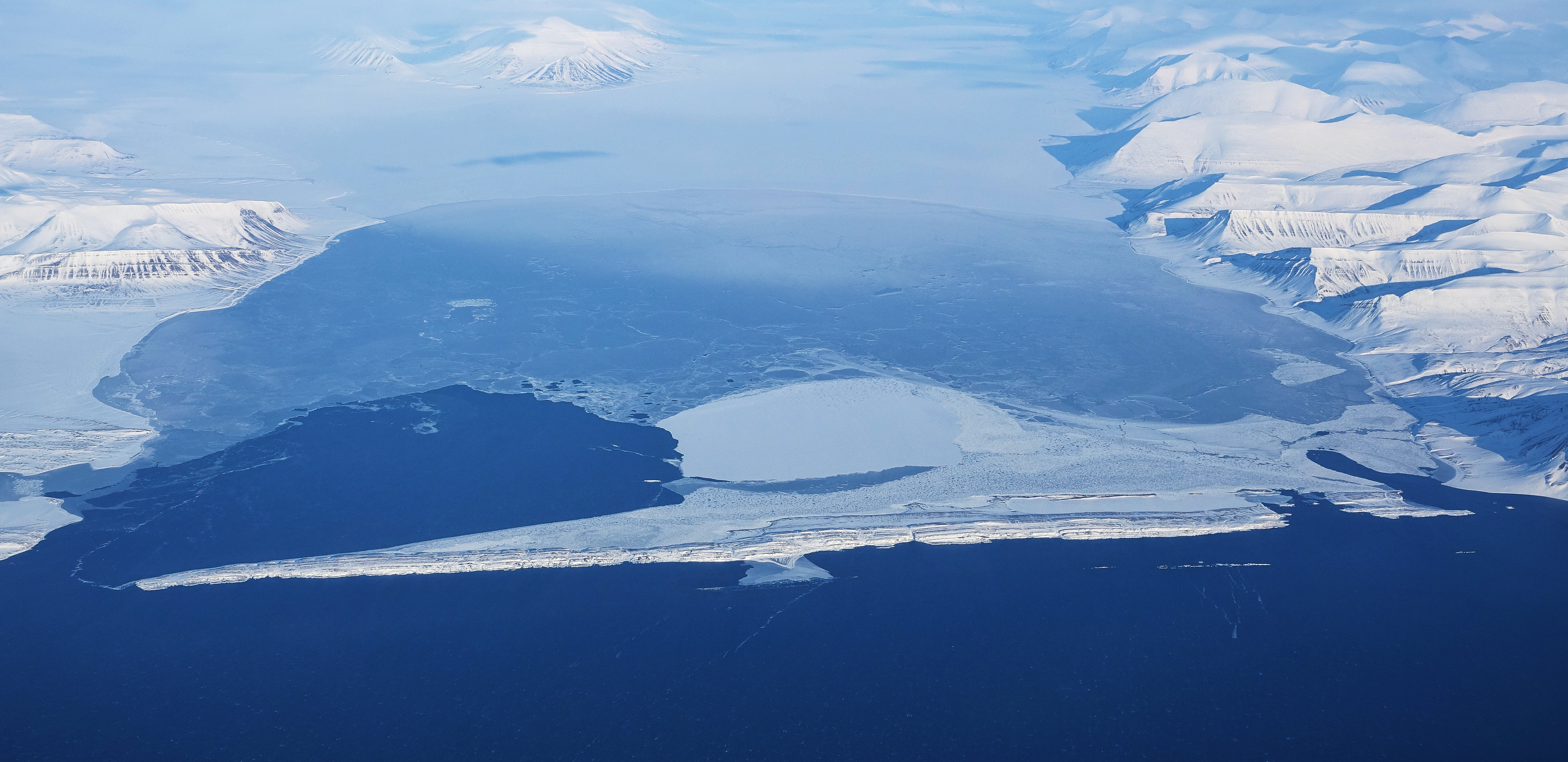
Akselsundet is a sound between Van Mijenfjorden and Bellsund at Spitsbergen, Svalbard. It has a width of about 1.2 kilometers, located north of Akseløya Akseløya (English: Axel Island) is a long, narrow island (about 8.5 km long and 1 km wide) at the mouth of Van Mijenfjorden, separating Van Mijenfjorden from Bellsund. It is separated from the mainland by Akselsundet to the north, and ..., and is the main entrance to Van Mijenfjorden. There are strong tidal currents in the strait, up to five to six knots. The entrance is marked by a light at Birkelandodden, the northern point of Akseløya. References Straits of Svalbard Landforms of Spitsbergen {{Spitsbergen-geo-stub ... [...More Info...] [...Related Items...] OR: [Wikipedia] [Google] [Baidu] |
Birkelandodden
Birkelandodden is the northern point of the island Akseløya between Van Mijenfjorden and Bellsund at Spitsbergen, Svalbard. The point is named after Kristian Birkeland. A light has been set up to help navigation through Akselsundet, the main entrance to Van Mijenfjorden Van Mijenfjorden is the third-longest fjord in Norway's Svalbard archipelago. It lies in the southern portion of Spitsbergen island, south of Nordenskiöld Land and north of Nathorst Land. The fjord is long, being separated from Bellsund further .... References Headlands of Svalbard Akseløya {{Svalbard-geo-stub ... [...More Info...] [...Related Items...] OR: [Wikipedia] [Google] [Baidu] |
Akseløya
Akseløya (English: Axel Island) is a long, narrow island (about 8.5 km long and 1 km wide) at the mouth of Van Mijenfjorden, separating Van Mijenfjorden from Bellsund. It is separated from the mainland by Akselsundet to the north, and another narrow strait to the south. The islands are named after the schooner ''Aksel Thordsen'', which was chartered by Adolf Erik Nordenskiöld Nils Adolf Erik Nordenskiöld (18 November 183212 August 1901) was a Finland-Swedish aristocrat, geologist, mineralogist and Arctic explorer. He was a member of the Fenno-Swedish Nordenskiöld family of scientists and held the title of a friher ... for an expedition to Svalbard in 1864. Norway and Arctic Sea. Retrieved 6 September 2016 See also [...More Info...] [...Related Items...] OR: [Wikipedia] [Google] [Baidu] |
Sound (geography)
In geography, a sound is a smaller body of water typically connected to a larger sea or ocean. There is little consistency in the use of "sound" in English-language place names. It can refer to an inlet, deeper than a bight and wider than a fjord, or a narrow sea or ocean channel between two bodies of land (similar to a strait), or it can refer to the lagoon located between a barrier island and the mainland. Overview A sound is often formed by the seas flooding a river valley. This produces a long inlet where the sloping valley hillsides descend to sea-level and continue beneath the water to form a sloping sea floor. The Marlborough Sounds in New Zealand are good examples of this type of formation. Sometimes a sound is produced by a glacier carving out a valley on a coast then receding, or the sea invading a glacier valley. The glacier produces a sound that often has steep, near vertical sides that extend deep underwater. The sea floor is often flat and deeper at the ... [...More Info...] [...Related Items...] OR: [Wikipedia] [Google] [Baidu] |
Van Mijenfjorden
Van Mijenfjorden is the third-longest fjord in Norway's Svalbard archipelago. It lies in the southern portion of Spitsbergen island, south of Nordenskiöld Land and north of Nathorst Land. The fjord is long, being separated from Bellsund further out by Akseløya and Mariaholmen. The settlement of Sveagruva lies on the fjord's north bank. The fjord is named after the Dutch Dutch commonly refers to: * Something of, from, or related to the Netherlands * Dutch people () * Dutch language () Dutch may also refer to: Places * Dutch, West Virginia, a community in the United States * Pennsylvania Dutch Country People E ... whaler Willem Cornelisz. van Muyden, who was involved in the trade in 1612 and 1613. Van Mijenfjorden (an obvious corruption of Van Muyden's name) was originally called ''Lowe Sound'', while the small cove north of Axel Island (at the mouth of the fjord) was called ''Van Muyden's Haven''. This latter name was moved from its proper location by Giles and Rep (c. 17 ... [...More Info...] [...Related Items...] OR: [Wikipedia] [Google] [Baidu] |
Bellsund
Bellsund is a long sound on the west coast of Spitsbergen, part of the Svalbard archipelago of Norway. It is separated from Van Mijenfjorden by the islands of Akseløya and Mariaholmen. Bellsund is located south of Nordenskiöld Land and north of Wedel Jarlsberg Land.Norwegian Polar InstitutPlace Names of Svalbard Database History Bellsund was first seen by William Barents in 1596. He simply referred to it as ''Inwyck'' (inlet). In 1610 Jonas Poole explored Bellsund, giving the fjord the name it retains to this day. He named it after a nearby bell-shaped mountain. In 1612 the Dutchman Willem Cornelisz. van Muyden was the first to attempt to catch whales here, but he wasn't very successful as he didn't have any Basque whalemen among his crew. In 1613, Basque, Dutch, and French whaling vessels resorted to Bellsund, but were either ordered away by armed English vessels or forced to pay a fine of some sort.Purchas, S. 1625. ''Hakluytus Posthumus or Purchas His Pilgrimes: Contay ... [...More Info...] [...Related Items...] OR: [Wikipedia] [Google] [Baidu] |
Spitsbergen
Spitsbergen (; formerly known as West Spitsbergen; Norwegian: ''Vest Spitsbergen'' or ''Vestspitsbergen'' , also sometimes spelled Spitzbergen) is the largest and the only permanently populated island of the Svalbard archipelago in northern Norway. Constituting the westernmost bulk of the archipelago, it borders the Arctic Ocean, the Norwegian Sea, and the Greenland Sea. Spitsbergen covers an area of , making it the largest island in Norway and the 36th-largest in the world. The administrative centre is Longyearbyen. Other settlements, in addition to research outposts, are the Russian mining community of Barentsburg, the research community of Ny-Ålesund, and the mining outpost of Sveagruva. Spitsbergen was covered in of ice in 1999, which was approximately 58.5% of the island's total area. The island was first used as a whaling base in the 17th and 18th centuries, after which it was abandoned. Coal mining started at the end of the 19th century, and several permanent commun ... [...More Info...] [...Related Items...] OR: [Wikipedia] [Google] [Baidu] |
Svalbard
Svalbard ( , ), also known as Spitsbergen, or Spitzbergen, is a Norwegian archipelago in the Arctic Ocean. North of mainland Europe, it is about midway between the northern coast of Norway and the North Pole. The islands of the group range from 74° to 81° north latitude, and from 10° to 35° east longitude. The largest island is Spitsbergen, followed by Nordaustlandet and . The largest settlement is Longyearbyen. The islands were first used as a base by the whalers who sailed far north in the 17th and 18th centuries, after which they were abandoned. Coal mining started at the beginning of the 20th century, and several permanent communities were established. The Svalbard Treaty of 1920 recognizes Norwegian sovereignty, and the 1925 Svalbard Act made Svalbard a full part of the Kingdom of Norway. They also established Svalbard as a free economic zone and a demilitarized zone. The Norwegian Store Norske and the Russian remain the only mining companies in place. Res ... [...More Info...] [...Related Items...] OR: [Wikipedia] [Google] [Baidu] |
Norwegian Polar Institute
The Norwegian Polar Institute (NPI; no, Norsk Polarinstitutt) is Norway's central governmental institution for scientific research, mapping and environmental monitoring in the Arctic and the Antarctic. The NPI is a directorate under Norway's Ministry of Climate and Environment. The institute advises Norwegian authorities on matters concerning polar environmental management and is the official environmental management body for Norwegian activities in Antarctica. Activities The institute's activities are focused on environmental research and management in the polar regions. The NPI's researchers investigate biodiversity, climate and environmental toxins in the Arctic and Antarctic, and in this context the institute equips and organizes large-scale expeditions to both polar regions. The institute contributes to national and international climate work, and is an active contact point for the international scientific community. The institute collects and analyses data on the environm ... [...More Info...] [...Related Items...] OR: [Wikipedia] [Google] [Baidu] |
Straits Of Svalbard
A strait is an Ocean, oceanic landform connecting two Sea, seas or two other large areas of water. The surface water generally flows at the same elevation on both sides and through the strait in either direction. Most commonly, it is a narrow ocean Channel (geography), channel that lies between two land masses. Some straits are not navigable, for example because they are either too narrow or too shallow, or because of an unnavigable reef or archipelago. Straits are also known to be loci for sediment accumulation. Usually, sand-size deposits occur on both the two opposite strait exits, forming subaqueous fans or deltas. Terminology The terms ''channel (geography), channel'', ''pass'', or ''passage'' can be synonymous and used interchangeably with ''strait'', although each is sometimes differentiated with varying senses. In Scotland, ''firth'' or ''Kyle'' are also sometimes used as synonyms for strait. Many straits are economically important. Straits can be important shipping ... [...More Info...] [...Related Items...] OR: [Wikipedia] [Google] [Baidu] |


