|
Van Mijenfjorden
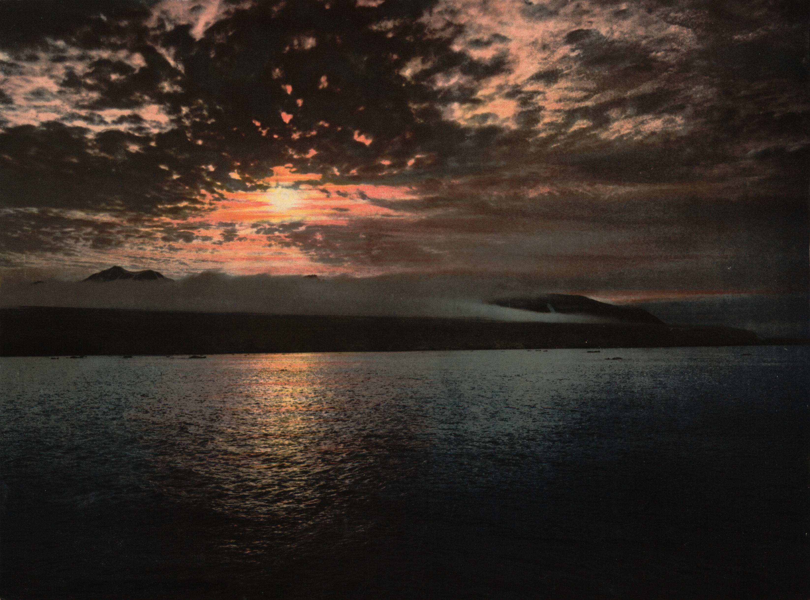
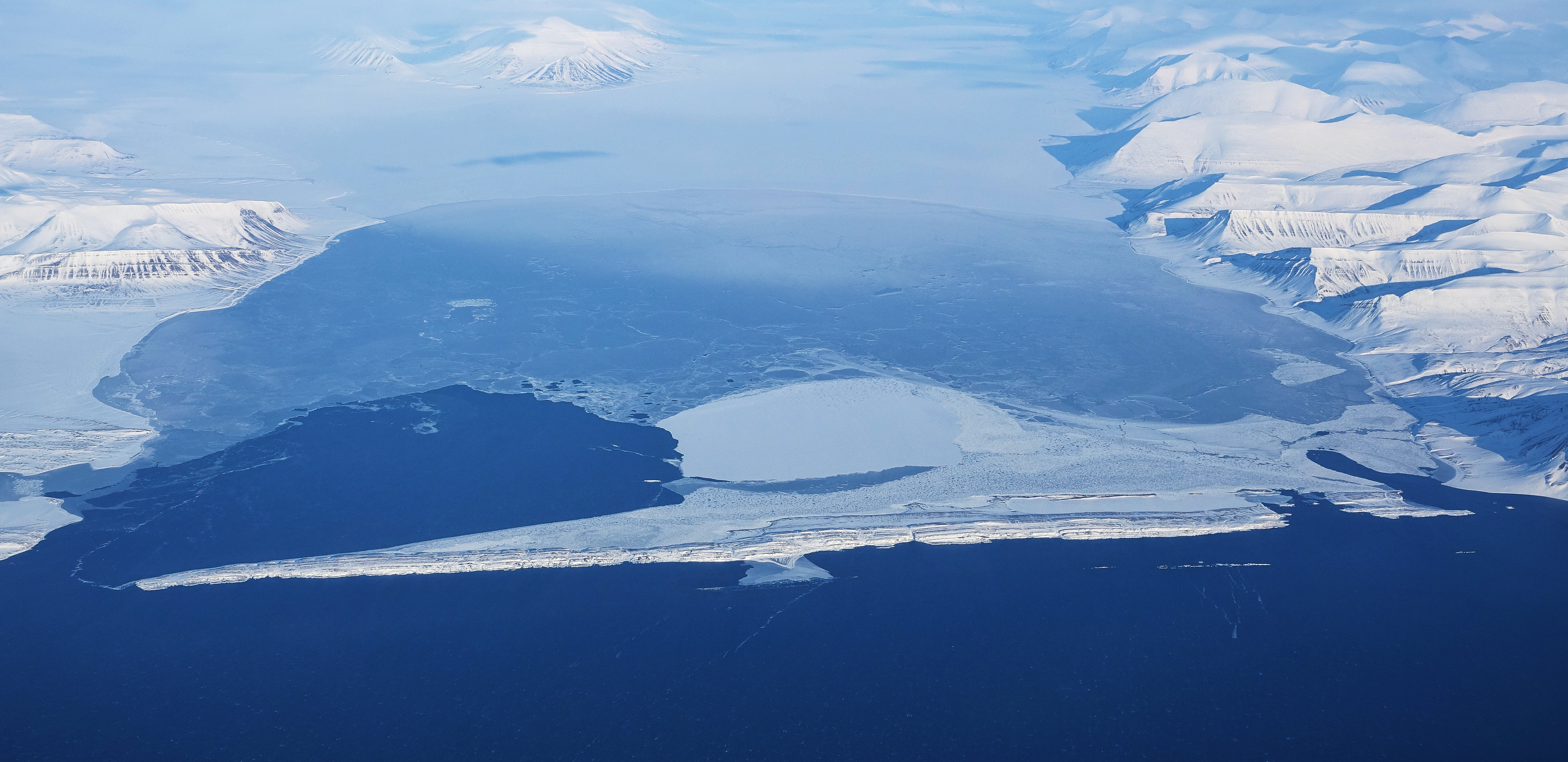
Van Mijenfjorden is the third-longest fjord in Norway's Svalbard archipelago. It lies in the southern portion of Spitsbergen island, south of Nordenskiöld Land and north of Nathorst Land. The fjord is long, being separated from Bellsund further out by Akseløya and Mariaholmen. The settlement of Sveagruva lies on the fjord's north bank. The fjord is named after the Dutch Dutch commonly refers to: * Something of, from, or related to the Netherlands * Dutch people () * Dutch language () Dutch may also refer to: Places * Dutch, West Virginia, a community in the United States * Pennsylvania Dutch Country People E ... whaler Willem Cornelisz. van Muyden, who was involved in the trade in 1612 and 1613. Van Mijenfjorden (an obvious corruption of Van Muyden's name) was originally called ''Lowe Sound'', while the small cove north of Axel Island (at the mouth of the fjord) was called ''Van Muyden's Haven''. This latter name was moved from its proper location by Giles and Rep (c. 17 ... [...More Info...] [...Related Items...] OR: [Wikipedia] [Google] [Baidu] |
Spitsbergen Labelled
Spitsbergen (; formerly known as West Spitsbergen; Norwegian: ''Vest Spitsbergen'' or ''Vestspitsbergen'' , also sometimes spelled Spitzbergen) is the largest and the only permanently populated island of the Svalbard archipelago in northern Norway. Constituting the westernmost bulk of the archipelago, it borders the Arctic Ocean, the Norwegian Sea, and the Greenland Sea. Spitsbergen covers an area of , making it the largest island in Norway and the 36th-largest in the world. The administrative centre is Longyearbyen. Other settlements, in addition to research outposts, are the Russian mining community of Barentsburg, the research community of Ny-Ålesund, and the mining outpost of Sveagruva. Spitsbergen was covered in of ice in 1999, which was approximately 58.5% of the island's total area. The island was first used as a whaling base in the 17th and 18th centuries, after which it was abandoned. Coal mining started at the end of the 19th century, and several permanent comm ... [...More Info...] [...Related Items...] OR: [Wikipedia] [Google] [Baidu] |
List Of Norwegian Fjords ...
This list of Norwegian fjords shows many of the fjords in Norway. In total, there are about 1,190 fjords in Norway and the Svalbard islands. The sortable list includes the lengths and locations of those fjords. Fjords See also * List of glaciers in Norway * Geography of Norway {{Authority control Fjords Norway Fjords In physical geography, a fjord or fiord () is a long, narrow inlet with steep sides or cliffs, created by a glacier. Fjords exist on the coasts of Alaska, Antarctica, British Columbia, Chile, Denmark, Germany, Greenland, the Faroe Islands, Icela ... [...More Info...] [...Related Items...] OR: [Wikipedia] [Google] [Baidu] |
Fjord
In physical geography, a fjord or fiord () is a long, narrow inlet with steep sides or cliffs, created by a glacier. Fjords exist on the coasts of Alaska, Antarctica, British Columbia, Chile, Denmark, Germany, Greenland, the Faroe Islands, Iceland, Ireland, Kamchatka, the Kerguelen Islands, Labrador, Newfoundland, New Zealand, Norway, Novaya Zemlya, Nunavut, Quebec, the Patagonia region of Argentina and Chile, Russia, South Georgia Island, Tasmania, United Kingdom, and Washington state. Norway's coastline is estimated to be long with its nearly 1,200 fjords, but only long excluding the fjords. Formation A true fjord is formed when a glacier cuts a U-shaped valley by ice segregation and abrasion of the surrounding bedrock. According to the standard model, glaciers formed in pre-glacial valleys with a gently sloping valley floor. The work of the glacier then left an overdeepened U-shaped valley that ends abruptly at a valley or trough end. Such valleys are fjords wh ... [...More Info...] [...Related Items...] OR: [Wikipedia] [Google] [Baidu] |
Norway
Norway, officially the Kingdom of Norway, is a Nordic country in Northern Europe, the mainland territory of which comprises the western and northernmost portion of the Scandinavian Peninsula. The remote Arctic island of Jan Mayen and the archipelago of Svalbard also form part of Norway. Bouvet Island, located in the Subantarctic, is a dependency of Norway; it also lays claims to the Antarctic territories of Peter I Island and Queen Maud Land. The capital and largest city in Norway is Oslo. Norway has a total area of and had a population of 5,425,270 in January 2022. The country shares a long eastern border with Sweden at a length of . It is bordered by Finland and Russia to the northeast and the Skagerrak strait to the south, on the other side of which are Denmark and the United Kingdom. Norway has an extensive coastline, facing the North Atlantic Ocean and the Barents Sea. The maritime influence dominates Norway's climate, with mild lowland temperatures on the se ... [...More Info...] [...Related Items...] OR: [Wikipedia] [Google] [Baidu] |
Svalbard
Svalbard ( , ), also known as Spitsbergen, or Spitzbergen, is a Norwegian archipelago in the Arctic Ocean. North of mainland Europe, it is about midway between the northern coast of Norway and the North Pole. The islands of the group range from 74° to 81° north latitude, and from 10° to 35° east longitude. The largest island is Spitsbergen, followed by Nordaustlandet and . The largest settlement is Longyearbyen. The islands were first used as a base by the whalers who sailed far north in the 17th and 18th centuries, after which they were abandoned. Coal mining started at the beginning of the 20th century, and several permanent communities were established. The Svalbard Treaty of 1920 recognizes Norwegian sovereignty, and the 1925 Svalbard Act made Svalbard a full part of the Kingdom of Norway. They also established Svalbard as a free economic zone and a demilitarized zone. The Norwegian Store Norske and the Russian remain the only mining companies in place. Res ... [...More Info...] [...Related Items...] OR: [Wikipedia] [Google] [Baidu] |
Spitsbergen
Spitsbergen (; formerly known as West Spitsbergen; Norwegian: ''Vest Spitsbergen'' or ''Vestspitsbergen'' , also sometimes spelled Spitzbergen) is the largest and the only permanently populated island of the Svalbard archipelago in northern Norway. Constituting the westernmost bulk of the archipelago, it borders the Arctic Ocean, the Norwegian Sea, and the Greenland Sea. Spitsbergen covers an area of , making it the largest island in Norway and the 36th-largest in the world. The administrative centre is Longyearbyen. Other settlements, in addition to research outposts, are the Russian mining community of Barentsburg, the research community of Ny-Ålesund, and the mining outpost of Sveagruva. Spitsbergen was covered in of ice in 1999, which was approximately 58.5% of the island's total area. The island was first used as a whaling base in the 17th and 18th centuries, after which it was abandoned. Coal mining started at the end of the 19th century, and several permanent commun ... [...More Info...] [...Related Items...] OR: [Wikipedia] [Google] [Baidu] |
Nordenskiöld Land
Nordenskiöld Land is the land area between Isfjorden and Van Mijenfjorden on Spitsbergen, Svalbard. The area is named after Finnish-Swedish explorer and geologist Nils Adolf Erik Nordenskiöld. The coastal region of Nordenskiöld Land (Nordenskiøldkysten) has been identified as an Important Bird Area (IBA) by BirdLife International because it supports breeding populations of barnacle geese and common eider The common eider (pronounced ) (''Somateria mollissima''), also called St. Cuthbert's duck or Cuddy's duck, is a large ( in body length) sea-duck that is distributed over the northern coasts of Europe, North America and eastern Siberia. It breed ...s. References Important Bird Areas of Svalbard Peninsulas of Spitsbergen {{Spitsbergen-geo-stub ... [...More Info...] [...Related Items...] OR: [Wikipedia] [Google] [Baidu] |
Nathorst Land
Nathorst Land is the land area between Van Keulenfjorden and Van Mijenfjorden on Spitsbergen, Svalbard. The area is named after Alfred Gabriel Nathorst Alfred Gabriel Nathorst (7 November 1850 – 20 January 1921) was a Swedish Arctic explorer, geologist, and palaeobotanist. Life He was born in Väderbrunn in Sweden. Nathorst's interest in geology was awoken by Charles Lyell’s ‘’Pr .... The Aspelintoppen mountain is the highest peak in Nathorst Land. References Peninsulas of Spitsbergen {{Spitsbergen-geo-stub ... [...More Info...] [...Related Items...] OR: [Wikipedia] [Google] [Baidu] |
Bellsund
Bellsund is a long sound on the west coast of Spitsbergen, part of the Svalbard archipelago of Norway. It is separated from Van Mijenfjorden by the islands of Akseløya and Mariaholmen. Bellsund is located south of Nordenskiöld Land and north of Wedel Jarlsberg Land.Norwegian Polar InstitutPlace Names of Svalbard Database History Bellsund was first seen by William Barents in 1596. He simply referred to it as ''Inwyck'' (inlet). In 1610 Jonas Poole explored Bellsund, giving the fjord the name it retains to this day. He named it after a nearby bell-shaped mountain. In 1612 the Dutchman Willem Cornelisz. van Muyden was the first to attempt to catch whales here, but he wasn't very successful as he didn't have any Basque whalemen among his crew. In 1613, Basque, Dutch, and French whaling vessels resorted to Bellsund, but were either ordered away by armed English vessels or forced to pay a fine of some sort.Purchas, S. 1625. ''Hakluytus Posthumus or Purchas His Pilgrimes: Contay ... [...More Info...] [...Related Items...] OR: [Wikipedia] [Google] [Baidu] |
Akseløya
Akseløya (English: Axel Island) is a long, narrow island (about 8.5 km long and 1 km wide) at the mouth of Van Mijenfjorden, separating Van Mijenfjorden from Bellsund. It is separated from the mainland by Akselsundet to the north, and another narrow strait to the south. The islands are named after the schooner ''Aksel Thordsen'', which was chartered by Adolf Erik Nordenskiöld Nils Adolf Erik Nordenskiöld (18 November 183212 August 1901) was a Finland-Swedish aristocrat, geologist, mineralogist and Arctic explorer. He was a member of the Fenno-Swedish Nordenskiöld family of scientists and held the title of a friher ... for an expedition to Svalbard in 1864. Norway and Arctic Sea. Retrieved 6 September 2016 See also [...More Info...] [...Related Items...] OR: [Wikipedia] [Google] [Baidu] |
Mariaholmen
Mariaholmen is an islet in Nathorst Land at the mouth of Van Mijenfjorden at Spitsbergen, Svalbard. It is located south of Akseløya, between Akseløya and Måseneset. While Akselsundet Akselsundet is a sound between Van Mijenfjorden and Bellsund at Spitsbergen, Svalbard. It has a width of about 1.2 kilometers, located north of Akseløya Akseløya (English: Axel Island) is a long, narrow island (about 8.5 km long and 1& ... north of Akseløya is regarded as the main entrance to Van Mijenfjorden, Mariasundet between Mariaholmen and Måseneset is also navigable. Mariaholmen is composed of Upper Permian (Kapp Starostin Fm.) and Lower Triassic (Vardebukta Fm. and Tvillingodden Fm.) sedimentary deposits that have been stratigraphically tilted to a vertical position. References Islands of Svalbard Spitsbergen {{Spitsbergen-geo-stub ... [...More Info...] [...Related Items...] OR: [Wikipedia] [Google] [Baidu] |
Sveagruva
Sveagruva (), or simply Svea, was a mining settlement in the Norwegian archipelago of Svalbard, lying at the head of Van Mijenfjord. It was the third largest settlement in the archipelago (after Longyearbyen and Barentsburg). Around 300 workers living in Longyearbyen commuted to Sveagruva for work on a daily or weekly basis. The mine was operated by Store Norske Spitsbergen Kulkompani. There is no road to Longyearbyen or any other settlements, so travel is done by air from Svea Airport and coal transport by ship from a port southwest. Sveagruva closed in 2017 and currently has no permanent inhabitants. History The town was established in 1917 by Swedes. It was thereafter destroyed in 1944, but quickly re-established after World War II World War II or the Second World War, often abbreviated as WWII or WW2, was a world war that lasted from 1939 to 1945. It involved the vast majority of the world's countries—including all of the great powers—forming two oppo ... [...More Info...] [...Related Items...] OR: [Wikipedia] [Google] [Baidu] |

.jpg)


