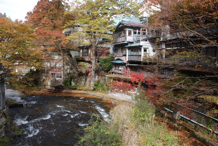
|
Aizu
is the westernmost of the three regions of Fukushima Prefecture, Japan, the other two regions being Nakadōri in the central area of the prefecture and Hamadōri in the east. As of October 1, 2010, it had a population of 291,838. The principal city of the area is Aizuwakamatsu. It was part of Mutsu Province; the area once was part of Iwase Province created during the reign of Empress Genshō.Meyners d'Estrey, Guillaume Henry Jean (1884). ; excerpt, '' Genshō crée sept provinces : Idzumi, Noto, Atoa, Iwaki, Iwase, Suwa et Sado en empiétant sur celles de Kawachi, Echizen, Etchū, Kazusa, Mutsu and Shinano'' The ''Yōrō Ritsuryo'' established the Iwase Province in 718 through the division of the Michinoku Province (Mutsu Province). It was composed of five districts of Shirakawa (白河), Iwase (石背), Aizu (会津), Asaka (安積) and Shinobu (信夫). The area encompassed by the province reverted to Mutsu some time between 722 and 724. During the Edo period ... [...More Info...] [...Related Items...] OR: [Wikipedia] [Google] [Baidu] |
Aizuwakamatsu
is a city in Fukushima Prefecture, Japan. , the city had an estimated population of 118,159 in 50,365 households, and a population density of 310 persons per km2. The total area of the city was . Geography Aizuwakamatsu is located in the western part of Fukushima Prefecture, in the southeast part of Aizu basin. Mountains * Mount Ōtodake (1416 m) * Mount Seaburi * Mount Oda * Mount Iimori Rivers * Aga River * Nippashi River * Yugawa River * Sesenagi River Lakes * Lake Inawashiro * Lake Wakasato * Lake Higashiyama * Lake Sohara Hot springs * Higashiyama Onsen * Ashinomaki Onsen Administrative divisions There are 11 administrative divisions (hamlets or ) in the city. * Wakamatsu * Machikita * Kouya * Kouzashi * Monden * Ikki * Higashiyama * Ōto * Minato * Kitaaizu * Kawahigashi Neighboring municipalities Fukushima Prefecture *North: Kitakata, Aizubange, Yugawa, Bandai *East: Koriyama, Inawashiro *West: Aizumisato *South: Shimogo, Tenei Climate Aizuwakam ... [...More Info...] [...Related Items...] OR: [Wikipedia] [Google] [Baidu] |
Aizu Domain
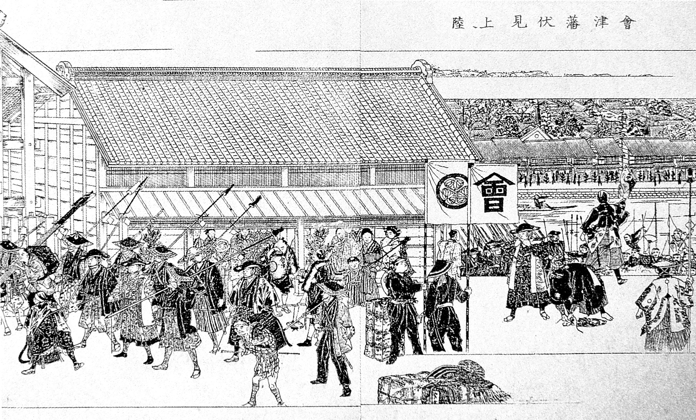
was a domain of the Tokugawa Shogunate of Japan during the Edo period from 1601 to 1871.Ravina, Mark. (1998) ''Land and Lordship in Early Modern Japan,'' p. 222 The Aizu Domain was based at Tsuruga Castle in Mutsu Province, the core of the modern city of Aizuwakamatsu, located in the Tōhoku region of the island of Honshu. The Aizu Domain was ruled for most of its existence by the ''shinpan'' '' daimyō'' of the Aizu-Matsudaira clan, a local cadet branch of the ruling Tokugawa clan, but was briefly ruled by the '' tozama'' ''daimyō'' of the Gamō and Katō clans. The Aizu Domain was assessed under the ''Kokudaka'' system with a peak value of 919,000 ''koku'', but this was reduced to 230,000 ''koku''. The Aizu Domain was dissolved in the abolition of the ''han'' system in 1871 by the Meiji government and its territory was absorbed into Fukushima Prefecture, covering much of the traditional region of Aizu. History Pre-Edo period The area of Kurokawa, later called " ... [...More Info...] [...Related Items...] OR: [Wikipedia] [Google] [Baidu] |
Fukushima Prefecture
Fukushima Prefecture (; ja, 福島県, Fukushima-ken, ) is a prefecture of Japan located in the Tōhoku region of Honshu. Fukushima Prefecture has a population of 1,810,286 () and has a geographic area of . Fukushima Prefecture borders Miyagi Prefecture and Yamagata Prefecture to the north, Niigata Prefecture to the west, Gunma Prefecture to the southwest, and Tochigi Prefecture and Ibaraki Prefecture to the south. Fukushima is the capital and Iwaki is the largest city of Fukushima Prefecture, with other major cities including Kōriyama, Aizuwakamatsu, and Sukagawa. Fukushima Prefecture is located on Japan's eastern Pacific coast at the southernmost part of the Tōhoku region, and is home to Lake Inawashiro, the fourth-largest lake in Japan. Fukushima Prefecture is the third-largest prefecture of Japan (after Hokkaido and Iwate Prefecture) and divided by mountain ranges into the three regions of Aizu, Nakadōri, and Hamadōri. History Prehistory The keyhol ... [...More Info...] [...Related Items...] OR: [Wikipedia] [Google] [Baidu] |
Tsuruga Castle
, also known as Tsuruga Castle (鶴ヶ城 ''Tsuru-ga-jō'') is a concrete replica of a traditional Japanese castle in northern Japan, at the center of the city of Aizuwakamatsu, in Fukushima Prefecture. Background Aizu Wakamatsu Castle is located in the center of the Aizu basin and at crossroads to Kōriyama to the north and Yonezawa to the east and Murakami on the Sea of Japan coast. During the Nanboku-cho period, the area was ruled by the Ashina clan. Ashina Naomori built within the Aizu basin in 1384. This castle was the predecessor of what later became Aizuwakamatsu Castle. It was ruled by Ashina Moriuji until 1561, when he turned his domain over to his son. The Ashina clan also built Mukaihaguroyama Castle, a huge mountain castle 10 kilometers south of Aizu Wakamatsu. However, by the Sengoku period, the power of the Ashina clan had weakened. Date Masamune, the greatest warlord of the Tōhoku area, who had struggled against the Ashina clan for years, and finally captur ... [...More Info...] [...Related Items...] OR: [Wikipedia] [Google] [Baidu] |
Dewa Shigetō
Baron was a Japanese admiral in the early days of the Imperial Japanese Navy. Biography Dewa was born as the son of a ''samurai'' of the Aizu domain (present day Fukushima prefecture). As a youth, he enlisted in the '' Byakkotai,'' a reserve unit of the Aizu domain's official military. The '' Byakkotai'' was called into action, and Dewa served at the Battle of Aizu in the Boshin War. Dewa attended the 5th class of the Imperial Japanese Naval Academy, graduating 6th out of 43 cadets. He was appointed a midshipman on 16 August 1878, promoted to ensign on 12 August 1880 and promoted to sub-lieutenant on 27 February 1883. He served as a junior officer on several vessels of the early Japanese Navy, including the corvette , ironclad warship , sloop ''Hōshō'', ironclad warship , corvette , and cruisers , and . He was promoted to lieutenant on 7 April 1886 and to lieutenant-commander on 16 October 1890. From 1886-1890, he was executive officer on the cruiser . From 1893-1893, he w ... [...More Info...] [...Related Items...] OR: [Wikipedia] [Google] [Baidu] |
Akabeko0926
is a legendary cow from the Aizu region of Japan, who inspired a traditional toy. In legend, Akabeko the cow was present at the building the Enzō-ji temple of Yanaizu in the ninth century, and became a permanent fixture there, with some stories saying that the animal was turned to stone. The toy is made out of two pieces of papier-mâché-covered wood, shaped and painted to look like a red cow or ox. One piece represents the cow's head and neck and the other its body. The head and neck hangs from a string and fits into the hollow body. When the toy is moved, the head thus bobs up and down and side to side. The earliest akabeko toys were created in the late 16th or early 17th century. Over time, people came to believe that the toys could ward off smallpox and other illnesses. Akabeko has become one of Fukushima Prefecture's most famous crafts and a symbol of the Aizu region. It has also been recognized as a symbol of the larger Tōhoku region, of which Fukushima Prefecture ... [...More Info...] [...Related Items...] OR: [Wikipedia] [Google] [Baidu] |
Akizuki Teijirō
was a Japanese samurai of the late Edo period, who served the Matsudaira clan of Aizu. Born in Aizuwakamatsu, Akizuki was recognized early as a skilled scholar, and studied at the Tokugawa Shogunate's Shoheizaka school, in Edo. He served as an advisor to Matsudaira Katamori, and was present for most of the latter's tenure as Kyoto Shugoshoku from 1862 to 1867. Akizuki was a senior commander of Aizu forces during the Boshin War. After the war, he became an educator, and worked in high schools in Kyushu. Later in his life, he was a colleague of Lafcadio Hearn, who referred to him in his writings. References *Hoshi Ryōichi. ''Onnatachi no Aizusensō''. *----. ''Byakkotai to Aizu bushidō''. *Yamakawa Kenjirō was a Japanese samurai, politician, physicist, academic administrator, and author of several histories of the Boshin War. He served as president of Tokyo Imperial University, Kyushu Imperial University, and Kyoto Imperial University. He also s ... (1933). ''Aizu Boshin ... [...More Info...] [...Related Items...] OR: [Wikipedia] [Google] [Baidu] |
Hamadōri
is the easternmost of the three regions of Fukushima Prefecture, Japan, the other two being Nakadōri in the central area of the prefecture and Aizu in the west. Hamadōri is bordered by the Abukuma Highlands to the west and the Pacific Ocean to the east. The principal city of the area is Iwaki. Overview In ancient Japan, the area currently known as Hamadōri served as a connecting route on the so-called route from Kinai in the central area of the country to Mutsu Province in northeastern Japan. The region that the road traversed also came to be known as Kaidō. Following the implementation of the Ritsuryō system, the route's name was changed to . Despite the newly named Tōkaidō route extending up to Taga Castle in present-day Miyagi Prefecture, the region known as Tōkaidō extended only as far as the northernmost border of Hitachi Province, and the area of Hamadōri was considered a part of the Tōsandō region. Following the conclusion of the Boshin War, the eas ... [...More Info...] [...Related Items...] OR: [Wikipedia] [Google] [Baidu] |
Mutsu Province
was an old province of Japan in the area of Fukushima, Miyagi, Iwate and Aomori Prefectures and the municipalities of Kazuno and Kosaka in Akita Prefecture. Mutsu Province is also known as or . The term is often used to refer to the combined area of Mutsu and the neighboring province Dewa, which together make up the entire Tōhoku region. History Invasion by the Kinai government Mutsu, on northern Honshū, was one of the last provinces to be formed as land was taken from the indigenous Emishi, and became the largest as it expanded northward. The ancient regional capital of the Kinai government was Tagajō in present-day Miyagi Prefecture. * 709 ('' Wadō 2, 3rd month''), an uprising against governmental authority took place in Mutsu and in nearby Echigo Province. Troops were dispatched to subdue the revolt. * 712 (''Wadō 5''), Mutsu was separated from Dewa Province. Empress Genmei's ''Daijō-kan'' made cadastral changes in the provincial map of the Nara pe ... [...More Info...] [...Related Items...] OR: [Wikipedia] [Google] [Baidu] |
Iwase Province
Map of the former Japanese provinces with Iwase highlighted is an old province of Japan which existed for a brief period of time in the Nara period in what is now western Fukushima Prefecture.Kodama. (1958). 図日本文化史大系, p. 30; excerpt 石背国 718-724?/ref> History Iwase Province was created during the reign of Empress Genshō.Meyners d'Estrey, Guillaume Henry Jean (1884). ; excerpt, '' Genshō crée sept provinces : Idzumi, Noto, Atoa, Iwaki, Iwase, Suwa et Sado en empiétant sur celles de Kawachi, Echizen, Etchū, Kazusa, Mutsu and Shinano'' The Yōrō Ritsuryo established the Iwase Province in 718 through the division of the Michinoku Province ( Mutsu Province). It was composed of five districts, named Shirakawa (白河), Iwase (石背), Aizu (会津), Asaka (安積) and Shinobu (信夫). The area encompassed by the province reverted to Mutsu at some point between 722 and 724. Some scholars have suggested that this may have been motivated by econo ... [...More Info...] [...Related Items...] OR: [Wikipedia] [Google] [Baidu] |


