|
Aizuwakamatsu
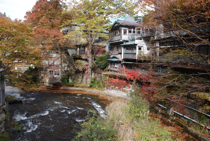
is a city in Fukushima Prefecture, Japan. , the city had an estimated population of 118,159 in 50,365 households, and a population density of 310 persons per km2. The total area of the city was . Geography Aizuwakamatsu is located in the western part of Fukushima Prefecture, in the southeast part of Aizu basin. Mountains * Mount Ōtodake (1416 m) * Mount Seaburi * Mount Oda * Mount Iimori Rivers * Aga River * Nippashi River * Yugawa River * Sesenagi River Lakes * Lake Inawashiro * Lake Wakasato * Lake Higashiyama * Lake Sohara Hot springs * Higashiyama Onsen * Ashinomaki Onsen Administrative divisions There are 11 administrative divisions (hamlets or ) in the city. * Wakamatsu * Machikita * Kouya * Kouzashi * Monden * Ikki * Higashiyama * Ōto * Minato * Kitaaizu * Kawahigashi Neighboring municipalities Fukushima Prefecture *North: Kitakata, Aizubange, Yugawa, Bandai *East: Koriyama, Inawashiro *West: Aizumisato *South: Shimogo, Tenei Climate Aizuwakamats ... [...More Info...] [...Related Items...] OR: [Wikipedia] [Google] [Baidu] |
Fukushima Prefecture
Fukushima Prefecture (; ja, 福島県, Fukushima-ken, ) is a prefecture of Japan located in the Tōhoku region of Honshu. Fukushima Prefecture has a population of 1,810,286 () and has a geographic area of . Fukushima Prefecture borders Miyagi Prefecture and Yamagata Prefecture to the north, Niigata Prefecture to the west, Gunma Prefecture to the southwest, and Tochigi Prefecture and Ibaraki Prefecture to the south. Fukushima is the capital and Iwaki is the largest city of Fukushima Prefecture, with other major cities including Kōriyama, Aizuwakamatsu, and Sukagawa. Fukushima Prefecture is located on Japan's eastern Pacific coast at the southernmost part of the Tōhoku region, and is home to Lake Inawashiro, the fourth-largest lake in Japan. Fukushima Prefecture is the third-largest prefecture of Japan (after Hokkaido and Iwate Prefecture) and divided by mountain ranges into the three regions of Aizu, Nakadōri, and Hamadōri. History Prehistory The keyhole-shaped Ōy ... [...More Info...] [...Related Items...] OR: [Wikipedia] [Google] [Baidu] |
Tōhoku Region
The , Northeast region, or consists of the northeastern portion of Honshu, the largest island of Japan. This traditional region consists of six prefectures (''ken''): Akita, Aomori, Fukushima, Iwate, Miyagi, and Yamagata. Tōhoku retains a reputation as a remote, scenic region with a harsh climate. In the 20th century, tourism became a major industry in the Tōhoku region. History Ancient & Classical period In mythological times, the area was known as Azuma (吾妻, あづま) and corresponded to the area of Honshu occupied by the native Emishi and Ainu. The area was historically the Dewa and the Michinoku regions, a term first recorded in (654). There is some variation in modern usage of the term "Michinoku". Tōhoku's initial historical settlement occurred between the seventh and ninth centuries, well after Japanese civilization and culture had become firmly established in central and southwestern Japan. The last stronghold of the indigenous Emishi on Honshu and ... [...More Info...] [...Related Items...] OR: [Wikipedia] [Google] [Baidu] |
Iimori Hill
is a mountain near the city of Aizuwakamatsu, Fukushima Prefecture, Japan. It is notable as the site where members of the Byakkotai (White Tiger Corps) committed ritual suicide in 1868, during the Boshin War. It is located about 1.5 kilometers northeast of Tsuruga Castle. There are two monuments at the top of the mountain: one was a gift from the Italian Fascist Party in 1928, and the other was from Nazi Germany. They were installed to show reverence for the Byakkotai spirit. After the surrender of Japan at the end of World War II, members of the Occupation, specifically of the U.S. Army, replaced the Hakenkreuz on the German monument with an iron cross. Iimori Mountain has been heavily commercialized and the site includes many souvenir shops and exhibitions. The staircases from the foot of the mountain to the top are fairly steep, though there is an escalator. Downhill from Iimori Mountain stands , an octagonal wooden pagoda built in the 18th century, which formerly seale ... [...More Info...] [...Related Items...] OR: [Wikipedia] [Google] [Baidu] |
Bandai, Fukushima
250px, Bandai Town Hall Panorama of Bandai town is a town located in Fukushima Prefecture, Japan. , the town had an estimated population of 3,533 in 1195 households, and a population density of 60.3 persons per km2. The total area of the town was . Geography Bandai is located in the northeastern part of the Aizu Basin, bordered by Yamagata Prefecture to the north. About 70% of the town is occupied by forests, with agricultural land and settlements along the hills at the southern foot of the mountains and along the Otani River. Much of the tow is within the borders of the Bandai-Asahi National Park. *Mountains : Mount Bandai, Mount Nekomadake *Rivers : Nippashi-gawa, Oya-gawa Neighboring municipalities Fukushima Prefecture * Kitakata *Aizuwakamatsu *Inawashiro * Kitashiobara Climate Bandai has a Humid continental climate (Köppen ''Dfb'') characterized by warm summers and cold winters with heavy snowfall. The average annual temperature in Bandai is 9.2 °C. The average ... [...More Info...] [...Related Items...] OR: [Wikipedia] [Google] [Baidu] |
Yugawa, Fukushima
Nippashi River at Yugawa is a village located in Fukushima Prefecture, Japan. , the village had an estimated population of 3,051 in 924 households, and a population density of 190 persons per km2. The total area of the village was .. Geography Yugawa is located in the northern portion of the Aizu region of Fukushima Prefecture, in center of the Aizu Basin. *Rivers : Nippashi River, Agakawa River Neighboring municipalities Fukushima Prefecture *Aizuwakamatsu * Kitakata *Aizubange Demographics Per Japanese census data, the population of Yugawa has declined steadily over the past 70 years. Climate Yugawa has a Humid continental climate (Köppen ''Dfb'') characterized by warm summers and cold winters with heavy snowfall. The average annual temperature in Yugawa is 11.9 °C. The average annual rainfall is 1383 mm with September as the wettest month. The temperatures are highest on average in August, at around 25.6 °C, and lowest in January, at around -0.8 °C ... [...More Info...] [...Related Items...] OR: [Wikipedia] [Google] [Baidu] |
Aizubange, Fukushima
Eryū-ji temple in Aizubange is a town located in Fukushima Prefecture, Japan. , the town had an estimated population of 15,159 in 5487 households, and a population density of 170 persons per km2. The total area of the town was . Geography Aizubange is located in the northern portion of the Aizu region of Fukushima Prefecture in the western part of Aizu Basin. The basin extends from the center of the town to the east and is relatively flat, with many paddy fields. On the other hand, the western part of the town has many forests. The Aga River flows from the east to the north of the town, and the Tadami River flows to the west. *Mountains : Mount Takadera *Rivers : Tadami River, Agakawa Neighboring municipalities Fukushima Prefecture *Aizuwakamatsu * Kitakata * Yanaizu * Yugawa *Aizumisato * Nishiaizu Climate Aizubange has a Humid continental climate (Köppen ''Dfb'') characterized by warm summers and cold winters with heavy snowfall. The average annual temperature in Aizubang ... [...More Info...] [...Related Items...] OR: [Wikipedia] [Google] [Baidu] |
Kitakata, Fukushima
is a Cities of Japan, city located in Fukushima Prefecture, Japan. , the city had an estimated population of 46,269 in 16,769 households, and a population density of 83 persons per km2. The total area of the city was . Kitakata was once written '北方', which meant 'northern place'. Geography Kitakata is located at the far northern Aizu region of Fukushima Prefecture, bordered by Yamagata Prefecture to the north and Niigata Prefecture to the west. *Mountains: Mount Bandai, Mount Iide *Rivers: Aga River, Tadami River Neighboring municipalities Fukushima Prefecture *Aizuwakamatsu, Fukushima, Aizuwakamatsu *Nishiaizu, Fukushima, Nishiaizu *Kitashiobara, Fukushima, Kitashiobara *Bandai, Fukushima, Bandai *Aizubange, Fukushima, Aizubange *Yugawa, Fukushima, Yugawa Yamagata Prefecture *Yonezawa, Yamagata, Yonezawa *Iide, Yamagata, Iide *Oguni, Yamagata, Oguni Niigata Prefecture *Shibata, Niigata, Shibata *Aga, Niigata, Aga Climate Kitakata has a Humid continental climate (Köppen ''D ... [...More Info...] [...Related Items...] OR: [Wikipedia] [Google] [Baidu] |
Yugawa River (Fukushima)
Nippashi River at Yugawa is a village located in Fukushima Prefecture, Japan. , the village had an estimated population of 3,051 in 924 households, and a population density of 190 persons per km2. The total area of the village was .. Geography Yugawa is located in the northern portion of the Aizu region of Fukushima Prefecture, in center of the Aizu Basin. *Rivers : Nippashi River, Agakawa River Neighboring municipalities Fukushima Prefecture *Aizuwakamatsu * Kitakata *Aizubange Demographics Per Japanese census data, the population of Yugawa has declined steadily over the past 70 years. Climate Yugawa has a Humid continental climate (Köppen ''Dfb'') characterized by warm summers and cold winters with heavy snowfall. The average annual temperature in Yugawa is 11.9 °C. The average annual rainfall is 1383 mm with September as the wettest month. The temperatures are highest on average in August, at around 25.6 °C, and lowest in January, at around -0.8 °C ... [...More Info...] [...Related Items...] OR: [Wikipedia] [Google] [Baidu] |
Lake Inawashiro
is the fourth-largest lake in Japan, located in central Fukushima Prefecture, south of Mount Bandai. It is also known as the . The lake is located within the borders of Bandai-Asahi National Park. It is a surface area of , circumference of , depth of and is located at an altitude of . In winter swans migrate to the beaches of the lake and stay there until spring. History Lake Inawashiro was formed some 30–40,000 years ago when a tectonic depression was dammed by a major eruption and pyroclastic flow from Mount Bandai. The water is acidic with a pH value of approximately 5.0, and has a high degree of transparency. The water level was considerably less during the Jōmon period as numerous artifacts and ceramic fragments have been found offshore. The lake water is an important source for irrigation in the Aizu region of western Fukushima Prefecture. An irrigation canal was completed during the Edo period and another, the Asaka Canal, in 1882. A third canal completed in 1915 su ... [...More Info...] [...Related Items...] OR: [Wikipedia] [Google] [Baidu] |
Prefectures Of Japan
Japan is divided into 47 prefectures (, ''todōfuken'', ), which rank immediately below the national government and form the country's first level of jurisdiction and administrative division. They include 43 prefectures proper (, ''ken''), two urban prefectures (, '' fu'': Osaka and Kyoto), one " circuit" or "territory" (, '' dō'': Hokkai-dō) and one metropolis (, '' to'': Tokyo). In 1868, the Meiji ''Fuhanken sanchisei'' administration created the first prefectures (urban ''fu'' and rural ''ken'') to replace the urban and rural administrators (''bugyō'', ''daikan'', etc.) in the parts of the country previously controlled directly by the shogunate and a few territories of rebels/shogunate loyalists who had not submitted to the new government such as Aizu/ Wakamatsu. In 1871, all remaining feudal domains ''( han)'' were also transformed into prefectures, so that prefectures subdivided the whole country. In several waves of territorial consolidation, today's 47 prefecture ... [...More Info...] [...Related Items...] OR: [Wikipedia] [Google] [Baidu] |


