|
Ahmadkhel District
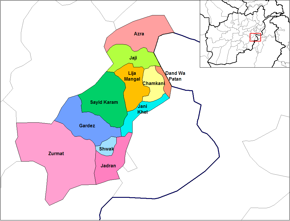
Ahmadkhel District ( ps, احمد خېل ولسوالۍ, fa, ولسوالی لجه احمدخیل) or Lazha Ahmadkhel is a district of Paktia Province, Afghanistan Afghanistan, officially the Islamic Emirate of Afghanistan,; prs, امارت اسلامی افغانستان is a landlocked country located at the crossroads of Central Asia and South Asia. Referred to as the Heart of Asia, it is bordere .... Districts of Paktia Province {{Paktia-geo-stub ... [...More Info...] [...Related Items...] OR: [Wikipedia] [Google] [Baidu] |
Paktia Districts
Paktia (Pashto/Dari: – ''Paktyā'') is one of the 34 provinces of Afghanistan, located in the east of the country. Forming part of the larger Loya Paktia region, Paktia Province is divided into 15 districts and has a population of roughly 623,000, which is mostly a tribal society living in rural areas. Pashtuns make up the majority of the population and a small percentage include Tajiks Gardez is the provincial capital. The traditional food in Paktia is known as (dandakai) which is made from rice and mung bean or green gram. In 2021, the Taliban gained control of the province during the 2021 Taliban offensive. History Paktia used to be a unified province with Khost and Paktika till Khost became a separate province in 1985. These three provinces are now referred to as ''Loya Paktia'', meaning "Greater Paktia". Paktia came to prominence during the 1980s, when a significant portion of Afghanistan's leadership originated from the province. Some of the more notable leaders inc ... [...More Info...] [...Related Items...] OR: [Wikipedia] [Google] [Baidu] |
Districts Of Afghanistan
The districts of Afghanistan, known as ''wuleswali'' ( ps, ولسوالۍ, ''wuləswāləi''; fa, شهرستان, ''shahrestān'') are secondary-level administrative units, one level below provinces. The Afghan government issued its first district map in 1973.''Afghanistan; Districts and Codes by Province'', Edition 2.0, AID / Rep. DC&A Mapping Unit, October 1991, Peshawar, Pakista/ref> It recognized 325 districts, counting ''wuleswalis'' (districts), ''alaqadaries'' (sub-districts), and ''markaz-e-wulaiyat'' (provincial center districts). In the ensuing years, additional districts have been added through splits, and some eliminated through merges. In June 2005, the Afghan government issued a map of 398 districts. It was widely adopted by many information management systems, though usually with the addition of ''Sharak-e-Hayratan'' for 399 districts in total. It remains the ''de facto'' standard as of late 2018, despite a string of government announcements of the creation of ... [...More Info...] [...Related Items...] OR: [Wikipedia] [Google] [Baidu] |
Paktia Province
Paktia (Pashto/Dari: – ''Paktyā'') is one of the 34 provinces of Afghanistan, located in the east of the country. Forming part of the larger Loya Paktia region, Paktia Province is divided into 15 districts and has a population of roughly 623,000, which is mostly a tribal society living in rural areas. Pashtuns make up the majority of the population and a small percentage include Tajiks Gardez is the provincial capital. The traditional food in Paktia is known as (dandakai) which is made from rice and mung bean or green gram. In 2021, the Taliban gained control of the province during the 2021 Taliban offensive. History Paktia used to be a unified province with Khost and Paktika till Khost became a separate province in 1985. These three provinces are now referred to as ''Loya Paktia'', meaning "Greater Paktia". Paktia came to prominence during the 1980s, when a significant portion of Afghanistan's leadership originated from the province. Some of the more notable leaders inc ... [...More Info...] [...Related Items...] OR: [Wikipedia] [Google] [Baidu] |
Afghanistan
Afghanistan, officially the Islamic Emirate of Afghanistan,; prs, امارت اسلامی افغانستان is a landlocked country located at the crossroads of Central Asia and South Asia. Referred to as the Heart of Asia, it is bordered by Pakistan to the Durand Line, east and south, Iran to the Afghanistan–Iran border, west, Turkmenistan to the Afghanistan–Turkmenistan border, northwest, Uzbekistan to the Afghanistan–Uzbekistan border, north, Tajikistan to the Afghanistan–Tajikistan border, northeast, and China to the Afghanistan–China border, northeast and east. Occupying of land, the country is predominantly mountainous with plains Afghan Turkestan, in the north and Sistan Basin, the southwest, which are separated by the Hindu Kush mountain range. , Demographics of Afghanistan, its population is 40.2 million (officially estimated to be 32.9 million), composed mostly of ethnic Pashtuns, Tajiks, Hazaras, and Uzbeks. Kabul is the country's largest city and ser ... [...More Info...] [...Related Items...] OR: [Wikipedia] [Google] [Baidu] |


