|
Aguadas, Caldas
Aguadas is a town and municipality in the Colombian department of Caldas. It is bordered to the north by Abejorral, to the east by Sonsón, to the southeast by Salamina, to the south by Pacora, to the west by Caramanta and Valparaiso, and to the northwest by La Pintada. The municipality of Aguadas, located in the northern part of the department, was founded in 1808 by José Narciso Estrada. In addition to the fame of Aguadeño hats (''sombrero aguadeño''), which are very similar to palm-straw Panama hats (also known as ''iraca'' in Colombia). Aguadas offers visitors its historic center, which was declared a national monument in 1982. It has a temperate climate thanks to the variety of climates ranging from warm to moor. Another of its main attractions is the National Festival of the Colombian Pasillo (''Festival Nacional del Pasillo Colombiano''), an annual event that has earned recognition for Aguadas as the capital of the Colombian Pasillo. Located along the Colombia ... [...More Info...] [...Related Items...] OR: [Wikipedia] [Google] [Baidu] |
Municipalities Of Colombia
The Municipalities of Colombia are decentralized subdivisions of the Republic of Colombia. Municipalities make up most of the departments of Colombia with 1,122 municipalities ('' municipios''). Each one of them is led by a mayor (''alcalde'') elected by popular vote and represents the maximum executive government official at a municipality level under the mandate of the governor of their department which is a representative of all municipalities in the department; municipalities are grouped to form departments. The municipalities of Colombia are also grouped in an association called the ''Federación Colombiana de Municipios'' (Colombian Federation of Municipalities), which functions as a union under the private law and under the constitutional right to free association to defend their common interests. Categories Conforming to the law 1551/12 that modified the sixth article of the law 136/94 Article 7 http://www.alcaldiabogota.gov.co/sisjur/normas/Norma1.jsp?i=48267 the mu ... [...More Info...] [...Related Items...] OR: [Wikipedia] [Google] [Baidu] |
Colombian Coffee Growing Axis
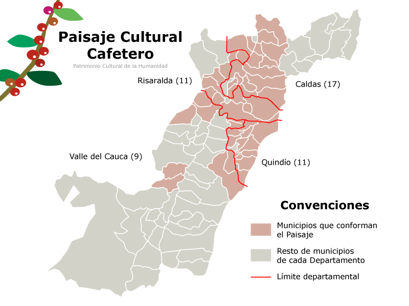
The Colombian coffee region ( es, Eje Cafetero), also known as the Coffee Triangle ( es, Triángulo del Café) is a part of the Paisa region in the rural area of Colombia. It is famous for growing and producing the majority of Colombian coffee. There are four departments in the area: Caldas, Quindío, Risaralda and the north municipalities of Tolima and Valle del Cauca. The most visited cities are Manizales, Armenia, Pereira, and Ibagué. History of coffee Coffee was first grown commercially in Colombia in Salazar de las Palmas, north of Santander, and over the twentieth century grew to be Colombia's primary export. When coffee was first brought into the country, the leaders tried to push the farming of coffee beans, but was met with resistance from the people because it takes about 5 years until the first harvest of the bean. In 1999 coffee revenues represented 3.7% of gross domestic product (gdp) and 37% of agricultural employment. The main coffee-producing departments ... [...More Info...] [...Related Items...] OR: [Wikipedia] [Google] [Baidu] |
Pueblo Patrimonio (Colombia)
''La Red Turística de Pueblos Patrimonio'' ("The Tourism Network of Heritage Towns") is an initiative led by Colombia's Ministry of Commerce, Industry, and Tourism, with the assistance of the Ministry of Culture. It is administered by the National Tourism Foundation (FONTUR). The program seeks to promote tourism in a network of small and mid-sized towns that represent aspects of Colombia's cultural heritage, and to encourage sustainable economic development in these communities. ''Pueblos Patrimonio'' are selected from amongst Colombia's inventory of designated ''Bienes de Interés Cultural'' (Cultural Heritage Assets) on the merits of their architectural, historical, and environmental characteristics, as well as unique cultural identities, which give them the potential to become "true cultural destinations." The network was first established in 2010, with an inaugural class of 11 municipalities.https://fontur.com.co/sites/default/files/2020-12/GUIA_PUEBLOS_PATRIMONIO.pdf As ... [...More Info...] [...Related Items...] OR: [Wikipedia] [Google] [Baidu] |
Cauca River
The Cauca River () is a river in Colombia that lies between the Occidental and Central cordilleras. From its headwaters in southwestern Colombia near the city of Popayán, it joins the Magdalena River near Magangue in Bolivar Department, and the combined river eventually flows out into the Caribbean Sea. It has a length of to its junction with the Magdalena, for a total length of . from origin to seamouth. The river is under the supervision of the ''Cauca Regional Corporation'' and the ''Cauca Valley Regional Autonomous Corporation'', and is navigable for above its junction with the Magdalena. File:Rio cauca popayan.JPG File:Salvajina.jpg File:Río Cauca. Puente Anacaro (3). Cartago - Ansermanuevo, Valle, Colombia.JPG File:Río Cauca.JPG File:Puentes en La Pintada 01.jpg File:Puente de Occidente.JPG File:El río Cauca.jpg Environmental issues On November 18, 2007, Colombian newspaper '' El Tiempo'' reported that the river was receiving an average of 500 tons of residual ... [...More Info...] [...Related Items...] OR: [Wikipedia] [Google] [Baidu] |
Santiago De Arma
Santiago (, ; ), also known as Santiago de Chile, is the capital and largest city of Chile as well as one of the largest cities in the Americas. It is the center of Chile's most densely populated region, the Santiago Metropolitan Region, whose total population is 8 million which is nearly 40% of the country's population, of which more than 6 million live in the city's continuous urban area. The city is entirely in the country's central valley. Most of the city lies between above mean sea level. Founded in 1541 by the Spanish conquistador Pedro de Valdivia, Santiago has been the capital city of Chile since colonial times. The city has a downtown core of 19th-century neoclassical architecture and winding side-streets, dotted by art deco, neo-gothic, and other styles. Santiago's cityscape is shaped by several stand-alone hills and the fast-flowing Mapocho River, lined by parks such as Parque Forestal and Balmaceda Park. The Andes Mountains can be seen from most points ... [...More Info...] [...Related Items...] OR: [Wikipedia] [Google] [Baidu] |
Antioquia Department
) , anthem = Himno de Antioquia , image_map = Antioquia in Colombia (mainland).svg , map_alt = , map_caption = Antioquia shown in red , image_map1 = Antioquia Topographic 2.png , map_caption1 = Topography of the department , coordinates = , subdivision_type = Country , subdivision_name = , subdivision_type1 = Region , subdivision_name1 = Andean Region , established_title = Established , established_date = 1826 , founder = , named_for = , seat_type = Capital , seat = Medellín , parts_type = Largest city , parts_style = para , p1 = , government_footnote ... [...More Info...] [...Related Items...] OR: [Wikipedia] [Google] [Baidu] |
Rionegro
Rionegro () is a city and municipality in Antioquia Department, Colombia, located in the subregion of Eastern Antioquia. The official name of the city is "Ciudad Santiago de Arma de Rionegro". Rio Negro means "Black River" in Spanish, as the city received its name after a river that looks black because of the shadows cast by trees. The river traverses the city and it is the most prominent geographical feature of the municipality. Rionegro is also sometimes called the ''Cuna de la democracia'' (Cradle of democracy) as it was one of the most important cities during the era of the Colombia's struggle for independence and the 1863 constitution was written in the city. History The territory was first mentioned in 1541 by the Spanish Lieutenant Álvaro de Mendoza. When the Field Marshal Jorge Robledo took possession of the Valley of Aburrá, he was commissioned by Alvaro de Mendoza. According to Fray Pedro Simón, Robledo was the first Iberian man who discovered the Valley of S ... [...More Info...] [...Related Items...] OR: [Wikipedia] [Google] [Baidu] |
Sebastián De Belalcázar
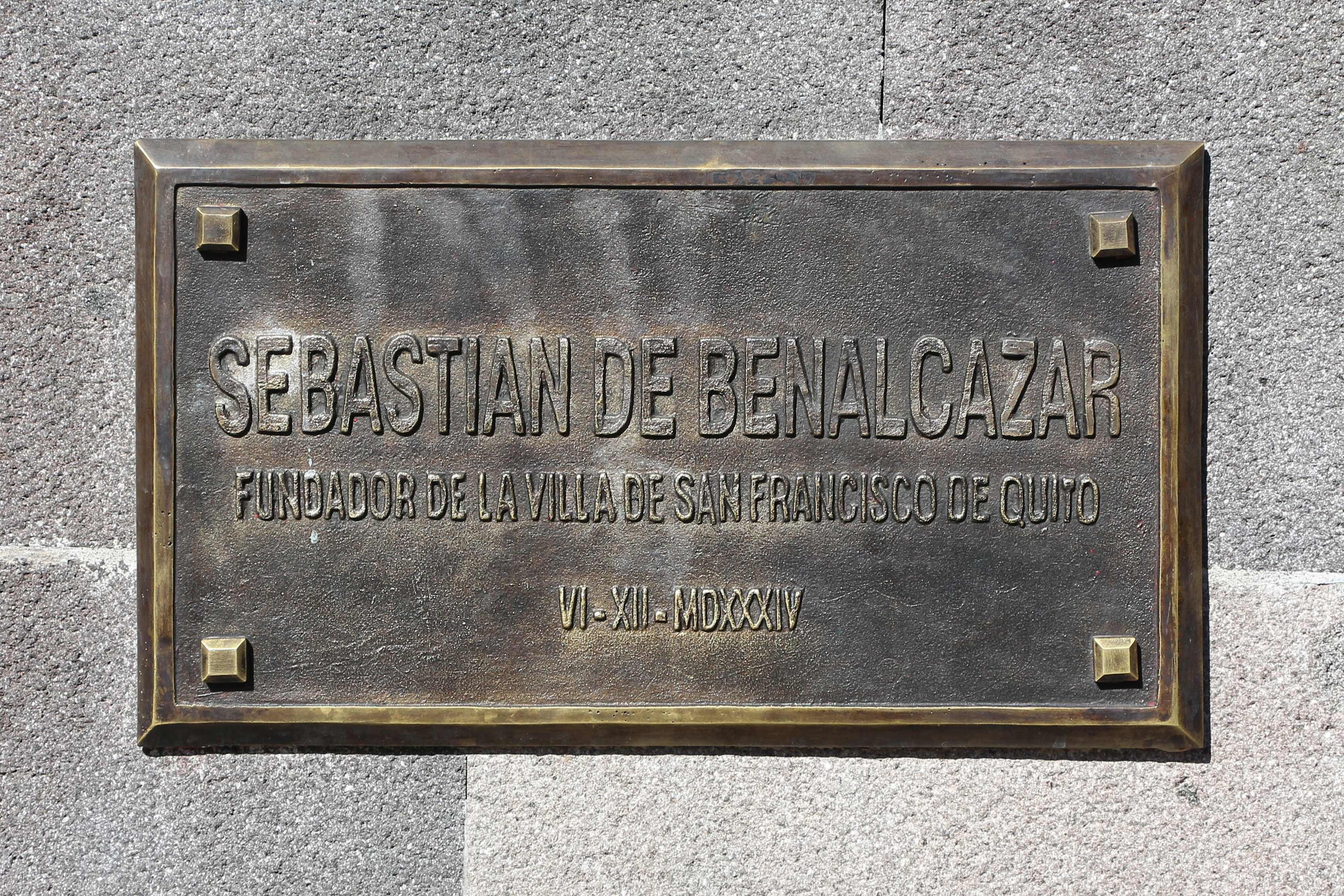
Sebastián de Belalcázar (; 1479/1480 – 1551) was a Spanish conquistador. De Belalcázar, also written as de Benalcázar, is known as the founder of important early colonial cities in the northwestern part of South America; Quito in 1534 and Cali, Pasto and Popayán in 1537. De Belalcázar led expeditions in present-day Ecuador and Colombia and died of natural causes after being sentenced to death in Cartagena, at the Caribbean coast in 1551. Early life He was born as Sebastián Moyano in the province of Córdoba, Spain, in either 1479 or 1480. He took the name Belalcázar as that was the name of the castle-town near to his birthplace in Córdoba. According to various sources, he may have left for the New World with Christopher Columbus as early as 1498. Americas He was an encomendero in Panama in 1522. He entered Nicaragua with Francisco Hernández de Córdoba in 1524 during the conquest of Nicaragua, and became the first mayor of the city of León in Nicaragua. H ... [...More Info...] [...Related Items...] OR: [Wikipedia] [Google] [Baidu] |
Spain
, image_flag = Bandera de España.svg , image_coat = Escudo de España (mazonado).svg , national_motto = '' Plus ultra'' ( Latin)(English: "Further Beyond") , national_anthem = (English: "Royal March") , image_map = , map_caption = , image_map2 = , capital = Madrid , coordinates = , largest_city = Madrid , languages_type = Official language , languages = Spanish , ethnic_groups = , ethnic_groups_year = , ethnic_groups_ref = , religion = , religion_ref = , religion_year = 2020 , demonym = , government_type = Unitary parliamentary constitutional monarchy , leader_title1 = Monarch , leader_name1 = Felipe VI , leader_title2 = Prime Minister , leader_name2 = Pedro Sánchez , legislature = ... [...More Info...] [...Related Items...] OR: [Wikipedia] [Google] [Baidu] |
Jorge Robledo (conquistador)
Jorge Robledo (1500 – 5 October 1546) was a Spanish conquistador. He traveled in modern-day Colombia, Guatemala, and Peru and was executed by decapitation by order of Sebastián de Belalcázar. Biography Jorge Robledo was born in the year 1500 in Úbeda, Jaén, Andalusia, Spain, with unknown parents. Banco de la República He is first mentioned in the historical chronicles as soldier in the army of Lorenzo de Aldana, who was sent north by Francisco Pizarro in 1539 towards the newly founded province of Popayán. He founded the cities of Santa Ana de los Caballeros (present-day Anserma, Caldas) on July 26, 1539, Cartago, Valle del Cauca (as Arma) in 1540, and Santa Fe de Antioquia in 1541, beating the Nutabe. After this, he spent three years in Spain where he married María de Carvajal y Mendoza, called ''La Mariscala''. His wife was also from Úbeda. Robledo returned to the New Kingdom of Granada with his spouse and many relatives. Jorge Robledo was executed by decapitat ... [...More Info...] [...Related Items...] OR: [Wikipedia] [Google] [Baidu] |
World Heritage Site
A World Heritage Site is a landmark or area with legal protection by an international convention administered by the United Nations Educational, Scientific and Cultural Organization (UNESCO). World Heritage Sites are designated by UNESCO for having cultural, historical, scientific or other form of significance. The sites are judged to contain "cultural and natural heritage around the world considered to be of outstanding value to humanity". To be selected, a World Heritage Site must be a somehow unique landmark which is geographically and historically identifiable and has special cultural or physical significance. For example, World Heritage Sites might be ancient ruins or historical structures, buildings, cities, deserts, forests, islands, lakes, monuments, mountains, or wilderness areas. A World Heritage Site may signify a remarkable accomplishment of humanity, and serve as evidence of our intellectual history on the planet, or it might be a place of great natural beauty. A ... [...More Info...] [...Related Items...] OR: [Wikipedia] [Google] [Baidu] |


