|
Afon Llynfi (Wye)
The Afon Llynfi is a short river in the county of Powys, south Wales. A tributary of the River Wye, it runs approximately south to north just to the west of the Black Mountains and partly within the Brecon Beacons National Park. Geography The river rises as a small stream to the west of the village of Bwlch and flows north for two miles into Llangorse Lake. It leaves the lake just to the southwest of the village of Llangors and follows a course past the hamlets of Trefecca and Tredustan. The river then travels between the twin villages of Talgarth and Bronllys, forming the boundary of the national park in part. It then flows northeast past the village of Three Cocks (otherwise known as Aberllynfi) before entering the River Wye just upstream of Glasbury Bridge. The Afon Llynfi is joined by a number of tributary streams including the Tawel and Gwlithen on its left bank and the Nant Cwy (emptying directly into the lake) and Nant yr Eiddil on its right bank. The two largest t ... [...More Info...] [...Related Items...] OR: [Wikipedia] [Google] [Baidu] |
Powys
Powys (; ) is a Local government in Wales#Principal areas, county and Preserved counties of Wales, preserved county in Wales. It is named after the Kingdom of Powys which was a Welsh succession of states, successor state, petty kingdom and principality that emerged during the Middle Ages following the end of Roman rule in Britain. Geography Powys covers the historic counties of Montgomeryshire and Radnorshire, most of Brecknockshire, and part of Denbighshire (historic), historic Denbighshire. With an area of about , it is now the largest administrative area in Wales by land and area (Dyfed was until 1996 before several Preserved counties of Wales, former counties created by the Local Government Act 1972 were abolished). It is bounded to the north by Gwynedd, Denbighshire and Wrexham County Borough; to the west by Ceredigion and Carmarthenshire; to the east by Shropshire and Herefordshire; and to the south by Rhondda Cynon Taf, Merthyr Tydfil County Borough, Caerphilly County Bor ... [...More Info...] [...Related Items...] OR: [Wikipedia] [Google] [Baidu] |
Aberllynfi
Three Cocks or () is a village near Glasbury in Powys, Wales. The Welsh name refers to the mouth of the Afon Llynfi which enters the River Wye a mile from the village. The nearest town is Hay-on-Wye some 5 miles (8.5 km) to the North East. Aberllynfi parish Aberllynfi was once a separate ecclesiastical parish, but its church fell into disuse in the 18th century. The curious English name of the village is comparatively recent and was taken from the former railway station ( Three Cocks Junction, now a garden centre) where the Hereford, Hay and Brecon Railway met the Mid-Wales Railway. The station derived its name from the 15th century Three Cocks Inn (a coaching inn, still extant) which in turn took its name from the armorial bearings of former local landowners, the Williams family of Old Gwernyfed. These were supposed to have been based on the arms of the medieval Welsh prince Einon Sais, who lived in Aberllynfi, but this is probably a later invention. The station, together ... [...More Info...] [...Related Items...] OR: [Wikipedia] [Google] [Baidu] |
Rivers Of The Brecon Beacons National Park
A river is a natural flowing watercourse, usually freshwater, flowing towards an ocean, sea, lake or another river. In some cases, a river flows into the ground and becomes dry at the end of its course without reaching another body of water. Small rivers can be referred to using names such as creek, brook, rivulet, and rill. There are no official definitions for the generic term river as applied to geographic features, although in some countries or communities a stream is defined by its size. Many names for small rivers are specific to geographic location; examples are "run" in some parts of the United States, "burn" in Scotland and northeast England, and "beck" in northern England. Sometimes a river is defined as being larger than a creek, but not always: the language is vague. Rivers are part of the water cycle. Water generally collects in a river from precipitation through a drainage basin from surface runoff and other sources such as groundwater recharge, springs, a ... [...More Info...] [...Related Items...] OR: [Wikipedia] [Google] [Baidu] |
Pwll Y Wrach
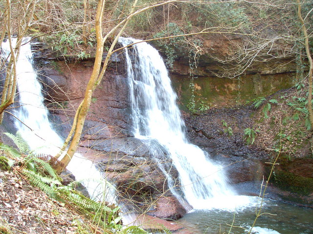
Pwll y wrach or Pwll-y-wrach (Welsh for "pool of the witch") is a feature on the River Ennig near Talgarth in south Powys, Wales. The river plunges in two separate streams over a lip of hard rock ( Bishop's Frome Limestone, formerly known as Psammosteus Limestone) into a pool scoured in the softer mudstones of the underlying Raglan Mudstone formation. The feature occurs within Cwm Pwll-y-wrach, a deep wooded valley that is a Site of Special Scientific Interest and a nature reserve managed by the Brecknock Wildlife Trust. The trust has established trails within the wood to enable public access. It is suggested that the name derives from the ancient practice of ducking witches in the plunge pool.Interpretive material provided on site by BWT. References External links Pwll-y-Wrachat cavinguk.co.uk Pwll-y-Wrachat Wildlife Trust of South and West Wales The Wildlife Trust of South and West Wales (WTSWW) ( cy, Ymddiriedolaeth Natur De a Gorllewin Cymru) is a Wildlife Trus ... [...More Info...] [...Related Items...] OR: [Wikipedia] [Google] [Baidu] |
Fish Kill
The term fish kill, known also as fish die-off, refers to a localized die-off of fish populations which may also be associated with more generalized mortality of aquatic life.University of Florida. Gainesville, FL (2005) ''Plant Management in Florida's Waters.'' The most common cause is reduced oxygen in the water, which in turn may be due to factors such as drought, algae bloom, overpopulation, or a sustained increase in water temperature. Infectious diseases and parasites can also lead to fish kill. Toxicity is a real but far less common cause of fish kill. Fish kills are often the first visible signs of environmental stress and are usually investigated as a matter of urgency by environmental agencies to determine the cause of the kill. Many fish species have a relatively low tolerance of variations in environmental conditions and their death is often a potent indicator of problems in their environment that may be affecting other animals and plants and may have a direct impa ... [...More Info...] [...Related Items...] OR: [Wikipedia] [Google] [Baidu] |
River Usk
The River Usk (; cy, Afon Wysg) rises on the northern slopes of the Black Mountain (''y Mynydd Du''), Wales, in the westernmost part of the Brecon Beacons National Park. Initially forming the boundary between Carmarthenshire and Powys, it flows north into Usk Reservoir, then east by Sennybridge to Brecon before turning southeast to flow by Talybont-on-Usk, Crickhowell and Abergavenny after which it takes a more southerly course. Beyond the eponymous town of Usk it passes the Roman legionary fortress of Caerleon to flow through the heart of the city of Newport and into the Severn Estuary at Uskmouth beyond Newport near the Newport Wetlands. The river is about long. The Monmouthshire and Brecon Canal follows the Usk for most of the length of the canal. Etymology The name of the river derives from a Common Brittonic word meaning "abounding in fish" (or possibly "water"), this root also appears in other British river names such as Exe, Axe, Esk and other variant ... [...More Info...] [...Related Items...] OR: [Wikipedia] [Google] [Baidu] |
Mountain Pass
A mountain pass is a navigable route through a mountain range or over a ridge. Since many of the world's mountain ranges have presented formidable barriers to travel, passes have played a key role in trade, war, and both Human migration, human and animal migration throughout history. At lower elevations it may be called a hill pass. A mountain pass is typically formed between two volcanic peaks or created by erosion from water or wind. Overview Mountain passes make use of a gap (landform), gap, saddle (landform), saddle, col or notch (landform), notch. A topographic saddle is analogous to the mathematical concept of a saddle surface, with a saddle point marking the highest point between two valleys and the lowest point along a ridge. On a topographic map, passes are characterized by contour lines with an hourglass shape, which indicates a low spot between two higher points. In the high mountains, a difference of between the summit and the mountain is defined as a mountain pas ... [...More Info...] [...Related Items...] OR: [Wikipedia] [Google] [Baidu] |
Glasbury
Glasbury ( cy, Y Clas-ar-Wy), also known as Glasbury-on-Wye, is a village and community in Powys, Wales. The village lies at an important crossing point on the River Wye, connecting the historic counties of Brecknockshire and Radnorshire, and is located just outside the Brecon Beacons National Park, north of the Black Mountains. The village is split between the communities of Glasbury and Gwernyfed. The nearest town is Hay-on-Wye, some to the north east. The nearest city is Hereford in England, some to the east. Glasbury is a popular location for river fishing, canoeing and kayaking. The population of Glasbury community in Radnorshire was 994 (census 2011), in 1841 it was 838. History Saint Cynidr and early settlement The early village grew north of the river crossing, where a church was built dedicated to St Cynidr, a 6th-century bishop said to be buried in Glasbury. The name 'Glasbury' derives from the Welsh ' clas', which signifies a glebe or church land. St Cynidr' ... [...More Info...] [...Related Items...] OR: [Wikipedia] [Google] [Baidu] |
Bronllys
Bronllys is a village and community in Powys, Wales between the nearby towns Brecon and Talgarth. Bronllys is also the name of an electoral ward to Powys County Council. The community includes Llyswen. Description The village is in the historic county of Brecknockshire (Breconshire). It has recently benefited from a new bypass as part of the Talgarth Relief Road and Bronllys Bypass scheme. Despite being a small village it has a swimming pool and small leisure centre, post office and hospital. Bronllys Castle Bronllys Castle is a motte and bailey fortress standing south of the village, towards Talgarth. The castle was founded in or soon after 1100, by Richard Fitz Pons, the owner of the adjacent Herefordshire barony of Clifford, who was a supporter of Bernard of Neufmarché, Lord of Brecknock (in which the land around Bronllys fell). Richard's castle was of the motte-and-bailey design, but only wooden. In 1521, the year the castle became a crown property, the antiquar ... [...More Info...] [...Related Items...] OR: [Wikipedia] [Google] [Baidu] |
Wales
Wales ( cy, Cymru ) is a Countries of the United Kingdom, country that is part of the United Kingdom. It is bordered by England to the Wales–England border, east, the Irish Sea to the north and west, the Celtic Sea to the south west and the Bristol Channel to the south. It had a population in 2021 of 3,107,500 and has a total area of . Wales has over of coastline and is largely mountainous with its higher peaks in the north and central areas, including Snowdon (), its highest summit. The country lies within the Temperateness, north temperate zone and has a changeable, maritime climate. The capital and largest city is Cardiff. Welsh national identity emerged among the Celtic Britons after the Roman withdrawal from Britain in the 5th century, and Wales was formed as a Kingdom of Wales, kingdom under Gruffydd ap Llywelyn in 1055. Wales is regarded as one of the Celtic nations. The Conquest of Wales by Edward I, conquest of Wales by Edward I of England was completed by 1283, th ... [...More Info...] [...Related Items...] OR: [Wikipedia] [Google] [Baidu] |
Talgarth
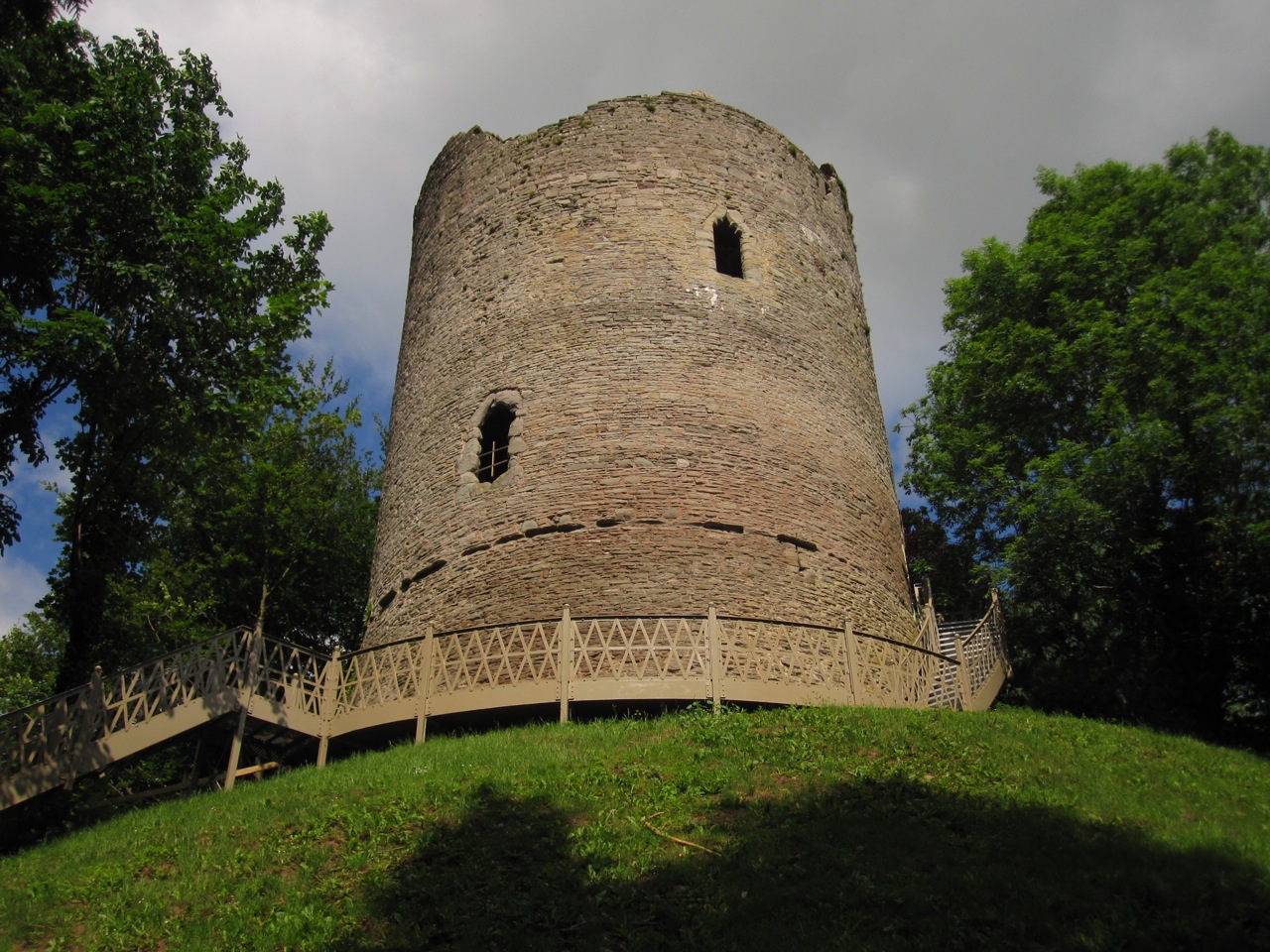
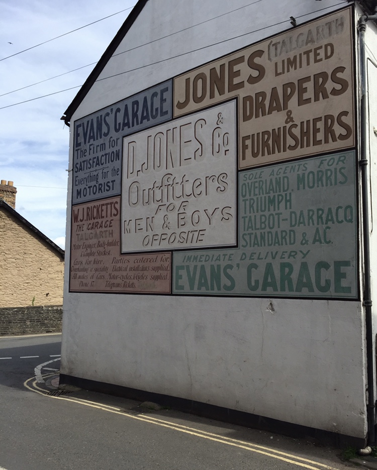
Talgarth is a market town, community and electoral ward in southern Powys, Mid Wales, about north of Crickhowell, north-east of Brecon and south-east of Builth Wells. Notable buildings in the town include the 14th-century parish church and a defensive tower house. According to traditional accounts, Talgarth was the capital of the early medieval Welsh Kingdom of Brycheiniog. It is in the historic county of Brecknockshire. In 2011, it had a population of 1,724. Name The meaning of the town's name is in the Welsh words ''tâl'' (forehead or brow of a hill) and ''garth'' (mountain ridge or promontory), thus "end of the ridge". It appears as Talgart in 1121, as Talgard after 1130, and in its present form in the years between 1203 and 1208. The church of Talgarth is recorded in 1488 as dedicated to ''Sce Wenne Virginis'', explained as Gwen (granddaughter of Brychan). Culture and community In August, the Talgarth Festival of the Black Mountains is held, a popular countryside eve ... [...More Info...] [...Related Items...] OR: [Wikipedia] [Google] [Baidu] |


