|
Adderbury Railway Station
Adderbury railway station served the village of Adderbury in Oxfordshire, England. History The station was built by the Banbury and Cheltenham Direct Railway, which was taken over by the Great Western Railway before its opening. When Britain's railways were nationalised in 1948 the B&CDR became part of the Western Region of British Railways The Western Region was a region of British Railways from 1948. The region ceased to be an operating unit in its own right on completion of the "Organising for Quality" initiative on 6 April 1992. The Region consisted principally of ex- Great ..., which then withdraw passenger services through Adderbury in 1951. Line through the station closed completely in 1969. A housing estate has now been built on the station site and no trace of the railway remains. Route References * * * Station on navigable O.S. map {{Closed stations Oxfordshire Disused railway stations in Oxfordshire Former Great Western Railway stations R ... [...More Info...] [...Related Items...] OR: [Wikipedia] [Google] [Baidu] |
Adderbury
Adderbury is a winding linear village and rural civil parish about south of Banbury in northern Oxfordshire, England. The settlement has five sections: the new Milton Road housing Development & West Adderbury towards the southwest; East Adderbury to the centre, both with a village green and a manor house; and the new housing Development on the Aynho Road; and the northeast, which is known as Twyford, named after a small outlying settlement by a forked section of the River Cherwell. East and West Adderbury are divided by the south- then east-flowing Sor Brook, a tributary of the Cherwell. Sor Brook rises at Ratley and Upton in Warwickshire and joins the Cherwell between Adderbury and Aynho, Northamptonshire, the latter river being the eastern parish boundary. The Oxford Canal and beyond which the Cherwell characterise the far east of the parish. The M40 motorway passes close to the northeast of Adderbury near Twyford wharf. Banbury Business Park and Banbury Golf Course are ... [...More Info...] [...Related Items...] OR: [Wikipedia] [Google] [Baidu] |
Cherwell (district)
Cherwell ( ) is a local government district in northern Oxfordshire, England. The district takes its name from the River Cherwell, which drains south through the region to flow into the River Thames at Oxford. Towns in Cherwell include Banbury and Bicester. Kidlington is a contender for largest village in England. The district was formed on 1 April 1974, under the Local Government Act 1972, by a merger of the municipal borough of Banbury, Bicester urban district, Banbury Rural District and Ploughley Rural District. Geography The Northern half of the Cherwell district consists mainly of soft rolling hills going down towards the River Cherwell, but the southern half of the district around Bicester is much flatter. Much of the district is soft rolling hills with the northwest of the district lying at the northern extremity of the Cotswolds. Transport Much of the district is within easy reach of the M40, with junctions 9, 10 and 11 in the district. It also has good rail links w ... [...More Info...] [...Related Items...] OR: [Wikipedia] [Google] [Baidu] |
Ordnance Survey National Grid
The Ordnance Survey National Grid reference system (OSGB) (also known as British National Grid (BNG)) is a system of geographic grid references used in Great Britain, distinct from latitude and longitude. The Ordnance Survey (OS) devised the national grid reference system, and it is heavily used in their survey data, and in maps based on those surveys, whether published by the Ordnance Survey or by commercial map producers. Grid references are also commonly quoted in other publications and data sources, such as guide books and government planning documents. A number of different systems exist that can provide grid references for locations within the British Isles: this article describes the system created solely for Great Britain and its outlying islands (including the Isle of Man); the Irish grid reference system was a similar system created by the Ordnance Survey of Ireland and the Ordnance Survey of Northern Ireland for the island of Ireland. The Universal Transverse Merca ... [...More Info...] [...Related Items...] OR: [Wikipedia] [Google] [Baidu] |
Banbury And Cheltenham Direct Railway
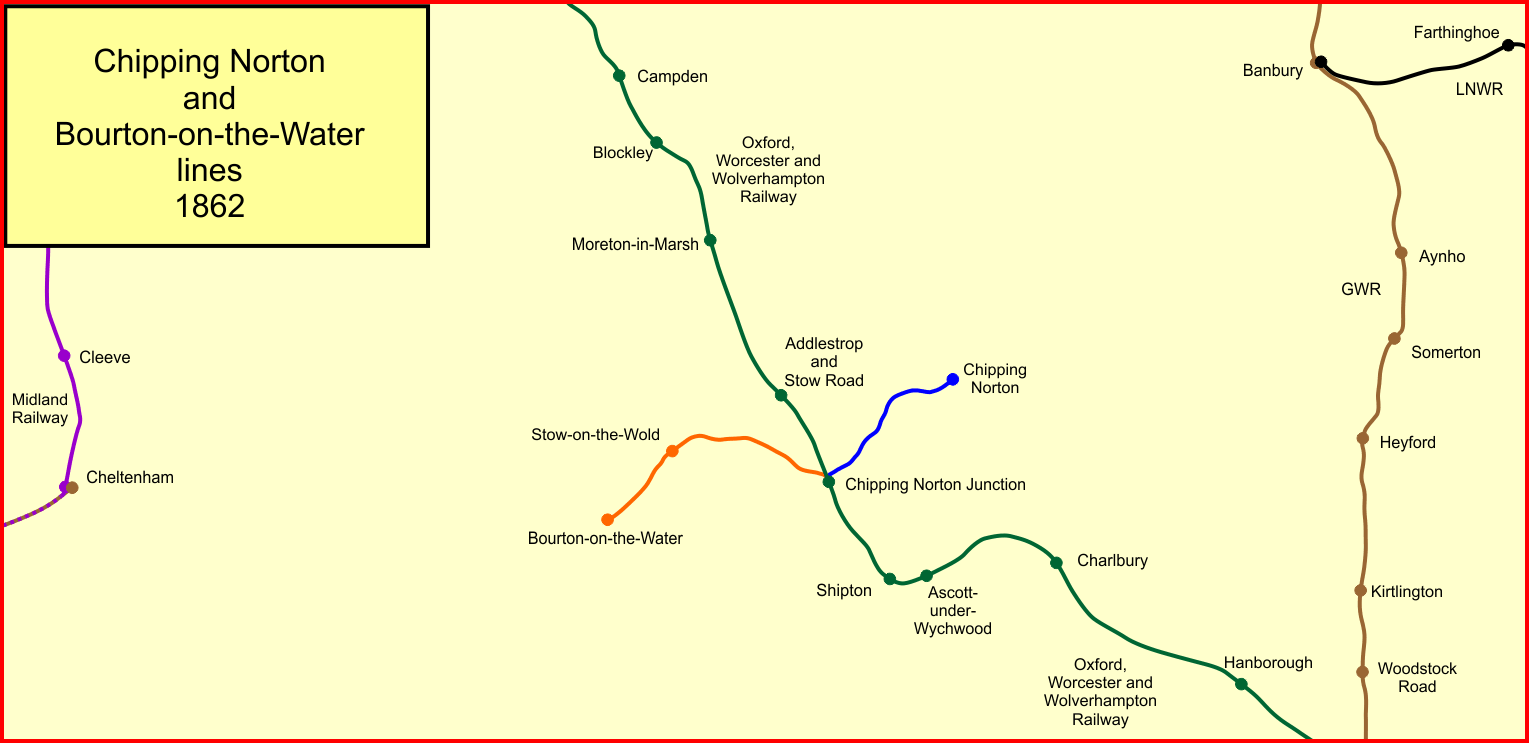
The Banbury and Cheltenham Direct Railway (B&CDR) was a railway company through the Cotswolds in England that built a line between points near Banbury and Cheltenham. Its principal objective, as well as a general rural rail service, was the conveyance of iron ore from the East Midlands to South Wales. It extended two pre-existing branches, the branch of the Oxford, Worcester and Wolverhampton Railway (OW&WR, opened in 1855) and the Railway (opened in 1862). Both branches had their main line junction at Chipping Norton Junction, later renamed , on the OW&WR main line. The B&CDR opened its western section, from Bourton-on-the-Water to a junction near Cheltenham, in 1881, and its eastern section, from Chipping Norton to a junction at , near Banbury, in 1887. The company was always short of money, and the timescale of construction was correspondingly lengthy. When the extensions opened, the Great Western Railway worked the B&CDR line and the two earlier branches as a single railway ... [...More Info...] [...Related Items...] OR: [Wikipedia] [Google] [Baidu] |
Great Western Railway
The Great Western Railway (GWR) was a British railway company that linked London with the southwest, west and West Midlands of England and most of Wales. It was founded in 1833, received its enabling Act of Parliament on 31 August 1835 and ran its first trains in 1838 with the initial route completed between London and Bristol in 1841. It was engineered by Isambard Kingdom Brunel, who chose a broad gauge of —later slightly widened to —but, from 1854, a series of amalgamations saw it also operate standard-gauge trains; the last broad-gauge services were operated in 1892. The GWR was the only company to keep its identity through the Railways Act 1921, which amalgamated it with the remaining independent railways within its territory, and it was finally merged at the end of 1947 when it was nationalised and became the Western Region of British Railways. The GWR was called by some "God's Wonderful Railway" and by others the "Great Way Round" but it was famed as the "Holiday ... [...More Info...] [...Related Items...] OR: [Wikipedia] [Google] [Baidu] |
Western Region Of British Railways
The Western Region was a region of British Railways from 1948. The region ceased to be an operating unit in its own right on completion of the "Organising for Quality" initiative on 6 April 1992. The Region consisted principally of ex- Great Western Railway lines, minus certain lines west of Birmingham, which were transferred to the London Midland Region in 1963 and with the addition of all former Southern Railway routes west of Exeter, which were subsequently rationalised. History When British Railways was created at the start of 1948, it was immediately subdivided into six Regions, largely based upon pre-nationalisation ownership. The Western Region initially consisted of the former Great Western Railway system, totalling 3,782 route miles and with its headquarters at Paddington. To this was added some minor railways and joint lines in which the GWR had an interest: *Brynmawr and Western Valleys Railway *Clifton Extension Railway * Easton and Church Hope Railway *Great ... [...More Info...] [...Related Items...] OR: [Wikipedia] [Google] [Baidu] |
Oxfordshire
Oxfordshire is a ceremonial and non-metropolitan county in the north west of South East England. It is a mainly rural county, with its largest settlement being the city of Oxford. The county is a centre of research and development, primarily due to the work of the University of Oxford and several notable science parks. These include the Harwell Science and Innovation Campus and Milton Park, both situated around the towns of Didcot and Abingdon-on-Thames. It is a landlocked county, bordered by six counties: Berkshire to the south, Buckinghamshire to the east, Wiltshire to the south west, Gloucestershire to the west, Warwickshire to the north west, and Northamptonshire to the north east. Oxfordshire is locally governed by Oxfordshire County Council, together with local councils of its five non-metropolitan districts: City of Oxford, Cherwell, South Oxfordshire, Vale of White Horse, and West Oxfordshire. Present-day Oxfordshire spanning the area south of the Thames was h ... [...More Info...] [...Related Items...] OR: [Wikipedia] [Google] [Baidu] |
England
England is a country that is part of the United Kingdom. It shares land borders with Wales to its west and Scotland to its north. The Irish Sea lies northwest and the Celtic Sea to the southwest. It is separated from continental Europe by the North Sea to the east and the English Channel to the south. The country covers five-eighths of the island of Great Britain, which lies in the North Atlantic, and includes over 100 smaller islands, such as the Isles of Scilly and the Isle of Wight. The area now called England was first inhabited by modern humans during the Upper Paleolithic period, but takes its name from the Angles, a Germanic tribe deriving its name from the Anglia peninsula, who settled during the 5th and 6th centuries. England became a unified state in the 10th century and has had a significant cultural and legal impact on the wider world since the Age of Discovery, which began during the 15th century. The English language, the Anglican Church, and Engli ... [...More Info...] [...Related Items...] OR: [Wikipedia] [Google] [Baidu] |
Transport Act 1947
The Transport Act 1947 (10 & 11 Geo. 6 c. 49) was an Act of the Parliament of the United Kingdom. Under the terms of the Act, the railway network, long-distance road haulage and various other types of transport were nationalised and came under the administration of the British Transport Commission. The BTC was responsible to the Ministry of Transport for general transport policy, which it exercised principally through financial control of a number of executives set up to manage specified sections of the industry under schemes of delegation. Overview The Act was part of the nationalisation agenda of Clement Attlee's Labour government, and took effect from 1 January 1948. In Northern Ireland, the Ulster Transport Authority acted in a similar manner. The government also nationalised other means of transport such as: canals, sea and shipping ports, bus companies, and eventually, in the face of much opposition, road haulage. All of these transport modes, including British Railways, ... [...More Info...] [...Related Items...] OR: [Wikipedia] [Google] [Baidu] |
King's Sutton Railway Station
Kings Sutton railway station serves the village of King's Sutton in Northamptonshire, England. It is also one of the nearest railway stations to the town of Brackley. The station is managed by Chiltern Railways, who provide most of the services, including from London Paddington and Marylebone to Oxford and Banbury. History The Great Western Railway built the — section of the Oxford and Rugby Railway between 1845 and 1850. However, the GWR did not open a station at King's Sutton until 1872. By 1881 the arrival of the Banbury and Cheltenham Direct Railway ''via'' had made King's Sutton a junction. British Railways withdrew passenger services between King's Sutton and Chipping Norton in 1951 and closed the B&CDR line to freight traffic in 1964. The station was reduced to an unstaffed halt from 2 November 1964. BR removed King's Sutton station footbridge in the 1960s and replaced it with a signal-controlled barrow crossing at the North end of the platform. An incident in ... [...More Info...] [...Related Items...] OR: [Wikipedia] [Google] [Baidu] |
Milton Halt Railway Station
Milton Halt railway station is a former railway station that served the village of Milton in northern Oxfordshire, England. History The station was built by the Great Western Railway. It opened to passengers on 1 January 1908 (Jenkins gives the date as 1 January 1906 but the Board of Trade plan on the same page is dated 14 November 1907 suggesting that the 1908 date given by other sources is correct). The Halt had a wooden platform and "pagoda" shelter. There was also a small corrugated iron shed, identified as "office" on the 1907 Board of Trade plan, with the area between the two buildings identified as "space for milk churns". Although no goods facilities were provided, milk traffic was important and as soon as the halt opened two farmers paid £5 a year each for milk carriage. Hemmings Vol.1, p.158. The halt was located on an embankment and approached by a cinder path from the road below. It was unstaffed and the guards of the first and last trains of the day would ligh ... [...More Info...] [...Related Items...] OR: [Wikipedia] [Google] [Baidu] |


