|
Abergele
Abergele (; ; ) is a market town and community, situated on the north coast of Wales between the holiday resorts of Colwyn Bay and Rhyl, in Conwy County Borough and in the historic county of Denbighshire. Its northern suburb of Pensarn lies on the Irish Sea coast. Abergele and Pensarn railway station serves both resorts. Abergele is often overlooked due to the popularity of towns in nearby Rhyl, Prestatyn, Colwyn Bay, Llandudno and Conwy. Only 46.5% of the population was born in Wales as of the 2011 census. Etymology The meaning of the name can be deduced by being the Welsh word for estuary, river mouth or confluence and the name of the river which flows through the town. is a dialectal form of , which means spear, describing the action of the river cutting through the land. It has also been suggested this river is named because its waters flash brightly. Abergele is often mispronounced as ah-bear-geh-lee by non-native Welsh speakers. Geography The town itself lies ... [...More Info...] [...Related Items...] OR: [Wikipedia] [Google] [Baidu] |
Tan-y-Gopa
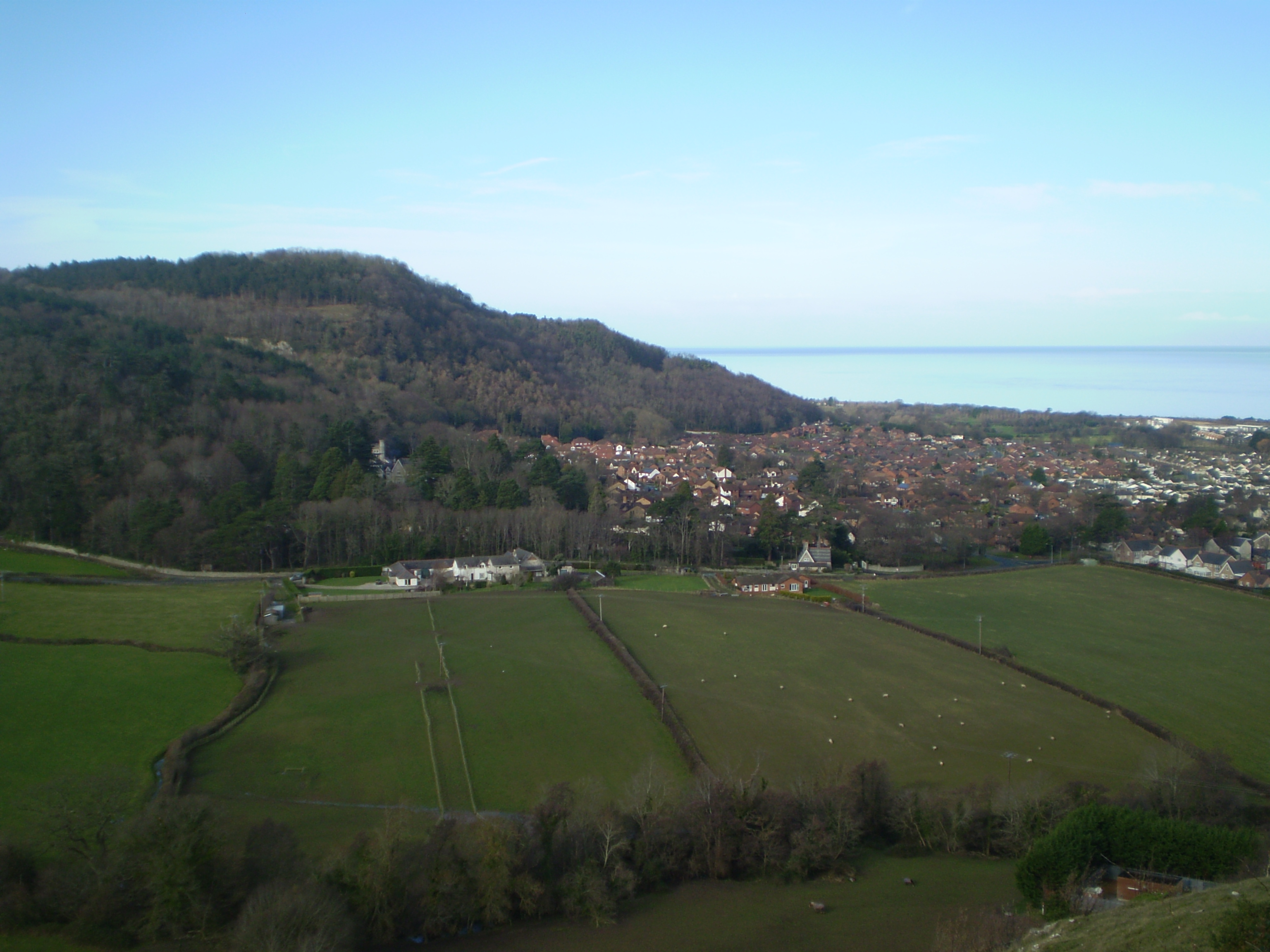
Castell Cawr, or Tan-y-Gopa as it is known locally, is a heavily forested hill above the town of Abergele in Conwy county borough, Wales. On it is found the Iron Age hillfort of Castell Cawr, which overlooks the River Clwyd. Rare lesser horseshoe bats inhabit caves on the hill. The woods are owned by the Woodland Trust. The hill rises to 189 m (620 ft) above sea level, with extensive views to Snowdonia and the Clwydian Range. Thomas Pennant visited the area in the 18th century, and noted the existence of the hillfort. In 1860, James Halliwell-Phillipps wrote that the outline of the hillfort was obscured by vegetation, and identified the workings of a Roman lead mine on the hillside. The Welsh knew these excavations by the name "Ffos-y-bleiddiaid" ("Ditch of the Wolves") See also *List of hillforts in Wales This is a list of hillforts in Wales. Anglesey *Bwrdd Arthur, Din Sylwy (Bwrdd Arthur) (), contour fort *Caer Idris Hillfort (), promontory fort *Caer y Tw ... [...More Info...] [...Related Items...] OR: [Wikipedia] [Google] [Baidu] |
Prestatyn
Prestatyn is a seaside town and community in Denbighshire, Wales. Historically a part of Flintshire, it is located on the Irish Sea coast, to the east of Rhyl. Prestatyn has a population of 19,085, History Prehistory There is evidence that the current town location has been occupied since prehistoric times. Prehistoric tools found in the caves of Graig Fawr, in the nearby village of Meliden, have revealed the existence of early human habitation in the area. Roman The Roman bathhouse is believed to be part of a fort on the road from Chester to Caernarfon. However, much of "Roman Prestatyn" has been destroyed as houses have been built over unexcavated land. Medieval The name Prestatyn derives from the Old English ''prēosta'' ("priests, the genitive plural of ''prēost'') and ''tūn'' ("town"), and was recorded in the ''Domesday Book'' as ''Prestetone''. Unlike similarly derived names in England, which generally lost their penultimate syllable and became Preston, this villag ... [...More Info...] [...Related Items...] OR: [Wikipedia] [Google] [Baidu] |
Moelfre Isaf
Moelfre Isaf is a 317 m (1,040 ft) hill located to the south of the town of Abergele. There are views towards the Clwydian Range, Snowdonia, and the Isle of Man and the Cumbrian Mountains can be seen on a clear day. Nearby is the small settlement of Moelfre, Conwy. Almost opposite is the higher hill of Moelfre Uchaf Moelfre Uchaf is a hill in the borough of Conwy, North Wales, 5 miles (8 km) south-east of Colwyn Bay and 1.5 mi (2 km) south-west of Betws-yn-Rhos. It is 396 m (1,299 ft) above sea level. A trigpoint A trian .... External links www.geograph.co.uk : photos of Moelfre Isaf and surrounding area Mountains and hills of Conwy County Borough {{Conwy-geo-stub ... [...More Info...] [...Related Items...] OR: [Wikipedia] [Google] [Baidu] |
Cave
A cave or cavern is a natural void in the ground, specifically a space large enough for a human to enter. Caves often form by the weathering of rock and often extend deep underground. The word ''cave'' can refer to smaller openings such as sea caves, rock shelters, and grottos, that extend a relatively short distance into the rock and they are called ''exogene'' caves. Caves which extend further underground than the opening is wide are called ''endogene'' caves. Speleology is the science of exploration and study of all aspects of caves and the cave environment. Visiting or exploring caves for recreation may be called ''caving'', ''potholing'', or ''spelunking''. Formation types The formation and development of caves is known as ''speleogenesis''; it can occur over the course of millions of years. Caves can range widely in size, and are formed by various geological processes. These may involve a combination of chemical processes, erosion by water, tectonic forces, microorgani ... [...More Info...] [...Related Items...] OR: [Wikipedia] [Google] [Baidu] |
Hill
A hill is a landform that extends above the surrounding terrain. It often has a distinct Summit (topography), summit. Terminology The distinction between a hill and a mountain is unclear and largely subjective, but a hill is universally considered to be not as tall, or as Grade (slope), steep as a mountain. Geographers historically regarded mountains as hills greater than above sea level, which formed the basis of the plot of the 1995 film ''The Englishman who Went up a Hill but Came down a Mountain''. In contrast, hillwalkers have tended to regard mountains as peaks above sea level. The ''Oxford English Dictionary'' also suggests a limit of and Whittow states "Some authorities regard eminences above as mountains, those below being referred to as hills." Today, a mountain is usually defined in the UK and Ireland as any summit at least high, while the official UK government's definition of a mountain is a summit of or higher. Some definitions include a topographical pro ... [...More Info...] [...Related Items...] OR: [Wikipedia] [Google] [Baidu] |
Woodland
A woodland () is, in the broad sense, land covered with trees, or in a narrow sense, synonymous with wood (or in the U.S., the ''plurale tantum'' woods), a low-density forest forming open habitats with plenty of sunlight and limited shade (see differences between British, American, and Australian English explained below). Woodlands may support an understory of shrubs and herbaceous plants including grasses. Woodland may form a transition to shrubland under drier conditions or during early stages of primary or secondary succession. Higher-density areas of trees with a largely closed canopy that provides extensive and nearly continuous shade are often referred to as forests. Extensive efforts by conservationist groups have been made to preserve woodlands from urbanization and agriculture. For example, the woodlands of Northwest Indiana have been preserved as part of the Indiana Dunes. Definitions United Kingdom ''Woodland'' is used in British woodland management to mean tre ... [...More Info...] [...Related Items...] OR: [Wikipedia] [Google] [Baidu] |
Gwrych Castle
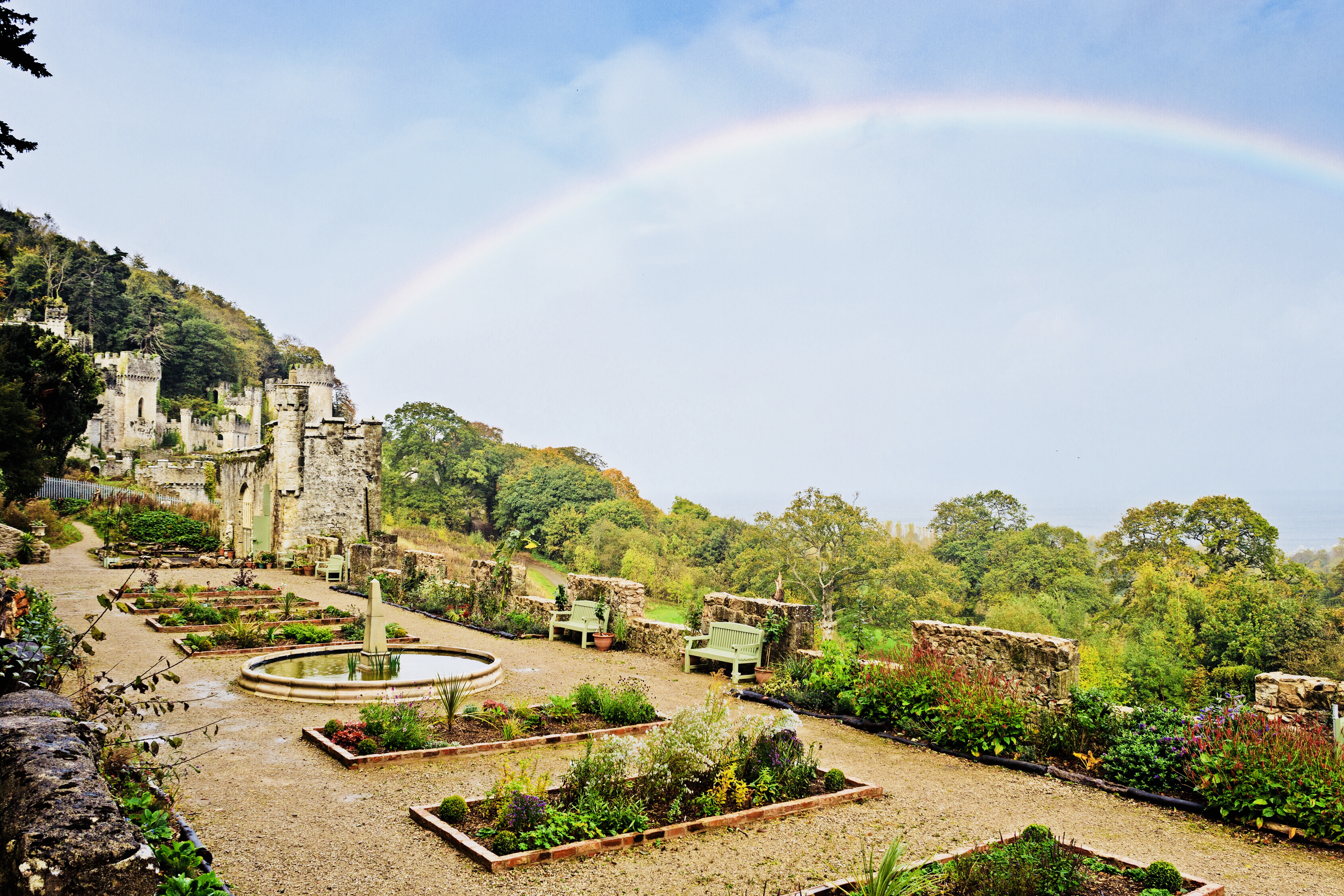
Gwrych Castle ( cy, Castell Gwrych meaning "hedged castle") (Originally spelt as 'Gwrŷch') is a Grade I listed 19th-century country house near Abergele in Conwy County Borough, Wales. The castle and 236 acre estate are owned by a charity, and a portion of the land is leased to Natural Resources Wales for a 999-year term. Foundation of the castle Gwrych Castle was built between 1810 and 1825 by Lloyd Hesketh Bamford-Hesketh (1787–1861), in memory of his mother Frances Lloyd and her ancestors. It incorporated an earlier house that had been in the ownership of the Lloyds since the late-medieval period. From 1894 until 1924, Winifred, Countess of Dundonald, the Hesketh heiress, owned the estate and it became the residence of the Earls of Dundonald (family name of Cochrane). The countess left the castle in her will to King George V and the then Prince of Wales (who later became Edward VIII). However, the gift was refused and the castle passed to the Venerable Order of Saint ... [...More Info...] [...Related Items...] OR: [Wikipedia] [Google] [Baidu] |
A55 Road
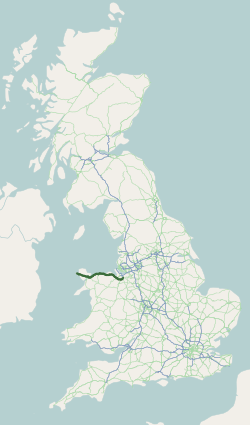
The A55, also known as the North Wales Expressway ( cy, Gwibffordd Gogledd Cymru) is a major road in Wales and England, connecting Cheshire and north Wales. The vast majority of its length from Chester to Holyhead is a dual carriageway primary route, with the exception of the Britannia Bridge over the Menai Strait and several short sections where there are gaps in between the two carriageways. All junctions are grade separated apart from a roundabout east of Penmaenmawr and another nearby in Llanfairfechan. Initially, the road ran from Chester to Bangor. In 2001, it was extended across Anglesey to the ferry port of Holyhead parallel to the A5. The road improvements have been part funded with European money, under the Trans-European Networks programme, as the route is designated part of Euroroute E22 ( Holyhead – Leeds – Amsterdam – Hamburg – Malmö – Riga – Moscow – Perm – Ekaterinburg – Ishim). Route The Chester southerly bypass The A55 begins ... [...More Info...] [...Related Items...] OR: [Wikipedia] [Google] [Baidu] |
Castell Cawr
Castell Cawr, or Tan-y-Gopa as it is known locally, is a heavily forested hill above the town of Abergele in Conwy county borough, Wales. On it is found the Iron Age hillfort of Castell Cawr, which overlooks the River Clwyd. Rare lesser horseshoe bats inhabit caves on the hill. The woods are owned by the Woodland Trust. The hill rises to 189 m (620 ft) above sea level, with extensive views to Snowdonia and the Clwydian Range. Thomas Pennant visited the area in the 18th century, and noted the existence of the hillfort. In 1860, James Halliwell-Phillipps wrote that the outline of the hillfort was obscured by vegetation, and identified the workings of a Roman lead mine on the hillside. The Welsh knew these excavations by the name "Ffos-y-bleiddiaid" ("Ditch of the Wolves") See also *List of hillforts in Wales This is a list of hillforts in Wales. Anglesey *Bwrdd Arthur, Din Sylwy (Bwrdd Arthur) (), contour fort *Caer Idris Hillfort (), promontory fort *Caer y Tw ... [...More Info...] [...Related Items...] OR: [Wikipedia] [Google] [Baidu] |
River Gele
River Gele near Towyn. Looking east from the road bridge. The River Gele (''Welsh:'' Afon Gele) is a river in the North Wales and a tributary of the River Clwyd. The town of Abergele takes its name from the river. The spelling is a dialectal spelling of the Welsh word ' (spear or blade). The river gives its name to an electoral ward, called Gele, which includes the southern half of Abergele town. The river used to empty into the sea direct through the town of Abergele, but the Rhuddlan Marsh embankment act of 1794, diverted the river from the south of the town in an eastwards direction across the south of Rhuddlan Marsh and into the River Clwyd at Towyn. A short distance of the rivermouth is tidal. In 2010 and 2011 there were pollution scares on the river near its meeting point with the River Clwyd at Kinmel Bay Kinmel Bay ( cy, Bae Cinmel) is a seaside village in Conwy County Borough, north-east Wales. It is also an electoral ward to the county council and town council. ... [...More Info...] [...Related Items...] OR: [Wikipedia] [Google] [Baidu] |


.jpg)


