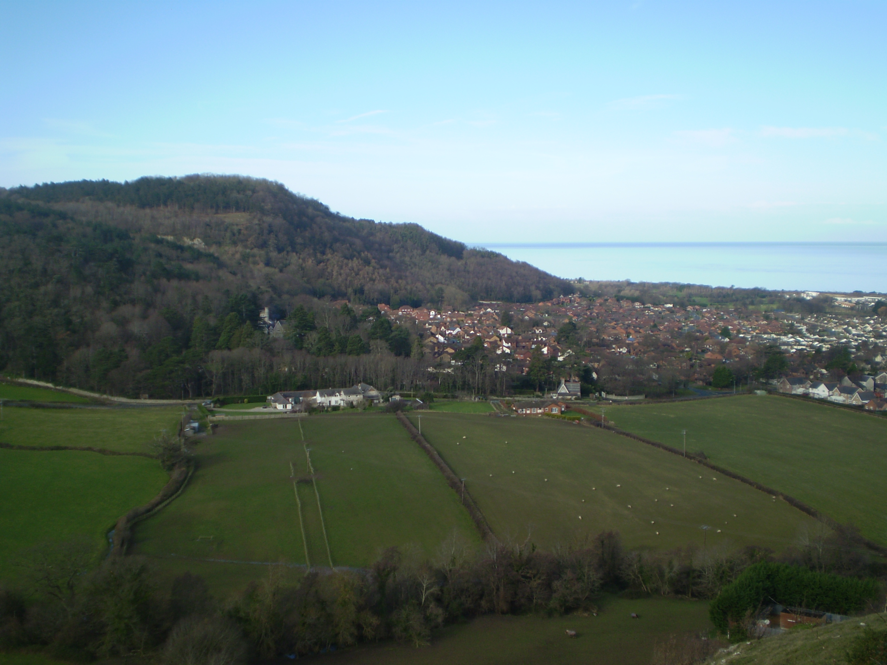
Tan-y-Gopa on:
[Wikipedia]
[Google]
[Amazon]
Castell Cawr, or Tan-y-Gopa as it is known locally, is a heavily forested hill above the town of 
Tan-y-Gopa and Castell Cawr
Abergele Hillforts in Conwy County Borough Mountains and hills of Conwy County Borough {{Conwy-geo-stub
Abergele
Abergele (; ; ) is a market town and community, situated on the north coast of Wales between the holiday resorts of Colwyn Bay and Rhyl, in Conwy County Borough and in the historic county of Denbighshire. Its northern suburb of Pensarn lies ...
in Conwy county borough
Conwy County Borough ( cy, Bwrdeistref Sirol Conwy) is a county borough in Wales. It borders Gwynedd to the west and south, and Denbighshire to the east. Other settlements in the county borough include Abergele, Betws-y-Coed, Colwyn Bay, Conwy ...
, Wales
Wales ( cy, Cymru ) is a Countries of the United Kingdom, country that is part of the United Kingdom. It is bordered by England to the Wales–England border, east, the Irish Sea to the north and west, the Celtic Sea to the south west and the ...
. On it is found the Iron Age
The Iron Age is the final epoch of the three-age division of the prehistory and protohistory of humanity. It was preceded by the Stone Age (Paleolithic, Mesolithic, Neolithic) and the Bronze Age (Chalcolithic). The concept has been mostly appl ...
hillfort
A hillfort is a type of earthwork used as a fortified refuge or defended settlement, located to exploit a rise in elevation for defensive advantage. They are typically European and of the Bronze Age or Iron Age. Some were used in the post-Roma ...
of Castell Cawr, which overlooks the River Clwyd
The River Clwyd ( Welsh: ''Afon Clwyd'') is a river in Wales that rises in the Clocaenog Forest () northwest of Corwen. Its total length is .
It flows due south until, at Melin-y-wig, it veers north-eastwards, tracking the A494 and passing ...
. Rare lesser horseshoe bats inhabit caves on the hill. The woods are owned by the Woodland Trust
The Woodland Trust is the largest woodland conservation charity in the United Kingdom and is concerned with the creation, protection, and restoration of native woodland heritage. It has planted over 50 million trees since 1972.
The Woodland Tr ...
. The hill rises to 189 m (620 ft) above sea level, with extensive views to Snowdonia and the Clwydian Range
The Clwydian Range ( cy, Bryniau Clwyd; also known as the Clwydian Hills; or simply the Clwyds) is a series of hills in the north-east of Wales that runs from Llandegla in the south to Prestatyn in the north, the highest point being the pop ...
.
Thomas Pennant
Thomas Pennant (14 June Old Style, OS 172616 December 1798) was a Welsh natural history, naturalist, traveller, writer and antiquarian. He was born and lived his whole life at his family estate, Downing Hall near Whitford, Flintshire, in Wales ...
visited the area in the 18th century, and noted the existence of the hillfort. In 1860, James Halliwell-Phillipps wrote that the outline of the hillfort was obscured by vegetation, and identified the workings of a Roman lead mine on the hillside. The Welsh knew these excavations by the name "Ffos-y-bleiddiaid" ("Ditch of the Wolves")

See also
*List of hillforts in Wales
This is a list of hillforts in Wales.
Anglesey
*Bwrdd Arthur, Din Sylwy (Bwrdd Arthur) (), contour fort
*Caer Idris Hillfort (), promontory fort
*Caer y Twr (), partial contour fort
*Dinas Gynfor (), promontory fort
*Dinas Porth Ruffydd (), p ...
References
External links
Tan-y-Gopa and Castell Cawr
Abergele Hillforts in Conwy County Borough Mountains and hills of Conwy County Borough {{Conwy-geo-stub