|
River Clwyd
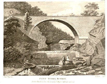
The River Clwyd (Welsh: ''Afon Clwyd'') is a river in Wales that rises in the Clocaenog Forest () northwest of Corwen. Its total length is . It flows due south until, at Melin-y-wig, it veers north-eastwards, tracking the A494 and passing through Derwen, Llanelidan, Pwllglas and Llanfair Dyffryn Clwyd to Ruthin. Here it leaves the relatively narrow valley and enters a broad agricultural vale, the Vale of Clwyd (Welsh: ''Dyffryn Clwyd''). Just south of Denbigh, it is joined by the River Clywedog. This substantial tributary also has its source in the Clocaenog Forest but drains out to the east and north of the forest and passes through Cyffylliog, Bontuchel and Rhewl before its confluence with the main river. Then the Clwyd meanders northwards through the fertile Clwyd valley to St Asaph. Around north of St Asaph, the river is joined by a tributary as large as the main river, the River Elwy. In normal flows at low tide, the waters of these two rivers can be seen flowing sid ... [...More Info...] [...Related Items...] OR: [Wikipedia] [Google] [Baidu] |
Rhuddlan Castle
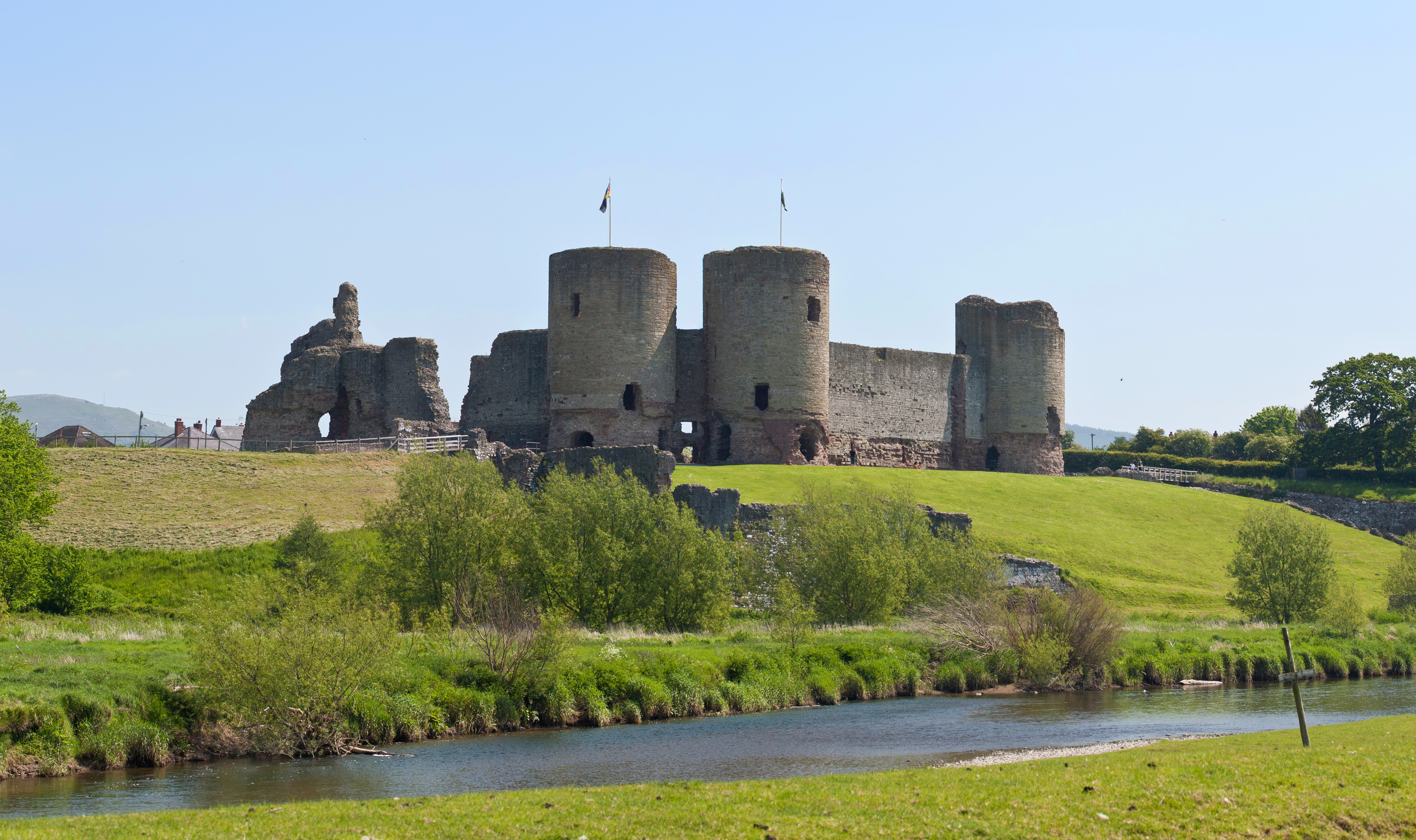
Rhuddlan Castle ( cy, Castell Rhuddlan; ) is a castle located in Rhuddlan, Denbighshire, Wales. It was erected by Edward I in 1277, following the First Welsh War. Much of the work was overseen by master mason James of Saint George. Rhuddlan, which was not completed until 1282, was built concurrently with Flint Castle, at a time when King Edward I of England was consolidating his conquest of Wales. It was temporarily his residence, and his daughter, Elizabeth, is presumed to have been born there. Construction Rhuddlan was planned as a concentric castle. It has a unique 'diamond' in layout as the gatehouses are positioned at the corners of the square baileys instead of along the sides like at Flint, Harlech or Beaumaris. Records of construction costs show that it was the major piece of building work being carried out by the English during the late 1270s. The inner ward has defensive walls with twin-tower gatehouses. The outer ward is surrounded by a curtain wall that h ... [...More Info...] [...Related Items...] OR: [Wikipedia] [Google] [Baidu] |
Valley
A valley is an elongated low area often running between Hill, hills or Mountain, mountains, which will typically contain a river or stream running from one end to the other. Most valleys are formed by erosion of the land surface by rivers or streams over a very long period. Some valleys are formed through erosion by glacier, glacial ice. These glaciers may remain present in valleys in high mountains or polar areas. At lower latitudes and altitudes, these glaciation, glacially formed valleys may have been created or enlarged during ice ages but now are ice-free and occupied by streams or rivers. In desert areas, valleys may be entirely dry or carry a watercourse only rarely. In karst, areas of limestone bedrock, dry valleys may also result from drainage now taking place cave, underground rather than at the surface. Rift valleys arise principally from tectonics, earth movements, rather than erosion. Many different types of valleys are described by geographers, using terms th ... [...More Info...] [...Related Items...] OR: [Wikipedia] [Google] [Baidu] |
River Elwy
The River Elwy (''Afon Elwy'' in Welsh) is a river in Wales forming a tributary to the River Clwyd. The source of the river is sometimes said to be on the northern flank of Moel Seisiog, south-east of Llanrwst, at Ordnance Survey grid reference SH 853593. However the river only receives the name Elwy at the village of Llangernyw, where three rivers, Afon Cledwen, Afon Collen and Afon Gallen, meet to form the Elwy. It flows eastwards through Llanfair Talhaiarn and a few miles downstream from this village it is joined by a tributary, the River Aled (''Afon Aled'') which has its source in Llyn Aled. After passing through Bont-newydd, the river turns northwards again and flows through St. Asaph (''Llanelwy'' or "the church enclosure on the Elwy" in Welsh). It joins the River Clwyd about half way between St. Asaph and Rhuddlan, and the waters of the two rivers can often be seen flowing side by side for several miles. A number of caves along the lower valley of the Elwy are of great a ... [...More Info...] [...Related Items...] OR: [Wikipedia] [Google] [Baidu] |
St Asaph
St Asaph (; cy, Llanelwy "church on the Elwy") is a City status in the United Kingdom, city and community (Wales), community on the River Elwy in Denbighshire, Wales. In the United Kingdom Census 2011, 2011 Census it had a population of 3,355, making it the List of smallest cities in the United Kingdom, second-smallest city in Britain in terms of population and Urban area#United Kingdom, urban area. It is in the Historic counties of Wales, historic county of Flintshire (historic), Flintshire. The city of St Asaph is surrounded by countryside and views of the Vale of Clwyd. It is situated close to a number of busy coastal towns such as Rhyl, Prestatyn, Abergele, Colwyn Bay and Llandudno. The historic castles of Denbigh and Rhuddlan are also nearby History The earliest inhabitants of the vale of Elwy lived at the nearby Paleolithic site of Pontnewydd Cave, Pontnewydd (Bontnewydd), which was excavated from 1978 by a team from the University of Wales, led by Stephen Aldhouse Gree ... [...More Info...] [...Related Items...] OR: [Wikipedia] [Google] [Baidu] |
Meander
A meander is one of a series of regular sinuous curves in the channel of a river or other watercourse. It is produced as a watercourse erodes the sediments of an outer, concave bank ( cut bank) and deposits sediments on an inner, convex bank which is typically a point bar. The result of this coupled erosion and sedimentation is the formation of a sinuous course as the channel migrates back and forth across the axis of a floodplain. The zone within which a meandering stream periodically shifts its channel is known as a meander belt. It typically ranges from 15 to 18 times the width of the channel. Over time, meanders migrate downstream, sometimes in such a short time as to create civil engineering challenges for local municipalities attempting to maintain stable roads and bridges.Neuendorf, K.K.E., J.P. Mehl Jr., and J.A. Jackson, J.A., eds. (2005) ''Glossary of Geology'' (5th ed.). Alexandria, Virginia, American Geological Institute. 779 pp. Charlton, R., 2007. ''Fundamentals ... [...More Info...] [...Related Items...] OR: [Wikipedia] [Google] [Baidu] |
Confluence
In geography, a confluence (also: ''conflux'') occurs where two or more flowing bodies of water join to form a single channel. A confluence can occur in several configurations: at the point where a tributary joins a larger river (main stem); or where two streams meet to become the source of a river of a new name (such as the confluence of the Monongahela and Allegheny rivers at Pittsburgh, forming the Ohio); or where two separated channels of a river (forming a river island) rejoin at the downstream end. Scientific study of confluences Confluences are studied in a variety of sciences. Hydrology studies the characteristic flow patterns of confluences and how they give rise to patterns of erosion, bars, and scour pools. The water flows and their consequences are often studied with mathematical models. Confluences are relevant to the distribution of living organisms (i.e., ecology) as well; "the general pattern ownstream of confluencesof increasing stream flow and decreasing s ... [...More Info...] [...Related Items...] OR: [Wikipedia] [Google] [Baidu] |
Rhewl (River Clywedog, Denbighshire)
Rhewl is a village on the A525 between Ruthin and Denbigh in the county of Denbighshire in Wales. The village is beside the River Clywedog, which is bridged by the A525. The village is notable for its football club, Rhewl F.C. Rhewl primary school was scheduled to be shut down in 2005, but protests by local newspapers and parents of the pupils saved the school from being closed. The village holds an annual Family Fun Day with live music, hog roast, displays and many more attractions. The village is also noted for the Drovers Arms public house and Lady Bagot's Drive, a picturesque two mile walk up the River Clywedog that was originally laid as a carriageway by Lord Bagot for his wife in Edwardian times to traverse between Rhewl and Bontuchel. Parts of the drive are privately owned. Rhewl railway station was on the line opened by the Denbigh, Ruthin and Corwen Railway The Denbigh, Ruthin and Corwen Railway was a standard gauge railway line that connected Corwen with Denbi ... [...More Info...] [...Related Items...] OR: [Wikipedia] [Google] [Baidu] |
Bontuchel
Bontuchel is a hamlet in Denbighshire, Wales, located by road west of Ruthin. The father of Calvinist Isaac Hughes Isaac Hughes (1798 – 23 June 1870) was a British Calvinist missionary and preacher. He was born to Welsh parents Edward and Mary Hughes in Manchester. His father came from Bontuchel in Denbighshire and his mother came from Brynsiencyn in Ang ... hailed from Bontuchel. References Villages in Denbighshire {{Denbighshire-geo-stub ... [...More Info...] [...Related Items...] OR: [Wikipedia] [Google] [Baidu] |
Cyffylliog
Cyffylliog (also ''Y Gyffylliog'' in Welsh) is a village and community in Denbighshire, Wales. It is situated to the west of Ruthin on the banks of the River Clywedog. The community covers an area of 31.59 km2 and includes the hamlet of Bontuchel and a section of Clocaenog Forest. It had a population of 495 at the time of the 2011 census, a slight increase from 484 during the 2001 census. The name of the village means "place of pollard trees/stumps" and comes from the Welsh word ''cyffyll'' meaning stumps. The village has a small, bilingual primary school, Ysgol Cyffylliog, which had 25 pupils in 2011. Church of St Mary The village church, St. Mary's, dates from the late 12th century but has been extensively renewed since that time including an almost complete rebuilding in 1876. Although the church has been arduously restored, it retains its late medieval ceiling and an unusual Georgian ‘hearse house’. The church is open for private prayer at all times. The village ... [...More Info...] [...Related Items...] OR: [Wikipedia] [Google] [Baidu] |
Tributary
A tributary, or affluent, is a stream or river that flows into a larger stream or main stem (or parent) river or a lake. A tributary does not flow directly into a sea or ocean. Tributaries and the main stem river drain the surrounding drainage basin of its surface water and groundwater, leading the water out into an ocean. The Irtysh is a chief tributary of the Ob river and is also the longest tributary river in the world with a length of . The Madeira River is the largest tributary river by volume in the world with an average discharge of . A confluence, where two or more bodies of water meet, usually refers to the joining of tributaries. The opposite to a tributary is a distributary, a river or stream that branches off from and flows away from the main stream. PhysicalGeography.net, Michael Pidwirny & S ... [...More Info...] [...Related Items...] OR: [Wikipedia] [Google] [Baidu] |
River Clywedog, Denbigh
: ''For the tributary of the River Dee near Wrexham see River Clywedog'' The River Clywedog (Welsh: ''Afon Clywedog'') is a tributary of the River Clwyd in northeast Wales. The river rises within Clocaenog Forest and flows in a generally easterly direction through the villages of Cyffylliog, Bontuchel and Rhewl before turning northwards to join the Clwyd to the east of Denbigh Denbigh (; cy, Dinbych; ) is a market town and a community in Denbighshire, Wales. Formerly, the county town, the Welsh name translates to "Little Fortress"; a reference to its historic castle. Denbigh lies near the Clwydian Hills. History ....Ordnance Survey 1:50,000 scale Landranger map sheet 116 ''Denbigh and Colwyn Bay'' References Clywedog {{Wales-river-stub ... [...More Info...] [...Related Items...] OR: [Wikipedia] [Google] [Baidu] |
Denbigh
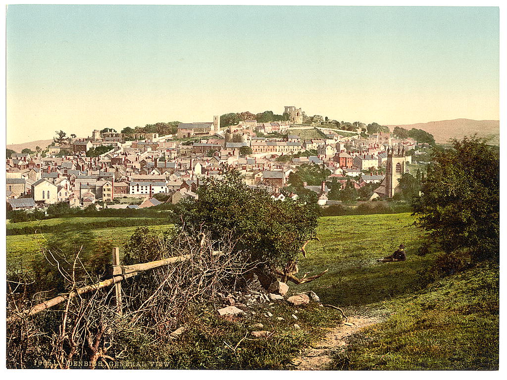
Denbigh (; cy, Dinbych; ) is a market town and a community in Denbighshire, Wales. Formerly, the county town, the Welsh name translates to "Little Fortress"; a reference to its historic castle. Denbigh lies near the Clwydian Hills. History Denbigh Castle, together with its town walls, was built in 1282 by order of King Edward I. The Burgess Gate, whose twin towers adorn the symbol on Denbigh's civic seal, was once the main entrance into the town. The first borough charter was granted to Denbigh in 1290, when the town was still contained within the old town walls. It was the centre of the Marcher Lordship of Denbigh. The town was involved in the revolt of Madog ap Llywelyn in 1294–1295; the castle was captured in the autumn, and on 11 November 1294 a relieving force was defeated by the Welsh rebels. The town was recaptured by Edward I in December. Denbigh was also burnt in 1400 during the revolt of Owain Glyndŵr. During the Wars of the Roses (1455-1487), the town was ... [...More Info...] [...Related Items...] OR: [Wikipedia] [Google] [Baidu] |


