|
Abbotsinch
Abbotsinch is an area in the town of Paisley, Renfrewshire, Paisley, Scotland. It is today almost entirely occupied by Glasgow Airport. Traditionally in the parish of Renfrew (although not within its burgh boundary), Abbotsinch is bordered by the Black Cart Water to the north and west, and the White Cart Water to the east. Its southern edge was delineated by the burgh boundary of Paisley, Renfrewshire, Paisley, although after the 1975 local government reorganisation in Scotland these demarcations became unofficial. Abbotsinch largely consisted of farmland before the construction of a Royal Air Force airfield there in 1932. The Georgian architecture, Georgian mansion Walkinshaw House, one of Robert Adam's most significant worksWalker, Frank Arneil (1986) ''The South Clyde Estuary'', RIAS Publishing, p. 102 was demolished in 1927 to enable the runway to be constructed. Today all that remains of the estate are parts of the walled garden which lie to the west of Glasgow Airport's main ... [...More Info...] [...Related Items...] OR: [Wikipedia] [Google] [Baidu] |
Glasgow Airport
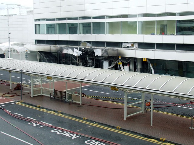
gd, Port-adhair Eadar-nàiseanta Ghlaschu , image = Glasgow Airport logo.svg , image-width = 200 , image2 = GlasgowAirportFromAir.jpg , image2-width = 250 , IATA = GLA , ICAO = EGPF , type = Public , owner = AGS Airports , hub = *easyJet *Loganair *TUI Airways , operator = Glasgow Airport Ltd. , city-served = Glasgow , elevation-f = 26 , pushpin_map = Scotland Renfrewshire , pushpin_map_caption = Location of airport in Renfrewshire , website = , r1-number = 05/23 , r1-length-m = 2,665 , stat-year = 2019 , stat1-header = Passengers , stat1-data = 8,843,214 , stat2-header = Passenger change 18–19 , stat2-data = 8.4% , stat3-header = Aircraft movements , stat3-data = 86,226 , stat4-header = Movements change 17–18 , stat4-data = 3.2% , footnotes = Sources: UK AIP at NATSStatistics from the UK Civil Aviation AuthorityLocation from Glasgow Airport Glasgow Airport, also known as Glasgow International Airport (), formerly ''Abbotsinch Airport'', is ... [...More Info...] [...Related Items...] OR: [Wikipedia] [Google] [Baidu] |
Paisley, Renfrewshire
Paisley ( ; sco, Paisley, gd, Pàislig ) is a large town situated in the west central Lowlands of Scotland. Located north of the Gleniffer Braes, the town borders the city of Glasgow to the east, and straddles the banks of the White Cart Water, a tributary of the River Clyde. Paisley serves as the administrative centre for the Renfrewshire council area, and is the largest town in the historic county of the same name. It is often cited as "Scotland's largest town" and is the fifth largest settlement in the country, although it does not have city status. The town became prominent in the 12th century, with the establishment of Paisley Abbey, an important religious hub which formerly had control over other local churches. By the 19th century, Paisley was a centre of the weaving industry, giving its name to the Paisley shawl and the Paisley pattern. The town's associations with political radicalism were highlighted by its involvement in the Radical War of 1820, with striking ... [...More Info...] [...Related Items...] OR: [Wikipedia] [Google] [Baidu] |
Scotland
Scotland (, ) is a country that is part of the United Kingdom. Covering the northern third of the island of Great Britain, mainland Scotland has a border with England to the southeast and is otherwise surrounded by the Atlantic Ocean to the north and west, the North Sea to the northeast and east, and the Irish Sea to the south. It also contains more than 790 islands, principally in the archipelagos of the Hebrides and the Northern Isles. Most of the population, including the capital Edinburgh, is concentrated in the Central Belt—the plain between the Scottish Highlands and the Southern Uplands—in the Scottish Lowlands. Scotland is divided into 32 administrative subdivisions or local authorities, known as council areas. Glasgow City is the largest council area in terms of population, with Highland being the largest in terms of area. Limited self-governing power, covering matters such as education, social services and roads and transportation, is devolved from the Scott ... [...More Info...] [...Related Items...] OR: [Wikipedia] [Google] [Baidu] |
Renfrew
Renfrew (; sco, Renfrew; gd, Rinn Friù) is a town west of Glasgow in the west central Lowlands of Scotland. It is the historic county town of Renfrewshire. Called the "Cradle of the Royal Stewarts" for its early link with Scotland's former royal house, Renfrew gained royal burgh status in 1397. As the county town, Renfrew once was a centre of local government for the surrounding area. Whilst the county remained known as "Renfrewshire", the focus of local government gradually shifted from Renfrew to its larger neighbour Paisley. Following the reorganisation of 1996, Renfrewshire was divided for local government purposes into three modern council areas: Renfrewshire, with considerably smaller boundaries than the old county, including Renfrew and with its administrative centre at Paisley; Inverclyde with its centre at Greenock, covering the western part of the county; and East Renfrewshire, with its centre at Giffnock. The boundaries of the historic County of Renfrew remain ... [...More Info...] [...Related Items...] OR: [Wikipedia] [Google] [Baidu] |
Burgh
A burgh is an autonomous municipal corporation in Scotland and Northern England, usually a city, town, or toun in Scots. This type of administrative division existed from the 12th century, when King David I created the first royal burghs. Burgh status was broadly analogous to borough status, found in the rest of the United Kingdom. Following local government reorganisation in 1975, the title of "royal burgh" remains in use in many towns, but now has little more than ceremonial value. History The first burgh was Berwick. By 1130, David I (r. 1124–53) had established other burghs including Edinburgh, Stirling, Dunfermline, Haddington, Perth, Dumfries, Jedburgh, Montrose and Lanark. Most of the burghs granted charters in his reign probably already existed as settlements. Charters were copied almost verbatim from those used in England, and early burgesses usually invited English and Flemish settlers.A. MacQuarrie, ''Medieval Scotland: Kinship and Nation'' (Thrupp: Sutton, 2 ... [...More Info...] [...Related Items...] OR: [Wikipedia] [Google] [Baidu] |
Black Cart Water
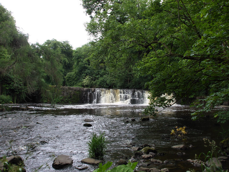
The River Cart ( sco, River Cairt) is a tributary of the River Clyde, Scotland, which it joins from the west roughly midway between the towns of Erskine and Renfrew and opposite the town of Clydebank. The River Cart itself is very short, being formed from the confluence of the Black Cart Water (from the west) and the White Cart Water (from the south east) and is only long. The River Cart and its tributary the White Cart Water were navigable as far as the Seedhill Craigs at Paisley; and, as with the River Clyde, various improvements were made to this river navigation. In 1840 the Forth and Cart Canal was opened, linking the Forth and Clyde Canal, at Whitecrook near Clydebank, to the River Clyde, opposite the mouth of the River Cart. The aim was to provide a direct link between Paisley, Port Dundas, Edinburgh, and the Firth of Forth.Lindsay, Jean (1968). ''The Canals of Scotland''. Newton Abbott: David & Charles Black Cart Water The Black Cart Water ( sco, Black Cairt Watt ... [...More Info...] [...Related Items...] OR: [Wikipedia] [Google] [Baidu] |
White Cart Water
The River Cart ( sco, River Cairt) is a tributary of the River Clyde, Scotland, which it joins from the west roughly midway between the towns of Erskine and Renfrew and opposite the town of Clydebank. The River Cart itself is very short, being formed from the confluence of the Black Cart Water (from the west) and the White Cart Water (from the south east) and is only long. The River Cart and its tributary the White Cart Water were navigable as far as the Seedhill Craigs at Paisley; and, as with the River Clyde, various improvements were made to this river navigation. In 1840 the Forth and Cart Canal was opened, linking the Forth and Clyde Canal, at Whitecrook near Clydebank, to the River Clyde, opposite the mouth of the River Cart. The aim was to provide a direct link between Paisley, Port Dundas, Edinburgh, and the Firth of Forth.Lindsay, Jean (1968). ''The Canals of Scotland''. Newton Abbott: David & Charles Black Cart Water The Black Cart Water ( sco, Black Cairt Watt ... [...More Info...] [...Related Items...] OR: [Wikipedia] [Google] [Baidu] |
Royal Air Force
The Royal Air Force (RAF) is the United Kingdom's air and space force. It was formed towards the end of the First World War on 1 April 1918, becoming the first independent air force in the world, by regrouping the Royal Flying Corps (RFC) and the Royal Naval Air Service (RNAS). Following the Allied victory over the Central Powers in 1918, the RAF emerged as the largest air force in the world at the time. Since its formation, the RAF has taken a significant role in British military history. In particular, it played a large part in the Second World War where it fought its most famous campaign, the Battle of Britain. The RAF's mission is to support the objectives of the British Ministry of Defence (MOD), which are to "provide the capabilities needed to ensure the security and defence of the United Kingdom and overseas territories, including against terrorism; to support the Government's foreign policy objectives particularly in promoting international peace and security". The R ... [...More Info...] [...Related Items...] OR: [Wikipedia] [Google] [Baidu] |
Georgian Architecture
Georgian architecture is the name given in most English-speaking countries to the set of architectural styles current between 1714 and 1830. It is named after the first four British monarchs of the House of Hanover—George I, George II, George III, and George IV—who reigned in continuous succession from August 1714 to June 1830. The so-called great Georgian cities of the British Isles were Edinburgh, Bath, pre-independence Dublin, and London, and to a lesser extent York and Bristol. The style was revived in the late 19th century in the United States as Colonial Revival architecture and in the early 20th century in Great Britain as Neo-Georgian architecture; in both it is also called Georgian Revival architecture. In the United States the term "Georgian" is generally used to describe all buildings from the period, regardless of style; in Britain it is generally restricted to buildings that are "architectural in intention", and have stylistic characteristics that are typical o ... [...More Info...] [...Related Items...] OR: [Wikipedia] [Google] [Baidu] |
Robert Adam
Robert Adam (3 July 17283 March 1792) was a British neoclassical architect, interior designer and furniture designer. He was the son of William Adam (1689–1748), Scotland's foremost architect of the time, and trained under him. With his older brother John, Robert took on the family business, which included lucrative work for the Board of Ordnance, after William's death. In 1754, he left for Rome, spending nearly five years on the continent studying architecture under Charles-Louis Clérisseau and Giovanni Battista Piranesi. On his return to Britain he established a practice in London, where he was joined by his younger brother James. Here he developed the "Adam Style", and his theory of "movement" in architecture, based on his studies of antiquity and became one of the most successful and fashionable architects in the country. Adam held the post of Architect of the King's Works from 1761 to 1769. Robert Adam was a leader of the first phase of the classical revival in En ... [...More Info...] [...Related Items...] OR: [Wikipedia] [Google] [Baidu] |
M8 Motorway (Scotland)
The M8 is the busiest motorway in Scotland and one of the busiest in the United Kingdom. It connects the country's two largest cities, Glasgow and Edinburgh, and serves other large communities including Airdrie, Coatbridge, Greenock, Livingston and Paisley. The motorway is long. A major construction project to build the final section between Newhouse and Baillieston was completed on 30 April 2017. The motorway has one service station, Heart of Scotland Services, previously named Harthill due to its proximity to the village. History With the advent of motorway-building in the United Kingdom in the late 1950s, the M8 was planned as one of a core of new motorways, designed to replace the A8 road as a high-capacity alternative for intercity travel. The motorway was constructed piecemeal in several stages bypassing towns, beginning in 1965 with the opening by Minister of State for Scotland George Willis of the bypass of Harthill. In 1968 the Renfrew Bypass was opened as t ... [...More Info...] [...Related Items...] OR: [Wikipedia] [Google] [Baidu] |
A726 Road
The A726 road in Scotland is a major route with several distinct sections with different characteristics and names; owing to its stages of construction, since 2005 it has two separate parts, the first running between Strathaven in South Lanarkshire and Junction 5 of the M77 motorway south of Newton Mearns in East Renfrewshire via East Kilbride, and the other running between Junction 3 of the M77 and the M898 motorway near the Erskine Bridge, via Paisley and Junction 29 of the M8 motorway near Glasgow International Airport.A726 Strathaven to Erskine Bridge Glasgow Motorway Archive, January 2021 Route Strathaven and East Kilbride The A726's first section begins in the small market town of |


.jpg)