|
A596
The A596 is a primary route in Cumbria, in northern England, that runs between Thursby ( north-east of Wigton) and Workington. For its entirety the A596 parallels the A595 road, A595, and meets the A595 at both ends. The A596 begins its course at a roundabout junction with the A595 at Thursby, before continuing past the towns of Wigton and Aspatria. As it travels further towards the coast, it reaches the town of Maryport, where there is a junction to the B5300 road, B5300 heading up the coast to Silloth via Allonby, Mawbray, and Beckfoot. It then crosses over the River Derwent, Cumbria, River Derwent, skirting the eastern edge of Workington shortly before terminating at the junction with the A595 at Lillyhall. Incidents November 2009 Great Britain and Ireland floods Workington Bridge on the A596 was closed after the November 2009 Great Britain and Ireland floods as were many other roads across the River Derwent, Cumbria, River Derwent. A temporary station, called Workington Nort ... [...More Info...] [...Related Items...] OR: [Wikipedia] [Google] [Baidu] |
A595 Road
The A595 is a primary route in Cumbria, in Northern England that starts in Carlisle, passes through Whitehaven and goes close to Workington, Cockermouth and Wigton. It passes Sellafield and Ravenglass before ending at the Dalton-in-Furness by-pass, in southern Cumbria, where it joins the A590 trunk road. The road is mostly single carriageway, apart from in central Carlisle, where it passes the castle as a busy dual carriageway road named Castle Way, and prior to that as Bridge Street and Church Street, where it passes close to the McVitie's or Carr's biscuit factory. The Lillyhall bypass is also dual carriageway. The road in the Whitehaven area was laid out in the 1930s and the A595 was designated a trunk route in 1946. It was detrunked in 1998, apart from an section between Little Clifton and Calder Bridge. This section represents the route from Sellafield to the A66. At Duddon Bridge and at Dove Ford near Grizebeck the road passes through farmyards. Route Northern s ... [...More Info...] [...Related Items...] OR: [Wikipedia] [Google] [Baidu] |
Workington North Railway Station
Workington North railway station was a temporary railway station in Cumbria, United Kingdom, constructed following floods which cut all road access to Workington town centre from north of the River Derwent. The station was located north of Workington station on the Cumbrian Coast Line. Until the new station opened, the closest station north of the River Derwent was Flimby railway station, which saw its passenger numbers increase enormously after the floods. Flimby had seen as many passengers on 24 November 2009 as would usually use the station in a fortnight. When the station first opened access to Workington by road from Northside involved a journey of because the bridges over the River Derwent for the A596 and A597 roads were destroyed or badly damaged by the flood. The construction of a temporary road bridge over the Derwent made vehicular access easier but the railway station remained open until 8 October 2010, when the last train called. Construction Network Rail beg ... [...More Info...] [...Related Items...] OR: [Wikipedia] [Google] [Baidu] |
Silloth
Silloth (sometimes known as Silloth-on-Solway) is a port town and civil parish in the Allerdale borough of Cumbria, England. Historically in the county of Cumberland, the town is an example of a Victorian seaside resort in the North of England. Silloth had a population of 2,932 at the 2001 Census, falling slightly to 2,906 at the 2011 Census. Location It sits on the shoreline of the Solway Firth, north of Workington and west of Carlisle. The town of Maryport lies south, down the B5300 coast road which also passes through the villages of Blitterlees, Beckfoot, Mawbray, and Allonby. Wigton is east, along the B5302 road, which also passes through the village of Abbeytown, southeast. History Silloth developed in the 1860s onwards around the terminus of the railway from Carlisle and associated docks which had begun construction in 1855 to replace Port Carlisle as the deep-water port for Carlisle. Workers from the factories of Carlisle were presented with access to t ... [...More Info...] [...Related Items...] OR: [Wikipedia] [Google] [Baidu] |
B5300 Road
The B5300 (known locally as the Coast Road) is a B road which runs for approximately twelve miles between the towns of Silloth and Maryport in the Allerdale borough of Cumbria, United Kingdom. From north to south, it passes through the villages of Blitterlees, Beckfoot, Mawbray, Dubmill, and Allonby. It runs through the Solway Coast Area of Outstanding Natural Beauty, passes close to the Salta Moss Site of Special Scientific Interest, Milefortlet 21, a Roman archaeological site, the salt pans, a remnant of the Solway plain's medieval saltmaking industry, and the village of Crosscanonby. It is an important route for carrying goods to and from Silloth docks and Maryport harbour. It is also the major road connecting smaller coastal settlements with Maryport and Silloth, from where other roads lead to Workington, Whitehaven, Wigton, and Carlisle. A short section of the road between Dubmill and Mawbray was closed in February 2019 due to coastal erosion, and reopened in June 2019 ... [...More Info...] [...Related Items...] OR: [Wikipedia] [Google] [Baidu] |
Aspatria
Aspatria is a town and civil parish in the non-metropolitan district of Allerdale, and is currently embraced in the Parliamentary constituency of Workington, Cumbria, England. Historically within Cumberland the town rests on the north side of the Ellen Valley, overlooking a panoramic view of the countryside, with Skiddaw to the South and the Solway Firth to the North. Its developments are aligned approximately east-west along the A596 Carlisle to Workington road and these extend to approximately 2 miles (3 km) in length. It lies about 8 miles (12 km) northeast of Maryport, a similar distance to the Southwest of Wigton, about 9 miles (14 km) north of Cockermouth and 5 miles (8 km) from the coast and Allonby. It comprises the townships of Aspatria and Brayton, Hayton and Mealo, and Oughterside and Allerby, the united area being ; while the township takes up an area of . In earlier days a Roman road leading from "Old Carlisle" to Ellenborough passed through the ... [...More Info...] [...Related Items...] OR: [Wikipedia] [Google] [Baidu] |
November 2009 Great Britain And Ireland Floods
The 2009 Great Britain and Ireland floods were a weather event that affected parts of Great Britain and Ireland throughout November and into December 2009. November was the wettest month across the United Kingdom since records began in 1914 and had well above average temperatures. The worst affected area in Great Britain was the English county of Cumbria. The Irish counties of Clare, Cork, Galway and Westmeath were among the worst affected areas of Ireland. European windstorms bringing heavy rain and gale-force winds caused damage and flooding to the south of Great Britain on 13–14 November. Unsettled weather continued across the south and later to the north. On 19–20 November, many towns and villages in Cumbria and Dumfries and Galloway were affected. A number of bridges collapsed, one of which led to the death of a police officer, who was standing on the bridge when it collapsed. Another death occurred on 21 November as a canoeist was trapped against a tree near Poundsg ... [...More Info...] [...Related Items...] OR: [Wikipedia] [Google] [Baidu] |
Workington
Workington is a coastal town and civil parish at the mouth of the River Derwent on the west coast in the Allerdale borough of Cumbria, England. The town was historically in Cumberland. At the 2011 census it had a population of 25,207. Location The town is south-west of Carlisle, north-east of Whitehaven, west of Cockermouth, and south-west of Maryport. History The area around Workington was long a producer of coal and steel. Between 79 and 122 CE, Roman forts, mile-forts and watchtowers were built along the Cumbrian coast,Richard L. M. Byers (1998). ''History of Workington: An Illustrated History from Earliest Times to 1865''. Richard Byers. . as defences against attacks by the Scoti of Ireland and the Caledonii, the most powerful tribe in what is now Scotland. The 16th-century ''Britannia'', written by William Camden, describes ruins of these defences. A Viking sword was discovered at Northside. This is seen to suggest there was a settlement at the river mouth. The ... [...More Info...] [...Related Items...] OR: [Wikipedia] [Google] [Baidu] |
Thursby
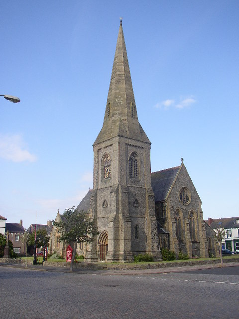
Thursby is a village in the Allerdale borough of Cumbria, England. It is near to the city of Carlisle in North West England. Thursby was historically part of Cumberland. History Thursby lies on an old Roman road, 6 miles south of Carlisle. Thursby takes its old name 'Thor's by' from Thor, the Thunder God of the Saxons, whose temple was reputedly nearby at Kirksteads. The village is predominantly centred on the church, a Victorian building built in 1846 and funded by the Brisco family of Crofton Hall. A bit of heritage comes to Thursby with the church reportedly have been built by King David I of Scotland. Thursby has always been known as a commuter village for travellers to pass through. The Romans once passed through Thursby on their way to Carlisle. However today the village is predominately a bedroom community for the city nearby – the village is closely linked. Thursby continues to thrive and grow with active community groups and regular events occurring at the paris ... [...More Info...] [...Related Items...] OR: [Wikipedia] [Google] [Baidu] |
Maryport
Maryport is a town and civil parish in the Allerdale borough of Cumbria, England, historically in Cumberland. The town is situated just outside the Lake District National Park, at the northern end of the former Cumberland Coalfield. Location Maryport is located on the A596 road north of Workington, west of Keswick and south-west of Carlisle. The town of Silloth is to the north on the B5300 coast road, which passes through the villages of Allonby, Mawbray, Beckfoot and Blitterlees. It's the southernmost town on the Solway Firth, where the River Ellen skirts the grounds of Netherhall School before flowing through Maryport into the Solway Firth. Maryport railway station is on the Cumbrian Coast Line. History Roman and medieval times The town was established around 122 as one of several Roman localities called Alauna. It was a command and supply base for the coastal defences at the western extremity of Hadrian's Wall. The town contains substantial remains of the Ro ... [...More Info...] [...Related Items...] OR: [Wikipedia] [Google] [Baidu] |
Wigton
Wigton is a market town in the Allerdale borough of Cumbria, England. Historically in Cumberland, it lies just outside the Lake District in the borough of Allerdale. Wigton is at the centre of the Solway Plain, between the Caldbeck Fells and the Solway coast. It is served by Wigton railway station on the Cumbrian Coast Line, and the A596 road to Workington. The town of Silloth-on-Solway lies to the west, beyond Abbeytown. Etymology Wigton is "Wicga's tūn". "Wicga" is an Old English pre-7th-century personal name meaning "a beetle" (as in "earwig"), while "tūn" is Old English for a demarcated plot, a "homestead" or "village", so Wigton is "the hamlet belonging to Wicga". History On the River Wampool and Wiza Beck ( beck being a dialect word meaning "brook" or "stream" – from the Old Norse ''bekkr''), the market town of Wigton is an ancient settlement and evolved from a pre-medieval street plan, which can still be traced today. The Romans had a cavalry station, Maglo ... [...More Info...] [...Related Items...] OR: [Wikipedia] [Google] [Baidu] |
Roundabout
A roundabout is a type of circular intersection or junction in which road traffic is permitted to flow in one direction around a central island, and priority is typically given to traffic already in the junction.''The New Shorter Oxford English Dictionary,'' Volume 2, Clarendon Press, Oxford (1993), page 2632 Engineers use the term modern roundabout to refer to junctions installed after 1960 that incorporate various design rules to increase safety. Both modern and non-modern roundabouts, however, may bear street names or be identified colloquially by local names such as rotary or traffic circle. Compared to stop signs, traffic signals, and earlier forms of roundabouts, modern roundabouts reduce the likelihood and severity of collisions greatly by reducing traffic speeds and minimizing T-bone and head-on collisions. Variations on the basic concept include integration with tram or train lines, two-way flow, higher speeds and many others. For pedestrians, traffic exiting th ... [...More Info...] [...Related Items...] OR: [Wikipedia] [Google] [Baidu] |
England
England is a country that is part of the United Kingdom. It shares land borders with Wales to its west and Scotland to its north. The Irish Sea lies northwest and the Celtic Sea to the southwest. It is separated from continental Europe by the North Sea to the east and the English Channel to the south. The country covers five-eighths of the island of Great Britain, which lies in the North Atlantic, and includes over 100 smaller islands, such as the Isles of Scilly and the Isle of Wight. The area now called England was first inhabited by modern humans during the Upper Paleolithic period, but takes its name from the Angles, a Germanic tribe deriving its name from the Anglia peninsula, who settled during the 5th and 6th centuries. England became a unified state in the 10th century and has had a significant cultural and legal impact on the wider world since the Age of Discovery, which began during the 15th century. The English language, the Anglican Church, and Engli ... [...More Info...] [...Related Items...] OR: [Wikipedia] [Google] [Baidu] |


