|
A5025
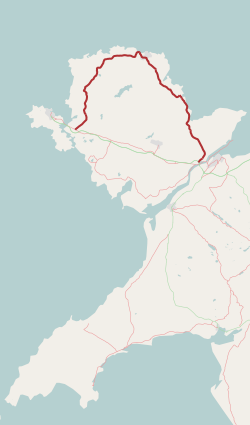
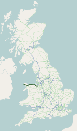
The A5025 is an 'A' road that runs from Llanfairpwllgwyngyll to Valley in Anglesey, Wales. A major road around the north coast of the isle, it runs up the east, north and finally north-west side of the island via several places including Benllech and Amlwch. In all the road is long. Description The A5025 begins at the A55 road, near Sant Tysilio Nursing Home on the northeastern outskirts of Llanfairpwllgwyngyll. It initially heads northeast but soon teeters northwest as its passes Pentraeth Motors. It continues northwest, passing through the town of Pentraeth itself, where it crosses the B5109 road, and then heads north through the coastal town of Benllech. The stretch of road in Benllech is known as Bangor Road. It heads northwest again, crossing the B5110 road, before briefly turning southwest at the junction with the A5108 road to the northeast of Llanallgo. After passing through Llanallgo it heads north-northwest through Brynrefail, Llaneuddog, and Penysarn. Northwest ... [...More Info...] [...Related Items...] OR: [Wikipedia] [Google] [Baidu] |
Llaneuddog
Llaneuddog is a hamlet in the community of Llaneilian, Ynys Môn, Wales. It lies along the A5025 road, between Brynrefail and Penysarn, near Dulas. It belonged to the historical parish of Llanwenllwyfo, now part of Llaneilian. The hamlet takes its name from an ancient chapel to St Euddog which was in the vicinity of the A5025. It was recorded in 1920 as having the stones re-used in farm buildings, and the water stoup used as a pig trough at nearby Lligwy. The presumed site is a small enclosure with a crescent-shaped bank thought to be the churchyard boundary. One of the prominent buildings near the Llaneuddog crossroads is Sardis Baptist Chapel. First built in 1834, it was rebuilt in 1905 at the height of the 1904–1905 Welsh revival. The 1919 ''Memoirs of the Geological Survey of England & Wales'' suggests that in the early part of the 20th century there was a brickworks in the area. See also * List of localities in Wales by population The following is a list of built ... [...More Info...] [...Related Items...] OR: [Wikipedia] [Google] [Baidu] |
B5110 Road
B roads are numbered routes in Great Britain of lesser importance than A roads. See the article Great Britain road numbering scheme The Great Britain road numbering scheme is a numbering scheme used to classify and identify all roads in Great Britain. Each road is given a single letter (which represents the road's category) and a subsequent number (between 1 and 4 digits). ... for the rationale behind the numbers allocated. Zone 5 (3 digits) Zone 5 (4 digits) References {{DEFAULTSORT:B Roads In Zone 5 Of The Great Britain Numbering Scheme 5 5 ... [...More Info...] [...Related Items...] OR: [Wikipedia] [Google] [Baidu] |
A55 Road
The A55, also known as the North Wales Expressway ( cy, Gwibffordd Gogledd Cymru) is a major road in Wales and England, connecting Cheshire and north Wales. The vast majority of its length from Chester to Holyhead is a dual carriageway primary route, with the exception of the Britannia Bridge over the Menai Strait and several short sections where there are gaps in between the two carriageways. All junctions are grade separated apart from a roundabout east of Penmaenmawr and another nearby in Llanfairfechan. Initially, the road ran from Chester to Bangor. In 2001, it was extended across Anglesey to the ferry port of Holyhead parallel to the A5. The road improvements have been part funded with European money, under the Trans-European Networks programme, as the route is designated part of Euroroute E22 (Holyhead – Leeds – Amsterdam – Hamburg – Malmö – Riga – Moscow – Perm – Ekaterinburg – Ishim). Route The Chester southerly bypass The A55 begins at ... [...More Info...] [...Related Items...] OR: [Wikipedia] [Google] [Baidu] |
Burwen
Burwen is a village in Anglesey, Wales, in the community of Amlwch. Located on the A5025, it is 1 kilometre south west of the larger village of Bull Bay and 2.2 kilometres west of the town of Amlwch Amlwch (; ) is a port town and community in Wales. It is situated on the north coast of the Isle of Anglesey, on the A5025 which connects it to Holyhead and to Menai Bridge. As well as Amlwch town and Amlwch Port, other settlements within t .... External links photos of Burwen and surrounding area on geograph Villages in Anglesey Amlwch {{Anglesey-geo-stub ... [...More Info...] [...Related Items...] OR: [Wikipedia] [Google] [Baidu] |
Llanynghenedl
Llanynghenedl is a village in Anglesey, in north-west Wales. It is located on the A5025 about 2 miles north-east of Valley and the A5. The village was the site of the historic St Enghenedl's Church, demolished in 1988. For a small settlement public transport links are good with Valley railway station being situated on the North Wales Coast Line and several bus routes connecting the towns of Holyhead and Amlwch Amlwch (; ) is a port town and community in Wales. It is situated on the north coast of the Isle of Anglesey, on the A5025 which connects it to Holyhead and to Menai Bridge. As well as Amlwch town and Amlwch Port, other settlements within t ... running directly through it. References Villages in Anglesey Valley, Anglesey {{Anglesey-geo-stub ... [...More Info...] [...Related Items...] OR: [Wikipedia] [Google] [Baidu] |
Amlwch
Amlwch (; ) is a port town and community in Wales. It is situated on the north coast of the Isle of Anglesey, on the A5025 which connects it to Holyhead and to Menai Bridge. As well as Amlwch town and Amlwch Port, other settlements within the community include Burwen, Porthllethog/Bull Bay and Pentrefelin. The town has a beach in Llaneilian, and it has significant coastal cliffs. Tourism is an important element of the local economy. At one time it was a booming mining town that became the centre of a vast global trade in copper ore. The harbour inlet became a busy port and significant shipbuilding and ship repair centre, as well as an embarkation point with boats sailing to the Isle of Man and to Liverpool. The community covers an area of about 18 square kilometres. Town Centre The name Amlwch – a reference to the site of the town's harbour, Porth Amlwch – derives from Welsh ''am'' ("about, on or around") and ''llwch'' (an old word meaning "inlet, creek" - similar to ... [...More Info...] [...Related Items...] OR: [Wikipedia] [Google] [Baidu] |
Anglesey
Anglesey (; cy, (Ynys) Môn ) is an island off the north-west coast of Wales. It forms a principal area known as the Isle of Anglesey, that includes Holy Island across the narrow Cymyran Strait and some islets and skerries. Anglesey island, at , is the largest in Wales, the seventh largest in Britain, largest in the Irish Sea and second most populous there after the Isle of Man. Isle of Anglesey County Council administers , with a 2011 census population of 69,751, including 13,659 on Holy Island. The Menai Strait to the mainland is spanned by the Menai Suspension Bridge, designed by Thomas Telford in 1826, and the Britannia Bridge, built in 1850 and replaced in 1980. The largest town is Holyhead on Holy Island, whose ferry service with Ireland handles over two million passengers a year. The next largest is Llangefni, the county council seat. From 1974 to 1996 Anglesey was part of Gwynedd. Most full-time residents are habitual Welsh speakers. The Welsh name Ynys M ... [...More Info...] [...Related Items...] OR: [Wikipedia] [Google] [Baidu] |
Benllech
Benllech (; ) is a large village on the Isle of Anglesey in Wales. It is in the community of Llanfair-Mathafarn-Eithaf, which has a population of 3,382, making it the fourth largest settlement on the island of Anglesey. The name of Benllech village had been removed by the time of the 2011 census with the community being listed under Llanfair-Mathafarn-Eithaf with the electoral ward being listed under Llanddyfnan. The built-up area has a population of 2,236. Description The name Benllech is perhaps a mutated form of ''penllech'', literally "head slab" or "head rock", i.e. "capstone" or "head of the rock", or possibly meaning 'on slate', shortened from the Welsh term 'ar ben llech'. Benllech is a well established seaside resort and popular beach holiday destination. Winner of the European Blue Flag award since 2004, the beach shelves an abundance of clean yellow sand and looks out toward the Great Orme and Penmon Point. The Anglesey Coastal Path and Wales Coast Path pass t ... [...More Info...] [...Related Items...] OR: [Wikipedia] [Google] [Baidu] |
Llanfachraeth
Llanfachraeth is a village and community in Anglesey, Wales. It is located near the west coast of the island, at the head of the Alaw estuary, east of Holyhead, south west of Amlwch and north west of Llangefni. The A5025 road runs through the village. A bus service operates along this road daily, except for Sundays, running between Cemaes, Llanfaethlu, Llanfachraeth and Holyhead. The Wales Coast Path is forced inland here to cross the Afon Alaw. The village has a pub and accommodation is provided by the Holland Hotel. At the 2001 census the community had a population of 566, increasing slightly at the 2011 census to 589. In the extreme north of the community, on the border with Llanfaethlu, stands Gronant, a Grade II* listed sub-medieval house dating from around 1540. A second house was built around 1618. In the 19th century the two houses were joined and a bell turret, used to call servants for meals, was added. The former servants' loft contains fragments of an o ... [...More Info...] [...Related Items...] OR: [Wikipedia] [Google] [Baidu] |
Llanfaethlu
Llanfaethlu is a village and community in the north west of Anglesey, in north-west Wales. The community population taken at the 2011 Census was 553. The village takes its name from the Church of Saint Maethlu. The community includes Llanfwrog. History There are two prehistoric scheduled monuments within Llanfaethlu Community. A hill fort with a single bank and ditch lies on a headland near the coastal hamlet of Tre-Fadog, overlooking the sandy bay of Port Trefadog. To the east of the village is the Capel Soar Standing Stone, a large and prominent standing stone visible from the A5025 and close to Soar Baptist Chapel. It is a slab, 3.2 metres (10 ft) high, and 1.7 metres (5.6 ft) wide at its base, tapering to a rounded top. Roman activity was shown by a small hoard of Roman coins, found in 1929 on a hill to the west of the church, some having been minted when Domitian was emperor, around 90 AD. The village is built around the Church of Saint Maethlu. This church is dedicated ... [...More Info...] [...Related Items...] OR: [Wikipedia] [Google] [Baidu] |
A5 Road (Great Britain)
The A5 (commonly known as the London-Holyhead Trunk Road) is a major road in England and Wales. It runs for about from London to the Irish Sea at the ferry port of Holyhead. In many parts the route follows that of the Roman Iter II route which later took the Anglo-Saxon name Watling Street. History Roman Road The section of the A5 between London and Shrewsbury is roughly contiguous with one of the principal Roman roads in Britain: that between '' Londinium'' and ''Deva'', which diverges from the present-day A5 corridor at Wroxeter ('' Viroconium Cornoviorum'') near Shrewsbury. Telford's Holyhead Road The Act of Union 1800, which unified Great Britain and Ireland, gave rise to a need to improve communication links between London and Dublin. A parliamentary committee led to an Act of Parliament of 1815 that authorised the purchase of existing turnpike road interests and, where necessary, the construction of new road, to complete the route between the two capitals. ... [...More Info...] [...Related Items...] OR: [Wikipedia] [Google] [Baidu] |
Dulas, Anglesey
Dulas () or City DulasOrdnance Survey mapping is a village in Anglesey, in north-west Wales. It is situated on the A5025 road, near the coast ( Dulas Bay) at only above sea level. It is in the community of Llaneilian Llaneilian (; ) is a village and community in the Welsh county of Anglesey. It is located in the north east of the island, east of Amlwch, north west of Menai Bridge and north of Llangefni. The community includes the villages and hamlets of .... Origin of the name The village has never held the status of a city and "City" is not a recognisable Welsh word, so its origin is unclear. It may be that the name came from an Anglicisation of ''Saith Tŷ'', which is Welsh for "Seven Houses". There are two places in Wales simply called 'City': City, Powys and City, Vale of Glamorgan. References Villages in Anglesey Llaneilian {{Anglesey-geo-stub ... [...More Info...] [...Related Items...] OR: [Wikipedia] [Google] [Baidu] |


