|
2023 Virginia Plane Crash
On June 4, 2023, a privately operated Cessna 560 Citation V carrying three passengers and a pilot crashed at approximately 3:23p.m. Eastern Daylight Time (EDT) in the George Washington National Forest, Virginia, killing the occupants, after the crew had been found unresponsive.Page 2: "According to a North American Aerospace Defense Command (NORAD) statement, about 1520 the airplane was intercepted by fighter aircraft." The plane had previously entered the no-fly zone over Washington, D.C., and was intercepted by F-16 fighter jets before it crashed. A preliminary report was released by the National Transportation Safety Board on June 21, 2023, and the investigation into the crash is ongoing as of August 2023. Accident The plane involved in the accident was a Cessna 560 Citation V, registered N611VG to Encore Motors of Melbourne, a Florida-based company under the ownership of John and Barbara Rumpel. It departed from Elizabethton Municipal Airport in Elizabethton, Tennessee ... [...More Info...] [...Related Items...] OR: [Wikipedia] [Google] [Baidu] |
Mine Bank Mountain
Mine Bank Mountain is a peak in the U.S. state of Virginia, in the Saint Mary's Wilderness near the Blue Ridge Parkway. The mountain was the site of the 2023 Virginia plane crash, which struck below the peak, killing all four on board. The mountain is named for nearby manganese-iron ore mines. Hikes up the mountain can be accomplished on the Mine Bank Trail, a loop, with a trailhead on the Blue Ridge Parkway (). References External links * Mine Bank Mountainat mountainzone.comMine Bank Mountain at peakbagger.com Mountains of Augusta County, Virginia {{Virginia-stub ... [...More Info...] [...Related Items...] OR: [Wikipedia] [Google] [Baidu] |
Long Island
Long Island is a densely populated island in the southeastern region of the U.S. state of New York (state), New York, part of the New York metropolitan area. With over 8 million people, Long Island is the most populous island in the United States and the List of islands by population, 18th-most populous in the world. The island begins at New York Harbor approximately east of Manhattan Island and extends eastward about into the Atlantic Ocean and 23 miles wide at its most distant points. The island comprises four List of counties in New York, counties: Kings and Queens counties (the New York City Borough (New York City), boroughs of Brooklyn and Queens, respectively) and Nassau County, New York, Nassau County share the western third of the island, while Suffolk County, New York, Suffolk County occupies the eastern two thirds of the island. More than half of New York City's residents (58.4%) lived on Long Island as of 2020, in Brooklyn and in Queens. Culturally, many people in t ... [...More Info...] [...Related Items...] OR: [Wikipedia] [Google] [Baidu] |
Montebello, Virginia
Montebello is an unincorporated community in Nelson County, Virginia, United States. It was among the communities severely affected by flash flooding from Hurricane Camille in 1969.Garnett P. Williams and Harold P. Guy. Erosional and Depositional Aspects of Hurricane Camille in Virginia, 1969. United States Government Printing Office The United States Government Publishing Office (USGPO or GPO; formerly the United States Government Printing Office) is an agency of the legislative branch of the United States Federal government. The office produces and distributes information ..., 1973, pp. 1. Climate Montebello weather is like most of the Blue Ridge region, mild, but occasionally hot summers, cool and pleasant in the spring and fall and usually cold, chilly and occasionally snowy weather during the winter. ReferencesGNIS reference Unincorporated communities in Nelson County, Virginia Unincorporated communities in Virginia {{NelsonCountyVA-geo-stub ... [...More Info...] [...Related Items...] OR: [Wikipedia] [Google] [Baidu] |
Altitude In Aviation
Altitude or height (also sometimes known as depth) is a distance measurement, usually in the vertical or "up" direction, between a reference datum and a point or object. The exact definition and reference datum varies according to the context (e.g., aviation, geometry, geographical survey, sport, or atmospheric pressure). Although the term ''altitude'' is commonly used to mean the height above sea level of a location, in geography the term elevation is often preferred for this usage. Vertical distance measurements in the "down" direction are commonly referred to as depth. In aviation In aviation, the term altitude can have several meanings, and is always qualified by explicitly adding a modifier (e.g. "true altitude"), or implicitly through the context of the communication. Parties exchanging altitude information must be clear which definition is being used. Aviation altitude is measured using either mean sea level (MSL) or local ground level (above ground level, ... [...More Info...] [...Related Items...] OR: [Wikipedia] [Google] [Baidu] |
FlightAware
FlightAware is an American multi-national technology company that provides real-time, historical, and predictive flight tracking data and products. , it is the world's largest flight tracking platform, with a network of over 32,000 ADS-B ground stations in 200 countries. FlightAware also provides aviation data and predicted ETAs to airlines, airport operators, and software developers. FlightAware is a subsidiary of Collins Aerospace, with headquarters in Eleven Greenway Plaza in Houston and sales offices in New York City, Austin, Singapore, and London. History In 2004, CEO Daniel Baker started exploring the idea of creating a free flight tracking service as he wanted a way for his family to track his private flights around the country. At the time, there were few enterprise solutions that offered this kind of service. Baker recruited friends Karl Lehenbauer and David McNett to help create a free public flight tracking service. On March 17, 2005, FlightAware was officially ... [...More Info...] [...Related Items...] OR: [Wikipedia] [Google] [Baidu] |
Virginia
Virginia, officially the Commonwealth of Virginia, is a state in the Mid-Atlantic and Southeastern regions of the United States, between the Atlantic Coast and the Appalachian Mountains. The geography and climate of the Commonwealth are shaped by the Blue Ridge Mountains and the Chesapeake Bay, which provide habitat for much of its flora and fauna. The capital of the Commonwealth is Richmond; Virginia Beach is the most-populous city, and Fairfax County is the most-populous political subdivision. The Commonwealth's population was over 8.65million, with 36% of them living in the Baltimore–Washington metropolitan area. The area's history begins with several indigenous groups, including the Powhatan. In 1607, the London Company established the Colony of Virginia as the first permanent English colony in the New World. Virginia's state nickname, the Old Dominion, is a reference to this status. Slave labor and land acquired from displaced native tribes fueled the ... [...More Info...] [...Related Items...] OR: [Wikipedia] [Google] [Baidu] |
Flare
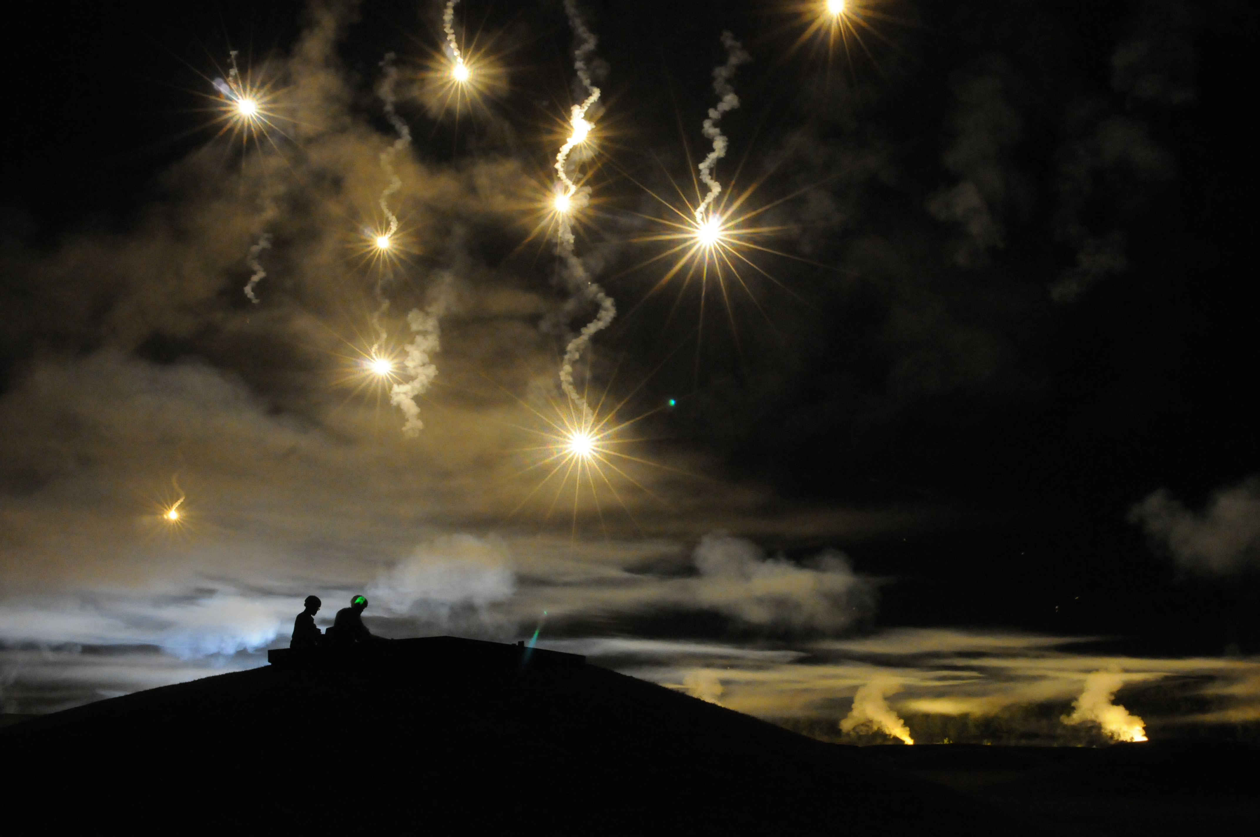
A flare, also sometimes called a fusée, fusee, or bengala in some Latin-speaking countries, is a type of pyrotechnic that produces a bright light or intense heat without an explosion. Flares are used for distress signaling, illumination, or defensive countermeasures in civilian and military applications. Flares may be ground pyrotechnics, projectile pyrotechnics, or parachute-suspended to provide maximum illumination time over a large area. Projectile pyrotechnics may be dropped from aircraft, fired from rocket or artillery, or deployed by flare guns or handheld percussive tubes. History The earliest recorded use of gunpowder for signaling purposes was the 'signal bomb' used by the Chinese Song Dynasty (960–1279) as the Mongol-led Yuan Dynasty (1271–1368) besieged Yangzhou in 1276. These soft-shelled bombs, timed to explode in midair, were used to send messages to a detachment of troops far in the distance. Another mention of the signal bomb appears in a text dating ... [...More Info...] [...Related Items...] OR: [Wikipedia] [Google] [Baidu] |
Joint Base Andrews
Joint Base Andrews (JBA) is a United States military facility located in Prince George's County, Maryland. The facility is under the jurisdiction of the United States Air Force 316th Wing, Air Force District of Washington (AFDW). The base was established in 2009, when Andrews Air Force Base and Naval Air Facility Washington were merged. The base is named for Lieutenant General Frank Maxwell Andrews (1884–1943), former Commanding General of United States Armed Forces in the European Theater of Operations during World War II. The base is widely known for serving as the home base of two Boeing VC-25 aircraft which have the call sign Air Force One while the President of the United States is on board.Factsheets : Presidential Airlift Group (AMC) ''United States Air Force'' ... [...More Info...] [...Related Items...] OR: [Wikipedia] [Google] [Baidu] |
113th Wing
The 113th Wing, known as the "Capital Guardians", is a unit of the District of Columbia Air National Guard, stationed at Joint Base Andrews, Maryland. If activated to federal service, the fighter portion of the Wing is gained by the United States Air Force's Air Combat Command, while the airlift portion is gained by Air Mobility Command. The 113th's primary mission is training of air combat and operational airlift crews for national defense. The 113th also provides a ready response force of fighters for the defense of the District of Columbia area. Members of the 113th also assist local and federal law enforcement agencies in combating drug trafficking in the District of Columbia on a case by case basis. The 121st Fighter Squadron, assigned to the wing's 113th Operations Group, is a descendant organization of the 121st Observation Squadron, established on 10 July 1940. It is one of the National Guard observation squadrons formed before World War II Units The 113th Wing consi ... [...More Info...] [...Related Items...] OR: [Wikipedia] [Google] [Baidu] |
Interceptor Aircraft
An interceptor aircraft, or simply interceptor, is a type of fighter aircraft designed specifically for the defensive interception role against an attacking enemy aircraft, particularly bombers and reconnaissance aircraft. Aircraft that are capable of being or are employed as both ‘standard’ air superiority fighters and as interceptors are sometimes known as fighter-interceptors. There are two general classes of interceptor: light fighters, designed for high performance over short range; and heavy fighters, which are intended to operate over longer ranges, in contested airspace and adverse meteorological conditions. While the second type was exemplified historically by specialized night fighter and all-weather interceptor designs, the integration of mid-air refueling, satellite navigation, on-board radar and beyond visual range (BVR) missile systems since the 1960s has allowed most frontline fighter designs to fill the roles once reserved for specialised night/all-weathe ... [...More Info...] [...Related Items...] OR: [Wikipedia] [Google] [Baidu] |
NORAD
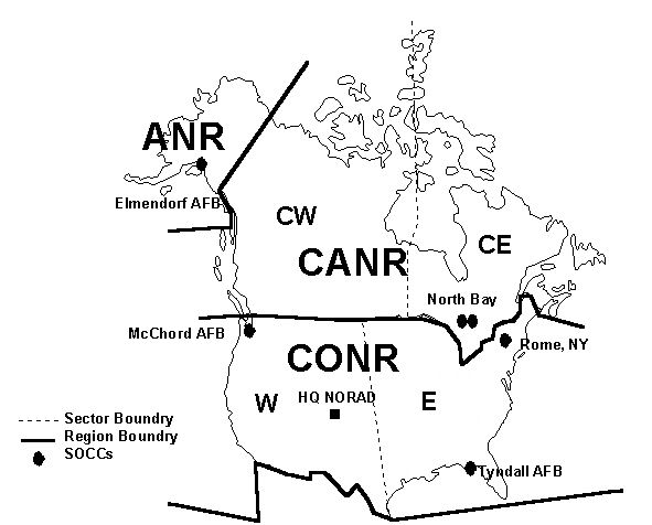
North American Aerospace Defense Command (NORAD ), known until March 1981 as the North American Air Defense Command, is a combined organization of the United States and Canada that provides aerospace warning, air sovereignty, and protection for Canada and the continental United States. Headquarters for NORAD and the NORAD/United States Northern Command (USNORTHCOM) center are located at Peterson Space Force Base in El Paso County, near Colorado Springs, Colorado. The nearby Cheyenne Mountain Complex has the Alternate Command Center. The NORAD commander and deputy commander (CINCNORAD) are, respectively, a United States four-star general or equivalent and a Canadian lieutenant-general or equivalent. Organization CINCNORAD maintains the NORAD headquarters at Peterson Space Force Base near Colorado Springs, Colorado. The NORAD and USNORTHCOM Command Center at Peterson SFB serves as a central collection and coordination facility for a worldwide system of sensors designed ... [...More Info...] [...Related Items...] OR: [Wikipedia] [Google] [Baidu] |


.jpg)
