|
2013–14 Australian Region Cyclone Season
The 2013–14 Australian region cyclone season was a slightly below-average tropical cyclone season, with 10 tropical cyclones occurring within the Australian region. It officially started on 1 November 2013, and ended on 30 April 2014. The regional tropical cyclone operational plan defines a "tropical cyclone year" separately from a "tropical cyclone season"; the "tropical cyclone year" began on 1 July 2013 and ended on 30 June 2014. After two seasons with no cyclones of Category 5 intensity, this season saw two of the ten named storms reaching this level: Gillian and Ita. Of the two systems, Gillian rapidly intensified from a tropical low to a Category 5 in just 48 hours but caused only minor damage. Ita was ultimately the strongest and most intense system inside the basin and made landfall on the Far North Queensland coast near Cooktown, causing minor damage but significant flooding. In addition, significant damage was also caused by Christine in the towns of Wickham and ... [...More Info...] [...Related Items...] OR: [Wikipedia] [Google] [Baidu] |
Cyclone Ita
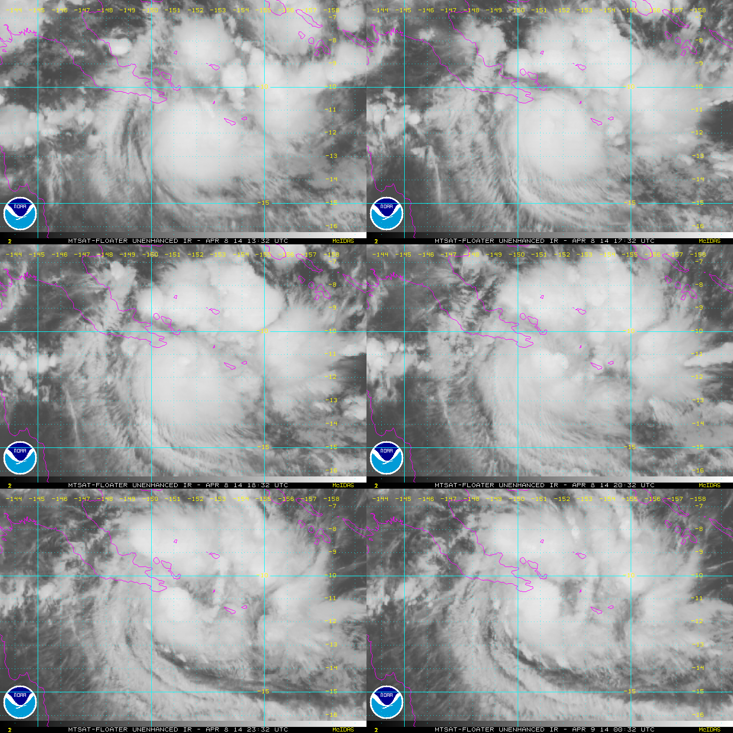
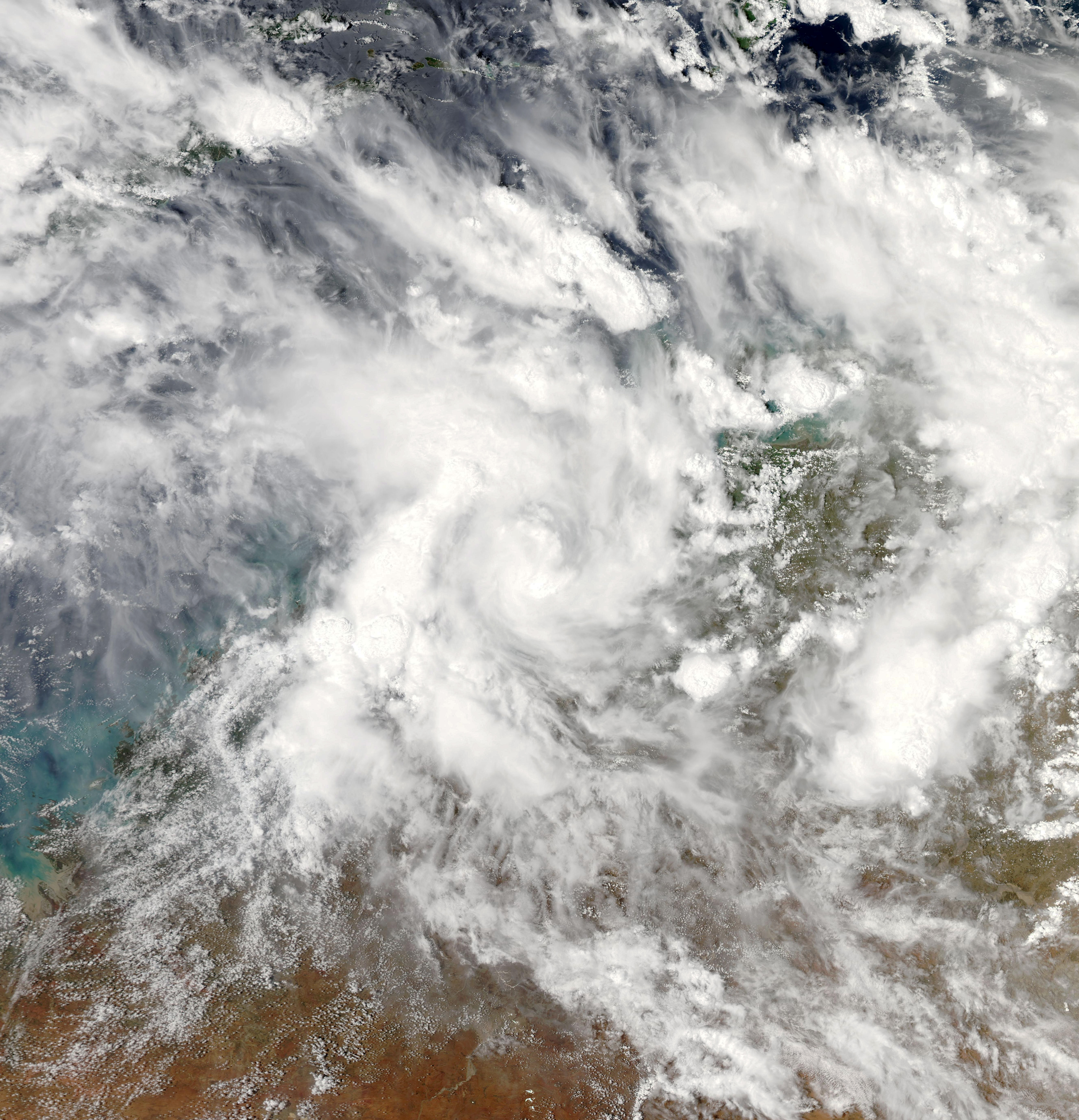
Severe Tropical Cyclone Ita was the strongest tropical cyclone in the Australian region by central pressure, since George in 2007, and since Monica in 2006 by wind speed. The system was first identified over the Solomon Islands as a tropical low on 1 April 2014, and gradually moved westward, eventually reaching cyclone intensity on 5 April. On 10 April, Ita intensified rapidly into a powerful Category 5 system on the Australian Scale, but it weakened to a Category 4 system in the hours immediately preceding landfall the following day. At the time of landfall at Cape Flattery at 12 April 22:00 (UTC+10), the cyclone's Dvorak intensity was approximately T5.0, consistent with a weak Category 4 system, and considerably lower than the T6.5 observed when the system was at its peak intensity. Meteorologists noted the system had, at that time, begun an eyewall replacement cycle; as a result, the system was considerably less powerful than various intensity scales had predicted. Ita's imp ... [...More Info...] [...Related Items...] OR: [Wikipedia] [Google] [Baidu] |
Cyclone Alessia
Tropical Cyclone Alessia was the first tropical cyclone to affect the Northern Territory of Australia in November since Cyclone Joan in 1975. The storm was first identified as a tropical low on 20 November 2013 well to the northwest of Australia. Tracking generally west to west-southwest, the small system steadily organized into a tropical cyclone by 22 November. Maintaining a small central dense overcast, Alessia brushed the Kimberley (Western Australia), Kimberley region before making landfall in the Top End region with winds of on 23 and 24 November respectively. Some weakening took place as the system moved over land; however, reorganization occurred as it neared the Gulf of Carpentaria. After moving over water on 26 November, it redeveloped gale-force winds. Alessia reached its peak intensity on 27 November with winds of and a barometric pressure of 991 Bar (unit), mbar (Pascal (unit), hPa; 29.26 Inches of Mercury, inHg) and subsequently m ... [...More Info...] [...Related Items...] OR: [Wikipedia] [Google] [Baidu] |
Centre Island, Australia
Centre Island is a small, uninhabited island in the Sir Edward Pellew Group of Islands in the Gulf of Carpentaria within the Northern Territory of Australia. An automated weather station run by the Bureau of Meteorology The Bureau of Meteorology (BOM or BoM) is an executive agency of the Australian Government responsible for providing weather services to Australia and surrounding areas. It was established in 1906 under the Meteorology Act, and brought together ... has been operating on the island since 1968. Temperatures range from 23.8 °C to 31.2 °C and the average annual rainfall is 1053.4 mm. References Islands of the Northern Territory Gulf of Carpentaria Uninhabited islands of Australia {{NorthernTerritory-geo-stub ... [...More Info...] [...Related Items...] OR: [Wikipedia] [Google] [Baidu] |
Borroloola
Borroloola ( local Aboriginal languages: ''Burrulula'') is a town in the Northern Territory of Australia. It is located on the McArthur River, about 50 km upstream from the Gulf of Carpentaria. Location Borroloola lies on the traditional country of the Yanyuwa people, on the coastal plain between the Barkly Tablelands and the Gulf of Carpentaria. Rivers that run from the Tablelands escarpment to the Gulf regularly flood in the wet season, making travel on the unsealed section of Highway One along the coastal plain to Queensland impossible. The rivers of this region have carved spectacular gorges through sandstone deposits in their upper reaches. The rivers and coastal areas are host to barramundi, earning Borroloola a reputation among sports fisherman, and also to the deadly saltwater crocodile. The region has little rain from May to September and is characterised by lightly treed Savanna grasslands. History Garrwa (also known as Garawa) is a language of the Gulf regio ... [...More Info...] [...Related Items...] OR: [Wikipedia] [Google] [Baidu] |
Gulf Of Carpentaria
The Gulf of Carpentaria (, ) is a large, shallow sea enclosed on three sides by northern Australia and bounded on the north by the eastern Arafura Sea (the body of water that lies between Australia and New Guinea). The northern boundary is generally defined as a line from Slade Point, Queensland (the northwestern corner of Cape York Peninsula) in the northeast, to Cape Arnhem on the Gove Peninsula, Northern Territory (the easternmost point of Arnhem Land) in the west. At its mouth, the Gulf is wide, and further south, . The north-south length exceeds . It covers a water area of about . The general depth is between and does not exceed . The tidal range in the Gulf of Carpentaria is between . The Gulf and adjacent Sahul Shelf were dry land at the peak of the last ice age 18,000 years ago when global sea level was around below its present position. At that time a large, shallow lake occupied the centre of what is now the Gulf. The Gulf hosts a submerged coral reef provinc ... [...More Info...] [...Related Items...] OR: [Wikipedia] [Google] [Baidu] |
Top End
The Top End of Australia's Northern Territory is a geographical region encompassing the northernmost section of the Northern Territory, which aside from the Cape York Peninsula is the northernmost part of the Australian continent. It covers a rather vaguely defined area of about 245,000 km² (95,000 sq mi) behind the northern coast from the Northern Territory capital of Darwin across to Arnhem Land with the Indian Ocean on the west, the Arafura Sea to the north, and the Gulf of Carpentaria to the east, and with the almost waterless semi-arid interior of Australia to the south, beyond the huge Kakadu National Park. The Top End contains both of the Territory's cities and one of its major towns, Darwin, Palmerston and Katherine. The well-known town of Alice Springs is located further south, in the arid southern part of the Northern Territory, sometimes referred to by Australians as the Red Centre. The landscape is relatively flat with river floodplains and grasslands with eucaly ... [...More Info...] [...Related Items...] OR: [Wikipedia] [Google] [Baidu] |
Anson Bay, Daly And Reynolds River Floodplains
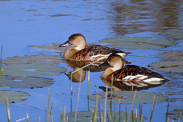
The Anson Bay, Daly and Reynolds River Floodplains comprise some of seasonally inundated floodplains around Anson Bay, and the lower reaches of the Daly, Reynolds and Docherty Rivers entering the bay, on the west coast of the Top End of the Northern Territory of Australia. Anson's Bay lies about south-west of Darwin, on the eastern side of the Joseph Bonaparte Gulf, opening on to the Timor Sea. The site is important for large numbers, and a wide variety, of waterbirds. Birds The floodplains have been identified as an Important Bird Area (IBA) by BirdLife International because they support large numbers of magpie geese, wandering whistling ducks, pied herons and intermediate egrets. The adjacent intertidal mudflats of Anson Bay support up to 27,000 waders, or shorebirds, probably including over 1% of the world population of great knots. The site several large waterbird nesting colonies; other birds that breed in relatively large numbers include little black, little pied ... [...More Info...] [...Related Items...] OR: [Wikipedia] [Google] [Baidu] |
Joseph Bonaparte Gulf
Joseph Bonaparte Gulf is a large body of water off the coast of the Northern Territory and Western Australia and part of the Timor Sea. It was named after Joseph Bonaparte, brother of Napoleon and King of Naples (1806-1808) and then Spain (1808-1813) by French explorer and naturalist Nicolas Baudin in 1803. It is also often referred to in Australia as the "Bonaparte Gulf". Description The Keep River and Victoria River drain into the gulf in the Northern Territory, the former close to the Western Australia - Northern Territory border. The Ord River, Pentecost River, Durack River, King River and the Forrest River drain into the Cambridge Gulf, another gulf within the southern part of the Joseph Bonaparte Gulf. The Legune (Joseph Bonaparte Bay) Important Bird Area lies at the south-eastern end of the gulf. The Bonaparte Basin is a large sedimentary basin underlying the gulf and a large part of the Timor Sea, deriving its name from the Joseph Bonaparte Gulf, which has several ... [...More Info...] [...Related Items...] OR: [Wikipedia] [Google] [Baidu] |
Kimberley (Western Australia)
The Kimberley is the northernmost of the nine regions of Western Australia. It is bordered on the west by the Indian Ocean, on the north by the Timor Sea, on the south by the Great Sandy Desert, Great Sandy and Tanami Desert, Tanami deserts in the region of the Pilbara, and on the east by the Northern Territory. The region was named in 1879 by government surveyor Alexander Forrest after Secretary of State for the Colonies John Wodehouse, 1st Earl of Kimberley. History The Kimberley was one of the earliest settled parts of Australia, with the first humans landing about 65,000 years ago. They created a complex culture that developed over thousands of years. Yam (vegetable), Yam (''Dioscorea hastifolia'') agriculture was developed, and rock art suggests that this was where some of the earliest boomerangs were invented. The worship of Wandjina deities was most common in this region, and a complex theology dealing with the transmigration of souls was part of the local people's r ... [...More Info...] [...Related Items...] OR: [Wikipedia] [Google] [Baidu] |
Ridge (meteorology)
A ridge or barometric ridge is a term in meteorology describing an elongated area of relatively high atmospheric pressure compared to the surrounding environment, without being a closed circulation. It is associated with an area of maximum anticyclonic curvature of wind flow. The ridge originates in the center of an anticyclone and sandwiched between two low-pressure areas, and the locus of the maximum curvature is called the ''ridge line''. This phenomenon is the opposite of a trough. Description Ridges can be represented in two ways: * On surface weather maps, the pressure isobars form contours where the maximum pressure is found along the axis of the ridge. * In upper-air maps, geopotential height isohypses form similar contours where the maximum defines the ridge. Related weather Given the direction of the winds around an anticyclonic circulation and the fact that weather systems move from west to east: *ahead of an upper-ridge, the airflow that comes from the polar regi ... [...More Info...] [...Related Items...] OR: [Wikipedia] [Google] [Baidu] |
Wind Shear
Wind shear (or windshear), sometimes referred to as wind gradient, is a difference in wind speed and/or direction over a relatively short distance in the atmosphere. Atmospheric wind shear is normally described as either vertical or horizontal wind shear. Vertical wind shear is a change in wind speed or direction with a change in altitude. Horizontal wind shear is a change in wind speed with a change in lateral position for a given altitude. Wind shear is a microscale meteorological phenomenon occurring over a very small distance, but it can be associated with mesoscale or synoptic scale weather features such as squall lines and cold fronts. It is commonly observed near microbursts and downbursts caused by thunderstorms, fronts, areas of locally higher low-level winds referred to as low-level jets, near mountains, radiation inversions that occur due to clear skies and calm winds, buildings, wind turbines, and sailboats. Wind shear has significant effects on the control of a ... [...More Info...] [...Related Items...] OR: [Wikipedia] [Google] [Baidu] |
Java
Java (; id, Jawa, ; jv, ꦗꦮ; su, ) is one of the Greater Sunda Islands in Indonesia. It is bordered by the Indian Ocean to the south and the Java Sea to the north. With a population of 151.6 million people, Java is the world's List of islands by population, most populous island, home to approximately 56% of the Demographics of Indonesia, Indonesian population. Indonesia's capital city, Jakarta, is on Java's northwestern coast. Many of the best known events in Indonesian history took place on Java. It was the centre of powerful Hindu-Buddhist empires, the Islamic sultanates, and the core of the colonial Dutch East Indies. Java was also the center of the History of Indonesia, Indonesian struggle for independence during the 1930s and 1940s. Java dominates Indonesia politically, economically and culturally. Four of Indonesia's eight UNESCO world heritage sites are located in Java: Ujung Kulon National Park, Borobudur Temple, Prambanan Temple, and Sangiran Early Man Site. ... [...More Info...] [...Related Items...] OR: [Wikipedia] [Google] [Baidu] |


