|
1893 New York Hurricane
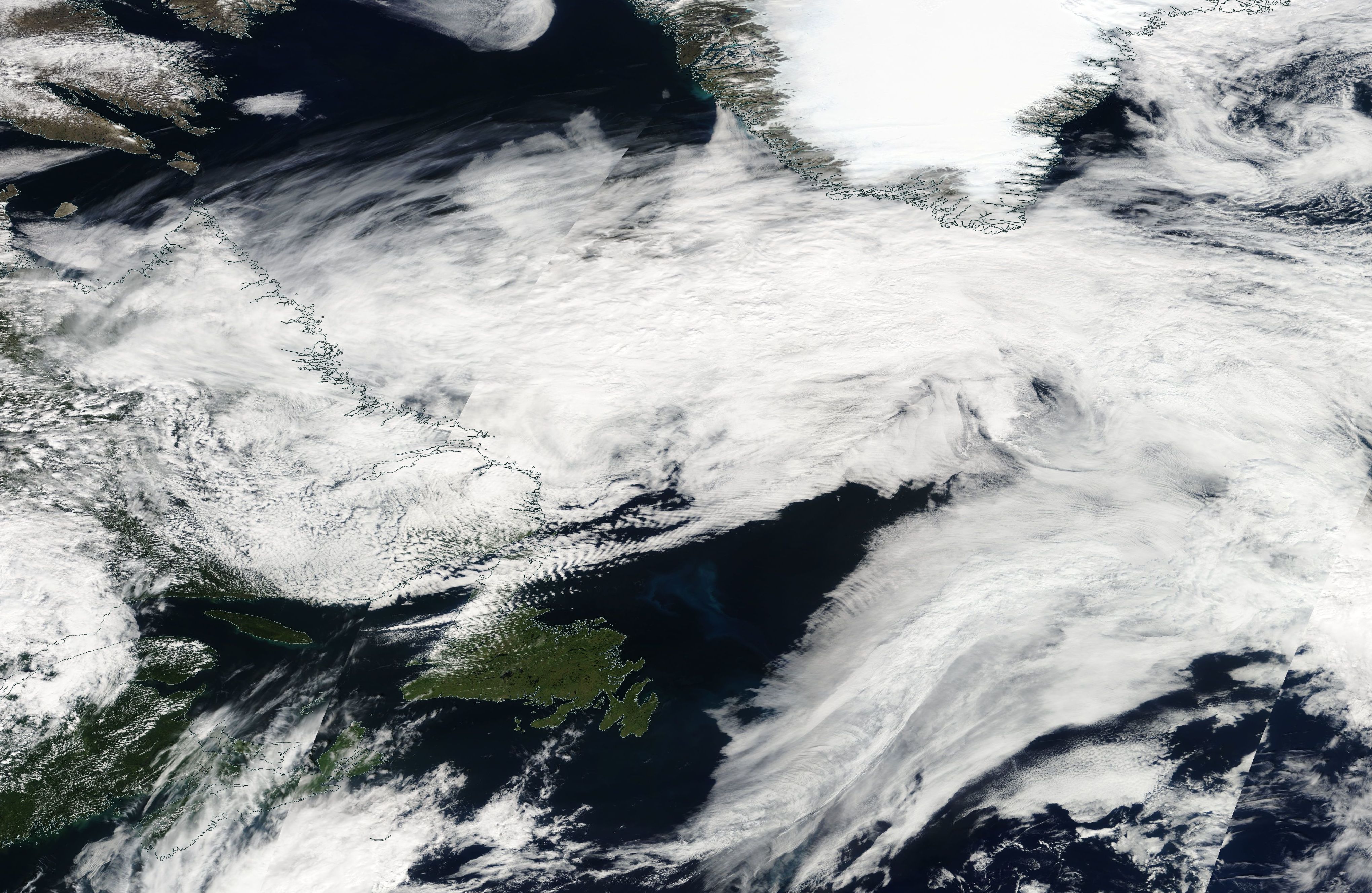
The 1893 New York hurricane, also known as the Midnight Storm, was a powerful and destructive tropical cyclone that struck the New York City area in August 1893. First identified as a tropical storm on August 15, over the central Atlantic Ocean, the hurricane moved northwestward for most of its course, ultimately peaking with maximum sustained winds of and a minimum barometric pressure reading of 952 mbar (hPa; 28.11 inHg). It turned due northward as it approached the U.S. East Coast and struck western Long Island on August 24. It moved inland and quickly deteriorated, degenerating the next day. The storm inflicted severe damage with storm tides as high as . Trees were brought down, houses were demolished, and Hog Island was largely washed away by the cyclone. Several areas suffered extensive effects from the hurricane, and at least 34 sailors lost their lives. The storm is regarded as one of the most severe hurricanes to strike the city. Meteorological history The system wa ... [...More Info...] [...Related Items...] OR: [Wikipedia] [Google] [Baidu] |
Eastern United States
The Eastern United States, commonly referred to as the American East, Eastern America, or simply the East, is the region of the United States to the east of the Mississippi River. In some cases the term may refer to a smaller area or the East Coast plus Illinois, Wisconsin, Indiana, Mississippi, and their border states. In 2011, the 26 states east of the Mississippi (in addition to Washington, D.C. but not including the small portions of Louisiana and Minnesota east of the river) had an estimated population of 179,948,346 or 58.28% of the total U.S. population of 331,745,358 (excluding Puerto Rico). New England New England is a region of the United States located in the northeastern corner of the country, bounded by the Atlantic Ocean, Canada and the state of New York, consisting of the modern states of Maine, New Hampshire, Vermont, Massachusetts, Rhode Island, and Connecticut. In one of the earliest English settlements in the New World, English Pilgrims from Europe first ... [...More Info...] [...Related Items...] OR: [Wikipedia] [Google] [Baidu] |
Storm Surge
A storm surge, storm flood, tidal surge, or storm tide is a coastal flood or tsunami-like phenomenon of rising water commonly associated with low-pressure weather systems, such as cyclones. It is measured as the rise in water level above the normal tidal level, and does not include waves. The main meteorological factor contributing to a storm surge is high-speed wind pushing water towards the coast over a long fetch. Other factors affecting storm surge severity include the shallowness and orientation of the water body in the storm path, the timing of tides, and the atmospheric pressure drop due to the storm. There is a suggestion that climate change may be increasing the hazard of storm surges. Some theorize that as extreme weather becomes more intense and sea level rises due to climate change, storm surge is expected to cause more risk to coastal populations. Communities and governments can adapt by building hard infrastructure, like surge barriers, soft infrastructure, ... [...More Info...] [...Related Items...] OR: [Wikipedia] [Google] [Baidu] |
Hurricane Sandy
Hurricane Sandy (unofficially referred to as ''Superstorm Sandy'') was an extremely destructive and strong Atlantic hurricane, as well as the largest Atlantic hurricane on record as measured by diameter, with tropical-storm-force winds spanning . The storm inflicted nearly $70 billion (2012 USD) in damage and killed 233 people across eight countries from the Caribbean to Canada. The eighteenth Tropical cyclone naming, named storm, tenth Atlantic hurricane, hurricane, and second major hurricane of the 2012 Atlantic hurricane season, Sandy was a List of Category 3 Atlantic hurricanes, Category 3 storm at its peak intensity when it made landfall in Cuba, though most of the damage it caused was after it became a Category 1-equivalent extratropical cyclone off the coast of the Northeastern United States. Sandy developed from a tropical wave in the western Caribbean Sea on October 22, quickly strengthened, and was upgraded to Tropical Storm Sandy six hours later. Sandy moved s ... [...More Info...] [...Related Items...] OR: [Wikipedia] [Google] [Baidu] |
Hurricane Irene
Hurricane Irene was a large and destructive tropical cyclone which affected much of the Caribbean and East Coast of the United States during late August 2011. The ninth named storm, first hurricane, and first major hurricane of the 2011 Atlantic hurricane season, Irene originated from a well-defined Atlantic tropical wave that began showing signs of organization east of the Lesser Antilles. Due to development of atmospheric convection and a closed center of circulation, the system was designated as Tropical Storm Irene on August 20, 2011. After intensifying, Irene made landfall in St. Croix as a strong tropical storm later that day. Early on August 21, the storm made a second landfall in Puerto Rico. While crossing the island, Irene strengthened into a Category 1 hurricane. The storm paralleled offshore of Hispaniola, continuing to slowly intensify in the process. Shortly before making four landfalls in the Bahamas, Irene peaked as a Category 3 hurricane. Th ... [...More Info...] [...Related Items...] OR: [Wikipedia] [Google] [Baidu] |
Hurricane Gloria
Hurricane Gloria was a powerful hurricane that caused significant damage along the east coast of the United States and in Atlantic Canada during the 1985 Atlantic hurricane season. It was the first significant tropical cyclone to strike the northeastern United States since Hurricane Agnes in 1972 and the first major storm to affect New York City and Long Island directly since Hurricane Donna in 1960. Gloria was a powerful Cape Verde hurricane originating from a tropical wave on September 16 in the eastern Atlantic Ocean. After remaining a weak tropical cyclone for several days, Gloria intensified into a hurricane on September 22 north of the Lesser Antilles. During that time, the storm had moved generally westward, although it turned to the northwest due to a weakening of the ridge. Gloria quickly intensified on September 24, and the next day reached peak winds of 145 mph (230 km/h). The hurricane weakened before striking the Outer Banks of North Car ... [...More Info...] [...Related Items...] OR: [Wikipedia] [Google] [Baidu] |
Sea Islands Hurricane
The 1893 Sea Islands hurricane was a deadly major hurricane that struck the Sea Islands which was near Savannah, Georgia on August 27, 1893.Christine Gibson "Our 10 Greatest Natural Disasters," ''American Heritage'', Aug./Sept. 2006. It was the 7th deadliest hurricane in the history, and was one of the three deadly hurricanes during the ; the storm killed an estimated 1,000–2,000 people, mostly from storm surge. This is also the storm that made |
Hoboken, New Jersey
Hoboken ( ; Unami: ') is a city in Hudson County in the U.S. state of New Jersey. As of the 2020 U.S. census, the city's population was 60,417. The Census Bureau's Population Estimates Program calculated that the city's population was 58,690 in 2021, ranking the city the 668th-most-populous in the country. With more than , Hoboken was ranked as the third-most densely populated municipality in the United States among cities with a population above 50,000. Hoboken is part of the New York metropolitan area and is the site of Hoboken Terminal, a major transportation hub for the tri-state region. Hoboken was first settled by Europeans as part of the Pavonia, New Netherland colony in the 17th century. During the early 19th century, the city was developed by Colonel John Stevens, first as a resort and later as a residential neighborhood. Originally part of Bergen Township and later North Bergen Township, it became a separate township in 1849 and was incorporated as a city in 1855 ... [...More Info...] [...Related Items...] OR: [Wikipedia] [Google] [Baidu] |
Jersey City, New Jersey
Jersey City is the second-most populous city in the U.S. state of New Jersey, after Newark.The Counties and Most Populous Cities and Townships in 2010 in New Jersey: 2000 and 2010 , . Accessed November 7, 2011. It is the of and the county's largest city. [...More Info...] [...Related Items...] OR: [Wikipedia] [Google] [Baidu] |
Brooklyn
Brooklyn () is a borough of New York City, coextensive with Kings County, in the U.S. state of New York. Kings County is the most populous county in the State of New York, and the second-most densely populated county in the United States, behind New York County (Manhattan). Brooklyn is also New York City's most populous borough,2010 Gazetteer for New York State . Retrieved September 18, 2016. with 2,736,074 residents in 2020. Named after the Dutch village of Breukelen, Brooklyn is located on the w ... [...More Info...] [...Related Items...] OR: [Wikipedia] [Google] [Baidu] |
Greenport, Suffolk County, New York
Greenport is a village in Suffolk County, on the North Fork of Long Island, in New York, United States. The population was 2,197 at the 2010 census. The Incorporated Village of Greenport is located entirely within the Town of Southold and is the only incorporated community in the town. Greenport was a major port for its area, having developed a strong fishing and whaling industry in the past, although currently there are only a handful of commercial fishing vessels operating out of the village. More recently the tourism industry has grown substantially too, especially in the summer. History Greenport was first settled in 1682. The village was called Winter Harbor, Stirling, and Green Hill and was incorporated in 1838. Greenport was once a whaling and ship building village, and since 1844, has been the eastern terminal station on the north fork for the Long Island Rail Road. During Prohibition, rum running and speakeasies became a significant part of Greenport's economy. ... [...More Info...] [...Related Items...] OR: [Wikipedia] [Google] [Baidu] |
Sheepshead Bay, Brooklyn
Sheepshead Bay is a neighborhood in southern Brooklyn, New York City. It is bounded by Ocean Parkway to the west; Avenue T and Kings Highway to the north; Nostrand Avenue and Gerritsen Avenue to the east; and the Atlantic Ocean to the south. Sheepshead Bay is abutted by the neighborhoods of Brighton Beach and Homecrest to the west; Midwood to the north; and Gerritsen Beach to the east. The neighborhood is named after a bay that separates mainland Brooklyn from the eastern portion of Coney Island, which was originally one of the Outer Barrier islands but is now a peninsula. The mouth of the bay is about southwest of Marine Park. Sheepshead Bay is part of Brooklyn Community District 15, and its primary ZIP Codes are 11229 and 11235. It is patrolled by the 61st Precinct of the New York City Police Department. Politically it is represented by the New York City Council's 46th and 48th Districts. History Fishing and tourism destination The name "Sheepshead Bay" applies t ... [...More Info...] [...Related Items...] OR: [Wikipedia] [Google] [Baidu] |


.jpg)