|
14th Maine Volunteer Infantry Regiment
The 14th Maine Infantry Regiment was mustered in for three years' service on December 31, 1861, and was mustered out on January 13, 1865. It lost 86 killed or died of wounds and 332 died from disease. Service in Louisiana The 14th Maine Infantry Regiment was organized at Augusta, Maine, and mustered in on December 31, 1861. The regiment left the state for Boston, Massachusetts, on February 5, 1862, and there embarked on February 6 on the steamer "North America." They arrived at Ship Island, Mississippi, on March 8. The regiment was attached to Butler's New Orleans Expeditionary Corps, January 1862. The Regiment remained at Ship Island until May 19, 1862, then moved to New Orleans, Louisiana, from May 19 to 25. They remained on duty there until July 7. They moved to Baton Rouge, Louisiana, on July 7. An expedition to the Amite River was carried out between July 23 and 25 by Companies "F" and "K". The Regiment participated in the Battle of Baton Rouge on August 5. The 14th Maine ... [...More Info...] [...Related Items...] OR: [Wikipedia] [Google] [Baidu] |
United States
The United States of America (U.S.A. or USA), commonly known as the United States (U.S. or US) or America, is a country primarily located in North America. It consists of 50 states, a federal district, five major unincorporated territories, nine Minor Outlying Islands, and 326 Indian reservations. The United States is also in free association with three Pacific Island sovereign states: the Federated States of Micronesia, the Marshall Islands, and the Republic of Palau. It is the world's third-largest country by both land and total area. It shares land borders with Canada to its north and with Mexico to its south and has maritime borders with the Bahamas, Cuba, Russia, and other nations. With a population of over 333 million, it is the most populous country in the Americas and the third most populous in the world. The national capital of the United States is Washington, D.C. and its most populous city and principal financial center is New York City. Paleo-Americ ... [...More Info...] [...Related Items...] OR: [Wikipedia] [Google] [Baidu] |
Des Allemands, Louisiana
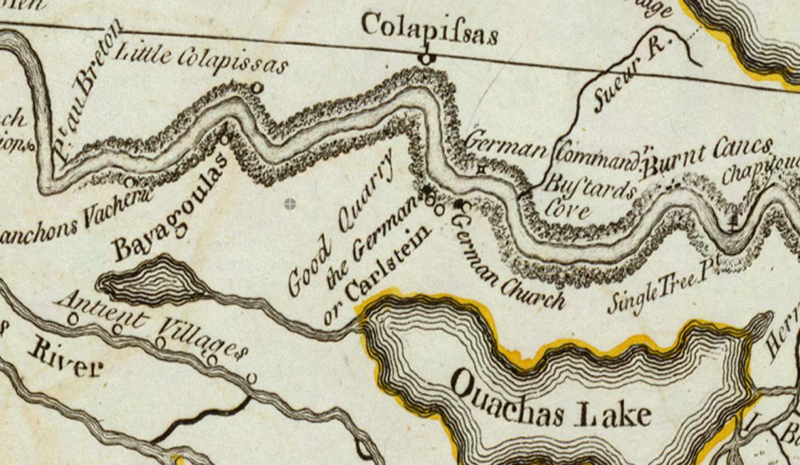
Des Allemands is an unincorporated community and census-designated place (CDP) in Lafourche and St. Charles parishes in the southeastern part of the U.S. state of Louisiana. The population was 2,179 at the 2020 census. The town, known as the "Catfish Capital of the Universe", is along the Bayou des Allemands, which is the boundary of Lafourche and St. Charles parishes. Lac des Allemands is located northwest of the town. The ZIP code for Des Allemands is 70030. The St. Charles Parish portion of Des Allemands is part of the New Orleans metropolitan statistical area, while the Lafourche Parish portion is part of the Houma– Bayou Cane–Thibodaux metropolitan statistical area. History In 1721, John Law and the Company of the Indies settled Germans along the Mississippi River, north of Ouachas Lake. The area of the Germans was called ''les Allemands'' (the Germans) or ''Karlstein''. The German Coast was in present-day St. Charles & St. John the Baptist Parishes. ' ... [...More Info...] [...Related Items...] OR: [Wikipedia] [Google] [Baidu] |
Bermuda Hundred, Virginia
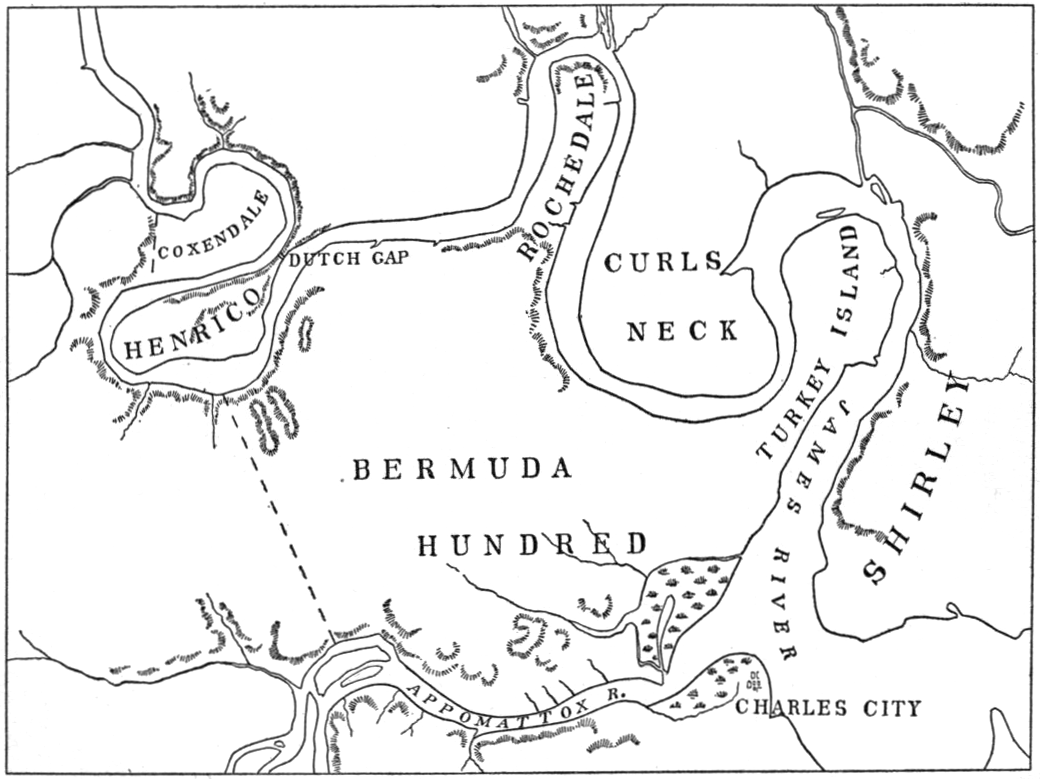
Bermuda Hundred was the first administrative division in the English colony of Virginia. It was founded by Sir Thomas Dale in 1613, six years after Jamestown. At the southwestern edge of the confluence of the Appomattox and James Rivers opposite City Point, annexed to Hopewell, Virginia in 1923, Bermuda Hundred was a port town for many years. The terminology "Bermuda Hundred" also included a large area adjacent to the town. In the colonial era, " hundreds" were large developments of many acres, arising from the English term to define an area which would support 100 homesteads. The port at the town of Bermuda Hundred was intended to serve other "hundreds" in addition to Bermuda Hundred. The area of the peninsula between the James and Appomattox Rivers on which Bermuda Hundred is located was part of the Bermuda Hundred Campaign of May 1864 during the American Civil War. No longer a shipping port, Bermuda Hundred is now a small community in the southeastern portion of Cheste ... [...More Info...] [...Related Items...] OR: [Wikipedia] [Google] [Baidu] |
Fort Monroe
Fort Monroe, managed by partnership between the Fort Monroe Authority for the Commonwealth of Virginia, the National Park Service as the Fort Monroe National Monument, and the City of Hampton, is a former military installation in Hampton, Virginia, at Old Point Comfort, the southern tip of the Virginia Peninsula, United States. Along with Fort Wool, Fort Monroe originally guarded the navigation channel between the Chesapeake Bay and Hampton Roads—the natural roadstead at the confluence of the Elizabeth, the Nansemond and the James rivers. Union General George B. McClellan landed his forces at the fort during Peninsula campaign of 1862 during the American Civil War. Until disarmament in 1946, the areas protected by the fort were the entire Chesapeake Bay and Potomac River regions, including the water approaches to the cities of Washington, D.C. and Baltimore, Maryland, along with important shipyards and naval bases in the Hampton Roads area. Surrounded by a moat, the six-side ... [...More Info...] [...Related Items...] OR: [Wikipedia] [Google] [Baidu] |
Algiers
Algiers ( ; ar, الجزائر, al-Jazāʾir; ber, Dzayer, script=Latn; french: Alger, ) is the capital and largest city of Algeria. The city's population at the 2008 Census was 2,988,145Census 14 April 2008: Office National des Statistiques de l'Algérie (web). and in 2020 was estimated to be around 4,500,000. Algiers is located on the Mediterranean Sea and in the north-central portion of Algeria. Algiers is situated on the west side of a bay of the Mediterranean Sea. The modern part of the city is built on the level ground by the seashore; the old part, the ancient city of the deys, climbs the steep hill behind the modern town and is crowned by the Casbah or citadel (a UNESCO World Heritage Site), above the sea. The casbah and the two quays form a triangle. Names The city's name is derived via French and Catalan ''Origins of Algiers'' by Louis Leschi, speech delivered June 16, 1941, published in ''El Djezair Sheets'', July 194History of Algeria . from the Arabic name '' ... [...More Info...] [...Related Items...] OR: [Wikipedia] [Google] [Baidu] |
Morganza, Louisiana
Morganza is an incorporated village near the Mississippi River in Pointe Coupee Parish, Louisiana, United States. The population was 610 at the 2010 census, down from 659 in 2000. It is part of the Baton Rouge Metropolitan Statistical Area. The village's zip code is 70759. The Morganza Spillway, a flood control structure between the Mississippi River and the Atchafalaya Basin, is located nearby. History Morganza takes its name from Morganza Plantation, the antebellum holding of Charles Morgan, an early surveyor, political figure and first American sheriff of Pointe Coupee Parish. Morgan, the son of James Morgan from a town of the family's name in Sayreville, New Jersey, and a captain in the Second Regiment of the Middlesex County (N.J.) militia during the Revolutionary War. Evidence indicates he was involved in the transfer of slaves from New Jersey to Louisiana in conflict with New Jersey law. The U.S. Post Office opened in 1847, closed some years later, and reopened in 1899. ... [...More Info...] [...Related Items...] OR: [Wikipedia] [Google] [Baidu] |
Camp Parapet
Camp Parapet was a Civil War fortification at Shrewsbury, Jefferson Parish, Louisiana, a bit more than a mile upriver from the current city limits of New Orleans. History The fortification consisted of a Confederate defensive line about a mile and 3/4 long stretching from the Mississippi River northward to Metairie Ridge. (The area farther north from the ridge to Lake Pontchartrain was at the time swampland.) This was intended to protect the city of New Orleans from Union attack from upriver. As the Union fleet took the city by sailing in from below, the fortification was never used. After the capture of New Orleans, U.S. forces garrisoned and expanded the fortifications to defend against a Confederate counter-attack, which never came. Under Union control, the Camp lay in the district of Brigadier General Thomas W. Sherman. In late-September 1862, Halbert E. Paine, captain of the 4th Wisconsin Infantry Regiment, assumed command of the camp. George H. Hanks, a lieutenant in the 1 ... [...More Info...] [...Related Items...] OR: [Wikipedia] [Google] [Baidu] |
Franklin, Louisiana
Franklin is a small city in and the parish seat of St. Mary Parish, Louisiana, United States. The population was 7,660 at the 2010 census. The city is located on Bayou Teche, southeast of the cities of Lafayette, () and New Iberia () and ) northwest of Morgan City. It is part of the Morgan City Micropolitan Statistical Area and the larger Lafayette-Acadiana combined statistical area. History Franklin, named for Benjamin Franklin, was founded in 1808 as the "Carlin's Settlement" by French-born pioneer Joseph Carlin and his family. It became the parish seat in 1811 and the town was incorporated in 1820. Though early settlers included French, Acadian, German, Danish and Irish, the town's culture and architecture is heavily influenced by the unusually large numbers of English that chose to settle there after the Louisiana Purchase in 1803. Numerous large sugar plantations arose in the area, and with the development of steam-boating, Franklin became an interior sugar port. With ... [...More Info...] [...Related Items...] OR: [Wikipedia] [Google] [Baidu] |
New Iberia, Louisiana
New Iberia (french: La Nouvelle-Ibérie; es, Nueva Iberia) is the largest city in and parish seat of Iberia Parish, Louisiana, Iberia Parish in the U.S. state of Louisiana. The city of New Iberia is located approximately southeast of Lafayette, Louisiana, Lafayette, and forms part of the Lafayette metropolitan area, Louisiana, Lafayette metropolitan statistical area in the region of Acadiana. The 2020 United States census tabulated a population of 28,555. New Iberia is served by a major four lane highway, being U.S. 90 (future Interstate 49), and has its own general aviation airfield, Acadiana Regional Airport. Scheduled passenger and cargo airline service is available via the nearby Lafayette Regional Airport located adjacent to U.S. 90 in Lafayette. History New Iberia dates its founding to the spring of 1779, when a group of some 500 colonists (''Province of Málaga, Malagueños'') from Spain, led by Francisco Bouligny, Lt. Col. Francisco Bouligny, came up Bayou Teche and sett ... [...More Info...] [...Related Items...] OR: [Wikipedia] [Google] [Baidu] |
Second Battle Of Sabine Pass
The Second Battle of Sabine Pass (September 8, 1863) was a failed Union Army attempt to invade the Confederate state of Texas during the American Civil War. The Union Navy supported the effort and lost three gunboats during the battle, two captured and one destroyed. It has often been credited as the war's most one-sided Confederate victory. Confederate President Jefferson Davis wrote in 1876 that he "considered the econdbattle of Sabine pass the most remarkable in military history." Background France was openly sympathetic to the Confederate States of America early in the Civil War, but never matched its sympathy with diplomatic or military action. After Mexican forces were defeated by French forces in summer 1863, Mexican president Benito Juárez escaped the capital, and the French installed Austrian Maximilian as "Emperor". With a de facto French government bordering Texas on the south across the Rio Grande, the Confederates hoped to establish a formal route between Texas a ... [...More Info...] [...Related Items...] OR: [Wikipedia] [Google] [Baidu] |
Port Hudson, Louisiana
Port Hudson is an unincorporated community in East Baton Rouge Parish, Louisiana, United States. Located about northwest of Baton Rouge, it is known primarily as the location of an American Civil War battle, the siege of Port Hudson, in 1863. Geography Port Hudson is located at , and is along the east bank of the Mississippi River. History In 1833, one of the first railroads in the United States was built from Port Hudson to Clinton. Clinton was the entrepôt for the produce of much of the region, which, sent by rail, was transferred to steamboats at Port Hudson. Old Port Hudson was incorporated as a town in 1838. During the American Civil War, the area was the scene of bitter fighting as the Confederacy and Union struggled over control of the Mississippi River (see Siege of Port Hudson). Location of the tracks and the old town can be seen at the bend of the Mississippi River (view 1864 map). The rails and crossties of the track were removed before 1920. What were then c ... [...More Info...] [...Related Items...] OR: [Wikipedia] [Google] [Baidu] |
Amite River
The Amite River (french: Rivière Amite) is a tributary of Lake Maurepas in Mississippi and Louisiana in the United States. It is about long. It starts as two forks in southwestern Mississippi and flows south through Louisiana, passing Greater Baton Rouge, Louisiana, Baton Rouge, to Lake Maurepas. The lower of the river is navigable. A portion of the river is diverted via the Petite Amite River and Amite Diversion Canal to the Blind River (Louisiana), Blind River, which also flows to Lake Maurepas. Name ''Amite'' could be an name derived from the Choctaw language meaning "young", although folk etymology holds it to be a corruption of the French ''amitié'' meaning "friendship". Gallery An excursion steamer on the Amite River in Louisiana (circa 1895).jpg, An excursion steamer on the Amite River, c. 1895 See also *2016 Louisiana floods *List of Louisiana rivers *List of rivers of Mississippi References External linksAmite River Basin Commission [...More Info...] [...Related Items...] OR: [Wikipedia] [Google] [Baidu] |


