|
┼īmiya-shuku
was the fourth of the sixty-nine stations of the Nakasend┼Ź. It is located in the ┼īmiya ward and Kita ward of the present-day city of Saitama, Saitama Prefecture, Japan. History Larger than its two neighboring post towns, Urawa-shuku and Ageo-shuku, ┼īmiya-shuku was recorded to have had a population of over 1,500 people with over 300 homes during the Tenp┼Ź era.┼īmiya-shuku Saitama Chamber of Commerce and Industry. Accessed July 20, 2007. It also had the largest number (nine) of secondary '''' along the Nakasend┼Ź. Neighboring post towns ;Nakasend┼Ź : |
Ageo-shuku
was the fifth of the sixty-nine stations of the Nakasend┼Ź highway connecting Edo with Kyoto during the Edo period. It was located in the present-day city of Ageo, Saitama Prefecture, Japan. History The name "Ageo" appears as the name of a locality in Musashi Province in late Sengoku period documents, as a rest area was built by the Later H┼Źj┼Ź clan when they came into control of the area. Ageo-shuku became formalized as a post station on the Nakasend┼Ź under the Tokugawa shogunate in 1603. Per an 1843 guidebook issued by the , the town stretched for about 1.1 kilometers along the highway, with a population of 793 (372 men, 421 women), and boasted one ''honjin'', three ''waki-honjin,'' one '' tonya'' and 41 ''hatago''. Ageo-shuku was approximately 10 ''ri'' from the starting point of the Nakasend┼Ź at Nihonbashi, which was the approximate distance the average traveler could walk in one day. Ageo-shuku was also famous for its large number of ''meshimori onna'' and numerous '' ... [...More Info...] [...Related Items...] OR: [Wikipedia] [Google] [Baidu] |
Urawa-shuku
was the third of the sixty-nine stations of the Nakasend┼Ź. It is located in Urawa-ku in the present-day city of Saitama, Saitama Prefecture, Japan. Its stone ruins can be found 300 meters from Tsuki Shrine (Ķ¬┐ńź×ńżŠ ''Tsuki Jinja'').Nakasend┼Ź Hitori Aruku Ki: Urawa-shuku . Hide-san. Accessed July 17, 2007. Presently, there is a flea market that takes place on the fourth Saturday of every month in Urawa-shuku's Tsuki Shrine.Urawa-juku, Furusato-shi . Gojyaku. Accessed July 17, 2007. Neighboring Post Towns ;N ...[...More Info...] [...Related Items...] OR: [Wikipedia] [Google] [Baidu] |
69 Stations Of The Nakasend┼Ź
The are the rest areas along the Nakasend┼Ź, which ran from Nihonbashi in Edo (modern-day Tokyo) to Sanj┼Ź ┼īhashi in Kyoto.Yama to Keikoku Publishing (2006). Nakasend┼Ź o Aruku (Revised ed.). Osaka: Yama to Keikoku Publishing. .Nakasend┼Ź J┼Źh┼Ź . NEC Corporation. Accessed August 18, 2007. The route stretched approximately and was an alternate to the T┼Źkaid┼Ź. 
|
┼īmiya-ku, Saitama
is one of ten wards of the city of Saitama, in Saitama Prefecture, Japan, and is located in the northeastern part of the city. , the ward had an estimated population of 119,298 and a population density of 9,300 persons per km┬▓. Its total area was . Although Urawa-ku is the governmental center of Saitama City, ┼īmiya-ku is the most active commercial and business centre in both Saitama City and Saitama Prefecture thanks to its transport infrastructure, especially railways connected at ┼īmiya Station. Geography ┼īmiya Ward is within the ┼īmiya Terrace of the Kant┼Ź plain, in the center of Saitama City. It is in the Greater Tokyo Area and about 25 km north of central Tokyo. Neighboring Municipalities ┼īmiya-ku is surrounded by Nishi-ku (to the west), Kita-ku (north), Minuma-ku (east), Urawa-ku (southeast), Ch┼½┼Ź-ku (south), and Sakura-ku (southwest). History ┼īmiya derives its name from a famous Shinto shrine, the Hikawa Shrine, which has been a place of pilgrimage ... [...More Info...] [...Related Items...] OR: [Wikipedia] [Google] [Baidu] |
The Sixty-nine Stations Of The Kiso Kaid┼Ź
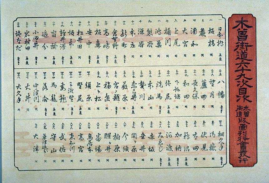
The or ''Sixty-nine Stations of the Kiso Road'', is a series of ''ukiyo-e'' works created by Utagawa Hiroshige and Keisai Eisen. There are 71 total prints in the series (one for each of the 69 post stations and Nihonbashi; Nakatsugawa-juku has two prints). The common name for the Kiso Kaid┼Ź is "Nakasend┼Ź" so the series is sometimes referred to as the ''Sixty-nine Stations of the Nakasend┼Ź''. It is a follow up to Hiroshige's ''The Fifty-three Stations of the T┼Źkaid┼Ź'' and he produced 47 of the prints, with Eisen being responsible for the rest.Hiroshige - Kisokaido www.hiroshige.org.uk. Accessed November 1, 2017. The series was published by Iseya Rihei (Kinjud┼Ź) from .Forrer The Naka ...
|
Keisai Eisen
Keisai Eisen (µĖōµ¢Ä Ķŗ▒µ│ē, 1790ŌĆō1848) was a Japanese ''ukiyo-e'' artist who specialised in ''bijin-ga'' (pictures of beautiful women). His best works, including his ''┼Źkubi-e'' ("large head pictures"), are considered to be masterpieces of the "decadent" Bunsei Era (1818–1830). He was also known as Ikeda Eisen, and wrote under the name of Ippitsuan. Biography Eisen was born in Edo into the Ikeda family, the son of a noted calligrapher. He was apprenticed to Kan┼Ź Hakkeisai, from whom he took the name Keisai, and after the death of his father he studied under Kikugawa Eizan. His initial works reflected the influence of his mentor, but he soon developed his own style. He produced a number of ''surimono'' (prints that were privately issued), erotic prints, and landscapes, including ''The Sixty-nine Stations of the Kiso Kaid┼Ź'', which he started and which was completed by Hiroshige. Eisen is most renowned for his ''bijin-ga'' (pictures of beautiful women) which portraye ... [...More Info...] [...Related Items...] OR: [Wikipedia] [Google] [Baidu] |
Saitama Prefecture
is a landlocked prefecture of Japan located in the Kant┼Ź region of Honshu. Saitama Prefecture has a population of 7,338,536 (1 January 2020) and has a geographic area of 3,797 km2 (1,466 sq mi). Saitama Prefecture borders Tochigi Prefecture and Gunma Prefecture to the north, Nagano Prefecture to the west, Yamanashi Prefecture to the southwest, Tokyo to the south, Chiba Prefecture to the southeast, and Ibaraki Prefecture to the northeast. Saitama is the capital and largest city of Saitama Prefecture, with other major cities including Kawaguchi, Kawagoe, and Tokorozawa. Saitama Prefecture is part of the Greater Tokyo Area, the most populous metropolitan area in the world, and many of its cities are described as bedroom communities and suburbs of Tokyo with many residents commuting into the city each day. History According to ''Sendai Kuji Hongi'' (''Kujiki''), Chichibu was one of 137 provinces during the reign of Emperor Sujin. Chichibu Province was in western Saitama. ... [...More Info...] [...Related Items...] OR: [Wikipedia] [Google] [Baidu] |
Honjin
The ''honjin'' at Inaba Kaid┼Ź's ┼īhara-shuku.">┼īhara-shuku.html" ;"title="Inaba Kaid┼Ź's ┼īhara-shuku">Inaba Kaid┼Ź's ┼īhara-shuku. is the Japanese word for an inn for government officials, generally located in post stations (''shukuba'') during the later part of the Edo period. Evolution of ''Honjin'' Originally, ''honjin'' were places from which generals directed battles and, therefore, were fleeting in nature. However, as commanders began to transform the ''honjin'' into temporary lodgings during battle and travel, ''honjin'' came to be places where ''daimy┼Ź'' and other representatives of the shogunate, including ''hatamoto'', ''monzeki'', etc., were allowed to stay during their travels. Many of the ''honjin'' were actually personal residences of village and town leaders. As such, they received official designations from the government and expanded their residences to include walls, gates and other features. Because of their cooperation, the owners of the ''honjin'' also ... [...More Info...] [...Related Items...] OR: [Wikipedia] [Google] [Baidu] |
Tenp┼Ź
was a after ''Bunsei'' and before ''K┼Źka.'' The period spanned from December 1830 through December 1844. The reigning emperor was . Introduction Change of era * December 10, 1830 () : In the 13th year of ''Bunsei'', the new era name of ''Tenp┼Ź'' (meaning "Heavenly Imperial Protection") was created to mark the disasters of a great fire in Edo and an earthquake at Kyoto. The new era name was created from an hortatory aphorism: "Respect and worship the Ways of heaven. Eternally keep the Mandate of Heaven" (µ¼ĮÕ┤ćÕż®ķüōŃĆüµ░Ėõ┐ØÕż®ÕæĮ). The Tenp┼Ź era is often described as the beginning of the end of bakufu government. Though the era accomplished much through its reforms, and also culturally speaking, the injury inflicted on the Tokugawa system of government during the Tenp┼Ź period was unparalleled. Public order and dissatisfaction with government was a main issue, but the bakufu was not entirely at fault for the stir amongst the people. For example, the failure of crops in ... [...More Info...] [...Related Items...] OR: [Wikipedia] [Google] [Baidu] |
Japan
Japan ( ja, µŚźµ£¼, or , and formally , ''Nihonkoku'') is an island country in East Asia. It is situated in the northwest Pacific Ocean, and is bordered on the west by the Sea of Japan, while extending from the Sea of Okhotsk in the north toward the East China Sea, Philippine Sea, and Taiwan in the south. Japan is a part of the Ring of Fire, and spans Japanese archipelago, an archipelago of List of islands of Japan, 6852 islands covering ; the five main islands are Hokkaido, Honshu (the "mainland"), Shikoku, Kyushu, and Okinawa Island, Okinawa. Tokyo is the Capital of Japan, nation's capital and largest city, followed by Yokohama, Osaka, Nagoya, Sapporo, Fukuoka, Kobe, and Kyoto. Japan is the List of countries and dependencies by population, eleventh most populous country in the world, as well as one of the List of countries and dependencies by population density, most densely populated and Urbanization by country, urbanized. About three-fourths of Geography of Japan, the c ... [...More Info...] [...Related Items...] OR: [Wikipedia] [Google] [Baidu] |
Kita-ku, Saitama
250px, ┼īmiya Bonsai Village is one of ten wards of the city of Saitama, in Saitama Prefecture, Japan, and is located in the northwestern part of the city. , the ward had an estimated population of 148,935 and a population density of 8800 persons per km┬▓. Its total area was . Geography Kita-ward is located in the northwestern side of the city of Saitama. Neighboring Municipalities Saitama Prefecture *Ageo * Nishi-ku * ┼īmiya-ku * Minuma-ku History The villages of ┼īsato, Nisshin, and Miyahara were created within Kitaadachi District, Saitama with the establishment of the municipalities system on April 1, 1889. The three villages were merged with ┼īmiya Town in 1940, becoming part of the city of ┼īmiya. On May 1, 2001, ┼īmiya merged with Urawa and Yono cities to form the new city of Saitama. When Saitama was proclaimed a designated city in 2003, the northwestern portion of former ┼īmiya city consisting of the three former villages and a portion of the original ┼īmiya villag ... [...More Info...] [...Related Items...] OR: [Wikipedia] [Google] [Baidu] |
Saitama, Saitama
is the capital and the most populous city of Saitama Prefecture, Japan. Its area incorporates the former cities of Urawa, ┼īmiya, Yono and Iwatsuki. It is a city designated by government ordinance. Being in the Greater Tokyo Area and lying 15 to 30 kilometres north of central Tokyo, many of its residents commute into Tokyo. , the city had an estimated population of 1,324,854, and a population density of 6,093 people per km┬▓ (15,781 people per mi┬▓). Its total area is . Etymology The name "Saitama" originally comes from the of what is now the city of Gy┼Źda in the northern part of what is now known as Saitama Prefecture. "Sakitama" has an ancient history and is mentioned in the famous 8th century poetry anthology '' Man'y┼Źsh┼½''. The pronunciation has changed from Sakitama to Saitama over the years. With the merger of Urawa, ┼īmiya, and Yono it was decided that a new name, one fitting for this newly created prefectural capital, was needed. The prefectural name was chan ... [...More Info...] [...Related Items...] OR: [Wikipedia] [Google] [Baidu] |


