|
ĹŚkura, Yamagata
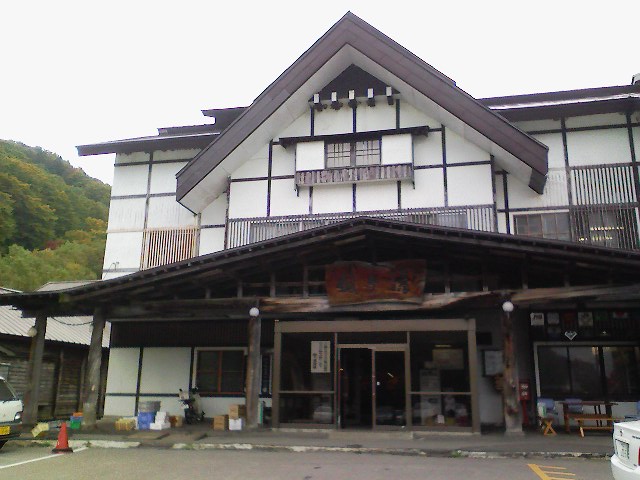
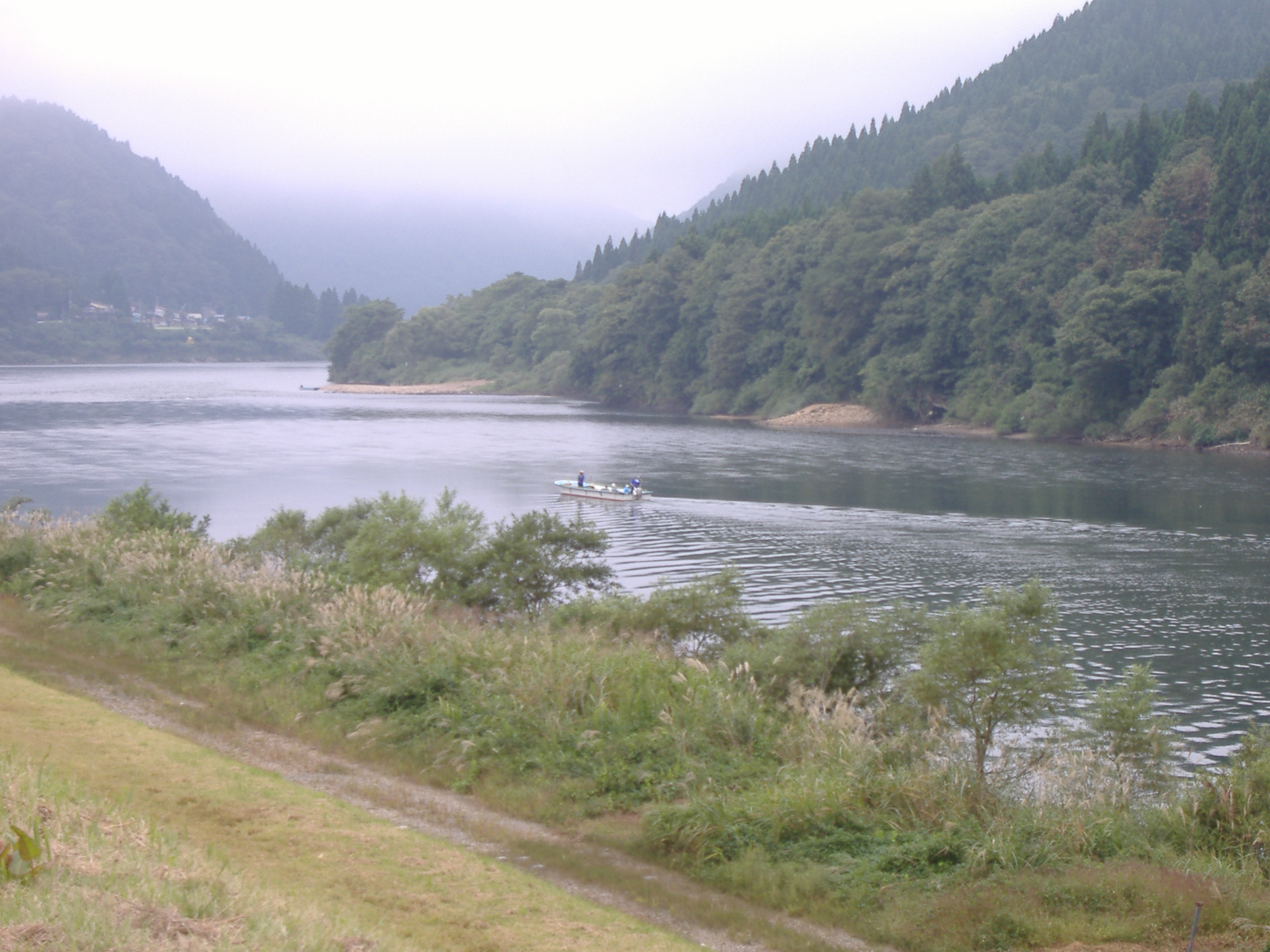
270px, Hijiri onsen in ĹŚkura is a village in Yamagata Prefecture, Japan. As of January 2020, the village has an estimated population of 3044, and a population density of 14 persons per km2. The total area is . Geography ĹŚkura is located in a mountainous north-central eastern Yamagata Prefecture, and includes Mount Gassan within its borders. The Mogami River runs through the village. The area is known for extremely heavy snows in winter. Its highest accumulation of snow recorded is 414 cm, second place in Japan after Sukayu Onsen in Aomori. Snow typically starts in November, and starts piling up on the ground by early December. The snow will usually stop by early May, but will not completely melt until mid-June. Similar to Sukayu Onsen, snowfalls of 50 to 100 cm in a single day are not uncommon at all. Neighboring municipalities *Yamagata Prefecture ** ShinjĹŤ ** Murayama **Sagae ** Funagata ** Tozawa ** ShĹŤnai ** Nishikawa Demographics Per Japanese census data, the ... [...More Info...] [...Related Items...] OR: [Wikipedia] [Google] [Baidu] |
Villages Of Japan
A is a local administrative unit in Japan. It is a local public body along with , , and . Geographically, a village's extent is contained within a prefecture. It is larger than an actual settlement, being in actuality a subdivision of a rural , which are subdivided into towns and villages with no overlap and no uncovered area. As a result of mergers and elevation to higher statuses, the number of villages in Japan is decreasing. Currently, 13 prefectures no longer have any villages: Tochigi (since March 20, 2006), Fukui (since March 3, 2006), Ishikawa (since March 1, 2005), Shizuoka (since July 1, 2005), HyĹŤgo (since April 1, 1999), Mie (since November 1, 2005), Shiga (since January 1, 2005), Hiroshima (since November 5, 2004), Yamaguchi (since March 20, 2006), Ehime (since January 16, 2005), Kagawa (since April 1, 1999), Nagasaki (since October 1, 2005), and Saga (since March 20, 2006). The six villages in the Northern Territories dispute and Atarashiki-mura (whic ... [...More Info...] [...Related Items...] OR: [Wikipedia] [Google] [Baidu] |
Sukayu Onsen
is an ''onsen'' (hot spring) in the HakkĹŤda Mountains in the city of Aomori, Aomori Prefecture in Japan. It is known for its "Sen-nin-buro" or "1,000-person bath", a large mixed gender public bath. Climate Sukayu Onsen is the snowiest inhabited place on Earth with an average yearly snowfall of and a winter season record of . It also holds the record of having the highest snow depth ever recorded at a JMA certified weather station of , recorded on February 26, 2013. Despite the extremely high snowfall, Sukayu Onsen is accessible by road all year round. Sukayu Onsen, despite the incredibly high yearly snowfall, has a humid continental climate (Dfb), and is one of the coldest and snowiest inhabited places in Japan. Summers are generally short, but mild to warm with many rainy days. Winters are cold by Japanese standards and extremely snowy, due to the high elevation and the Aleutian Low The Aleutian Low is a semi-permanent low-pressure system located near the Aleutian Islands ... [...More Info...] [...Related Items...] OR: [Wikipedia] [Google] [Baidu] |
Edo Period
The or is the period between 1603 and 1867 in the history of Japan, when Japan was under the rule of the Tokugawa shogunate and the country's 300 regional '' daimyo''. Emerging from the chaos of the Sengoku period, the Edo period was characterized by economic growth, strict social order, isolationist foreign policies, a stable population, perpetual peace, and popular enjoyment of arts and culture. The period derives its name from Edo (now Tokyo), where on March 24, 1603, the shogunate was officially established by Tokugawa Ieyasu. The period came to an end with the Meiji Restoration and the Boshin War, which restored imperial rule to Japan. Consolidation of the shogunate The Edo period or Tokugawa period is the period between 1603 and 1867 in the history of Japan, when Japan was under the rule of the Tokugawa shogunate and the country's regional '' daimyo''. A revolution took place from the time of the Kamakura shogunate, which existed with the TennĹŤ's court, to the Tok ... [...More Info...] [...Related Items...] OR: [Wikipedia] [Google] [Baidu] |
Mogami Clan
were Japanese ''daimyĹŤs'', and were a branch of the Ashikaga family. In the Sengoku period, they were the Sengoku ''daimyĹŤs'' who ruled Dewa Province which is now Yamagata Prefecture and part of Akita Prefecture. The Mogami clan is derived from the Shiba clan_that_was_a_branch_of_the_Ashikaga_clan._In_1354,_Shiba_Iekane.html" ;"title="DF 58 of 80/nowiki>">DF 58 of 80">("Shi ... that was a branch of the Ashikaga clan. In 1354, Shiba Iekane">DF 58 of 80/nowiki>">DF 58 of 80">("Shi ... that was a branch of the Ashikaga clan. In 1354, Shiba Iekane (斯波家兼) got orders from Ashikaga Takauji, and fought against the Southern Court (南朝) army in ĹŚu (奥羽) region, TĹŤhoku region now. In 1356, Iekane sent his son Shiba Kaneyori (ć–Żćł˘ĺ…Ľé Ľ) to the Yamagata basin as a measure to cope with the Southern Court army. Kaneyori built Yamagata Castle in about 1360, and won against the Southern Court army in 1367. After that, he settled there and took the name "Mogami", from the t ... [...More Info...] [...Related Items...] OR: [Wikipedia] [Google] [Baidu] |
Sengoku Period
The was a period in History of Japan, Japanese history of near-constant civil war and social upheaval from 1467 to 1615. The Sengoku period was initiated by the ĹŚnin War in 1467 which collapsed the Feudalism, feudal system of Japan under the Ashikaga shogunate. Various samurai warlords and Japanese clans, clans fought for control over Japan in the power vacuum, while the emerged to fight against samurai rule. The Nanban trade, arrival of Europeans in 1543 introduced the arquebus into Japanese warfare, and Japan ended its status as a Tributary system of China, tributary state of China in 1549. Oda Nobunaga dissolved the Ashikaga shogunate in 1573 and launched a war of political unification by force, including the Ishiyama Hongan-ji War, until his death in the HonnĹŤ-ji Incident in 1582. Nobunaga's successor Toyotomi Hideyoshi completed his campaign to unify Japan and consolidated his rule with numerous influential reforms. Hideyoshi launched the Japanese invasions of Korea (159 ... [...More Info...] [...Related Items...] OR: [Wikipedia] [Google] [Baidu] |
Dewa Province
was a province of Japan comprising modern-day Yamagata Prefecture and Akita Prefecture, except for the city of Kazuno and the town of Kosaka. Dewa bordered on Mutsu and Echigō Provinces. Its abbreviated form name was . History Early period Prior to the Asuka period, Dewa was inhabited by Ainu or Emishi tribes, and was effectively outside of the control of the Yamato dynasty. Abe no Hirafu conquered the native Emishi tribes at what are now the cities of Akita and Noshiro in 658 and established a fort on the Mogami River. In 708 AD was created within Echigō Province. The area of Dewa District was roughly that of the modern Shōnai area of Yamagata Prefecture, and was gradually extended to the north as the Japanese pushed back the indigenous people of northern Honshū. Dewa District was promoted to the status of a province () in 712 AD, and gained Okitama and Mogami Districts, formerly part of Mutsu Province. A number of military expeditions were sent to the area, with ar ... [...More Info...] [...Related Items...] OR: [Wikipedia] [Google] [Baidu] |
Köppen Climate Classification
The Köppen climate classification is one of the most widely used climate classification systems. It was first published by German-Russian climatologist Wladimir Köppen (1846–1940) in 1884, with several later modifications by Köppen, notably in 1918 and 1936. Later, the climatologist Rudolf Geiger (1894–1981) introduced some changes to the classification system, which is thus sometimes called the Köppen–Geiger climate classification system. The Köppen climate classification divides climates into five main climate groups, with each group being divided based on seasonal precipitation and temperature patterns. The five main groups are ''A'' (tropical), ''B'' (arid), ''C'' (temperate), ''D'' (continental), and ''E'' (polar). Each group and subgroup is represented by a letter. All climates are assigned a main group (the first letter). All climates except for those in the ''E'' group are assigned a seasonal precipitation subgroup (the second letter). For example, ''Af'' indi ... [...More Info...] [...Related Items...] OR: [Wikipedia] [Google] [Baidu] |
Humid Continental Climate
A humid continental climate is a climatic region defined by Russo-German climatologist Wladimir Köppen in 1900, typified by four distinct seasons and large seasonal temperature differences, with warm to hot (and often humid) summers and freezing cold (sometimes severely cold in the northern areas) winters. Precipitation is usually distributed throughout the year but often do have dry seasons. The definition of this climate regarding temperature is as follows: the mean temperature of the coldest month must be below or depending on the isotherm, and there must be at least four months whose mean temperatures are at or above . In addition, the location in question must not be semi-arid or arid. The cooler ''Dfb'', ''Dwb'', and ''Dsb'' subtypes are also known as hemiboreal climates. Humid continental climates are generally found between latitudes 30° N and 60° N, within the central and northeastern portions of North America, Europe, and Asia. They are rare and isolat ... [...More Info...] [...Related Items...] OR: [Wikipedia] [Google] [Baidu] |
Nishikawa, Yamagata
file:SagaeDamLake2.JPG, 270px, Sagae Dam Reservoir is a Towns of Japan, town located in Yamagata Prefecture, Japan. , the town had an estimated population of 5,225 in 1851 households, and a population density of 145.1 persons per km². The total area of the town is . Geography Nishikawa is located in mountainous central Yamagata and includes Mount Gassan and Mount Asahi (Yamagata), Mount Asahi within its borders. The Sagae River passes through the town. Part of the town is within the borders of the Bandai-Asahi National Park. Neighboring municipalities *Yamagata Prefecture **Sagae, Yamagata, Sagae **Tsuruoka, Yamagata, Tsuruoka **Ōe, Yamagata, Ōe **Asahi, Yamagata, Asahi **Oguni, Yamagata, Oguni **Shōnai, Yamagata, Shōnai **Ōkura, Yamagata, Ōkura *Niigata Prefecture **Murakami, Niigata, Murakami Climate Nishikawa has a Humid continental climate (Köppen climate classification ''Dfb'') with large seasonal temperature differences, with warm to hot (and often humid) summers an ... [...More Info...] [...Related Items...] OR: [Wikipedia] [Google] [Baidu] |
ShĹŤnai, Yamagata
is a Towns of Japan, town located in Yamagata Prefecture, Japan. , the town has an estimated population of 20,940 in 7108 households, and a population density of 87.5 per km². The total area of the town is . Geography Shōnai is located in the coastal plains of north-central Yamagata Prefecture. The Mogami River flows through the town. Mount Gassan, the highest of the Three Mountains of Dewa is at the intersection of the borders of Shōnai, Tsuruoka, Ōkura and Nishikawa. Neighboring municipalities *Yamagata Prefecture **Tsuruoka, Yamagata, Tsuruoka **Sakata, Yamagata, Sakata **Mikawa, Yamagata, Mikawa **Tozawa, Yamagata, Tozawa **Ōkura, Yamagata, Ōkura **Nishikawa, Yamagata, Nishikawa Climate Shōnai has a Humid continental climate (Köppen climate classification ''Cfa'') with large seasonal temperature differences, with warm to hot (and often humid) summers and cold (sometimes severely cold) winters. Precipitation is significant throughout the year, but is heaviest from Aug ... [...More Info...] [...Related Items...] OR: [Wikipedia] [Google] [Baidu] |
Tozawa, Yamagata
is a village located in Yamagata Prefecture, Japan. , the village had an estimated population of 4.431 in 1602 households, and a population density of 17 persons per km². The total area of the village is . Geography Tozawa is located in north-central eastern Yamagata Prefecture, bordered to the east by the Dewa Mountains. The Mogami River runs through the village. Neighboring municipalities *Yamagata Prefecture ** Shinjō ** Sakata ** Sakegawa ** Shōnai ** Ōkura Climate Tozawa has a Humid continental climate (Köppen climate classification ''Cfa'') with large seasonal temperature differences, with warm to hot (and often humid) summers and cold (sometimes severely cold) winters. Precipitation is significant throughout the year, but is heaviest from August to October. The average annual temperature in Tozawa is 11.1 °C. The average annual rainfall is 1877 mm with September as the wettest month. The temperatures are highest on average in August, at around 24.6&n ... [...More Info...] [...Related Items...] OR: [Wikipedia] [Google] [Baidu] |
Funagata, Yamagata
is a town located in Yamagata Prefecture, Japan. , the town has an estimated population of 5,101, and a population density of 43 persons per km². The total area of the town is . Geography Funagata is located in mountainous north-central eastern Yamagata Prefecture. The Mogami River runs through the town. The area is known for extremely heavy snowfall in winter. Neighboring municipalities *Yamagata Prefecture ** Shinjō ** Obanazawa ** Murayama ** Mogami ** Ōkura **Ōishida Climate Funagata has a Humid continental climate (Köppen climate classification ''Cfa'') with large seasonal temperature differences, with warm to hot (and often humid) summers and cold (sometimes severely cold) winters. Precipitation is significant throughout the year, but is heaviest from August to October. The average annual temperature in Funagata is 11.2 °C. The average annual rainfall is 1785 mm with September as the wettest month. The temperatures are highest on average in August, at arou ... [...More Info...] [...Related Items...] OR: [Wikipedia] [Google] [Baidu] |


