|
┼īkato
┼īkato is a small town in rural Taranaki, New Zealand. It is situated about 25 minutes drive around the coast from New Plymouth on State Highway 45. Oakura is 12 km to the north-east, and Warea is 9 km to the south-west. The place offers popular rocky surfing spots around coastal beaches. The town was established as a military settlement in the 1860s. The New Zealand Ministry for Culture and Heritage gives a translation of "place of Kato" for . While "Kato" was probably a personal name, an alternative translation is "place of full tide/tsunami". In July 2020, the name of the locality was officially gazetted as ┼īkato by the New Zealand Geographic Board. ┼īkato has all the elements of a New Zealand rural community with sporting facilities (rugby grounds, bowling club, squash courts, tennis courts and swimming pool), Coastal Taranaki School, a police station, and a volunteer fire brigade. ┼īkato was also notable as the home of Okato Cheese which was manufactured by ... [...More Info...] [...Related Items...] OR: [Wikipedia] [Google] [Baidu] |
Coastal Taranaki School
By the whole community, the child will blossom. , established = 2005 , principal = Scott Walden , address = Carthew StreetPO Box 8┼īkatoTaranaki , coordinates = , type = State coed, years 0ŌĆō13 , roll = () , decile = 7 , MOE = 551 , homepage www.coastaltaranaki.school.nz Coastal Taranaki School is a rural area school located in ┼īkato, Taranaki Taranaki is a region in the west of New Zealand's North Island. It is named after its main geographical feature, the stratovolcano of Mount Taranaki, also known as Mount Egmont. The main centre is the city of New Plymouth. The New Plymouth Dist ..., New Zealand. Established in 2005, the school formed through the merger of a number of small primary schools and Okato College. As an area school, Coastal Taranaki School caters for the educational needs of students year 0 to 13. Notes External links Official WebsiteCoastal Taranaki School Knowledge Net {{Authority control New Plymouth District Pri ... [...More Info...] [...Related Items...] OR: [Wikipedia] [Google] [Baidu] |
New Zealand State Highway 45
State Highway 45 (SH 45) is a New Zealand state highway which has the moniker of the ''Surf Highway'' due to the number of prominent surfing breaks that are accessible from it. It is two-line single carriageway for most of its length, with at-grade intersections and property access' in both urban and rural areas. Route SH 45 leaves at the corner of Leach and Eliot streets north-east of the New Plymouth CBD. It then continues west along the New Plymouth one-way network (westbound Leach and Vivian streets, eastbound Powderham and Courtenay streets) then onto Devon St West and South Road exiting New Plymouth via the south-western suburbs. It then heads south-west along the Taranaki coastal plain passing through Oakura and ┼īkato. At Cape Egmont it turns south-east following the coast passing the Oaonui production station and through ┼īpunake and Manaia before terminating at the crossroad intersection of Waihi, Denby and South Roads in Hawera, where it again meets SH 3. See ... [...More Info...] [...Related Items...] OR: [Wikipedia] [Google] [Baidu] |
New Plymouth
New Plymouth ( mi, Ng─ümotu) is the major city of the Taranaki region on the west coast of the North Island of New Zealand. It is named after the English city of Plymouth, Devon from where the first English settlers to New Plymouth migrated. The New Plymouth District, which includes New Plymouth City and several smaller towns, is the 10th largest district (out of 67) in New Zealand, and has a population of ŌĆō about two-thirds of the total population of the Taranaki Region and % of New Zealand's population. This includes New Plymouth City (), Waitara (), Inglewood (), ┼īakura (), ┼īkato (561) and Urenui (429). The city itself is a service centre for the region's principal economic activities including intensive pastoral activities (mainly dairy farming) as well as oil, natural gas and petrochemical exploration and production. It is also the region's financial centre as the home of the TSB Bank (formerly the Taranaki Savings Bank), the largest of the remaining non-governm ... [...More Info...] [...Related Items...] OR: [Wikipedia] [Google] [Baidu] |
First Taranaki War
The First Taranaki War (also known as the North Taranaki War) was an armed conflict over land ownership and sovereignty that took place between M─üori people, M─üori and the New Zealand government in the Taranaki district of New Zealand's North Island from March 1860 to March 1861. The war was sparked by a dispute between the government and M─üori landowners over the sale of a property at Waitara, New Zealand, Waitara, but spread throughout the region. It was fought by more than 3,500 imperial troops brought in from Australia, as well as volunteer soldiers and militia, against M─üori forces that fluctuated between a few hundred and about 1,500. Total losses among the imperial, volunteer and militia troops are estimated to have been 238, while M─üori casualties totalled about 200, although the proportion of M─üori casualties was higher. The war ended in a ceasefire, with neither side explicitly accepting the peace terms of the other. Although there were claims by the British that ... [...More Info...] [...Related Items...] OR: [Wikipedia] [Google] [Baidu] |
Dale Copeland
Dale Devereux Copeland (born 1943) is a New Zealand collage and assemblage artist. Copeland's work is about "society's detritus" and reworking "discarded things" into art. Copeland, who is also a community art organiser, is called "the backbone of the Taranaki art scene" by the '' Taranaki Daily News.'' Career Copeland lives and works in Taranaki. She has a studio filled with found objects connected to her house near ┼īkato. Copeland is part of an artist collective in rural Taranaki called Virtual TART, and which shows their work online through the Virtual TART site. In the late 1990s, Copeland created the International Collage Exhibition and Exchange art show. In 2009, Copeland earned three Special Recognition Merit Awards for her art in the 8th Annual Summer All Media Juried Online International Art Exhibition. In 2011, Copeland and other Taranaki artists exhibited their work at the Lincoln Center in New York. The next year, Copeland was appointed a Member of the New Zeal ... [...More Info...] [...Related Items...] OR: [Wikipedia] [Google] [Baidu] |
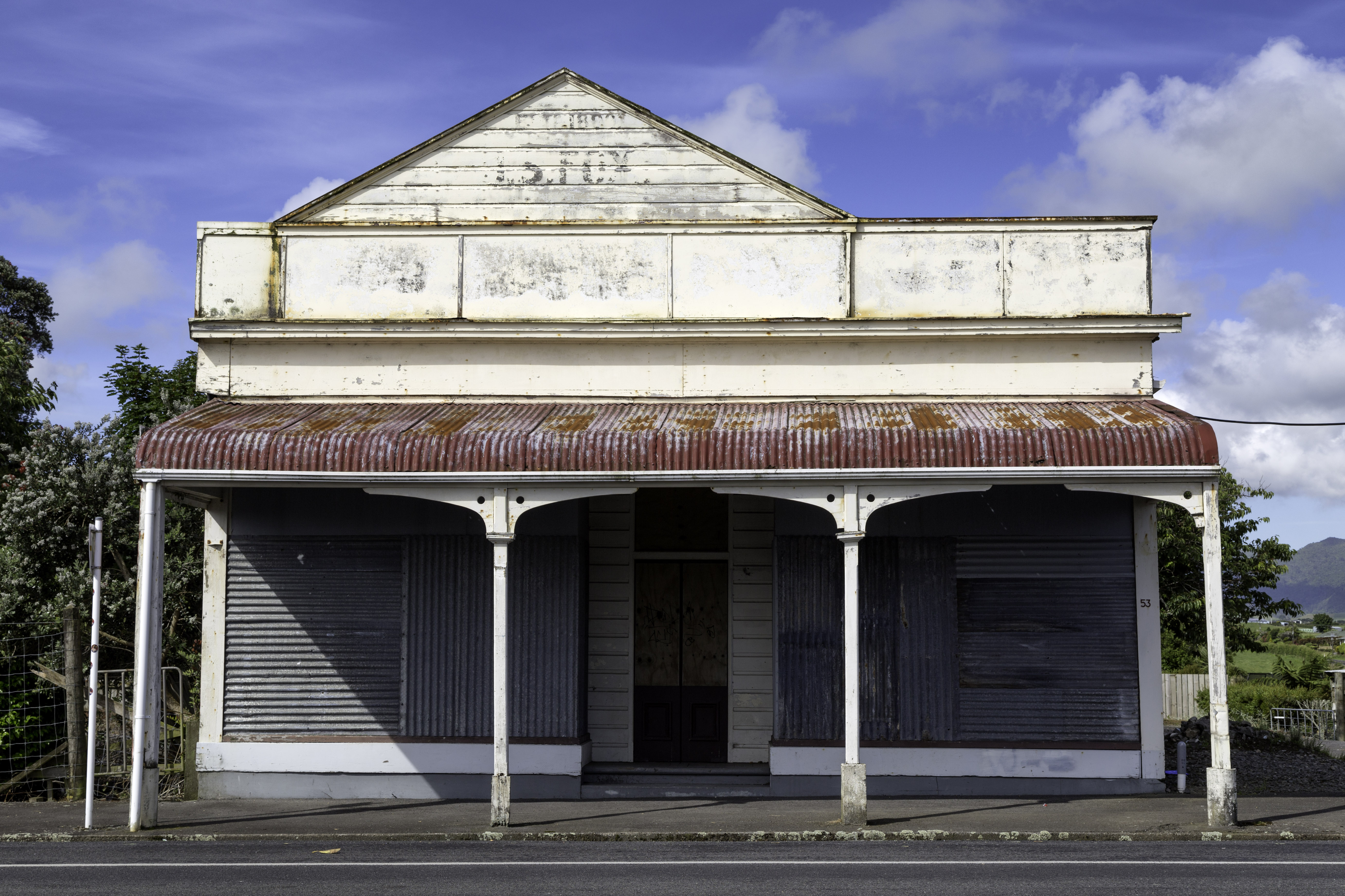
Okato Boarded Up Store
Russian Classification on Objects of Administrative DivisionThe English name of the document is given per the English title included on the document's first page. (russian: ą×ą▒čēąĄčĆąŠčüčüąĖ╠üą╣čüą║ąĖą╣ ą║ą╗ą░čüčüąĖčäąĖą║ą░╠üč鹊čĆ ąŠą▒čŖąĄ╠üą║č鹊ą▓ ą░ą┤ą╝ąĖąĮąĖčüčéčĆą░čéąĖ╠üą▓ąĮąŠ-č鹥čĆčĆąĖč鹊čĆąĖą░╠üą╗čīąĮąŠą│ąŠ ą┤ąĄą╗ąĄ╠üąĮąĖčÅ), or OKATO (russian: ą×ąÜąÉąóą×), also called All-Russian classification on units of administrative and territorial distribution in English,''Country Report of the Russian Federation'' submitted to the 12th session of the UN |
Taranaki
Taranaki is a region in the west of New Zealand's North Island. It is named after its main geographical feature, the stratovolcano of Mount Taranaki, also known as Mount Egmont. The main centre is the city of New Plymouth. The New Plymouth District is home to more than 65 per cent of the population of Taranaki. New Plymouth is in North Taranaki along with Inglewood and Waitara. South Taranaki towns include H─üwera, Stratford, Eltham, and ┼īpunake. Since 2005, Taranaki has used the promotional brand "Like no other". Geography Taranaki is on the west coast of the North Island, surrounding the volcanic peak of Mount Taranaki. The region covers an area of 7258 km2. Its large bays north-west and south-west of Cape Egmont are North Taranaki Bight and South Taranaki Bight. Mount Taranaki is the second highest mountain in the North Island, and the dominant geographical feature of the region. A M─üori legend says that Mount Taranaki previously lived with the Tongariro, Ngaur ... [...More Info...] [...Related Items...] OR: [Wikipedia] [Google] [Baidu] |
2013 New Zealand Census
The 2013 New Zealand census was the thirty-third national census. "The National Census Day" used for the census was on Tuesday, 5 March 2013. The population of New Zealand was counted as 4,242,048, ŌĆō an increase of 214,101 or 5.3% over the 2006 census. The 2013 census forms were the same as the forms developed for the 2011 census which was cancelled due to the February 2011 major earthquake in Christchurch. There were no new topics or questions. New Zealand's next census was conducted in March 2018. Collection methods The results from the post-enumeration survey showed that the 2013 census recorded 97.6 percent of the residents in New Zealand on census night. However, the overall response rate was 92.9 percent, with a non-response rate of 7.1 percent made up of the net undercount and people who were counted in the census but had not received a form. Results Population and dwellings Population counts for New Zealand regions. Note: All figures are for the census usually r ... [...More Info...] [...Related Items...] OR: [Wikipedia] [Google] [Baidu] |
Parihaka
Parihaka is a community in the Taranaki region of New Zealand, located between Mount Taranaki and the Tasman Sea. In the 1870s and 1880s the settlement, then reputed to be the largest M─üori village in New Zealand, became the centre of a major campaign of non-violent resistance to European occupation of confiscated land in the area. Armed soldiers were sent in and arrested the peaceful resistance leaders and many of the Maori residents, often holding them in jail for months without trials. The village was founded about 1866 by M─üori chiefs Te Whiti o Rongomai and Tohu K─ükahi on land seized by the government during the post-New Zealand Wars land confiscations of the 1860s. The population of the village grew to more than 2,000, attracting M─üori who had been dispossessed of their land by confiscations and impressing European visitors with its cleanliness and industry, and its extensive cultivations producing cash crops as well as food sufficient to feed its inhabitants. When an in ... [...More Info...] [...Related Items...] OR: [Wikipedia] [Google] [Baidu] |
2006 New Zealand Census
The New Zealand Census of Population and Dwellings ( mi, Te Tatauranga o ng─ü T─üngata Huri Noa i Aotearoa me ┼Ź r─ütou Whare Noho) is a national population and housing census conducted by government department Statistics New Zealand every five years. There have been 34 censuses since 1851. In addition to providing detailed information about national demographics, the results of the census play an important part in the calculation of resource allocation to local service providers. The 2018 census took place on Tuesday 6 March 2018. The next census is expected in March 2023. Census date Since 1926, the census has always been held on a Tuesday and since 1966, the census always occurs in March. These are statistically the month and weekday on which New Zealanders are least likely to be travelling. The census forms have to be returned by midnight on census day for them to be valid. Conducting the census Until 2018, census forms were hand-delivered by census workers during the lead ... [...More Info...] [...Related Items...] OR: [Wikipedia] [Google] [Baidu] |
Hangatahua River
The Hangatahua River, alternatively known as the Stony River, is a river of the Taranaki Region of New Zealand. It is one of the larger of the numerous rivers and streams which drain the slopes of Mount Taranaki, receiving water from streams covering most of the northwest sector of the mountain. In addition it drains the southern flank of the Pouakai complex and the alpine Ahukawakawa Swamp. The river's upper reaches lie within Egmont National Park. The Hangatahua River forms the boundary between New Plymouth District and South Taranaki District South Taranaki is a territorial authority on the west coast of New Zealand's North Island that contains the towns of H─üwera (the seat of the district), Manaia, ┼īpunake, Patea, Eltham, and Waverley. The District has a land area of 3,575.46 .... The river was considered Taranaki's best trout fishery until severe erosion and land instability in the river's headwaters since 1997 caused high sediment loads. References Rivers of T ... [...More Info...] [...Related Items...] OR: [Wikipedia] [Google] [Baidu] |
2018 New Zealand Census
Eighteen or 18 may refer to: * 18 (number), the natural number following 17 and preceding 19 * one of the years 18 BC, AD 18, 1918, 2018 Film, television and entertainment * ''18'' (film), a 1993 Taiwanese experimental film based on the short story ''God's Dice'' * ''Eighteen'' (film), a 2005 Canadian dramatic feature film * 18 (British Board of Film Classification), a film rating in the United Kingdom, also used in Ireland by the Irish Film Classification Office * 18 (''Dragon Ball''), a character in the ''Dragon Ball'' franchise * "Eighteen", a 2006 episode of the animated television series ''12 oz. Mouse'' Music Albums * ''18'' (Moby album), 2002 * ''18'' (Nana Kitade album), 2005 * '' 18...'', 2009 debut album by G.E.M. Songs * "18" (5 Seconds of Summer song), from their 2014 eponymous debut album * "18" (One Direction song), from their 2014 studio album ''Four'' * "18", by Anarbor from their 2013 studio album '' Burnout'' * "I'm Eighteen", by Alice Cooper commo ... [...More Info...] [...Related Items...] OR: [Wikipedia] [Google] [Baidu] |


