|
Parihaka
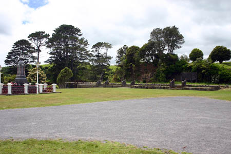
Parihaka is a community in the Taranaki region of New Zealand, located between Mount Taranaki and the Tasman Sea. In the 1870s and 1880s the settlement, then reputed to be the largest Māori village in New Zealand, became the centre of a major campaign of non-violent resistance to European occupation of confiscated land in the area. Armed soldiers were sent in and arrested the peaceful resistance leaders and many of the Maori residents, often holding them in jail for months without trials. The village was founded about 1866 by Māori chiefs Te Whiti o Rongomai and Tohu Kākahi on land seized by the government during the post-New Zealand Wars land confiscations of the 1860s. The population of the village grew to more than 2,000, attracting Māori who had been dispossessed of their land by confiscations and impressing European visitors with its cleanliness and industry, and its extensive cultivations producing cash crops as well as food sufficient to feed its inhabitants. When an in ... [...More Info...] [...Related Items...] OR: [Wikipedia] [Google] [Baidu] |
Te Whiti O Rongomai
Te Whiti o Rongomai III (–18 November 1907) was a Māori spiritual leader and founder of the village of Parihaka, in New Zealand's Taranaki region. Te Whiti established Parihaka community as a place of sanctuary and peace for Māori many of whom seeking refuge as their land was confiscated in the early 1860s. Parihaka became a place of peaceful resistance to the encroaching confiscations. On 5 November 1881, the village was invaded by 1500 Armed Constabulary with its leaders arrested and put on trial. Te Whiti was sent to Christchurch at the Crown's insistence after it was clear the crown was losing its case in New Plymouth. The trial, however, was never reconvened and Te Whiti, along with Tohu were held for two years. Te Whiti and Tohu returned to Parihaka in 1883, seeking to rebuild Parihaka as a place of learning and cultural development though land protests continued. Te Whiti was imprisoned on two further occasions after 1885 before his death in 1907. Biography Te W ... [...More Info...] [...Related Items...] OR: [Wikipedia] [Google] [Baidu] |
Tohu Kākahi
Tohu Kākahi (c. 1828 – 4 February 1907) was a Māori leader, a warrior leader in the anti government Hau Hau Movement 1864-66 and later a prophet at Parihaka, who along with Te Whiti o Rongomai organised passive resistance against the occupation of Taranaki in the 1870s in New Zealand. Details of Tohu's early life are unclear. According to some descendants he was born at Puketapu on 22 January 1828, although other locations and dates have been claimed. He was regarded as a warrior, teacher and prophet and it is said Tohu confirmed Pōtatau Te Wherowhero's son Tawhiao as the second Māori King, and was his spiritual adviser. In November 1861 Tohu captured Bishop Selwyn during his visit to Taranaki to see Tamihana Te Rauparaha. This and his later repeated attacks against the settlers and government as part of the violent Hau hau movement convinced the government they were dealing with a war like leader. Along with other members of Te Ati Awa, Tohu fought in the Taranaki Wars ... [...More Info...] [...Related Items...] OR: [Wikipedia] [Google] [Baidu] |
John Bryce
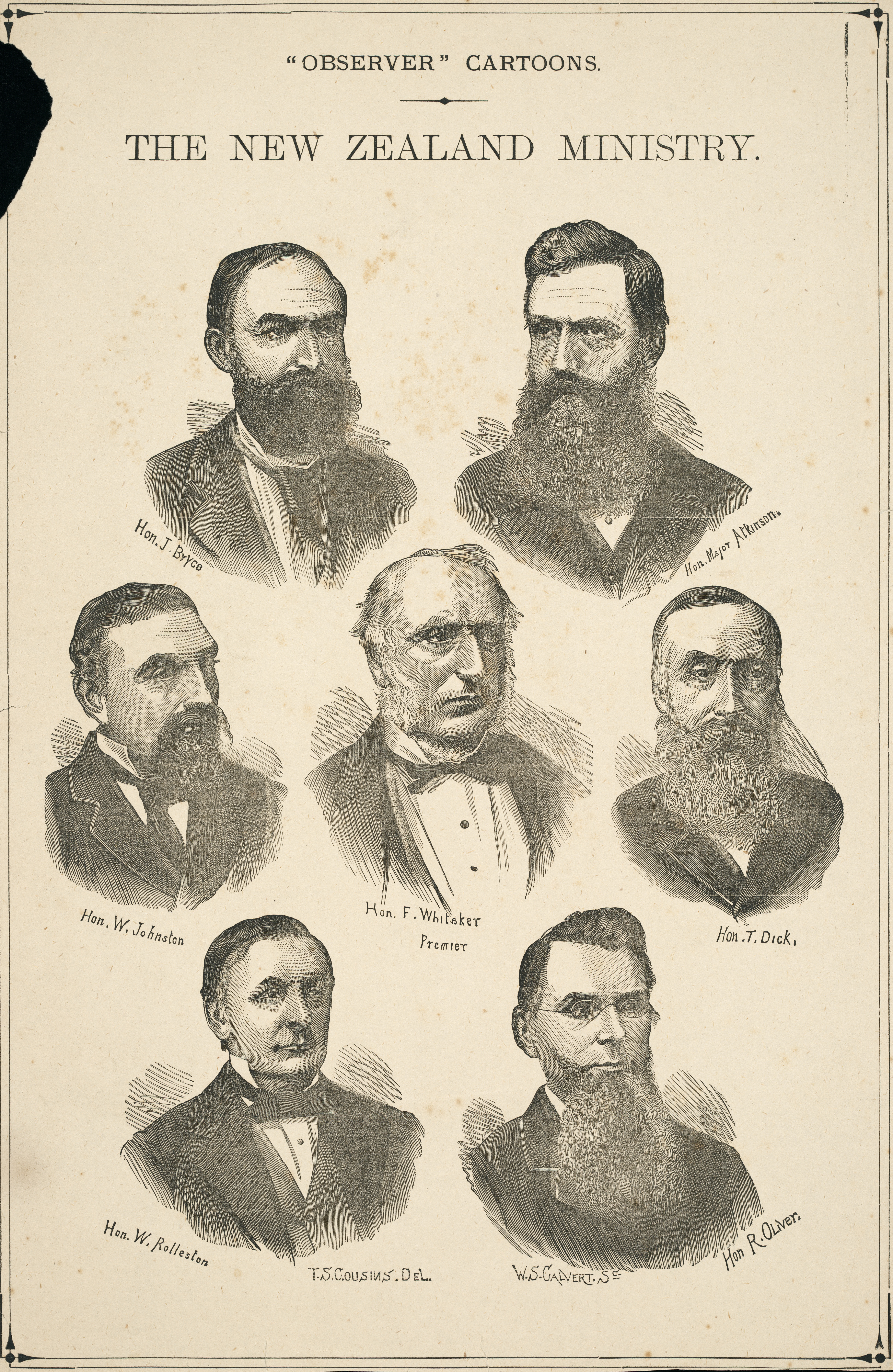
John Bryce (14 September 1833 – 17 January 1913) was a New Zealand politician from 1871 to 1891 and Minister of Native Affairs from 1879 to 1884. In his attitudes to Māori land questions, he favoured strict legal actions against Māori opposed to alienation, and he personally directed the invasion of Parihaka and the arrest of the leaders of the movement. Described as being stubborn and embittered to Māori questions, Bryce was the public face of a harsh policy towards Māori, but his actions were supported by the Premier and other members of his cabinet. Early life John Bryce arrived in New Zealand as a child in 1840, and had little formal education. After a short time in the Australian gold-fields in 1851, he purchased a farm near Wanganui and remained a farmer for the next fifty years. Early political career In 1859, Bryce started his political career. By 1862 he was representing his area in the Wellington Provincial Council, and by 1866 was the Member of ... [...More Info...] [...Related Items...] OR: [Wikipedia] [Google] [Baidu] |
Taranaki Region
Taranaki is a region in the west of New Zealand's North Island. It is named after its main geographical feature, the stratovolcano of Mount Taranaki, also known as Mount Egmont. The main centre is the city of New Plymouth. The New Plymouth District is home to more than 65 per cent of the population of Taranaki. New Plymouth is in North Taranaki along with Inglewood and Waitara. South Taranaki towns include Hāwera, Stratford, Eltham, and Ōpunake. Since 2005, Taranaki has used the promotional brand "Like no other". Geography Taranaki is on the west coast of the North Island, surrounding the volcanic peak of Mount Taranaki. The region covers an area of 7258 km2. Its large bays north-west and south-west of Cape Egmont are North Taranaki Bight and South Taranaki Bight. Mount Taranaki is the second highest mountain in the North Island, and the dominant geographical feature of the region. A Māori legend says that Mount Taranaki previously lived with the Tongariro, ... [...More Info...] [...Related Items...] OR: [Wikipedia] [Google] [Baidu] |
Second Taranaki War
The Second Taranaki War is a term used by some historians for the period of hostilities between Māori and the New Zealand Government in the Taranaki district of New Zealand between 1863 and 1866. The term is avoided by some historians, who either describe the conflicts as merely a series of West Coast campaigns that took place between the Taranaki War (1860–1861) and Titokowaru's War (1868–69), or an extension of the First Taranaki War. The conflict, which overlapped the wars in Waikato and Tauranga, was fuelled by a combination of factors: lingering Māori resentment over the sale of land at Waitara in 1860 and government delays in resolving the issue; a large-scale land confiscation policy launched by the government in late 1863; and the rise of the so-called Hauhau movement, an extremist part of the Pai Marire syncretic religion, which was strongly opposed to the alienation of Māori land and eager to strengthen Māori identity. The Hauhau movement became a unifying ... [...More Info...] [...Related Items...] OR: [Wikipedia] [Google] [Baidu] |
Taranaki
Taranaki is a region in the west of New Zealand's North Island. It is named after its main geographical feature, the stratovolcano of Mount Taranaki, also known as Mount Egmont. The main centre is the city of New Plymouth. The New Plymouth District is home to more than 65 per cent of the population of Taranaki. New Plymouth is in North Taranaki along with Inglewood and Waitara. South Taranaki towns include Hāwera, Stratford, Eltham, and Ōpunake. Since 2005, Taranaki has used the promotional brand "Like no other". Geography Taranaki is on the west coast of the North Island, surrounding the volcanic peak of Mount Taranaki. The region covers an area of 7258 km2. Its large bays north-west and south-west of Cape Egmont are North Taranaki Bight and South Taranaki Bight. Mount Taranaki is the second highest mountain in the North Island, and the dominant geographical feature of the region. A Māori legend says that Mount Taranaki previously lived with the Tongariro ... [...More Info...] [...Related Items...] OR: [Wikipedia] [Google] [Baidu] |
New Zealand Wars
The New Zealand Wars took place from 1845 to 1872 between the New Zealand colonial government and allied Māori on one side and Māori and Māori-allied settlers on the other. They were previously commonly referred to as the Land Wars or the Māori Wars, while Māori language names for the conflicts included ("the great New Zealand wars") and ("the white man's anger"). Historian James Belich popularised the name "New Zealand Wars" in the 1980s, although according to Vincent O'Malley, the term was first used by historian James Cowan in the 1920s. Though the wars were initially localised conflicts triggered by tensions over disputed land purchases, they escalated dramatically from 1860 as the government became convinced it was facing united Māori resistance to further land sales and a refusal to acknowledge Crown sovereignty. The colonial government summoned thousands of British troops to mount major campaigns to overpower the Kīngitanga (Māori King) movement and also c ... [...More Info...] [...Related Items...] OR: [Wikipedia] [Google] [Baidu] |
Māori People
The Māori (, ) are the indigenous Polynesian people of mainland New Zealand (). Māori originated with settlers from East Polynesia, who arrived in New Zealand in several waves of canoe voyages between roughly 1320 and 1350. Over several centuries in isolation, these settlers developed their own distinctive culture, whose language, mythology, crafts, and performing arts evolved independently from those of other eastern Polynesian cultures. Some early Māori moved to the Chatham Islands, where their descendants became New Zealand's other indigenous Polynesian ethnic group, the Moriori. Initial contact between Māori and Europeans, starting in the 18th century, ranged from beneficial trade to lethal violence; Māori actively adopted many technologies from the newcomers. With the signing of the Treaty of Waitangi in 1840, the two cultures coexisted for a generation. Rising tensions over disputed land sales led to conflict in the 1860s, and massive land confiscations, to ... [...More Info...] [...Related Items...] OR: [Wikipedia] [Google] [Baidu] |
John Hall (New Zealand)
Sir John Hall (18 December 1824 – 25 June 1907) was a New Zealand politician who served as the 12th premier of New Zealand from 1879 to 1882. He was born in Kingston upon Hull, England, the third son of George Hall, a captain in the navy. At the age of ten he was sent to school in Switzerland and his education continued in Paris and Hamburg. After returning to England and being employed by the Post Office, at the age of 27 he decided to emigrate. He was also Mayor of Christchurch. Migration to New Zealand After reading a book on sheep farming, Hall emigrated to New Zealand, on the ''Samarang'', arriving in Lyttelton on 31 July 1852. His brothers George and Thomas followed him to New Zealand soon after. He developed one of the first large scale sheep farming runs in Canterbury. Political offices In 1853, he was elected to the Canterbury Provincial Council. He would later rise through the ranks of magistrate, was the first town council Chairman in Christc ... [...More Info...] [...Related Items...] OR: [Wikipedia] [Google] [Baidu] |
New Zealand Land Confiscations
The New Zealand land confiscations took place during the 1860s to punish the Kīngitanga movement for attempting to set up an alternative, Māori, form of government that forbade the selling of land to European settlers. The confiscation law targeted Kīngitanga Māori against whom the government had waged war to restore the rule of British law. More than or 4.4 percent of land were confiscated,Ranginui Walker, ''Ka Whawhai Tonu Matou - Struggle Without End'', Penguin Books, 1990. mainly in Waikato, Taranaki and the Bay of Plenty, but also in South Auckland, Hauraki, Te Urewera, Hawke's Bay and the East Coast.Taranaki Report, Kaupapa Tuatahi, Chapter 1, Waitangi Tribunal, 1996. Legislation for the confiscations was contained in the New Zealand Settlements Act 1863, which provided for the seizing of land from Māori tribes who had been in rebellion against the Government after 1 January 1863. Its stated purpose was to achieve the "permanent protection and security" of the count ... [...More Info...] [...Related Items...] OR: [Wikipedia] [Google] [Baidu] |
Ngāti Moeahu
Taranaki (Tuturu) is a Māori iwi of New Zealand. Taranaki iwi were an important part of the First and Second Taranaki Wars. At least 13 members of Taranaki died during the First Taranaki War, mostly defending Waireka on 28 March 1860, including Paora Kūkūtai (chief of the Patukai hapū) and Paratene te Kopara (chief of Ngā Māhanga a Tairi). Wellington pan-tribal Māori radio station Te Upoko O Te Ika has been affiliated to Taranaki since 2014. It began part-time broadcasting in 1983 and full-time broadcasting in 1987, and it is New Zealand's longest-running Māori radio station. Radio station Te Korimako O Taranaki is affiliated with Taranaki and other local iwi, including Ngati Tama, Te Atiawa, Ngati Maru, Ngāruahine, Ngati Mutunga, Ngati Ruanui, and Ngaa Rauru Kiitahi. It started at the Bell Block campus of Taranaki Polytechnic in 1992, and moved to the Spotswood campus in 1993. It is available on across Taranaki. See also *List of Māori iwi This is a l ... [...More Info...] [...Related Items...] OR: [Wikipedia] [Google] [Baidu] |


