|
ûresund Station
ûresund station is a station on the Copenhagen Metro, located in the Sundbyû¡ster district of Copenhagen Copenhagen ( or .; da, Kû¡benhavn ) is the capital and most populous city of Denmark, with a proper population of around 815.000 in the last quarter of 2022; and some 1.370,000 in the urban area; and the wider Copenhagen metropolitan ar .... It opened on 28 September 2007. The station serves the M2 line, in fare zone 3. External links ûresund station on www.m.dk ûresund station on www.m.dk M2 (Copenhagen Metro) stations Railway stations opened in 2007 {{Copenhagen-metro-stub ... [...More Info...] [...Related Items...] OR: [Wikipedia] [Google] [Baidu] |
List Of Copenhagen Metro Stations
There are 39 stations in the Copenhagen Metro, a driverless rapid transit system serving Copenhagen, Frederiksberg and TûËrnby in Denmark. Of the original 22 metro stations, nine are underground, twelve are elevated, and one is at street level. Christianshavn Station offers transfer between the system's two original lines ( M1 and M2), which share track between Vanlû¡se and Christianshavn stations. From Christianshavn, M1 branches south traveling to Vestamager Station, while M2 heads southeast to Lufthavnen Station, which serves Copenhagen Airport. The City Circle Line, which opened on 29 September 2019, has 17 stations, with transfer between the current and new lines at Frederiksberg and Kongens Nytorv stations. The new lines have a stop at Copenhagen Central Station (Kû¡benhavn H), the largest train station in Denmark. On 28 March 2020, the first part of the M4 line opened, adding two additional stations and an increased number of trains on the Kû¡benhavn H - ûsterport par ... [...More Info...] [...Related Items...] OR: [Wikipedia] [Google] [Baidu] |
Copenhagen
Copenhagen ( or .; da, Kû¡benhavn ) is the capital and most populous city of Denmark, with a proper population of around 815.000 in the last quarter of 2022; and some 1.370,000 in the urban area; and the wider Copenhagen metropolitan area has 2,057,142 people. Copenhagen is on the islands of Zealand and Amager, separated from MalmûÑ, Sweden, by the ûresund strait. The ûresund Bridge connects the two cities by rail and road. Originally a Viking fishing village established in the 10th century in the vicinity of what is now Gammel Strand, Copenhagen became the capital of Denmark in the early 15th century. Beginning in the 17th century, it consolidated its position as a regional centre of power with its institutions, defences, and armed forces. During the Renaissance the city served as the de facto capital of the Kalmar Union, being the seat of monarchy, governing the majority of the present day Nordic region in a personal union with Sweden and Norway ruled by the Danis ... [...More Info...] [...Related Items...] OR: [Wikipedia] [Google] [Baidu] |
Copenhagen Municipality
Copenhagen Municipality ( da, Kû¡benhavns Kommune), also known in English as the Municipality of Copenhagen, located in the Capital Region of Denmark, is the largest of the four municipalities that constitute the City of Copenhagen (), the other three being Dragû¡r, Frederiksberg, and TûËrnby. The Municipality of Copenhagen constitutes the historical city centre and the majority of its landmarks. It is the most populous in the country with a population of 652,564 inhabitants (), and covers in area,. Copenhagen Municipality is located at the Zealand and Amager islands and totally surrounds Frederiksberg Municipality on all sides. The strait of ûresund lies to the east. The city of Copenhagen has grown far beyond the municipal boundaries from 1901, when Frederiksberg Municipality was made an enclave within Copenhagen Municipality. Frederiksberg has the largest population density of the municipalities of Denmark. The municipal seat of government is the Copenhagen City Hall ( ... [...More Info...] [...Related Items...] OR: [Wikipedia] [Google] [Baidu] |
Cut (earthmoving)
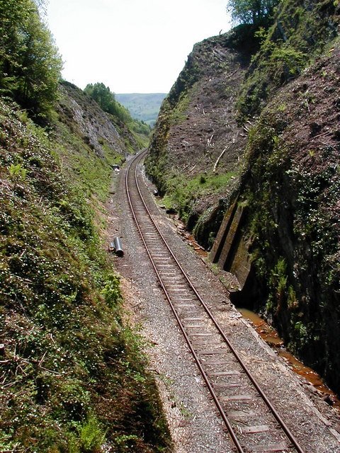
In civil engineering, a cut or cutting is where soil or rock from a relative rise along a route is removed. The term is also used in river management to speed a waterway's flow by short-cutting a meander. Cuts are typically used in road, rail, and canal construction to reduce the length and grade of a route. Cut and fill construction uses the spoils from cuts to fill in defiles to cost-effectively create relatively straight routes at steady grades. Cuts are used as alternatives to indirect routes, embankments, or viaducts. They also have the advantage of comparatively lower noise pollution than elevated or at-grade solutions. History The term ''cutting'' appears in the 19th century literature to designate rock cuts developed to moderate grades of railway lines. ''Railway Age's Comprehensive Railroad Dictionary'' defines a cut as "a passage cut for the roadway through an obstacle of rock or dirt." Creation Cuts can be created by multiple passes of a shovel, grader, scrap ... [...More Info...] [...Related Items...] OR: [Wikipedia] [Google] [Baidu] |
Island Platform
An island platform (also center platform, centre platform) is a station layout arrangement where a single platform is positioned between two tracks within a railway station, tram stop or transitway interchange. Island platforms are popular on twin-track routes due to pragmatic and cost reasons. They are also useful within larger stations where local and express services for the same direction of travel can be provided from opposite sides of the same platform thereby simplifying transfers between the two tracks. An alternative arrangement is to position side platforms on either side of the tracks. The historical use of island platforms depends greatly upon the location. In the United Kingdom the use of island platforms is relatively common when the railway line is in a cutting or raised on an embankment, as this makes it easier to provide access to the platform without walking across the tracks. Advantages and tradeoffs Island platforms are necessary for any station with many th ... [...More Info...] [...Related Items...] OR: [Wikipedia] [Google] [Baidu] |
Copenhagen Metro
The Copenhagen Metro ( da, Kû¡benhavns Metro, ) is a 24/7 rapid transit system in Copenhagen, Denmark, serving the municipalities of Copenhagen, Frederiksberg, and TûËrnby. The original system opened in October 2002, serving nine stations on two lines: M1 and M2. In 2003 and 2007, the Metro was extended to Vanlû¡se and Copenhagen Airport (Lufthavnen) respectively, adding an additional six plus five stations to the network. In 2019, seventeen stations on a wholly underground circle line, the M3, was added bringing the number of stations to 37.MetroselskabetCityringen ûËbner The driverless light metro supplements the larger S-train rapid transit system, and is integrated with local DSB and regional (ûresundstûËg) trains and municipal Movia buses. Through the city centre and west to Vanlû¡se, M1 and M2 share a common line. To the southeast, the system serves Amager, with the M1 running through the new neighborhood of ûrestad, and the M2 serving the eastern neighborhoods a ... [...More Info...] [...Related Items...] OR: [Wikipedia] [Google] [Baidu] |
Sundbyû¡ster
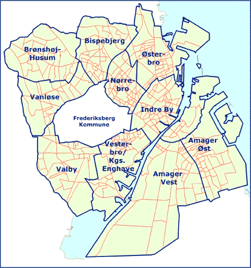
Sundbyû¡ster () is one of the 15 administrative, statistical, and tax city districts (''bydele'') comprising the municipality of Copenhagen, Denmark. It lies on the southeast border of the municipality on the island of Amager. It covers an area of 8.60 km2, has a population of 48,673 and a population density of 5,658 per km2, which makes it the most populated district in Copenhagen. Neighboring city districts are as follows: * to the northwest is Christianshavn, separated from Syndbyû¡ster by Stadsgraven (the city moat) * to the west is Sundbyvester * to the south is TûËrnby municipality, which is outside the Copenhagen municipality area * to the east is the ûresund, the strait which separates the island of Zealand from Sweden Sweden, formally the Kingdom of Sweden,The United Nations Group of Experts on Geographical Names states that the country's formal name is the Kingdom of SwedenUNGEGN World Geographical Names, Sweden./ref> is a Nordic country located on ... [...More Info...] [...Related Items...] OR: [Wikipedia] [Google] [Baidu] |
M2 (Copenhagen)
M2 is a line of the Copenhagen Metro, colored yellow on the map. It runs from Vanlû¡se to Lufthavnen through the center of Copenhagen, sharing track with the M1 from Vanlû¡se to Christianshavn. The line was built along with M1 as part of the redevelopment of ûrestad. The principle of the line was passed in 1992, and construction commenced in 1998. The line opened in several stages between 2002 and 2007. It is owned by Metroselskabet and operated by Metro Service, and operates with a headway between four and twenty minutes. The line is long, and runs in a tunnel through the city center between Lindevang and Amager Strand. It connects the western borough of Vanlû¡se and the municipality of Frederiksberg to the city center of Copenhagen, as well as the eastern parts of Amager and Copenhagen Airport. It provides transfer to the S-train at three stations and to DSB trains at two stations. Its southern end, in the district of Amager ûst, largely follows the same route as a disuse ... [...More Info...] [...Related Items...] OR: [Wikipedia] [Google] [Baidu] |
ûresund Station, Copenhagen Metro
ûresund or ûresund (, ; da, ûresund ; sv, ûresund ), commonly known in English as the Sound, is a strait which forms the DanishãSwedish border, separating Zealand ( Denmark) from Scania (Sweden). The strait has a length of ; its width varies from to . It is wide at its narrowest point between Helsingû¡r in Denmark and Helsingborg in Sweden. ûresund, along with the Great Belt, the Little Belt and the Kiel Canal, is one of four waterways that connect the Baltic Sea to the Atlantic Ocean via Kattegat, Skagerrak, and the North Sea; this makes it one of the busiest waterways in the world. The ûresund Bridge, between the Danish capital Copenhagen and the Swedish city of MalmûÑ, inaugurated on 1 July 2000, connects a bi-national metropolitan area with close to 4 million inhabitants. The HH Ferry route, between Helsingû¡r, Denmark and Helsingborg, Sweden, in the northern part of ûresund, is one of the world's busiest international ferry routes, with more ... [...More Info...] [...Related Items...] OR: [Wikipedia] [Google] [Baidu] |
M2 (Copenhagen Metro) Stations
M2, M-2, M.2 or M02 may refer to: Entertainment * ''Môý'' (album), a 2001 album by jazz musician Marcus Miller * ''môý'' (artist), an ambient project of Mathis Mootz * M2 (TV channel), a Hungarian TV channel * M2 (Ukraine), a Ukrainian music television channel * M2, a South Korean music television channel * M2 (game developer), Japanese game developer Computing * M.2, a specification for internally mounted expansion cards * Apple M2, a central processing unit in the Apple M series * Socket M2, a CPU socket * Memory Stick Micro, a removable flash memory card format * Fast Universal Digital Computer M-2, an early Russian digital computer (1957) * Opera Mail, formerly known as M2 * Modula-2, a computer programming language * Macaulay2, a free computer algebra system Military Vehicles * M2 (missile), a French submarine-launched ballistic missile * M2 Bradley, an armored fighting vehicle * M2 half-track car * M2 light tank * M2 medium tank * (M2), a WWI British Royal Navy moni ... [...More Info...] [...Related Items...] OR: [Wikipedia] [Google] [Baidu] |


.jpg)
