|
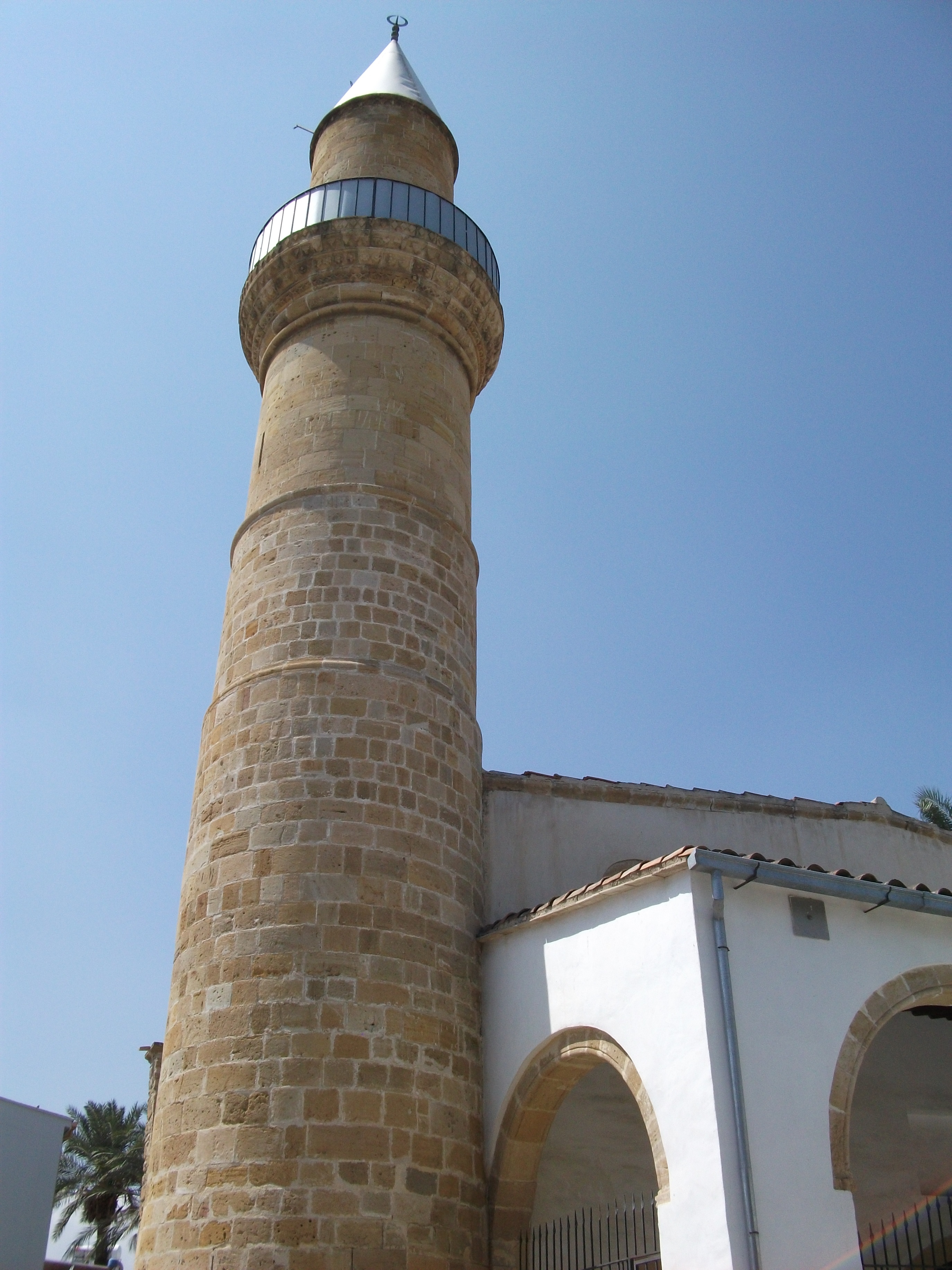
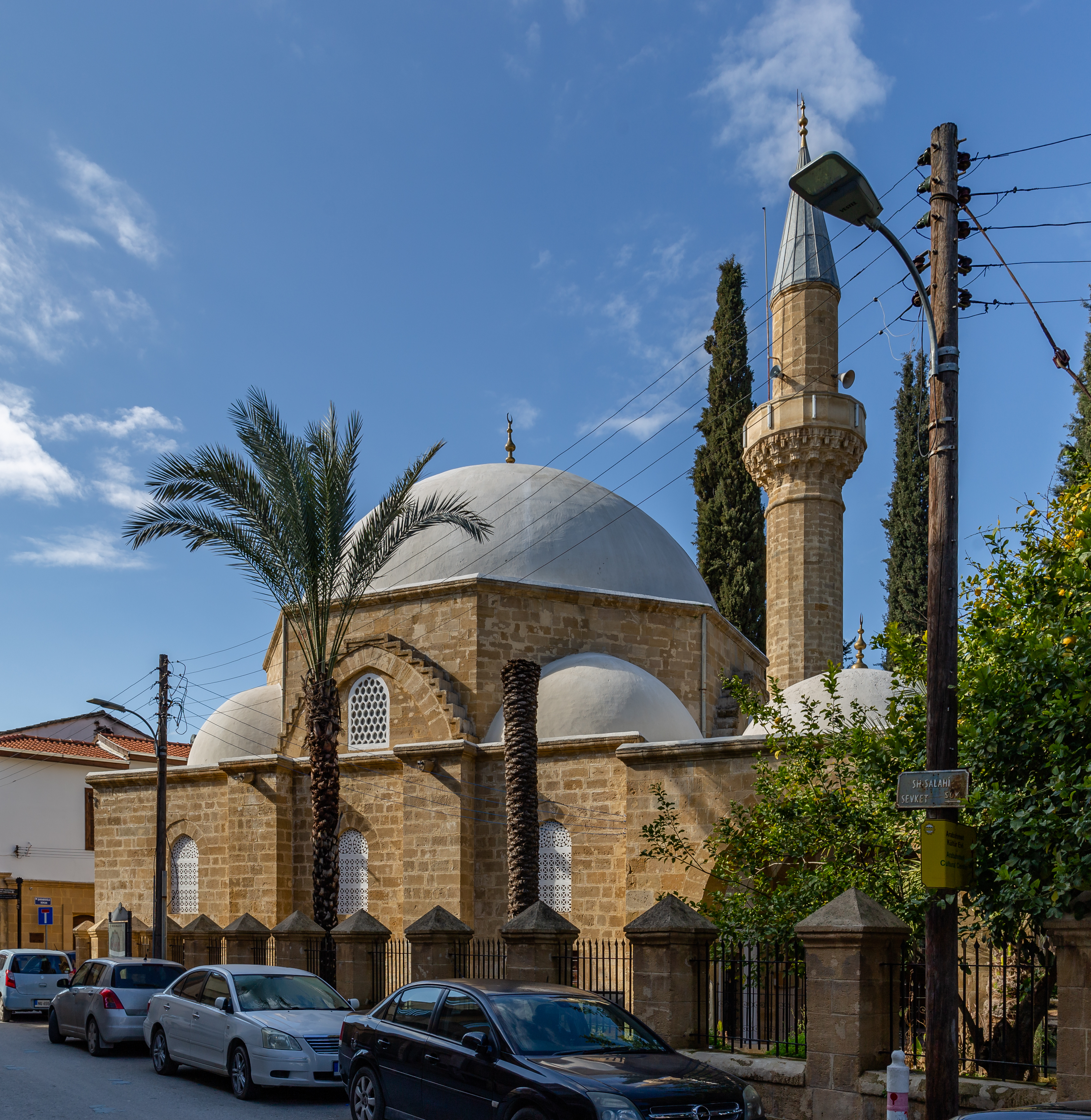
Ûmeriye Mosque
├¢meriye Mosque ( el, ╬ż╬Ł╬╝╬Ą╬Į╬┐Žé ╬¤╬╝╬ĄŽü╬╣╬Ł ''Temenos Omeri├®'', tr, ├¢meriye Camii), is a mosque in the walled city of Nicosia on the island of Cyprus, currently located in the south section of Nicosia. Following the Turkish invasion of Cyprus, the mosque gained significance as one of the most important sites of Muslim worship in the non-Muslim section of the island and the city. Currently the mosque is functioning and open for both worshipers and visitors. History Formerly, the site of the mosque was occupied by the Augustinian Church of Saint Mary, which dated back to the 14th century. During the Ottoman-Venetian War of 1570ŌĆō73, the church was first heavily damaged during the siege of Nicosia in 1570, and was eventually levelled after the war. After the Turkish conquest of Cyprus, Lala Mustafa Pasha, the Ottoman commander, ordered a mosque to be built on the site of the former church, based on a popular belief that Umar, second caliph of Islam, was buried at this ... [...More Info...] [...Related Items...] OR: [Wikipedia] [Google] [Baidu] |
Nicosia
Nicosia ( ; el, ╬ø╬ĄŽģ╬║ŽēŽā╬»╬▒, Lefkos├Ła ; tr, Lefko┼¤a ; hy, šåš½š»šĖšĮš½šĪ, romanized: ''Nikosia''; Cypriot Arabic: Nikusiya) is the largest city, capital, and seat of government of Cyprus. It is located near the centre of the Mesaoria plain, on the banks of the River Pedieos. According to Greek mythology, Nicosia ( in Greek) was a siren, one of the daughters of Acheloos and Melpomene and its name translates as "White State" or city of White Gods. Nicosia is the southeasternmost of all EU member states' capitals. It has been continuously inhabited for over 4,500 years and has been the capital of Cyprus since the 10th century. The Greek Cypriot and Turkish Cypriot communities of Nicosia segregated into the south and north of the city respectively in early 1964, following the fighting of the Cyprus crisis of 1963ŌĆō64 that broke out in the city. This separation became a militarised border between the Republic of Cyprus and Northern Cyprus after Turkey invaded the isla ... [...More Info...] [...Related Items...] OR: [Wikipedia] [Google] [Baidu] |
Taht-el-kale, Nicosia
Taht-el-kale (Greek: ╬ż╬¼ŽćŽä ╬Ģ╬╗ ╬Ü╬▒╬╗╬Ł; Turkish: Tahtakale) is a neighbourhood, quarter of Nicosia, CyprusCoexistence in the Disappeared Mixed Neighbourhoods of Nicosia by Ahmet An (Paper read at the conference: Nicosia: The Last Divided Capital in Europe, organized by the London Metropolitan University on 20 June 2011) and the mosque situated therein. At the last Census (2011) it had a population of 826, an increase from a population of 611 in 2001. It covers 28 streets in the eastern part of the municipal area of Nicosia, within and without the walls. The population in 1946 was 1,433 consisting of 902 Greek Cypriots, 518 Turkish Cypriots and 13 others. Taht-el-kale is the neighbourhood, near Famagusta Gate. The Ottomans named it as "Taht-el-kale", meaning the lower part of the fortress, i.e. Famagusta Gate. But the word was corrupted as "Tahtakale or Tahtagala", meaning wooden fortress. The street going from the gate to the west was called ├ćar┼¤─▒ (Market) Street, now cal ... [...More Info...] [...Related Items...] OR: [Wikipedia] [Google] [Baidu] |
Tourist Attractions In Nicosia
Tourism is travel for pleasure or business; also the theory and practice of touring (other), touring, the business of attracting, accommodating, and entertaining tourists, and the business of operating tour (other), tours. The World Tourism Organization defines tourism more generally, in terms which go "beyond the common perception of tourism as being limited to holiday activity only", as people "travelling to and staying in places outside their usual environment for not more than one consecutive year for leisure and not less than 24 hours, business and other purposes". Tourism can be Domestic tourism, domestic (within the traveller's own country) or International tourism, international, and international tourism has both incoming and outgoing implications on a country's balance of payments. Tourism numbers declined as a result of a strong economic slowdown (the late-2000s recession) between the second half of 2008 and the end of 2009, and in consequence of t ... [...More Info...] [...Related Items...] OR: [Wikipedia] [Google] [Baidu] |
Mosques In Nicosia
A mosque (; from ar, ┘ģ┘Äž│┘Æž¼┘Éž», masjid, ; literally "place of ritual prostration"), also called masjid, is a Place of worship, place of prayer for Muslims. Mosques are usually covered buildings, but can be any place where prayers (sujud) are performed, including outdoor courtyards. The first mosques were simple places of prayer for Muslims, and may have been open spaces rather than buildings. In the first stage of Islamic architecture, 650-750 CE, early mosques comprised open and closed covered spaces enclosed by walls, often with minarets from which Adhan, calls to prayer were issued. Mosque buildings typically contain an ornamental niche (''mihrab'') set into the wall that indicates the direction of Mecca (''qiblah''), Wudu, ablution facilities. The pulpit (''minbar''), from which the Friday (jumu'ah) sermon (''khutba'') is delivered, was in earlier times characteristic of the central city mosque, but has since become common in smaller mosques. Mosques typically have Isl ... [...More Info...] [...Related Items...] OR: [Wikipedia] [Google] [Baidu] |
North Nicosia
North Nicosia or Northern Nicosia ( tr, Kuzey Lefko┼¤a ; el, ╬ÆŽīŽü╬Ą╬╣╬▒ ╬ø╬ĄŽģ╬║ŽēŽā╬»╬▒) is the capital and largest city of the ''de facto'' state of Northern Cyprus. It is the northern part of the divided city of Nicosia, and is governed by the Nicosia Turkish Municipality. , North Nicosia had a population of 61,378 and a metropolitan area with a population of 82,539. The city is the economic, political and cultural centre of Northern Cyprus, with many shops, restaurants and shopping malls. It is home to a historic walled city, centred on the Saray├Čn├╝ Square, and a modern metropolitan area, with the Dereboyu region as its centre of business and entertainment. Described as a city with high levels of welfare, it has seen great urban growth and development in the 21st century, including the construction of new highways and high-rises. It hosts a significant number of tourists and a variety of cultural activities, including its international festivals of theatre and music. W ... [...More Info...] [...Related Items...] OR: [Wikipedia] [Google] [Baidu] |
Turkish Republic Of Northern Cyprus
Northern Cyprus ( tr, Kuzey K─▒br─▒s), officially the Turkish Republic of Northern Cyprus (TRNC; tr, Kuzey K─▒br─▒s T├╝rk Cumhuriyeti, ''KKTC''), is a ''de facto'' state that comprises the northeastern portion of the island of Cyprus. Recognised only by Turkey, Northern Cyprus is considered by the international community to be part of the Republic of Cyprus. Northern Cyprus extends from the tip of the Karpass Peninsula in the northeast to Morphou Bay, Cape Kormakitis and its westernmost point, the Kokkina exclave in the west. Its southernmost point is the village of Louroujina. A buffer zone under the control of the United Nations stretches between Northern Cyprus and the rest of the island and divides Nicosia, the island's largest city and capital of both sides. A coup d'├®tat in 1974, performed as part of an attempt to annex the island to Greece, prompted the Turkish invasion of Cyprus. This resulted in the eviction of much of the north's Greek Cypriot population, the f ... [...More Info...] [...Related Items...] OR: [Wikipedia] [Google] [Baidu] |
List Of Mosques In Cyprus ...
This is a list of mosques in Cyprus. See also * Islam in Cyprus References External links Greek Cypriot and Turkish Cypriot Religious buildings Built before 1974Whatson North Cyprus {{List of mosques Mosques Cyprus Cyprus ; tr, K─▒br─▒s (), officially the Republic of Cyprus,, , lit: Republic of Cyprus is an island country located south of the Anatolian Peninsula in the eastern Mediterranean Sea. Its continental position is disputed; while it is geo ... [...More Info...] [...Related Items...] OR: [Wikipedia] [Google] [Baidu] |
Islam In Cyprus
Islam in Cyprus is the island's second largest religion and the predominant faith of Northern Cyprus. Islam was introduced to Cyprus when the island finally fell to Umayyad conquerors during the Arab-Byzantine wars. Prior to this, the Muslim presence on the island was itinerant. Conversion to Islam was not compulsory but the majority of the Catholic Latin population of the island, along with a smaller subsection of the Greek Orthodox population, converted to Islam. Before the Turkish invasion of Cyprus in 1974, the Turkish Cypriots (the Muslim community of Cyprus) made up 18% of the island's population and lived throughout the island. Today, most of the estimated 264,172 Muslims are based in the north of the island. Turkish Cypriot society is markedly secular though, at least formally; adherents to the faith subscribe mostly to the Sunni branch, with an influential stream of Sufism underlying their spiritual heritage and development. Nazim al-Qubrusi, the leader of the Naqs ... [...More Info...] [...Related Items...] OR: [Wikipedia] [Google] [Baidu] |
Ottoman Cyprus
, common_name = Cyprus , subdivision = Eyalet and Sanjak , nation = the Ottoman Empire , year_start = 1571 , year_end = 1878 , life_span = , date_start = , date_end = , event_start = , event_end = , p1 = Venetian Cyprus , flag_p1 = Flag of Most Serene Republic of Venice.svg , s1 = British Cyprus , flag_s1 = Flag of Cyprus (1881ŌĆō1922).svg , image_flag = Flag of the Ottoman Empire.svg , flag = , flag_type = Flag (after 1844) , image_coat = , symbol = , symbol_type = , image_map = Cyprus Eyalet, Ottoman Empire (1609).png , image_map_caption = Ottoman Cyprus in 1609 in red. The rest of the Ottoman Empire in light-yellow , capital = Nicosia , toda ... [...More Info...] [...Related Items...] OR: [Wikipedia] [Google] [Baidu] |
Ûmeriye Hamam
Ûmeriye Hamam () in Nicosia, Cyprus is a historic Ottoman hammam ( public bathhouse). It was created by Lala Mustafa Pasha in the 1570s, soon after the Ottoman conquest of Cyprus, and was part of the larger complex of the Ûmeriye Mosque dedicated to the memory of the Caliph Omar. The complex reused the earlier 14th-century Augustinian Augustinian may refer to: *Augustinians, members of religious orders following the Rule of St Augustine *Augustinianism, the teachings of Augustine of Hippo and his intellectual heirs *Someone who follows Augustine of Hippo * Canons Regular of Sain ... church of St. Mary which was damaged in the Ottoman siege. The hammam was restored in 2002-2004 as part of the Lefkosia Master Plan and is still in use today as a bathhouse and spa. History of Ûmeriye Hamam The site's history dates back to the 14th century, when it stood as an Augustinian church of St. Mary. Stone-built, with small domes, it is chronologically placed at around the time of Fra ... [...More Info...] [...Related Items...] OR: [Wikipedia] [Google] [Baidu] |
Turkish Bath
A hammam ( ar, žŁ┘ģ┘枦┘ģ, translit=ßĖźamm─üm, tr, hamam) or Turkish bath is a type of steam bath or a place of public bathing associated with the Islamic world. It is a prominent feature in the culture of the Muslim world and was inherited from the model of the Roman ''thermae.'' Muslim bathhouses or hammams were historically found across the Middle East, North Africa, al-Andalus (Islamic Spain and Portugal), Central Asia, the Indian subcontinent, and in Southeastern Europe under Ottoman rule. A variation on the Muslim bathhouse, the Victorian Turkish bath, became popular as a form of therapy, a method of cleansing, and a place for relaxation during the Victorian era, rapidly spreading through the British Empire, the United States of America, and Western Europe. In Islamic cultures the significance of the hammam was both religious and civic: it provided for the needs of ritual ablutions but also provided for general hygiene in an era before private plumbing and served other ... [...More Info...] [...Related Items...] OR: [Wikipedia] [Google] [Baidu] |
Minaret
A minaret (; ar, ┘ģ┘垦ž▒ž®, translit=man─üra, or ar, ┘ģ┘Éž”┘Æž░┘Ä┘åž®, translit=mi╩ŠßĖÅana, links=no; tr, minare; fa, ┌»┘äŌĆīž»ž│ž¬┘ć, translit=goldaste) is a type of tower typically built into or adjacent to mosques. Minarets are generally used to project the Muslim call to prayer ('' adhan''), but they also served as landmarks and symbols of Islam's presence. They can have a variety of forms, from thick, squat towers to soaring, pencil-thin spires. Etymology Two Arabic words are used to denote the minaret tower: ''man─üra'' and ''man─ür''. The English word "minaret" originates from the former, via the Turkish version (). The Arabic word ''man─üra'' (plural: ''man─ür─üt'') originally meant a "lamp stand", a cognate of Hebrew '' menorah''. It is assumed to be a derivation of an older reconstructed form, ''manwara''. The other word, ''man─ür'' (plural: ''man─ü'ir'' or ''man─üyir''), means "a place of light". Both words derive from the Arabic root ''n-w-r'', which has a ... [...More Info...] [...Related Items...] OR: [Wikipedia] [Google] [Baidu] |


_MAP_OF_CYPRUS.jpg)


