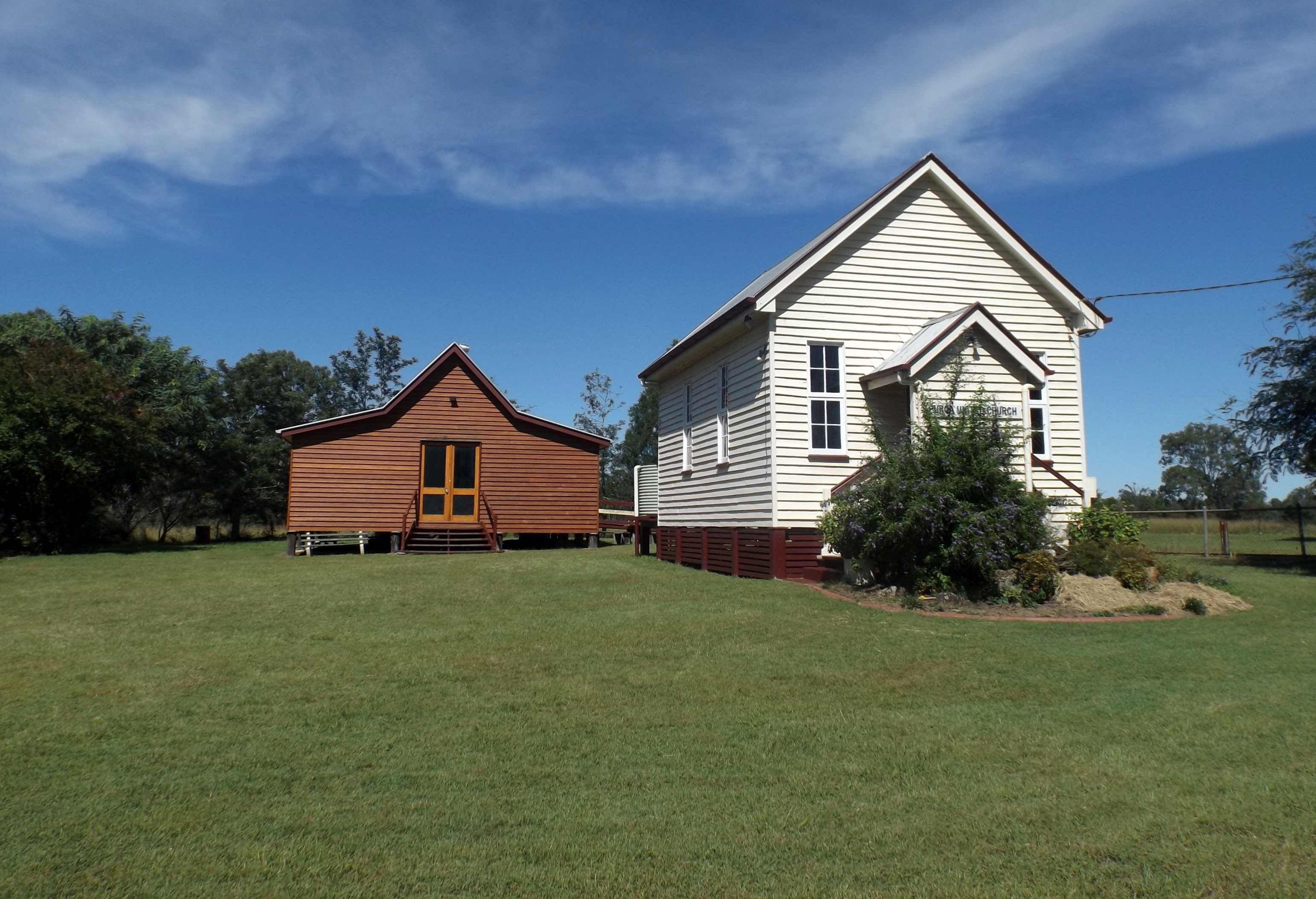
Purga, Queensland on:
[Wikipedia]
[Google]
[Amazon]
Purga is a rural
 Purga has a number of
locality
Locality may refer to:
* Locality, a historical named location or place in Canada
* Locality (association), an association of community regeneration organizations in England
* Locality (linguistics)
* Locality (settlement)
* Suburbs and localitie ...
in the City of Ipswich
The City of Ipswich is a local government area (LGA) located within the southwest of Greater Brisbane, which in turn, is situated within the vast South East region of the state of Queensland. Positioned between the City of Brisbane and the Ci ...
, Queensland
Queensland ( , commonly abbreviated as Qld) is a States and territories of Australia, state in northeastern Australia, and is the second-largest and third-most populous state in Australia. It is bordered by the Northern Territory, South Austr ...
, Australia. In the , Purga had a population of 561 people.
Geography
Purga is on the south-western outskirts of the urban area ofIpswich
Ipswich () is a port town and Borough status in the United Kingdom, borough in Suffolk, England. It is the county town, and largest in Suffolk, followed by Lowestoft and Bury St Edmunds, and the third-largest population centre in East Anglia, ...
.
The western boundary of Purga follows Warrill Creek. Purga Creek enters the locality from the south ( Peak Crossing) and then flows north, exiting the locality to north ( Amberley / Yamanto) where it becomes a tributary of Warrill Creek.
The Cunningham Highway
The Cunningham Highway is a National Highway (Australia), national highway located in South East Queensland, south-eastern Queensland, Australia. The highway links the Darling Downs region with the urbanised outskirts of Ipswich, Queensland, I ...
enters the locality from the north (Yamanto / Deebing Heights) and travels west, exiting the locality to the north-west ( Willowbank / Amberley).
Ipswich – Boonah Road
Ipswich () is a port town and borough in Suffolk, England. It is the county town, and largest in Suffolk, followed by Lowestoft and Bury St Edmunds, and the third-largest population centre in East Anglia, after Peterborough and Norwich. It is ...
(State Route 93) enters the locality from the north-east (Yamanto), then runs south through the locality, before exiting to the south-east (Peak Crossing / Goolman).
The predominant land use is grazing
In agriculture, grazing is a method of animal husbandry whereby domestic livestock are allowed outdoors to free range (roam around) and consume wild vegetations in order to feed conversion ratio, convert the otherwise indigestible (by human diges ...
on vegetation.
History
The area was named after theparish
A parish is a territorial entity in many Christianity, Christian denominations, constituting a division within a diocese. A parish is under the pastoral care and clerical jurisdiction of a priest#Christianity, priest, often termed a parish pries ...
which was derived from the Aboriginal word ''pur-pur'', meaning ''a meeting place''.
Purga Creek State School was opened on 1 September 1871. It was renamed Purga State School about 1945. It closed in 1967. It was at 68 Purga School Road ().
Residents in the Fassifern Valley
Fassifern Valley is a valley of the Scenic Rim in South East Queensland. Towns found in the valley include Harrisville, Queensland, Harrisville, Kalbar, Queensland, Kalbar, Roadvale, Queensland, Roadvale, Warrill View, Queensland, Warril View ...
petitioned the Queensland Government
The Queensland Government is the state government of Queensland, Australia, a Parliament, parliamentary constitutional monarchy. Government is formed by the party or coalition that has gained a majority in the Queensland Legislative Assembly, ...
to build a railway line to their district, and the first section of the Dugandan railway line
The Dugandan railway line was a branch railway in the Scenic Rim region of South East Queensland, Australia. It was also known as the Fassifern railway line. It operated from 1882 to 1964.
Geography
The line began west of Ipswich station ...
was opened on 10 July 1882 as far as Harrisville. This is considered to be Queensland's first branch railway. Purga was served by three stations:
* Loamside railway station on the Ipswich Boonah Road ()
* Hampstead railway station on the Ipswich Boonah Road ()
* Purga railway station on the Ipswich Boonah Road ()
The branch was extended to Dugandan on 12 September 1887. The line closed in 1964.
Deebing Creek Provisional School opened on 21 January 1895. In 1924, it became Purga Aboriginal State School. It closed circa 1948. It was within an Aboriginal reserve to the west of Ipswich Boonah Road (approx ).
Demographics
In the , Purga and surrounding suburbs had a population of 600. In the , Purga had a population of 576 people. In the , Purga had a population of 561 people.Heritage listings
 Purga has a number of
 heritage-listed
This list is of heritage registers, inventories of cultural properties, natural and human-made, tangible and intangible, movable and immovable, that are deemed to be of sufficient heritage value to be separately identified and recorded. In ma ...
sites, including:
* Purga United Church, 68 Purga School Road ()
* Purga Aboriginal Cemetery, 133-145 Carmichaels Road ()
Education
There are no current schools in Purga. The nearest government primary schools are Amberley District State School in neighbouring Yamanto to the north-east and Peak Crossing State School in neighbouring Peak Crossing to the south. The nearest government secondary school is Bremer State High School in Ipswich CBD to the north-east.Facilities
There is a sewage treatment plant at 2540-2576 Cunningham Highway ().References
External links
{{Ipswich City City of Ipswich Localities in Queensland