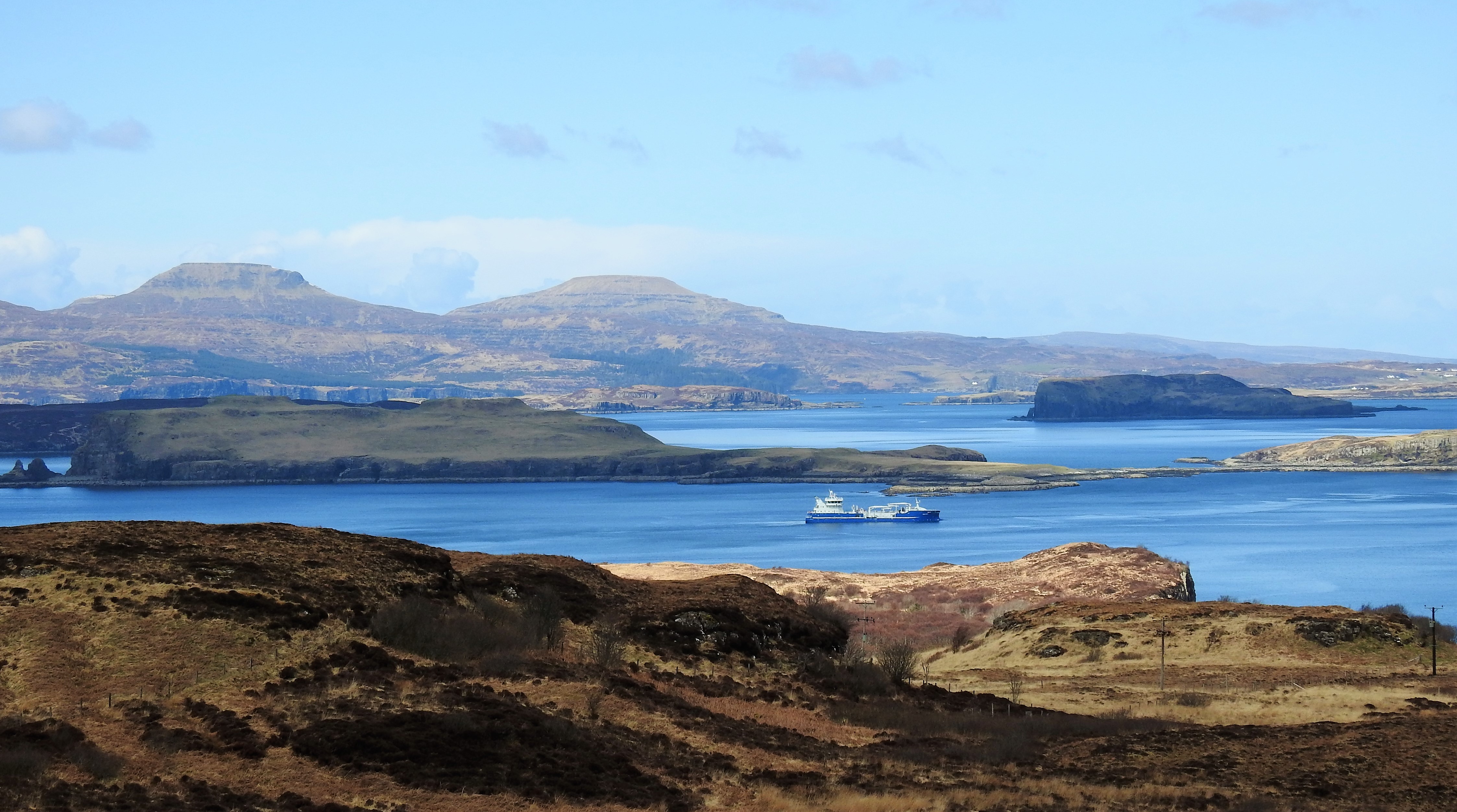
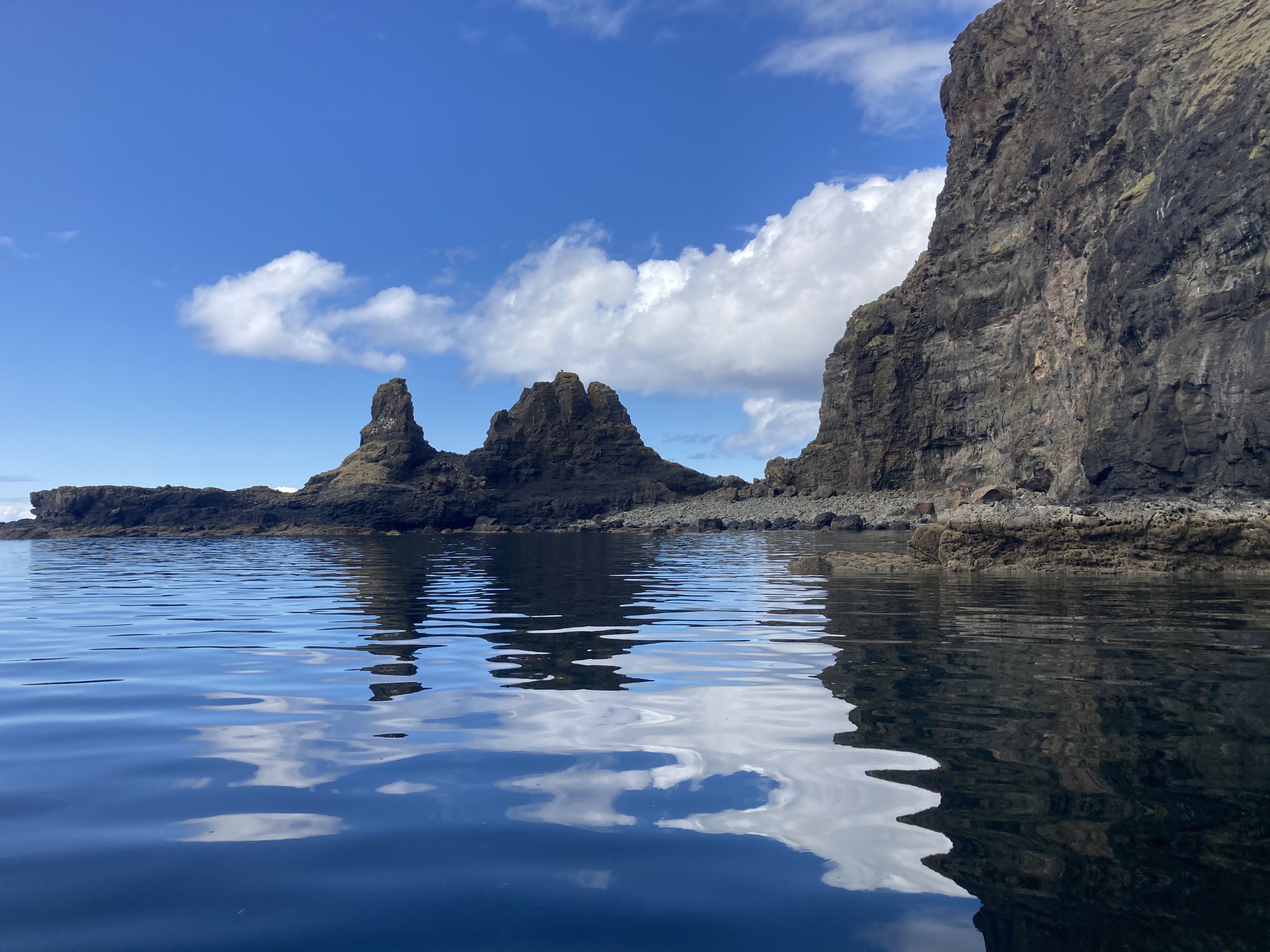
Oronsay, Loch Bracadale on:
[Wikipedia]
[Google]
[Amazon]

 Oronsay () is an uninhabited
Image:Oronsay_Loch_Bracadale_Cliffs_01.jpg, The most westerly point of the island, as viewed from the most southwesterly point, looking north
Image:Oronsay_Loch_Bracadale_Cliffs_02.jpg, The most southwesterly point of Oronsay, as viewed from the most westerly point, looking south
Image:Oronsay_Loch_Bracadale_Cliffs_03.jpg, The cliffs along the northwestern side of the island, looking northeast

 Oronsay () is an uninhabited
 tidal island
A tidal island is a raised area of land within a waterbody, which is connected to the larger mainland by a natural isthmus or man-made causeway that is exposed at low tide and submerged at high tide, causing the land to switch between being ...
in Loch Bracadale
Loch Bracadale (Scottish Gaelic: ''Loch Bhràcadail'') is a sea loch on the west coast of Skye in Scotland. It separates the Minginish Peninsula in the south from the Duirinish Peninsula in the north.
Loch Bracadale and its associated inner loc ...
on the west coast of Skye
The Isle of Skye, or simply Skye, is the largest and northernmost of the major islands in the Inner Hebrides of Scotland. The island's peninsulas radiate from a mountainous hub dominated by the Cuillin, the rocky slopes of which provide some o ...
, Scotland.
It is c.1,000 metres (0.7miles) long by 220m wide running approximately north-east to south west.
At low tide (approx. below 4 metres) the island is connected to Ullinish
Ullinish (Gaelic: Uilfhinis) is a crofting township on Loch Bracadale, on the southwest coast of Skye, Scotland. The only promontory fort on Skye is located at Ullinish. It is situated to the west of Struan and just south of the hamlet of Ebost ...
Point on Skye via a narrow rocky causeway, some 200m long.
The name Oronsay is believed to derive from the Old Norse for 'tidal island'.
The eastern part of the island, which faces Skye, is low-lying grass land, while the western part rises until it reaches several cliffs, up to in height.
Views from the westward side are to the Atlantic, Idrigill Point, Macleod's Maidens, with the much larger island of Wiay c.0.8 miles north-west, behind which the flat tops of Healabhal Bheag
Healabhal Bheag is a hill located on the Duirinish peninsula of the Isle of Skye in the Inner Hebrides
The Inner Hebrides ( ; ) is an archipelago off the west coast of mainland Scotland, to the south east of the Outer Hebrides. Together t ...
and Healabhal Mhòr
Healabhal Mhòr (471 m), is a hill in the north of the Isle of Skye, Scotland. It is also known as MacLeod's Table North, as it lies close the fellow flat-topped hill of Healabhal Bheag, or MacLeod's Table South. Despite its lower height, it h ...
(Macleod's Tables) dominate from the Duirinish Peninsula.
Behind Wiay some 2.7miles north-west is Harlosh Island
Harlosh Island is one of four islands to be found in Isle of Skye, Skye's Loch Bracadale. Harlosh Island is from the coast of the Duirinish, Skye, Duirinish Peninsula and from the coast of the Minginish peninsula. At low tide it is only about ...
(narrowly separated from Harlosh
Harlosh () is a settlement on the island of Skye off the west coast of Scotland. The settlement is on a peninsula of the same name.
Situated at the end of a narrow peninsula between Lochs Caroy and Bharcasaig (both of which are arms of Loch Br ...
on Skye) and to the east of this, 1.7miles north-west (and directly north of Wiay) is Tarner Island
Tarner Island is a triangular shaped island in Loch Bracadale just off the coast off the Harlosh peninsula of Skye in Scotland. It is about in extent and is 0.65 miles at its longest by 0.33 miles at its widest
The coastline is largely cliff-l ...
.
Below the westernmost cliff of Oronsay sit several small sea stacks and the coast of the island contains several caves, however these are largely accessible except from the sea.
Oronsay is a well known hiking destination.
Images of the cliffs of Oronsay
Footnotes
Landforms of the Isle of Skye Tidal islands of Scotland Uninhabited islands of Highland (council area) {{SkyeLochalsh-geo-stub