|
Lambeth Marsh
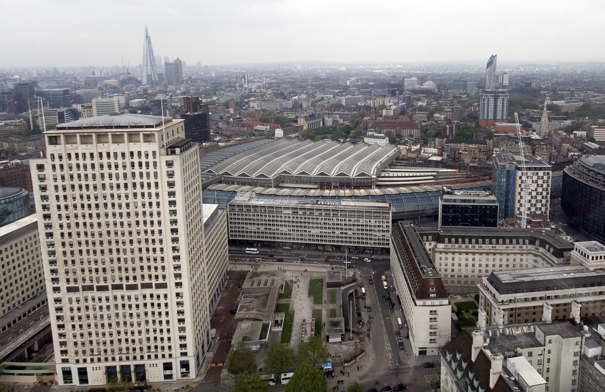
Lambeth Marsh (also Lower Marsh and Lambeth Marshe) is one of the oldest settlements on the South Bank of London, England. Until the early 19th century much of north Lambeth (now known as the South Bank) was mostly marsh. The settlement of Lambeth Marsh was built on a raised through road over the marsh lands, potentially dating back to Roman times. The land on which it stands was owned by the church of England, with Lambeth Palace nearby. Records and maps show that it was a separate village until the early 19th century when the church sold off the land in small pockets, thereby leading to sporadic development of individual houses rather than the grander redevelopments occurring north of the river. The northern tip of the ancient parish of Lambeth was a marshland known as ''Lambeth Marshe'', but it was drained in the 18th century and is remembered in the Lower Marsh street name. Sometime after the opening of Waterloo railway station in 1848 the locality around the station and ... [...More Info...] [...Related Items...] OR: [Wikipedia] [Google] [Baidu] [Amazon] |
Roger D'Amory
Roger Damory, Lord d'Amory, Baron d'Amory in Ireland, (d. bef. 14 March 1321/1322) was a nobleman and Constable of Corfe Castle. He was the younger son of Sir Robert D'Amory, Knight, of Bucknell and Woodperry, Oxfordshire. Sir Roger also possessed in his own right the manors of Bletchington and Holton, Oxfordshire, Standon in Hertfordshire, Caythorpe in Lincolnshire, and Knaresborough and St. Briavels' castles. He fought at the Battle of Bannockburn where he provided "good services", following which he was granted the manors of Sandal, Yorkshire and Vauxhall, Surrey, in 1317. He was summoned to Parliament on 20 November 1317, and again in the 11th (1318), 12th (1319), 13th (1320), and 14th (1321) years of the reign of King Edward II, whereby he is held to have become Lord d'Amory. He had been a favourite of King Edward II of England until he was displaced by Hugh Despenser the Younger. D'Amory took an active part in the Despenser War in 1321–1322 and was ... [...More Info...] [...Related Items...] OR: [Wikipedia] [Google] [Baidu] [Amazon] |
Westminster Bridge Road
Westminster Bridge Road is a road in London, England. It is on an east–west axis, and passes through the northern extremities of the boroughs of Lambeth and Southwark. Between 1740 and 1746, the Commissioners of Westminster Bridge bought land from the Archbishop of Canterbury and ground in Lambeth Marsh from the Lord Mayor and Commonalty of the City of London for the approach to the bridge on the southern side (which at that time was in Surrey). This was the start of Westminster Bridge Road. The route From the western end, the road starts as the A302 on the east side of the County Hall roundabout, where Westminster Bridge, York Road and the A3036 Lambeth Palace Road intersect. It then passes under the railway viaduct south of Waterloo station and intersects with Lower Marsh and Upper March before reaching the junction at Lambeth North Underground station (named ''Kennington Road'' when it opens on 10 March 1906, renamed ''Westminster Bridge Road'' in July 1906, and ... [...More Info...] [...Related Items...] OR: [Wikipedia] [Google] [Baidu] [Amazon] |
Vauxhall
Vauxhall ( , ) is an area of South London, within the London Borough of Lambeth. Named after a medieval manor called Fox Hall, it became well known for the Vauxhall Pleasure Gardens. From the Victorian period until the mid-20th century, Vauxhall was a mixed industrial and residential area, of predominantly manual workers' homes – many demolished and replaced by Lambeth Council with social housing after the Second World War – and business premises, including large railway, gas, and water works. These industries contrasted with the mostly residential neighbouring districts of Kennington and Pimlico. As in neighbouring Battersea and Nine Elms, riverside redevelopment has converted most former industrial sites into residential properties and new office space. Vauxhall has given its name to the Vauxhall Bridge, Vauxhall parliamentary constituency and Vauxhall Motors. Geography Vauxhall is south of Charing Cross and southwest of the actual centre of London at Frazie ... [...More Info...] [...Related Items...] OR: [Wikipedia] [Google] [Baidu] [Amazon] |
Blackfriars Bridge
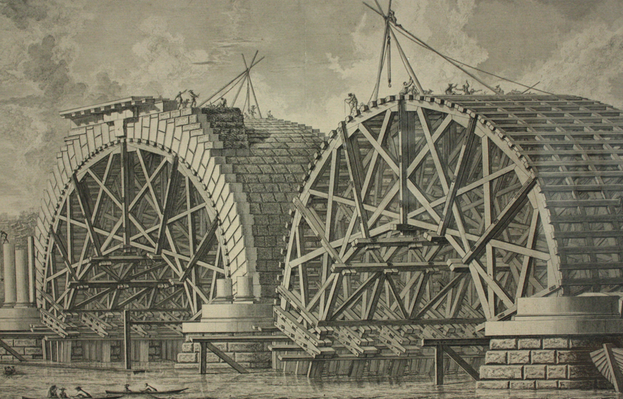
Blackfriars Bridge is a road and foot traffic bridge over the River Thames in London, between Waterloo Bridge and Blackfriars Railway Bridge, carrying the A201 road. The north end is in the City of London near the Inns of Court and Temple Church, along with Blackfriars station. The south end is in the London Borough of Southwark, near the Tate Modern art gallery and the Oxo Tower. Opened in the 1860s, it replaced an earlier bridge from the 1760s. History The first fixed crossing at Blackfriars was a long toll bridge designed in an Italianate style by Robert Mylne and constructed with nine semi-elliptical arches of Portland stone. Beating designs by John Gwynn and George Dance, it took nine years to build, opening to the public in 1769. It was the third bridge across the Thames in the then built-up area of London, supplementing the ancient London Bridge, which dated from several centuries earlier, and Westminster Bridge. It was originally named "William Pitt Bridge" ... [...More Info...] [...Related Items...] OR: [Wikipedia] [Google] [Baidu] [Amazon] |
The Cut (London)
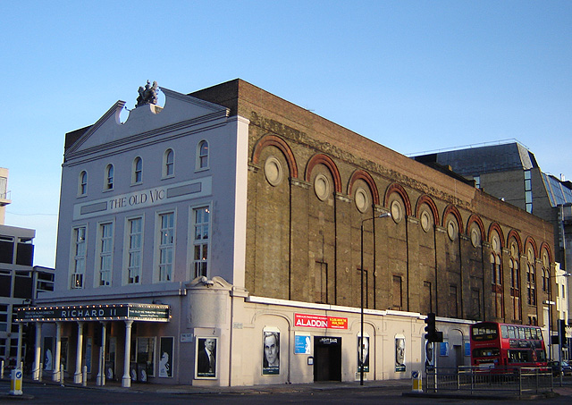
The Cut (formerly New Cut) is a street in London which runs between Waterloo Road in Lambeth and Blackfriars Road in Southwark, approximately parallel to the South Eastern Railway. The Old Vic theatre is at the western (Lambeth) end, and the more experimental Young Vic theatre halfway along on the other side. Lewisham Southwark College is sited on the south side of the Cut and at the eastern (Southwark) end is Southwark Underground station. Waterloo and Waterloo East stations are also nearby. Street market Lower Marsh and the Cut formed the commercial heart of the area from the early 19th century. Henry Mayhew estimated in the 1840s that 300 costermongers attended the market here. He described the scene in his work '' London Labour and the London Poor'': The fortunes of the street market changed rapidly with time. In 1851 Mayhew wrote: "Since the above description was written, the New Cut has lost much of its noisy and brilliant glory. In consequence of a New Poli ... [...More Info...] [...Related Items...] OR: [Wikipedia] [Google] [Baidu] [Amazon] |
London Borough Of Lambeth
Lambeth () is a London borough in South London, England, which forms part of Inner London. Its name was recorded in 1062 as ''Lambehitha'' ("landing place for lambs") and in 1255 as ''Lambeth''. The geographical centre of London is at Frazier Street near Lambeth North tube station, though nearby Charing Cross on the other side of the Thames in the City of Westminster is traditionally considered the centre of London. History The area of the modern borough had historically been part of the county of Surrey, and generally corresponds to the three ancient parishes of Lambeth, Clapham and Streatham. The parish of Lambeth included the archiepiscopal Lambeth Palace, and formed part of the Hundred of Brixton. It was an elongated north–south parish with of River Thames frontage opposite the cities of London and Westminster. Lambeth became part of the Metropolitan Police District in 1829. From 1856 the area of the modern borough was governed by the Metropolitan Board of Wo ... [...More Info...] [...Related Items...] OR: [Wikipedia] [Google] [Baidu] [Amazon] |
City Of London
The City of London, also known as ''the City'', is a Ceremonial counties of England, ceremonial county and Districts of England, local government district with City status in the United Kingdom, city status in England. It is the Old town, historic centre of London, though it forms only a small part of the larger Greater London metropolis. The City of London had a population of 8,583 at the 2021 United Kingdom census, 2021 census, however over 500,000 people were employed in the area as of 2019. It has an area of , the source of the nickname ''the Square Mile''. The City is a unique local authority area governed by the City of London Corporation, which is led by the Lord Mayor of London, Lord Mayor of the City of London. Together with Canary Wharf and the West End of London, West End, the City of London forms the primary central business district of London, which is one of the leading financial centres of the world. The Bank of England and the London Stock Exchange are both ba ... [...More Info...] [...Related Items...] OR: [Wikipedia] [Google] [Baidu] [Amazon] |
William Curtis
William Curtis (11 January 1746 – 7 July 1799) was an English botanist and entomologist, who was born at Alton, Hampshire, site of the Curtis Museum. Curtis began as an apothecary, before turning his attention to botany and other natural history. The publications he prepared reached a wider audience than early works on the subject had intended. At the age of 25 he produced ''Instructions for collecting and preserving insects; particularly moths and butterflies''. Curtis was demonstrator of plants and Praefectus Horti at the Chelsea Physic Garden from 1771 to 1777. He established his own London Botanic Garden at Lambeth in 1779, moving to Brompton in 1789. He published '' Flora Londinensis'' (6 volumes, 1777–1798), a pioneering work in that it devoted itself to urban nature. Financial success was not found, but he went on the publish '' The Botanical Magazine'' in 1787, a work that would also feature hand coloured plates by artists such as James Sowerby and Sydenham Ed ... [...More Info...] [...Related Items...] OR: [Wikipedia] [Google] [Baidu] [Amazon] |
Cupers Gardens
Cuper's Gardens were 17th- and 18th-century pleasure gardens (or tea gardens) on the south side of the River Thames in Lambeth, London. The gardens looked over to Somerset House near Waterloo Bridge, and were centered on what is now the north end of Waterloo Road. In 1643, Thomas Howard, 21st Earl of Arundel bought of land which he leased to his gardener Abraham Boydell Cuper. The gardens opened in the 1680s and were named after the original proprietor. They were also known as Cupid's Gardens. In 1686, of adjoining land was bought from the Archbishop of Canterbury, William Sancroft, and added to the gardens. A long landing stage in the river known as Cuper's Bridge acted as a popular entrance for the gardens. In 1736, an orchestra was included among the attractions. It also became known for its firework displays. However, it lost its license in 1753 due to the loose morals of its visitors. It remained open as an unlicensed tea garden before finally closing in 1760. See also ... [...More Info...] [...Related Items...] OR: [Wikipedia] [Google] [Baidu] [Amazon] |
Samuel Pepys
Samuel Pepys ( ; 23 February 1633 – 26 May 1703) was an English writer and Tories (British political party), Tory politician. He served as an official in the Navy Board and Member of Parliament (England), Member of Parliament, but is most remembered today for the diary he kept for almost a decade. Though he had no Maritime pilot, maritime experience, Pepys rose to be the Chief Secretary to the Admiralty under both Charles II of England, Charles II and James II of England, James II through patronage, diligence, and his talent for administration. His influence and reforms at the Admiralty (United Kingdom), English Admiralty were important in the early professionalisation of the Royal Navy. The detailed private diary that Pepys kept from 1660 until 1669 was first published in the 19th century and is one of the most important primary sources of the Stuart Restoration. It provides a combination of personal revelation and eyewitness accounts of great events, such as the Grea ... [...More Info...] [...Related Items...] OR: [Wikipedia] [Google] [Baidu] [Amazon] |
A3036 Road
The A3036 is an A road in London, England, running from Waterloo to Wandsworth. Route It starts at the southern tip of the County Hall roundabout where the A302 Westminster Bridge, York Road and A23 Westminster Bridge Road all intersect. Lambeth Palace Road This stretch of the route is called Lambeth Palace Road and heads southwest, past St Thomas' Hospital and at the southern end meets Palace itself, the London base of the Archbishop of Canterbury at the roundabout junction with the A3203 at Lambeth Bridge, where it runs along the south side of the Thames. History The road was constructed in the 1860s at the same time as the Albert Embankment as part of the land reclamation that allowed the construction of St Thomas' Hospital. The road originally ran in a straight line parallel to the river, with views between the pavilion blocks of the hospital to the Thames. Since the redevelopment of the hospital in the 1960s, the road now follows a route further inland, alth ... [...More Info...] [...Related Items...] OR: [Wikipedia] [Google] [Baidu] [Amazon] |
