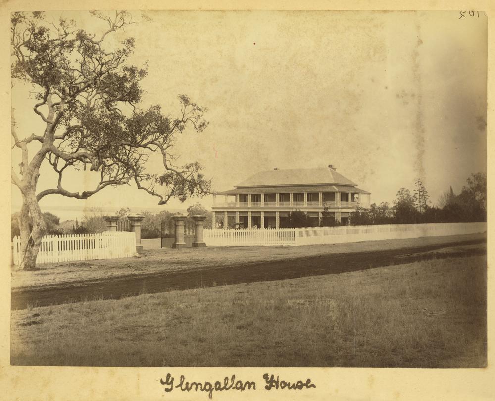
Glengallan, Queensland on:
[Wikipedia]
[Google]
[Amazon]
Glengallan is a rural
 Glengallan has a number of
locality
Locality may refer to:
* Locality, a historical named location or place in Canada
* Locality (association), an association of community regeneration organizations in England
* Locality (linguistics)
* Locality (settlement)
* Suburbs and localitie ...
in the Southern Downs Region
The Southern Downs Region is a local government area (LGA) in the Darling Downs region of Queensland, Australia. The region runs along the state's southern boundary with New South Wales and was created in 2008 from a merger of the Shire of War ...
, Queensland
Queensland ( , commonly abbreviated as Qld) is a States and territories of Australia, state in northeastern Australia, and is the second-largest and third-most populous state in Australia. It is bordered by the Northern Territory, South Austr ...
, Australia. In the , Glengallan had a population of 57 people.
Geography
Glengallan is part of theDarling Downs
The Darling Downs is a farming region on the western slopes of the Great Dividing Range in southern Queensland, Australia. The Downs are to the west of South East Queensland and are one of the major regions of Queensland. The name was generally ...
.
The New England Highway
New England Highway is an long highway in Australia running from Yarraman, Queensland, Yarraman, north of Toowoomba, Queensland, at its northern end to Hexham, New South Wales, Hexham at Newcastle, New South Wales, Newcastle, New South Wales, ...
enters the locality from the north-west ( Mount Marshall). The Cunningham Highway
The Cunningham Highway is a National Highway (Australia), national highway located in South East Queensland, south-eastern Queensland, Australia. The highway links the Darling Downs region with the urbanised outskirts of Ipswich, Queensland, I ...
enters the locality from the south-east and merges with the New England Highway, and then together exits the locality to the south ( Willowvale and Sladevale).
The land is mostly flat (approx above sea level except for Mount Marshall in the north-east of the locality () which rises to .
The land use is predominantly crop growing with grazing on native vegetation on the sloes of Mount Marshall.
History
The name ''Glengallan'' derives from the name of the pastoral run, taken up by Colin and John Campbell in 1841. Glengallan Station School opened circa 1886 for the education for the children of the staff of Glengallan Station. In 1891, it became Glengallan Provisional School. On 1 January 1909, it became Glengallon State School. It closed in 1921. In late 1922 or early 1923, it was amalgamated with Wilsonville State School to become Mount Marshall State School, which closed in 1965. On Monday 14 September 1908, the foundation stone of St Andrew's Anglican Church was laid by Archdeacon Rivers. The church was dedicated on 23 November 1908 byArchbishop
In Christian denominations, an archbishop is a bishop of higher rank or office. In most cases, such as the Catholic Church, there are many archbishops who either have jurisdiction over an ecclesiastical province in addition to their own archdi ...
St Clair Donaldson
St Clair George Alfred Donaldson (11 February 1863 – 7 December 1935) was an English Anglican bishop. He was the first Anglican Archbishop of Brisbane, Australia.
Early life
Donaldson was the third son of Sir Stuart Alexander Donaldson and h ...
. It closed in 1962.
Glengallan Methodist church opened on Sunday 4 October 1908 with a celebratory tea meeting on Wednesday 7 October 1908.
Glengallan Presbyterian Church was officially opened and dedicated on Sunday 19 September 1909 by Reverend R. Kerr. It was on a site donated by Walter Skerman opposite the provisional school.
Demographics
In the , Glengallan had a population of 54 people. In the , Glengallan had a population of 57 people.Heritage listings
 Glengallan has a number of
 heritage-listed
This list is of heritage registers, inventories of cultural properties, natural and human-made, tangible and intangible, movable and immovable, that are deemed to be of sufficient heritage value to be separately identified and recorded. In ma ...
sites, including:
* Glengallan Homestead
Glengallan Homestead is a heritage-listed homestead (buildings), homestead on the New England Highway, Glengallan, Queensland, Glengallan, Southern Downs Region, Queensland, Australia. It was built from 1864 to 1904. It is also known as Glengal ...
, New England Highway
Education
There are no schools in Glengallan. The nearest government primary schools are Allora State School inAllora
Allora is a rural town and Suburbs and localities (Australia), locality in the Southern Downs Region, Queensland, Australia. In the , the locality of Allora had a population of 1,205.
Geography
Allora is on the Darling Downs in south-easter ...
to the north-west and Freestone State School in Freestone to the south-east. The nearest government secondary schools are Allora State School (to Year 10) in Allora and Warwick State High School
Warwick State High School is a heritage-listed state high school at 15 Palmerin Street, Warwick, Southern Downs Region, Queensland, Australia. It was designed by Thomas Pye and Block A was built from 1914 to 1915. It is also known as Warwick Te ...
(to Year 12) in Warwick
Warwick ( ) is a market town, civil parish and the county town of Warwickshire in the Warwick District in England, adjacent to the River Avon, Warwickshire, River Avon. It is south of Coventry, and south-east of Birmingham. It is adjoined wit ...
to the south.
References
{{Southern Downs Region Southern Downs Region Localities in Queensland