|
Świdwin
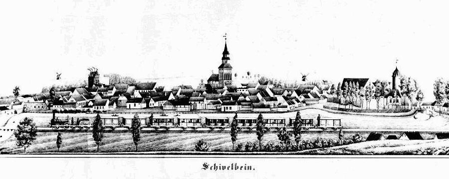
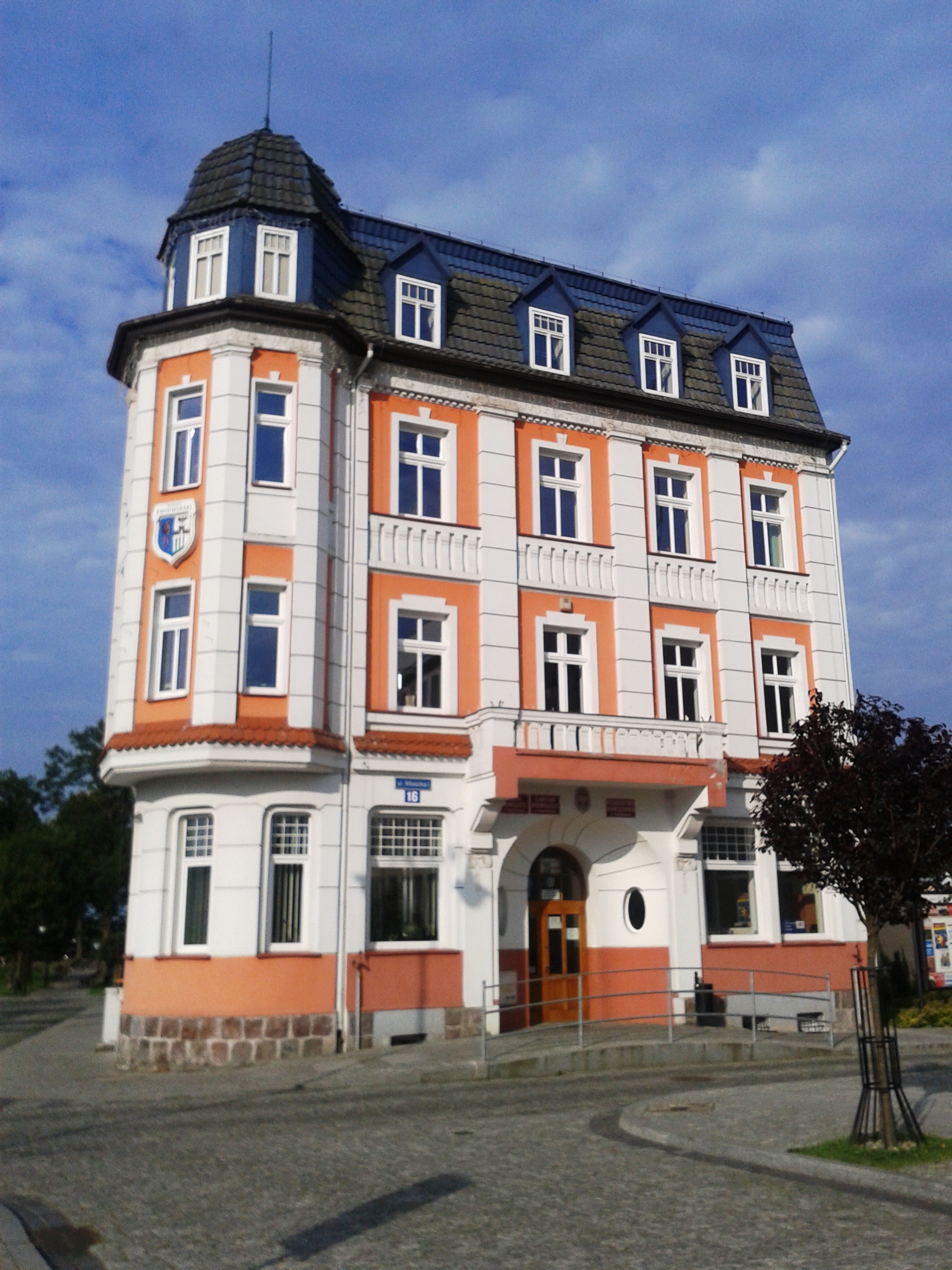
Świdwin (german: Schivelbein; csb, Skwilbëno) is a town in West Pomeranian Voivodeship of northwestern Poland. It is the capital of Świdwin County established 1999, previously having been in Koszalin Voivodeship (1950–1998), and the administrative seat - though not part - of the Gmina Świdwin. Świdwin is situated in the historic Pomerania region on the left banks of the Rega river, about east of the regional capital Szczecin and south of the Baltic coast at Kołobrzeg. In 2018 the town had a population of 15,725. History In the 12th century there was a gród on the trade route from the coastal city of Kołobrzeg to Greater Poland. In the 13th century the settlement belonged to the Duchy of Pomerania under the Griffin duke Barnim I. In 1248 the duke ceded the area to the Bishop of Cammin, who shortly afterwards sold it to the Ascanian margraves of Brandenburg. Schivelbein was incorporated as the northeastern outpost of the Neumark region. It was granted tow ... [...More Info...] [...Related Items...] OR: [Wikipedia] [Google] [Baidu] |
Gmina Świdwin
__NOTOC__ Gmina Świdwin is a rural gmina (administrative district) in Świdwin County, West Pomeranian Voivodeship, in north-western Poland. Its seat is the town of Świdwin, although the town is not part of the territory of the gmina. The gmina covers an area of , and as of 2006 its total population is 6,202. Villages Gmina Świdwin contains the villages and settlements of Bedlno, Bełtno, Berkanowo, Bierzwnica, Blizno, Buczyna, Bystrzyna, Bystrzynka, Cieszeniewo, Cieszyno, Czarnolesie, Dobrowola, Głuszkowo, Gola Dolna, Gola Górna, Karpno, Kartlewo, Kawczyno, Klępczewo, Kleśnica, Kłośniki, Kluczkówko, Kluczkowo, Kowanowo, Krasna, Krosino, Kunowo, Łąkowo, Lekowo, Lipce, Miłobrzegi, Niemierzyno, Nowy Przybysław, Oparzno, Osowo, Półchleb, Przybyradz, Przymiarki, Psary, Rogalinko, Rogalino, Rusinowo, Rycerzewko, Sława, Śliwno, Smardzko, Stary Przybysław, Świdwinek and Ząbrowo. Neighbouring gminas Gmina Świdwin is ... [...More Info...] [...Related Items...] OR: [Wikipedia] [Google] [Baidu] |
Świdwin County
__NOTOC__ Świdwin County ( pl, powiat świdwiński) is a unit of territorial administration and local government (powiat) in West Pomeranian Voivodeship, north-western Poland. It came into being on January 1, 1999, as a result of the Polish local government reforms passed in 1998. Its administrative seat and largest town is Świdwin, which lies north-east of the regional capital Szczecin. The only other town in the county is Połczyn-Zdrój, lying east of Świdwin. The county covers an area of . As of 2012 its total population is 49,181. Neighbouring counties Świdwin County is bordered by Kołobrzeg County and Białogard County to the north, Szczecinek County to the east, and Drawsko County and Łobez County to the south. Administrative division The county is subdivided into six gmina The gmina (Polish: , plural ''gminy'' , from German ''Gemeinde'' meaning ''commune'') is the principal unit of the administrative division of Poland, similar to a municipality. , there wer ... [...More Info...] [...Related Items...] OR: [Wikipedia] [Google] [Baidu] |
West Pomeranian Voivodeship
The West Pomeranian Voivodeship, also known as the West Pomerania Province, is a voivodeship (province) in northwestern Poland. Its capital and largest city is Szczecin. Its area equals 22 892.48 km² (8,838.84 sq mi), and in 2021, it was inhabited by 1 682 003 people. It was established on 1 January 1999, out of the former Szczecin and Koszalin Voivodeships and parts of Gorzów, Piła and Słupsk Voivodeships, pursuant to the Polish local government reforms adopted in 1998. It borders on Pomeranian Voivodeship to the east, Greater Poland Voivodeship to the southeast, Lubusz Voivodeship to the south, the German federal-states of Mecklenburg-West Pomerania and Brandenburg to the west, and the Baltic Sea to the north.Ustawa z dnia 24 lipca 1998 r. o wprowadzeniu zasadniczego trójstopniowego podziału terytorialnego państwa (Dz.U. z 1998 r. nr 96, poz. 603). Geography and tourism West Pomeranian Voivodeship is the fifth largest voivodeship of Poland in terms of area. ... [...More Info...] [...Related Items...] OR: [Wikipedia] [Google] [Baidu] |
Rega
The Rega is a river in north-western Poland, flowing into the Baltic Sea. It is the country's 24th longest river, with a total length of 188 km and a catchment area of 2,767 km2. Statistics Poland, p. 85-86 Towns The following towns are situated on the Rega:Tributaries The following rivers are tributaries of the Rega: * Brzeźnicka Węgorza *[...More Info...] [...Related Items...] OR: [Wikipedia] [Google] [Baidu] |
Polish Car Number Plates
Vehicle registration plates of Poland indicate the region of registration of the vehicle given the number plate. According to Polish law, the registration plate is tied to the vehicle, not the owner. There is no possibility for the owner to keep the licence number for use on a different car, even if it's a cherished registration. The licence plates are issued by the powiat (county) of the vehicle owner's registered address of residence, in the case of a natural person. If it is owned by a legal person, the place of registration is determined by his/her address. Vehicles leased under operating leases and many de facto finance leases will be registered at the address of the lessor. When a vehicle changes hands, the new owner must apply for new vehicle registration document bearing his or her name and registered address. The new owner may obtain a new licence plate although it is not necessary when the new owner's residence address is in the same district as the previous owner's. I ... [...More Info...] [...Related Items...] OR: [Wikipedia] [Google] [Baidu] |
Neumark
The Neumark (), also known as the New March ( pl, Nowa Marchia) or as East Brandenburg (), was a region of the Margraviate of Brandenburg and its successors located east of the Oder River in territory which became part of Poland in 1945. Called the Lubusz Land while part of medieval Poland, the territory later known as the Neumark gradually became part of the German Margraviate of Brandenburg from the mid-13th century. As Brandenburg-Küstrin the Neumark formed an independent state of the Holy Roman Empire of the German Nation from 1535 to 1571; after the death of the margrave John, a younger son of Joachim I Nestor, Elector of Brandenburg, it returned to Elector John George, the margrave's nephew and Joachim I Nestor's grandson. With the rest of the Electorate of Brandenburg, it became part of the Kingdom of Prussia in 1701 and part of the German Empire in 1871 when each of those states first formed. After World War I the entirely ethnic German Neumark remained within the ... [...More Info...] [...Related Items...] OR: [Wikipedia] [Google] [Baidu] |
Pomerania
Pomerania ( pl, Pomorze; german: Pommern; Kashubian: ''Pòmòrskô''; sv, Pommern) is a historical region on the southern shore of the Baltic Sea in Central Europe, split between Poland and Germany. The western part of Pomerania belongs to the German states of Mecklenburg-Western Pomerania and Brandenburg, while the eastern part belongs to the West Pomeranian, Pomeranian and Kuyavian-Pomeranian voivodeships of Poland. Its historical border in the west is the Mecklenburg-Western Pomeranian border '' Urstromtal'' which now constitutes the border between the Mecklenburgian and Pomeranian part of Mecklenburg-Western Pomerania, while it is bounded by the Vistula River in the east. The easternmost part of Pomerania is alternatively known as Pomerelia, consisting of four sub-regions: Kashubia inhabited by ethnic Kashubians, Kociewie, Tuchola Forest and Chełmno Land. Pomerania has a relatively low population density, with its largest cities being Gdańsk and Szczecin. Outside ... [...More Info...] [...Related Items...] OR: [Wikipedia] [Google] [Baidu] |
Voivodeships Of Poland
, alt_name = province, state , map = , category = Provinces (unitary local government subdivision) , territory = Republic of Poland , start_date = , current_number = 16 voivodeships , number_date = , population_range = 966,000 (Opole) – 5,432,000 ( Masovian) , area_range = (Opole) – ( Masovian) , government = Voivodeship government, National government , subdivision = Powiat (county) A voivodeship (; pl, województwo ; plural: ) is the highest-level administrative division of Poland, corresponding to a province in many other countries. The term has been in use since the 14th century and is commonly translated into English as "province". The Polish local government reforms adopted in 1998, which went into effect on 1 January 1999, created sixteen new voivodeships. These replaced the 49 former voivodeships that had existed from 1 July 1975, and bear a greater resemblance ... [...More Info...] [...Related Items...] OR: [Wikipedia] [Google] [Baidu] |
Barnim I, Duke Of Pomerania
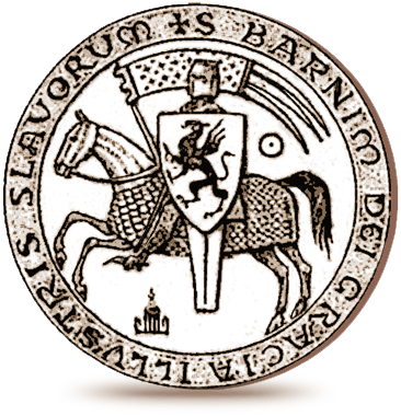
Barnim I the Good ( – 13 November 1278) from the Griffin dynasty was a Duke of Pomerania (''ducis Slauorum et Cassubie'') from 1220 until his death. Life Son of Duke Bogislaw II and Miroslava of Pomerelia, he succeeded to the Duchy of Pomerania-Stettin upon his father's death in 1220; he had however to share the rule of Pomerania with his cousin Wartislaw III, who resided at Demmin. Because he was minor when his father died, until about 1226 his lands were under the regency of his mother Miroslawa from the Pomerelian Samborides dynasty. At first still a Danish fief, the Pomeranian lands fell back to the Holy Roman Empire after the victory of several North-German princes at the 1227 Battle of Bornhöved. Emperor Frederick II of Hohenstufen in 1231 put the Duchy of Pomerania under the suzerainty of the Ascanian margraves of Brandenburg, disregarding the tenure of the Griffin dynasty, and thereby fueling the long-term Brandenburg–Pomeranian conflict. After his cousin Wa ... [...More Info...] [...Related Items...] OR: [Wikipedia] [Google] [Baidu] |
Bishopric Of Cammin
The Bishopric of Cammin (also Kammin, Kamień Pomorski) was both a former Roman Catholic diocese in the Duchy of Pomerania from 1140 to 1544, and a secular territory of the Holy Roman Empire ( Prince-Bishopric) in the Kolberg (Kołobrzeg) area from 1248 to 1650. The diocese comprised the areas controlled by the House of Pomerania in the 12th century, thus differing from the later territory of the Duchy of Pomerania by the exclusion of the Principality of Rügen and inclusion of Circipania, Mecklenburg-Strelitz, and the northern Uckermark and New March. The diocese was rooted in the Conversion of Pomerania by Otto of Bamberg in 1124 and 1128, and was dissolved during the Protestant Reformation, when the Pomeranian nobility adopted Lutheranism in 1534 and the last pre-reformatory bishop died in 1544. The Catholic diocese was succeeded by the Pomeranian Evangelical Church and suppressed until 1945, when its new incarnation, the Apostolic Administration of Kamień (''Cammin''), Lub ... [...More Info...] [...Related Items...] OR: [Wikipedia] [Google] [Baidu] |
Margraviate Of Brandenburg
The Margraviate of Brandenburg (german: link=no, Markgrafschaft Brandenburg) was a major principality of the Holy Roman Empire from 1157 to 1806 that played a pivotal role in the history of Germany and Central Europe. Brandenburg developed out of the Northern March founded in the territory of the Slavic Wends. It derived one of its names from this inheritance, the March of Brandenburg (). Its ruling margraves were established as prestigious prince-electors in the Golden Bull of 1356, allowing them to vote in the election of the Holy Roman Emperor. The state thus became additionally known as Electoral Brandenburg or the Electorate of Brandenburg ( or ). The House of Hohenzollern came to the throne of Brandenburg in 1415. In 1417, Frederick I moved its capital from Brandenburg an der Havel to Berlin. By 1535, the electorate had an area of some and a population of 400,000. Preserved SmithThe Social Background of the Reformation.1920. Page 17. Under Hohenzollern leadership, Bra ... [...More Info...] [...Related Items...] OR: [Wikipedia] [Google] [Baidu] |
House Of Ascania
The House of Ascania (german: Askanier) was a dynasty of German rulers. It is also known as the House of Anhalt, which refers to its longest-held possession, Anhalt. The Ascanians are named after Ascania (or Ascaria) Castle, known as ''Schloss Askanien'' in German, which was located near and named after Aschersleben. The castle was the seat of the County of Ascania, a title that was later subsumed into the titles of the princes of Anhalt. History The earliest known member of the house, Esiko, Count of Ballenstedt, first appears in a document of 1036. He is assumed to have been a grandson (through his mother) of Odo I, Margrave of the Saxon Ostmark. From Odo, the Ascanians inherited large properties in the Saxon Eastern March. Esiko's grandson was Otto, Count of Ballenstedt, who died in 1123. By Otto's marriage to Eilika, daughter of Magnus, Duke of Saxony, the Ascanians became heirs to half of the property of the House of Billung, former dukes of Saxony. Otto's son, Al ... [...More Info...] [...Related Items...] OR: [Wikipedia] [Google] [Baidu] |


