|
Common Dentex
The common dentex (''Dentex dentex'') is a species of marine ray-finned fish belonging to the family Sparidae, which includes the seabreams and porgies. This species is found in the northeastern Atlantic Ocean and the Mediterranean Sea. It is a highly valued food fish and is an important target species for fisheries and the population has shown large declines leading the International Union for Conservation of Nature to classify its conservation status as Vulnerable. Taxonomy The common dentex was first formally described as ''Sparus dentex'' by Carl Linnaeus in the 10th edition of his ''Systema Naturae''. Linnaeus gave type locality as the Atlantic Ocean and the Mediterranean Sea. In 1814 Georges Cuvier proposed the genus '' Dentex'' with ''Sparus dentex'' as the type species by absolute tautonymy. The genus ''Dentex'' is placed in the family Sparidae within the order Spariformes by the 5th edition of ''Fishes of the World''. Some authorities classify this genus in the subfami ... [...More Info...] [...Related Items...] OR: [Wikipedia] [Google] [Baidu] |
Carl Linnaeus
Carl Linnaeus (23 May 1707 – 10 January 1778), also known after ennoblement in 1761 as Carl von Linné,#Blunt, Blunt (2004), p. 171. was a Swedish biologist and physician who formalised binomial nomenclature, the modern system of naming organisms. He is known as the "father of modern Taxonomy (biology), taxonomy". Many of his writings were in Latin; his name is rendered in Latin as and, after his 1761 ennoblement, as . Linnaeus was the son of a curate and was born in Råshult, in the countryside of Småland, southern Sweden. He received most of his higher education at Uppsala University and began giving lectures in botany there in 1730. He lived abroad between 1735 and 1738, where he studied and also published the first edition of his ' in the Netherlands. He then returned to Sweden where he became professor of medicine and botany at Uppsala. In the 1740s, he was sent on several journeys through Sweden to find and classify plants and animals. In the 1750s and 1760s, he co ... [...More Info...] [...Related Items...] OR: [Wikipedia] [Google] [Baidu] |
Fishes Of The World
''Fishes of the World'' is a standard reference for the systematics of fishes. It was first written in 1976 by the American ichthyologist Joseph S. Nelson (1937–2011). Now in its fifth edition (2016), the work is a comprehensive overview of the diversity and classification of the 30,000-plus fish species known to science. The book begins with a general overview of ichthyology, although it is not self-contained. After a short section on Chordata and non-fish taxa, the work lists all known fish families in a systematic fashion. Each family is given at least one paragraph, and usually a body outline drawing; large families have subfamilies and tribes described as well. Notable genera and species are mentioned, though the book does generally not deal with the species-level diversity. The complexities of the higher taxa are described succinctly, with many references for difficult points. The book does not contain any color illustrations. The fourth edition was the first to inco ... [...More Info...] [...Related Items...] OR: [Wikipedia] [Google] [Baidu] |
Black Sea
The Black Sea is a marginal sea, marginal Mediterranean sea (oceanography), mediterranean sea lying between Europe and Asia, east of the Balkans, south of the East European Plain, west of the Caucasus, and north of Anatolia. It is bounded by Bulgaria, Georgia (country), Georgia, Romania, Russia, Turkey, and Ukraine. The Black Sea is Inflow (hydrology), supplied by major rivers, principally the Danube, Dnieper and Dniester. Consequently, while six countries have a coastline on the sea, its drainage basin includes parts of 24 countries in Europe. The Black Sea, not including the Sea of Azov, covers , has a maximum depth of , and a volume of . Most of its coasts ascend rapidly. These rises are the Pontic Mountains to the south, bar the southwest-facing peninsulas, the Caucasus Mountains to the east, and the Crimean Mountains to the mid-north. In the west, the coast is generally small floodplains below foothills such as the Strandzha; Cape Emine, a dwindling of the east end ... [...More Info...] [...Related Items...] OR: [Wikipedia] [Google] [Baidu] |
British Isles
The British Isles are an archipelago in the Atlantic Ocean, North Atlantic Ocean off the north-western coast of continental Europe, consisting of the islands of Great Britain, Ireland, the Isle of Man, the Inner Hebrides, Inner and Outer Hebrides, Outer Hebrides, the Northern Isles (Orkney and Shetland), and over six thousand smaller islands. They have a total area of and a combined population of almost 72 million, and include two sovereign states, the Republic of Ireland (which covers roughly five-sixths of Ireland), and the United Kingdom, United Kingdom of Great Britain and Northern Ireland. The Channel Islands, off the north coast of France, are normally taken to be part of the British Isles, even though geographically they do not form part of the archipelago. Under the UK Interpretation Act 1978, the Channel Islands are clarified as forming part of the British Islands, not to be confused with the British Isles. The oldest rocks are 2.7 billion years old and are ... [...More Info...] [...Related Items...] OR: [Wikipedia] [Google] [Baidu] |
Madeira
Madeira ( ; ), officially the Autonomous Region of Madeira (), is an autonomous Regions of Portugal, autonomous region of Portugal. It is an archipelago situated in the North Atlantic Ocean, in the region of Macaronesia, just under north of the Canary Islands, Spain, west of the Morocco and southwest of mainland Portugal. Madeira sits on the African Plate, African Tectonic Plate, but is culturally, politically and ethnically associated with Europe, with its population predominantly descended from Portuguese settlers. Its population was 251,060 in 2021. The capital of Madeira is Funchal, on the main island's south coast. The archipelago includes the islands of Madeira Island, Madeira, Porto Santo Island, Porto Santo, and the Desertas Islands, Desertas, administered together with the separate archipelago of the Savage Islands. Roughly half of the population lives in Funchal. The region has political and administrative autonomy through the Autonomous Regions of Portugal#Const ... [...More Info...] [...Related Items...] OR: [Wikipedia] [Google] [Baidu] |
Canary Islands
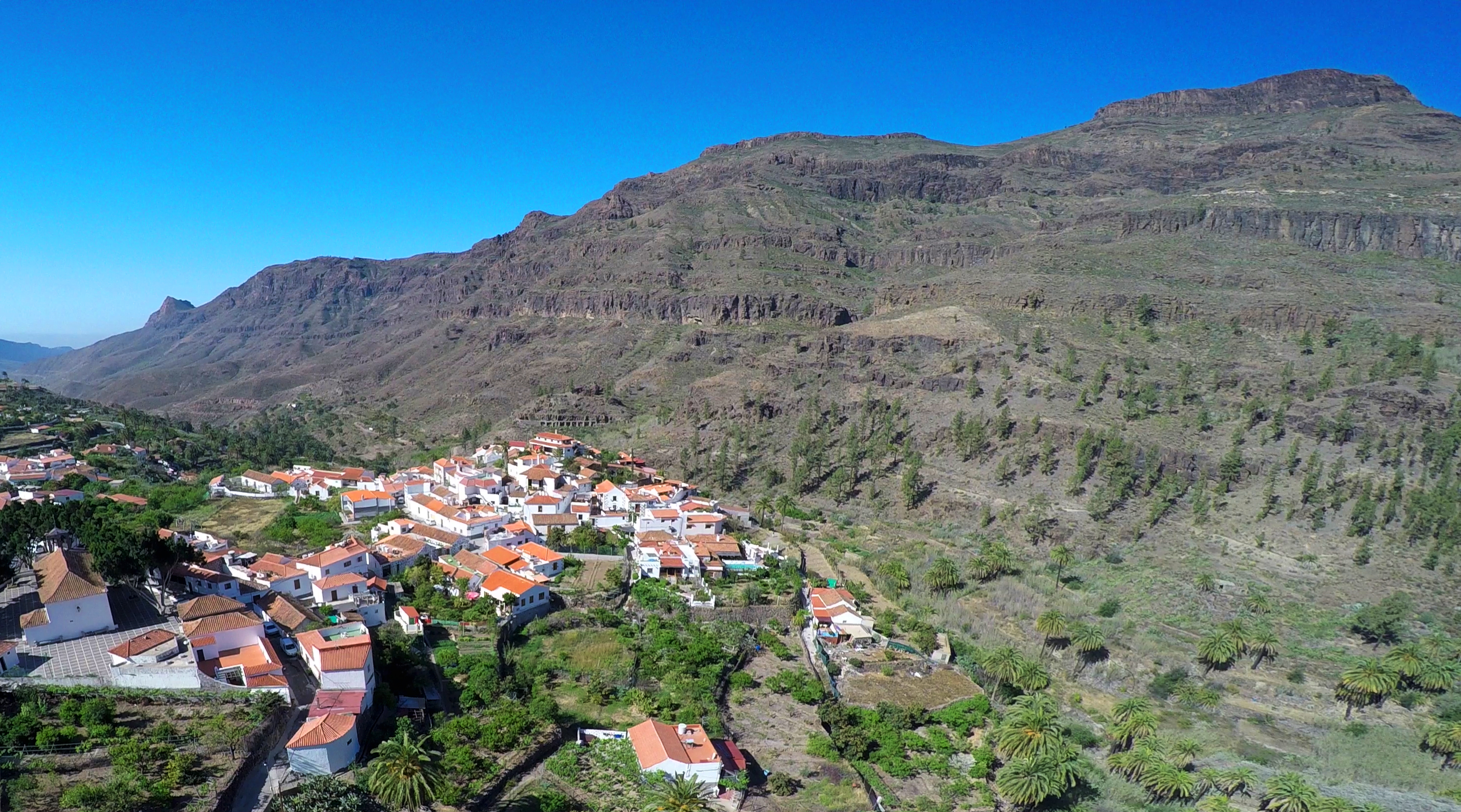
The Canary Islands (; ) or Canaries are an archipelago in the Atlantic Ocean and the southernmost Autonomous communities of Spain, Autonomous Community of Spain. They are located in the northwest of Africa, with the closest point to the continent being 100 kilometres (62 miles) away. The islands have a population of 2.25 million people and are the most populous overseas Special member state territories and the European Union, special territory of the European Union. The seven main islands are from largest to smallest in area, Tenerife, Fuerteventura, Gran Canaria, Lanzarote, La Palma, La Gomera, and El Hierro. The only other populated island is Graciosa, Canary Islands, La Graciosa, which administratively is dependent on Lanzarote. The archipelago includes many smaller islands and islets, including Alegranza, Islote de Lobos, Isla de Lobos, Montaña Clara, Roque del Oeste, and Roque del Este. It includes a number of rocks, including Roque de Garachico, Garachico and Roques de ... [...More Info...] [...Related Items...] OR: [Wikipedia] [Google] [Baidu] |
Ras Nouadhibou
Ras Nouadhibou () is a peninsula or headland divided by the border between Mauritania and Western Sahara on the African coast of the Atlantic Ocean. Since colonial times, it has internationally been known as ''Cabo Blanco'' in Spanish or ''Cap Blanc'' in French (both meaning "White Headland"). Geography The headland forms the western limit of Dakhlet Nouadhibou Bay. It is divided between Mauritania and Western Sahara. On the western side lies the ghost town of La Güera; on the eastern side, less than from the border, lies Mauritania's Nouadhibou (formerly Port Etienne). Although it is not the westernmost point of Africa, due to the Earth's tilt it is at least twice a year the last place in Africa where the sun sets. Environment Birds The headland has been designated an Important Bird Area (IBA) by BirdLife International because it supports significant populations of wintering water birds, including ruddy turnstones, slender-billed and lesser black-backed gulls, and ... [...More Info...] [...Related Items...] OR: [Wikipedia] [Google] [Baidu] |
Bay Of Biscay
The Bay of Biscay ( ) is a gulf of the northeast Atlantic Ocean located south of the Celtic Sea. It lies along the western coast of France from Point Penmarc'h to the Spanish border, and along the northern coast of Spain, extending westward to Cape Ortegal. The average depth is and the greatest depth is . Etymology The Bay of Biscay is known in Spain as the Gulf of Biscay (; ). In France, it is called the Gulf of Gascony ( ; ; ; ). In Latin, the bay was known as ( Cantabrian Gulf); the name Cantabrian Sea is still used locally for the southern area of the Bay of Biscay that washes over the northern coast of Spain ( Cantabria). The English name comes from Biscay on the northern Spanish coast, probably standing for the western Basque districts (''Biscay'' up to the early 19th century). Geography Parts of the continental shelf extend far into the bay, resulting in fairly shallow waters in many areas and thus the rough seas for which the region is known. Heavy storms ... [...More Info...] [...Related Items...] OR: [Wikipedia] [Google] [Baidu] |
Total Length
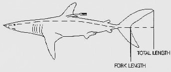
Fish measurement is the measuring of individual fish and various parts of their anatomies, for data used in many areas of ichthyology, including taxonomy and fishery biology. Overall length Standard length (SL) is the length of a fish measured from the tip of the snout to the posterior end of the last vertebra or to the posterior end of the midlateral portion of the hypural plate. This measurement excludes the length of the caudal (tail) fin. Total length (TL) is the length of a fish measured from the tip of the snout to the tip of the longer lobe of the caudal fin, usually measured with the lobes compressed along the midline. It is a straight-line measure, not measured over the curve of the body. Standard length measurements are used with Teleostei (most bony fish), while total length measurements are used with Myxini (hagfish), Petromyzontiformes ( lampreys) and usually Elasmobranchii (shark Sharks are a group of elasmobranch cartilaginous fish characterized by a ... [...More Info...] [...Related Items...] OR: [Wikipedia] [Google] [Baidu] |
Preoperculum
This glossary of ichthyology is a list of definitions of terms and concepts used in ichthyology, the study of fishes. A B C D E F G H I J K L M N O P R S T U V W References Further reading * {{Cite book , last1=Moyle , first1=Peter , url=https://books.google.com/books?id=sZYWAQAAIAAJ , title=Fishes: An Introduction to Ichthyology , last2=C ... [...More Info...] [...Related Items...] OR: [Wikipedia] [Google] [Baidu] |
Anal Fin
Fins are moving appendages protruding from the body of fish that interact with water to generate thrust and help the fish swim. Apart from the tail or caudal fin, fish fins have no direct connection with the back bone and are supported only by muscles. Fish fins are distinctive anatomical features with varying structures among different clades: in ray-finned fish (Actinopterygii), fins are mainly composed of bony spines or rays covered by a thin stretch of scaleless skin; in lobe-finned fish ( Sarcopterygii) such as coelacanths and lungfish, fins are short rays based around a muscular central bud supported by jointed bones; in cartilaginous fish ( Chondrichthyes) and jawless fish ( Agnatha), fins are fleshy " flippers" supported by a cartilaginous skeleton. Fins at different locations of the fish body serve different purposes, and are divided into two groups: the midsagittal ''unpaired fins'' and the more laterally located ''paired fins''. Unpaired fins are pr ... [...More Info...] [...Related Items...] OR: [Wikipedia] [Google] [Baidu] |
Dorsal Fin
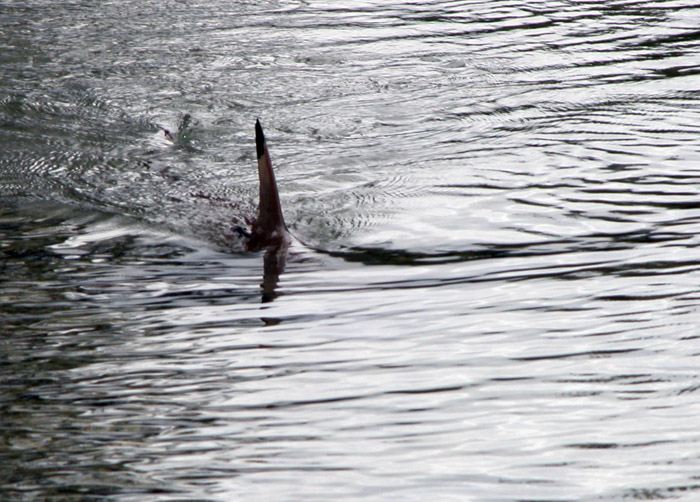
A dorsal fin is a fin on the back of most marine and freshwater vertebrates. Dorsal fins have evolved independently several times through convergent evolution adapting to marine environments, so the fins are not all homologous. They are found in most fish, in mammals such as whales, and in extinct ancient marine reptiles such as ichthyosaurs. Most have only one dorsal fin, but some have two or three. Wildlife biologists often use the distinctive nicks and wear patterns which develop on the dorsal fins of whales to identify individuals in the field. The bones or cartilages that support the dorsal fin in fish are called pterygiophores. Functions The main purpose of the dorsal fin is usually to stabilize the animal against rolling and to assist in sudden turns. Some species have further adapted their dorsal fins to other uses. The sunfish uses the dorsal fin (and the anal fin Fins are moving appendages protruding from the body of fish that interact with water to ge ... [...More Info...] [...Related Items...] OR: [Wikipedia] [Google] [Baidu] |


