|
Zalužany
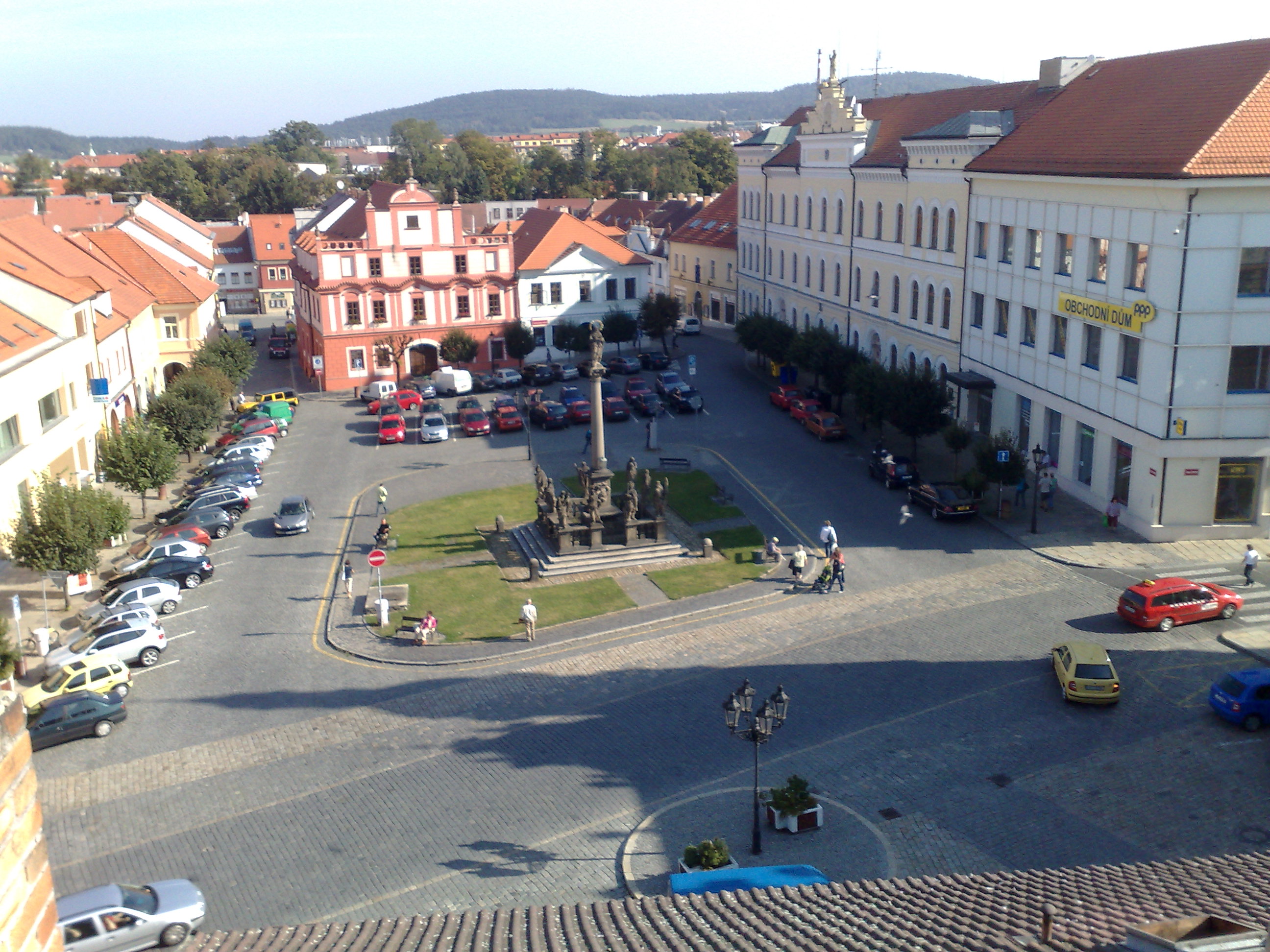
Zalužany () is a municipality and village in Příbram District in the Central Bohemian Region of the Czech Republic. It has about 300 inhabitants. Etymology The name is derived from or , i.e. "behind a meadow". It referred to its location. Geography Zalužany is located about southeast of Příbram and southwest of Prague. It lies in the Benešov Uplands. The highest point is at above sea level. There are several small fishponds in the municipal territory. History A Slavic settlement was founded in the area of today's Zalužany between the 8th and 10th centuries. In the 13th century, the village belonged under the administration of the royal castle of Kamýk nad Vltavou. The first written mention of Zalužany is from 1291 when King Wenceslaus II donated it to the Ostrov monastery in Davle. In the 14th century, the village had been divided in two parts. The smaller one belonged under the administration of the royal Orlík Castle and the larger one was consecutively owned by ... [...More Info...] [...Related Items...] OR: [Wikipedia] [Google] [Baidu] |
Příbram District
Příbram District () is a Okres, district in the Central Bohemian Region of the Czech Republic. Its capital is the town of Příbram. Administrative division Příbram District is divided into three Districts of the Czech Republic#Municipalities with extended competence, administrative districts of municipalities with extended competence: Dobříš and Sedlčany. List of municipalities Towns are marked in bold and market towns in ''italics'': Bezděkov pod Třemšínem - Bohostice - Bohutín (Příbram District), Bohutín - Borotice (Příbram District), Borotice - Bratkovice - Březnice (Příbram District), Březnice - Buková u Příbramě - Bukovany (Příbram District), Bukovany - Čenkov - Cetyně - Chotilsko - Chrást (Příbram District), Chrást - Chraštice - Čím - Daleké Dušníky - Dlouhá Lhota (Příbram District), Dlouhá Lhota - Dobříš - Dolní Hbity - Drahenice - Drahlín - Drásov (Příbram District), Drásov - Drevníky - Drhovy - Dubenec (Příbram Dis ... [...More Info...] [...Related Items...] OR: [Wikipedia] [Google] [Baidu] |
Písek
Písek (; ) is a town in the South Bohemian Region of the Czech Republic. It has about 31,000 inhabitants. The town is known for the oldest bridge in the country. The historic town centre is well preserved and is protected as an urban monument zone. Písek is a centre of education with a number of important schools. Up to the last decades of 19th century, Písek was the centre of the large autonomous Prácheňsko region. Administrative division Písek consists of nine municipal parts (in brackets population according to the 2021 census): *Budějovické Předměstí (18,219) *Hradiště (2,016) *Pražské Předměstí (5,577) *Václavské Předměstí (1,589) *Vnitřní Město (1,036) *Nový Dvůr (110) *Purkratice (47) *Semice (425) *Smrkovice (590) The urban core is formed by Budějovické Předměstí, Hradiště, Pražské Předměstí, Václavské Předměstí and Vnitřní Město, Etymology The name of Písek literally means 'sand' in Czech. It refers to the sand of th ... [...More Info...] [...Related Items...] OR: [Wikipedia] [Google] [Baidu] |
D4 Motorway (Czech Republic)
D4 motorway (), until 31 December 2015 formerly Limited-access highway, Expressway R4 () is a Controlled-access highway, motorway running from Prague in the Czech Republic, in a southwesterly direction. Some of the sections are managed through the Public–private partnership, PPP project called ''Via Salis'' (Salt Road). A total of is in operation. The route roughly follows the route of the historic Golden Trail and the I/4 road, which connects Prague and the western half of the South Bohemian Region. The highway starts at the exit from the I/4 Jíloviště road, because the section between Prague and Jíloviště, although it is four-lane, lacks an accompanying road, and therefore this section cannot be classified as a highway and tolled. A Vignette (road tax), vignette is therefore required only further south of Jíloviště, and along the entire route of the highway. On the second newest section between Mirotici and Třebkovo, the D4 highway is still free of tolls. The free ... [...More Info...] [...Related Items...] OR: [Wikipedia] [Google] [Baidu] |
Orlík Castle
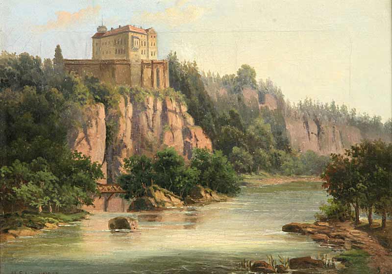
Orlík Castle () is a château in Orlík nad Vltavou, in Písek District in the South Bohemian Region of the Czech Republic. The original position of the spur castle, on a rock above the Vltava valley, was altered by the creation of the Orlík Reservoir in 1954–62, and the chateâu is now barely a few metres above the water level. The meaning of the name ''Orlík'' stems from the word "young eagle" (). It is often suggested that this castle would have resembled an eagle or nest perched upon the rocky outcrop above a turn in the river. History Orlík was established as a royal castle beside a ford across the Vltava River in the second half of the 13th century, probably by Ottokar II of Bohemia, although in the Middle Ages it came into the hands of noble families and its ownership changed many times. From 1408 the Zmrzlík of Svojšín family owned it, and during their time the Hussites, Hussite general Jan Žižka stayed in the castle. In 1508 the castle burned down, and was r ... [...More Info...] [...Related Items...] OR: [Wikipedia] [Google] [Baidu] |
Davle
Davle is a market town in Prague-West District in the Central Bohemian Region of the Czech Republic. It has about 1,900 inhabitants. Administrative division Davle consists of three municipal parts (in brackets population according to the 2021 census): *Davle (1,127) *Sázava (307) *Sloup (440) Etymology The name is derived from the personal name Davel, meaning "Davel's (court)". Until the 16th century, the settlement was called Davel, but then the name evolved to the feminine gender. Geography Davle is located about south of Prague. It lies in the Benešov Uplands. The highest point is the hill Suchý vrch with an elevation of . The market town is situated at the confluence of the Vltava and Sázava (river), Sázava rivers. History The first written mention of Davle is in the founding deed of the Benedictines, Benedictine monastery of St. John the Baptist by Duke Boleslaus II of Bohemia, Boleslaus II in 999. It became known as Ostrov Monastery, referring to its location on an i ... [...More Info...] [...Related Items...] OR: [Wikipedia] [Google] [Baidu] |
Wenceslaus II Of Bohemia
Wenceslaus II Přemyslid (; ; 27 SeptemberK. Charvátová, ''Václav II. Král český a polský'', Prague 2007, p. 18. 1271 – 21 June 1305) was King of Bohemia (1278–1305), Duke of Cracow (1291–1305), and King of Poland (1296–1305). He was the only son of King Ottokar II of Bohemia and Ottokar's second wife Kunigunda. He was born in 1271, ten years after the marriage of his parents. Kunigunda was the daughter of Rostislav Mikhailovich, lord of Slavonia, son of a Grand Prince of Kiev, and Anna of Hungary, daughter of Béla IV of Hungary. His great-grandfather was the German king Philip of Swabia. Wenceslaus II was the grandfather of the Holy Roman Emperor, Charles IV. He was a member of the Přemyslid dynasty. Early years In 1276 Rudolf I, King of the Romans, placed Ottokar under the ban of the empire and besieged Vienna. This compelled Ottokar in November 1276 to sign a new treaty by which he gave up all claims to Austria and the neighbouring duchies, r ... [...More Info...] [...Related Items...] OR: [Wikipedia] [Google] [Baidu] |
Kamýk Nad Vltavou
Kamýk nad Vltavou is a municipality and village in Příbram District in the Central Bohemian Region of the Czech Republic. It has about 1,000 inhabitants. It lies on the Vltava River. Administrative division Kamýk nad Vltavou consists of two municipal parts (in brackets population according to the 2021 census): *Kamýk nad Vltavou (842) *Velká (104) Etymology The word ''kamýk'' is and old Czech diminutive form of the Slavic word ''kamy'', meaning 'little stone', 'little rock'. Geography Kamýk nad Vltavou is located about east of Příbram and south of Prague. It lies in the Benešov Uplands. The highest point is the hill Bába at above sea level. The Vltava River flows through the municipality. A part of the Kamýk Reservoir, built on the Vltava, is located in the southern part of the municipality. History The first written mention of the Vrškamýk Castle is from 1236. The settlements above the castle called Starý Kamýk and Nový Kamýk were first mentioned in 1285. K ... [...More Info...] [...Related Items...] OR: [Wikipedia] [Google] [Baidu] |
Slavs
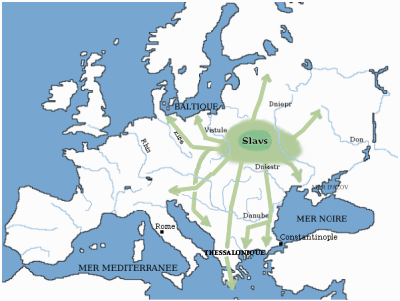
The Slavs or Slavic people are groups of people who speak Slavic languages. Slavs are geographically distributed throughout the northern parts of Eurasia; they predominantly inhabit Central Europe, Eastern Europe, Southeastern Europe, and Northern Asia, though there is a large Slavic minority scattered across the Baltic states and Central Asia, and a substantial Slavic diaspora in the Americas, Western Europe, and Northern Europe. Early Slavs lived during the Migration Period and the Early Middle Ages (approximately from the 5th to the 10th century AD), and came to control large parts of Central, Eastern, and Southeast Europe between the sixth and seventh centuries. Beginning in the 7th century, they were gradually Christianized. By the 12th century, they formed the core population of a number of medieval Christian states: East Slavs in the Kievan Rus', South Slavs in the Bulgarian Empire, the Principality of Serbia, the Duchy of Croatia and the Banate of B ... [...More Info...] [...Related Items...] OR: [Wikipedia] [Google] [Baidu] |
Obec
(, ; plural ) is the Czech and Slovak word for a municipality (in the Czech Republic, in Slovakia and abroad). The literal meaning of the word is " commune" or " community". It is the smallest administrative unit that is governed by elected representatives. Cities and towns are also municipalities. Definition The legal definition (according to the Czech code of law with similar definition in the Slovak code of law) is: ''"The municipality is a basic territorial self-governing community of citizens; it forms a territorial unit, which is defined by the boundary of the municipality."'' Every municipality is composed of one or more cadastral areas. Every municipality is also composed of one or more municipal parts (), which are usually town quarters or villages. A municipality can have its own flag and coat of arms. Czech Republic Almost the entire area of the Czech Republic is divided into municipalities, with the only exception being military training areas. The smaller mu ... [...More Info...] [...Related Items...] OR: [Wikipedia] [Google] [Baidu] |
Benešov Uplands
The Benešov Uplands or Benešov Hills () are uplands and a geomorphological mesoregion of the Czech Republic. It is located mostly in the Central Bohemian Region. It belongs to the largest mesoregions in the country. It is named after Benešov, which is the most populated town in the territory. Geomorphology The Benešov Uplands is a mesoregion of the Central Bohemian Hills within the Bohemian Massif. It is a rugged hilly area with erosional denudation relief, tectonically disturbed, with distinct structural ridges and inselbergs. The uplands are further subdivided into the microregions of Březnice Uplands and Dobříš Uplands. There are a lot of medium-high hills. The highest peaks are located in the southwestern part of the territory. The highest peaks of the Benešov Uplands are: *Stráž, *Pteč, *Hrby, *Špalková hora, *Drahenický vrch, *Levín, *Vraneč, *Kozí vrch, *Mumlin, *Holý vrch, Geography The Benešov Uplands stretches from southwest to nor ... [...More Info...] [...Related Items...] OR: [Wikipedia] [Google] [Baidu] |


