|
Zajezierze, Masovian Voivodeship
Zajezierze is a village in the administrative district of Gmina Sieciechów, within Kozienice County, Masovian Voivodeship, in east-central Poland. It lies approximately east of Sieciechów, east of Kozienice, and south-east of Warsaw. It is located in the central valley of the Vistula River on its left bank, opposite the city Dęblin, from which it is separated by two bridges, road and rail. On the national road and the rail trail (line 26) Łuków-Radom. In the years 1957-1975 as a class town, administratively belonged to the district Kozienice as part of the Region Kielce. In the period 1975-1998 was administratively belonged to the district Kozienice as part of the Region Radom Radom is a city in east-central Poland, located approximately south of the capital, Warsaw. It is situated on the Mleczna River in the Masovian Voivodeship. Radom is the fifteenth-largest city in Poland and the second-largest in its province w .... See also * Zajezierze (other) * ... [...More Info...] [...Related Items...] OR: [Wikipedia] [Google] [Baidu] |
List Of Sovereign States
The following is a list providing an overview of sovereign states around the world with information on their status and recognition of their sovereignty. The 205 listed states can be divided into three categories based on membership within the United Nations System: 193 member states of the United Nations, UN member states, two United Nations General Assembly observers#Current non-member observers, UN General Assembly non-member observer states, and ten other states. The ''sovereignty dispute'' column indicates states having undisputed sovereignty (188 states, of which there are 187 UN member states and one UN General Assembly non-member observer state), states having disputed sovereignty (15 states, of which there are six UN member states, one UN General Assembly non-member observer state, and eight de facto states), and states having a political status of the Cook Islands and Niue, special political status (two states, both in associated state, free association with New ... [...More Info...] [...Related Items...] OR: [Wikipedia] [Google] [Baidu] |
List Of Postal Codes In Poland
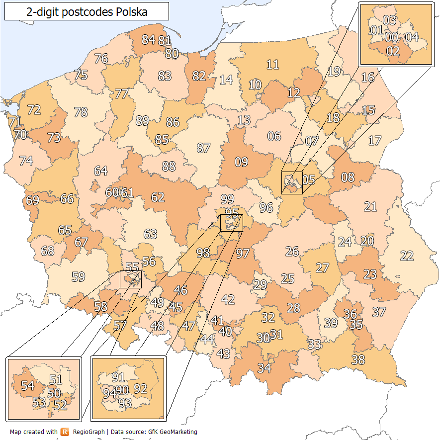
In Poland, postal codes are used for assigning post to addresses. They were introduced in 1973. They are five-digit codes of two-then-three digits, with a hyphen between them. The first digit indicates one of the 10 large postal regions the country is divided into. These areas do not follow the administrative divisions. The second and third digits specify a particular smaller region (originally the number of a regional sorting office, there was one in every county), and the last two are the number of a postal delivery branch. Clients receiving particularly large volumes of mail may have their own unique postal codes; the same goes for PO Box lobbies of the largest post offices. Postal codes are written in Poland before the city/town/locality name, e.g. 00-001 Warszawa. First digit in the postal code represents the postal district, second digit major geographical subdivision of this district, and the three digits after dash: the post office, or in case of large cities: particu ... [...More Info...] [...Related Items...] OR: [Wikipedia] [Google] [Baidu] |
Zajezierze (other) (north-west Poland)
{{geodis ...
Zajezierze may refer to the following places in Poland: *Zajezierze, Masovian Voivodeship (east-central Poland) * Zajezierze, Otwock County in Masovian Voivodeship (east-central Poland) * Zajezierze, Pomeranian Voivodeship (north Poland) * Zajezierze, Kartuzy County in Pomeranian Voivodeship (north Poland) * Zajezierze, Warmian-Masurian Voivodeship (north Poland) *Zajezierze, West Pomeranian Voivodeship Zajezierze is a village in the administrative district of Gmina Łobez, within Łobez County, West Pomeranian Voivodeship, in north-western Poland. It lies approximately south-east of Łobez and east of the regional capital Szczecin. Referenc ... [...More Info...] [...Related Items...] OR: [Wikipedia] [Google] [Baidu] |
Kielce
Kielce (; ) is a city in south-central Poland and the capital of the Świętokrzyskie Voivodeship. In 2021, it had 192,468 inhabitants. The city is in the middle of the Świętokrzyskie Mountains (Holy Cross Mountains), on the banks of the Silnica River, in the northern part of the historical Polish province of Lesser Poland. Kielce has a history back over 900 years, and the exact date that it was founded remains unknown. Kielce was once an important centre of limestone mining, and the vicinity is famous for its natural resources like copper, lead, uranium, and iron, which, over the centuries, were exploited on a large scale. There are several fairs and exhibitions held in Kielce throughout the year. One of the city's most famous food products is Kielecki Mayonnaise, a List of mayonnaises, type of mayonnaise. The city and its surroundings are also known for their historic architecture, park, green spaces, and recreational areas like the Świętokrzyski National Park. In sports, ... [...More Info...] [...Related Items...] OR: [Wikipedia] [Google] [Baidu] |
Radom
Radom is a city in east-central Poland, located approximately south of the capital, Warsaw. It is situated on the Mleczna River in the Masovian Voivodeship. Radom is the fifteenth-largest city in Poland and the second-largest in its province with a population of 196,918 (30.06.2023) Radom was a significant center of administration, having served as seat of the Polish Crown Council which ratified the Pact of Vilnius and Radom between Lithuania and Poland in 1401. The Nihil novi and Łaski's Statute were adopted by the Sejm at Radom's Royal Castle in 1505. In 1976, it was a center of the June 1976 protests. Despite being part of the Masovian Voivodeship, the city historically belongs to Lesser Poland. The city is home to the biennial Radom Air Show, the largest air show in the country, held during the last weekend of August. "Radom" is also the popular unofficial name for a semiautomatic FB Vis pistol, which was produced from 1935 to 1944 by Radom's Łucznik Arms Factory. ... [...More Info...] [...Related Items...] OR: [Wikipedia] [Google] [Baidu] |
Łuków
Łuków is a city in eastern Poland with 30,727 inhabitants (as of January 1, 2005). Since 1999, it has been situated in the Lublin Voivodeship, previously it had belonged to the Siedlce Voivodeship (between 1975–1998). It is the capital of Łuków County. The town has an area of , of which forests make up 13%. Łuków is located on the Southern Krzna river, at approximately 160 meters Above mean sea level, above sea level. For 500 years Łuków, together with neighboring towns Siedlce and Radzyń Podlaski, was part of Lesser Poland, and was located in the extreme northeastern corner of the province. Some time in the 19th century, it became associated with another historical region of Poland, Podlasie. Etymology The name of the town first appeared in documents in 1233 (''Castelani nostri de Lucow''). Łuków comes from Old Slavic word ''łuk'', which means "a place located in a wetland". History Łuków was established as a Gord (archaeology), grod, around the year 1233. It ... [...More Info...] [...Related Items...] OR: [Wikipedia] [Google] [Baidu] |
Rail Trail
A rail trail or railway walk is a shared-use path on a Right of way#Rail right of way, railway right of way. Rail trails are typically constructed after a railway has been abandoned and the track has been removed but may also share the rail corridor with active railways, light rail, or tram, streetcars (rails with trails), or with disused track. As shared-use paths, rail trails are primarily for non-motorized traffic including pedestrians, bicycles, horseback riders, skaters, and cross-country skiers, although snowmobiles and all-terrain vehicle, ATVs may be allowed. The characteristics of abandoned railways—gentle grades, well-engineered rights of way and structures (bridges and tunnels), and passage through historical areas—lend themselves to rail trails and account for their popularity. Many rail trails are long-distance trails, while some shorter rail trails are known as Greenway (landscape), greenways or linear parks. Rail trails around the world Americas Bermuda The B ... [...More Info...] [...Related Items...] OR: [Wikipedia] [Google] [Baidu] |
National Roads In Poland
According to classes and categories of public roads in Poland, a national road () is a public trunk road controlled by the Polish central government authority, the General Directorship of National Roads and Motorways (). All motorways and expressways in Poland are classified as part of the national roads network. Other types of roads in Poland are under the control of entities at voivodeship, powiat and gmina levels: voivodeship roads, powiat roads and gmina roads. National roads network National roads include: * motorways and expressways and other roads that are planned to be upgraded to motorways or expressways * International E-road network, almost all of which has been upgraded to either Motorway or Expressway by late 2023. * roads connecting the national road network * roads to or from border crossings * roads which are alternatives to toll roads * beltways of major cities and metropolitan areas * roads of military importance Currently, there are 96 national ro ... [...More Info...] [...Related Items...] OR: [Wikipedia] [Google] [Baidu] |
Dęblin
Dęblin is a town at the Confluence (geography), confluence of Vistula and Wieprz rivers, in Lublin Voivodeship, Poland. Dęblin is the part of the agglomeration with adjacent towns of Ryki and Puławy, which together have over 100,000 inhabitants. The population of the town itself is 15,505 (December 2021). Dęblin is part of the historic region of Lesser Poland. Since 1927 it has been the home of the chief Polish Air Force Academy (), and as such Dęblin is one of the most important places associated with aviation in Poland. The town is also a key railroad junction, located along the major Warsaw – Kyiv line, with two additional connections stemming from Dęblin – one westwards to Radom, and another one northeast to Łuków. History Dęblin was first mentioned as a village in historical documents dating from 1397. At that time, it was ruled by Castellans from Sieciechów, Masovian Voivodeship, Sieciechów. It was a private village of szlachta, Polish nobility, including t ... [...More Info...] [...Related Items...] OR: [Wikipedia] [Google] [Baidu] |
Vistula River
The Vistula (; ) is the longest river in Poland and the ninth-longest in Europe, at in length. Its drainage basin, extending into three other countries apart from Poland, covers , of which is in Poland. The Vistula rises at Barania Góra in the south of Poland, above sea level in the Silesian Beskids (western part of Carpathian Mountains), where it begins with the White Little Vistula (''Biała Wisełka'') and the Black Little Vistula (''Czarna Wisełka''). It flows through Poland's largest cities, including Kraków, Sandomierz, Warsaw, Płock, Włocławek, Toruń, Bydgoszcz, Świecie, Grudziądz, Tczew and Gdańsk. It empties into the Vistula Lagoon (''Zalew Wiślany'') or directly into the Gdańsk Bay of the Baltic Sea with a delta of six main branches ( Leniwka, Przekop, Śmiała Wisła, Martwa Wisła, Nogat and Szkarpawa). The river has many associations with Polish culture, history and national identity. It is Poland's most important waterway and natural sy ... [...More Info...] [...Related Items...] OR: [Wikipedia] [Google] [Baidu] |
Warsaw
Warsaw, officially the Capital City of Warsaw, is the capital and List of cities and towns in Poland, largest city of Poland. The metropolis stands on the Vistula, River Vistula in east-central Poland. Its population is officially estimated at 1.86 million residents within a Warsaw metropolitan area, greater metropolitan area of 3.27 million residents, which makes Warsaw the List of cities in the European Union by population within city limits, 6th most-populous city in the European Union. The city area measures and comprises List of districts and neighbourhoods of Warsaw, 18 districts, while the metropolitan area covers . Warsaw is classified as an Globalization and World Cities Research Network#Alpha 2, alpha global city, a major political, economic and cultural hub, and the country's seat of government. It is also the capital of the Masovian Voivodeship. Warsaw traces its origins to a small fishing town in Masovia. The city rose to prominence in the late 16th cent ... [...More Info...] [...Related Items...] OR: [Wikipedia] [Google] [Baidu] |
Kozienice
Kozienice (; ''Kozhnits'') is a town in eastern Poland with 21,500 inhabitants (1995). Located four miles from the Vistula, it is the capital of Kozienice County. Even though Kozienice is part of Lesser Poland, it is situated in the Masovian Voivodeship (since 1999); previously, it was in Radom Voivodeship (1975–1998) and in Kielce Voivodeship (1919–1939, 1945–1975). North-west of Kozienice, in Świerże Górne, Poland's second largest coal-fired thermal Kozienice Power Station is located. Kozienice gives its name to the protected area called Kozienice Landscape Park. Etymology In records from 1429, the name of the town was spelled in Latin ''Coszinicze'' (''Kozinice''). In 1569 it was called ''Kozienycze'' – the name comes from the given name Kozina. History History of the town dates back to 1206, when – together with neighboring villages, Kozienice was owned by the Norbertine Nuns from Płock. Subsequently, it used to belong to Polish crown, and remained so until th ... [...More Info...] [...Related Items...] OR: [Wikipedia] [Google] [Baidu] |


