|
Zagarzazú International Airport
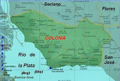
Zagarzazú International Airport is an airport serving the city of Carmelo in Colonia Department, Uruguay. The airport is northwest of Carmelo, by the Río de la Plata village of Zagarzazú. South approach and departure may be over the river. The San Fernando VOR-DME (Ident: FDO) is located south-southwest of the airport. History On December 19, 2022 a new passenger terminal was dedicated. In addition the runway was surfaced with asphalt and LED runway and approach lights were installed. Airlines and destinations No scheduled flights operate at this airport. See also * * *Transport in Uruguay The transport network in Uruguay consists of 1,673 km of rail network, 7,743 km of paved roads, 1,600 km of navigable waterways, and 11 airports with paved roads. Railways Uruguayan railways have a total operational length of . ... * List of airports in Uruguay References External links OpenStreetMap - Balneario Zagarzazú* Airports in Uruguay Building ... [...More Info...] [...Related Items...] OR: [Wikipedia] [Google] [Baidu] |
Carmelo, Uruguay
Carmelo is a city located in the department of Colonia of western Uruguay, noted for its wineries. Geography Location Route 21 passes through the city, joining it with Nueva Palmira to the northwest and Colonia del Sacramento to the southeast. History During the beginning of the Conquest of the 16th century, the Spanish founded the Fuerte de San Lázaro (April 7, 1527 - October 1530). In 1611, Hernando Arias de Saavedra, governor of Asuncion, landed cattle near the mouth of the Arroyo de las Vacas. A populated centre was established here which had reached the status of "Pueblo" (village) before the Independence of Uruguay. The present city was founded by José Gervasio Artigas on 12 February 1816. Its status was elevated to "Ciudad" (city) on 17 August 1920 by the Act of Ley Nº 7.257. It is the only city founded personally by the Uruguayan national hero, and it still holds this office proudly. Population In 2011 Carmelo had a population of 18,041. Source: ''Instituto Nac ... [...More Info...] [...Related Items...] OR: [Wikipedia] [Google] [Baidu] |
Colonia Department
Colonia () is a department of southwestern Uruguay. Its capital is Colonia del Sacramento, the country's second-oldest city. Geography Climate Colonia has an annual average temperature of 20.4 °C (68.7 °F). In winter it has an average temperature of 9 °C (48.2 °F) and in summer it has an average temperature of 27 °C (80.6 °F) Economy The southwestern region of Uruguay, in which Colonia is located, is typically associated with dairy production. Its proximity to Buenos Aires makes it the main entry point for tourists traveling from Argentina to Uruguay. Tourism is also favored by part of the capital being a World Heritage Site. The PepsiCo PepsiCo, Inc. is an American multinational corporation, multinational food, snack, and beverage corporation headquartered in Harrison, New York, in the hamlet of Purchase, New York, Purchase. PepsiCo's business encompasses all aspects of the f ... plant located in the department's capital, is one of the ... [...More Info...] [...Related Items...] OR: [Wikipedia] [Google] [Baidu] |
Uruguay
Uruguay, officially the Oriental Republic of Uruguay, is a country in South America. It shares borders with Argentina to its west and southwest and Brazil to its north and northeast, while bordering the Río de la Plata to the south and the Atlantic Ocean to the southeast. It is part of the Southern Cone region of South America. Uruguay covers an area of approximately . It has a population of almost 3.5 million people, of whom nearly 2 million live in Montevideo metropolitan area, the metropolitan area of its capital and List of cities in Uruguay, largest city, Montevideo. The area that became Uruguay was first inhabited by groups of hunter gatherer, hunter gatherers 13,000 years ago. The first European explorer to reach the region was Juan Díaz de Solís in 1516, but the area was colonized later than its neighbors. At the time of Spanish colonization of the Americas, European arrival, the Charrúa were the predominant tribe, alongside other groups such as the Guaraní people ... [...More Info...] [...Related Items...] OR: [Wikipedia] [Google] [Baidu] |
Río De La Plata
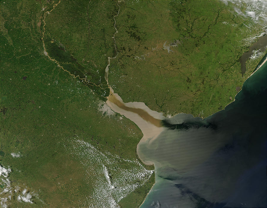
The Río de la Plata (; ), also called the River Plate or La Plata River in English, is the estuary formed by the confluence of the Uruguay River and the Paraná River at Punta Gorda, Colonia, Punta Gorda. It empties into the Atlantic Ocean and forms a funnel-shaped indentation on the southeastern coastline of South America. Depending on the geographer, the Río de la Plata may be considered a river, an estuary, a gulf, or a marginal sea. If considered a river, it is the widest in the world, with a maximum width of . The river is about long and widens from about at its source to about at its mouth. It forms part of Argentina–Uruguay border, the border between Argentina and Uruguay. The name Río de la Plata is also used to refer to the populations along the estuary, especially the main Port city, port cities of Buenos Aires and Montevideo, where Rioplatense Spanish is spoken and tango culture developed. The coasts of the river are the most densely populated areas of Urugua ... [...More Info...] [...Related Items...] OR: [Wikipedia] [Google] [Baidu] |
VOR-DME
In radio navigation, a VOR/DME is a radio beacon that combines a VHF omnidirectional range (VOR) with a distance-measuring equipment (DME). The VOR allows the receiver to measure its Bearing (navigation), bearing to or from the beacon, while the DME provides the slant distance between the receiver and the station. Together, the two measurements allow the receiver to compute a position fix. The VOR system was first introduced in the 1930s, but did not enter significant commercial use until the early 1950s. It became much more practical with the introduction of low-cost Solid state (electronics), solid state receivers in the 1960s. DME was a modification of World War II-era navigation systems like Gee-H (navigation), Gee-H, and began development in 1946. Like VOR, it only became practical with the introduction of solid state receivers during the 1960s. In 1948, the United States Congress directed civilian and military aviation to standardize on VOR/DME equipment. However, the milita ... [...More Info...] [...Related Items...] OR: [Wikipedia] [Google] [Baidu] |
Transport In Uruguay
The transport network in Uruguay consists of 1,673 km of rail network, 7,743 km of paved roads, 1,600 km of navigable waterways, and 11 airports with paved roads. Railways Uruguayan railways have a total operational length of . All of them are standard gauge as of 2005. Passenger services Regular passenger services have been operated between Montevideo and 25 de Agosto (63km) since August 26, 1993 (previously all regular passenger services were withdrawn on January 2, 1988). One daily train was extended to San José (96km from Montevideo) on January 15, 2007 and another was extended from 25 de Agosto to Florida (109km from Montevideo) on January 2, 2008. Another line, which operates between Montevideo and Ingeniero Victor Sudriers, was reopened on December 15, 2005 (44km). International links * There is a freight rail connection with Argentina over the Salto Grande Dam. * There is a connection with Brazil which includes freight transshipment because of ga ... [...More Info...] [...Related Items...] OR: [Wikipedia] [Google] [Baidu] |
List Of Airports In Uruguay
This is a list of airports in Uruguay, sorted alphabetically by ICAO code. Uruguay, officially known as the Oriental Republic of Uruguay (), is a country located in the southeastern part of South America. Uruguay's only land border is with Brazil, to the north. To the west lies the Uruguay River, to the southwest lies the estuary of Río de la Plata, with Argentina only a short commute across the banks of either of these bodies of water, while to the southeast lies the South Atlantic Ocean. Uruguay is the second smallest country in South America, being larger only than Suriname. Airports Airport names shown in bold indicate the airport has scheduled service on commercial airlines. Note: : Since August 14, 2023, SURV is a special case being a binational facility, serving both Uruguay and Brazil. See also * Transport in Uruguay * Uruguayan Air Force (''Fuerza Aérea Uruguaya'') * List of airports by ICAO code: S#SU - Uruguay * Wikipedia: WikiProject Aviation/Airline destina ... [...More Info...] [...Related Items...] OR: [Wikipedia] [Google] [Baidu] |


