|
Yambuya
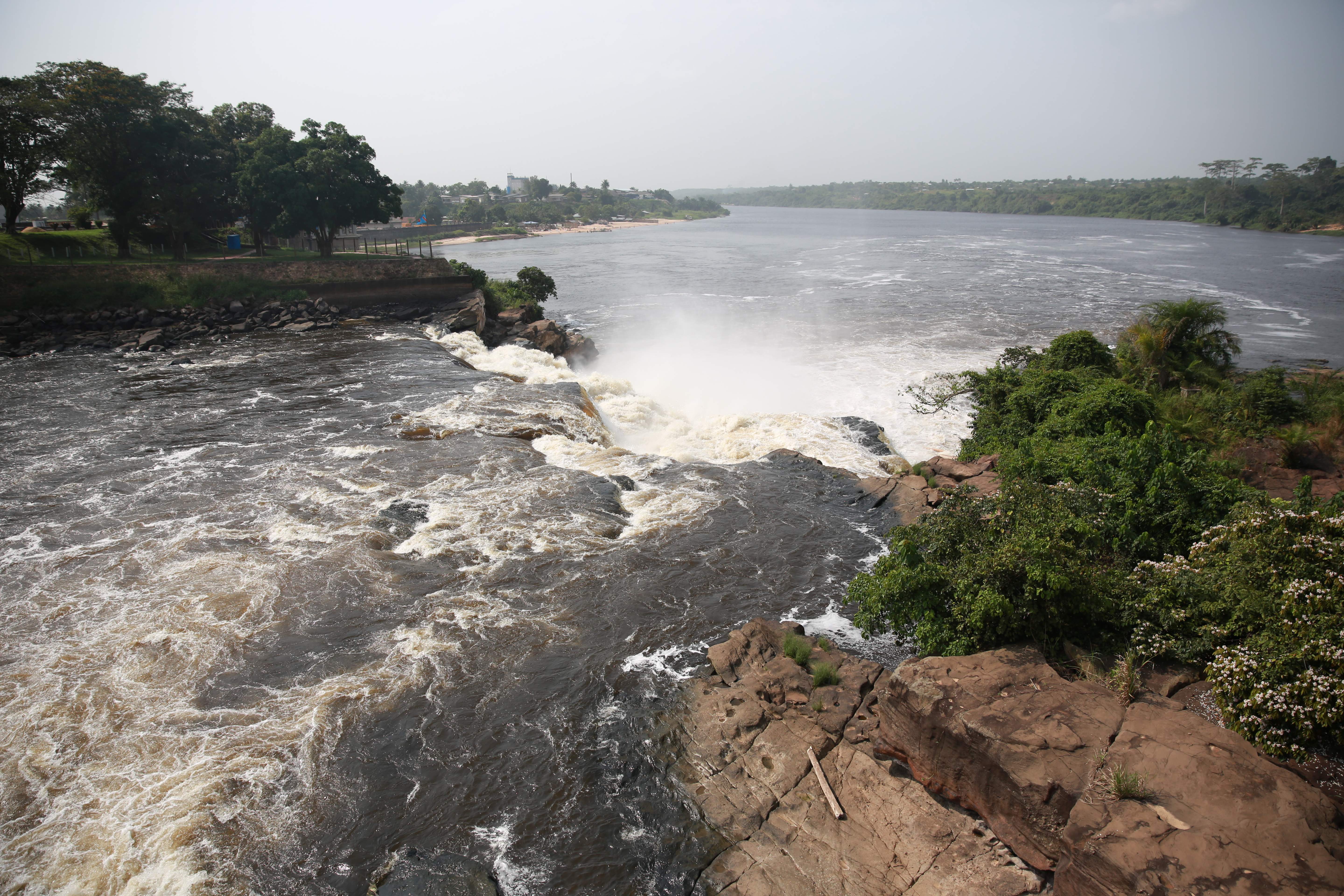
Yambuya is a community in the Democratic Republic of the Congo, on the Aruwimi River, roughly due north of Yangambi. The river is navigable as far as Yambuya, but is blocked by cataracts further upstream. Yambuya was made a base for the Emin Pasha Relief Expedition of 1886 to 1889, when an expedition led by Henry Morton Stanley went cross-country to the relief of Emin Pasha, General Charles Gordon's besieged governor of Equatoria Equatoria is a region of southern South Sudan, along the upper reaches of the White Nile. Originally a province of Anglo-Egyptian Sudan, it also contained most of northern parts of present-day Uganda, including Lake Albert and West Nile. It ..., threatened by Mahdist forces. File:Yambuya RDC congo 1890.jpg, Relief expedition troops landing at Yambuya File:VingtAnnees 319.jpg, Rapids of Yambuya. - Aruwimi (1889) References {{DRCongo-geo-stub Populated places in Tshopo ... [...More Info...] [...Related Items...] OR: [Wikipedia] [Google] [Baidu] |
Emin Pasha Relief Expedition
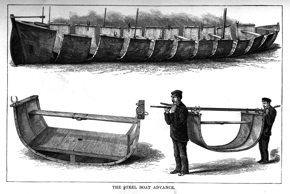
The Emin Pasha Relief Expedition of 1886 to 1889 was one of the last major European expeditions into the interior of Africa in the nineteenth century, ostensibly to the relief of Emin Pasha, General Charles Gordon's besieged governor of Equatoria, threatened by Mahdist forces. The expedition was led by Henry Morton Stanley and came to be both celebrated for its ambition in crossing "darkest Africa", and notorious for the deaths of so many of its members and the disease unwittingly left in its wake. Anxiety about Equatoria The Mahdists captured Khartoum in 1885 and Egyptian administration of the Sudan collapsed. The extreme southern province Equatoria was nearly cut off from the outside world, located as it was on the upper reaches of the Nile near Lake Albert. Emin Pasha was an Ottoman doctor and naturalist who had been appointed Governor of Equatoria. He was able to send and receive letters via Buganda and Zanzibar and had been informed in February 1886 that the Egyptian ... [...More Info...] [...Related Items...] OR: [Wikipedia] [Google] [Baidu] |
Aruwimi River
The Aruwimi River is a tributary of the Congo River, located to the north and east of the Congo.Stanley, H.M., 1899, Through the Dark Continent, London: G. Newnes, Vol. One , Vol. Two The Aruwimi begins as the Ituri River, which rises near Lake Albert, in the savannas north of the Kibale River watershed. It then runs generally south southwest until it is joined by the Shari River which flows by Bunia. The Ituri then turns west, through the Ituri Forest, becoming the Aruwimi where the Nepoko (or Nepoki) River joins it, at the town of Bomili. The river continues westward, joining the Congo at Basoko. The length of the Aruwimi–Ituri-Nizi is about , with the Ituri being about , the Nizi about and the Aruwimi about . The Aruwimi is about wide where it joins the Congo. The watershed of the Ituri/Aruwimi is almost entirely dense forest, with just a handful of villages along its course, and crossed by roads in about four places. The Kango language (SIL code KZY) is spoken by sever ... [...More Info...] [...Related Items...] OR: [Wikipedia] [Google] [Baidu] |
Tshopo
Tshopo is one of the 21 new provinces of the Democratic Republic of the Congo created in the 2015 repartitioning. It is situated in the north central part of the country on the Tshopo River, for which it is named. Tshopo, Bas-Uele, Haut-Uele, and Ituri provinces are the result of the dismemberment of the former Orientale province. Tshopo was formed from the Tshopo district and the independently administered city of Kisangani which retained its status as a provincial capital. History From 1963 to 1966, the area was constituted as the province of Haut-Congo. It was merged into Orientale Province in 1966 as, separately, the District of Tshopo and the city of Kisangani. The Presidents (later governors) of Haut-Congo were: * 1963 – 26 June 1963: Georges Grenfell (b. 1908) * 26 June 1963 – 1964: Paul Isombuma * 1964 – August 1964: François Aradjabu * August 1964 – 5 Nov 1966: Jean Marie Alamazani Provincial status was re-instated to Tshopo in 2015, ... [...More Info...] [...Related Items...] OR: [Wikipedia] [Google] [Baidu] |
Banalia Territory
Banalia is a territory and a locality of Tshopo province in the Democratic Republic of the Congo. It is located in the north-central part of the country, 1,300 km northeast of the capital Kinshasa . The locality was one of the milestones during the Emin Pasha relief expedition The Emin Pasha Relief Expedition of 1886 to 1889 was one of the last major European expeditions into the interior of Africa in the nineteenth century, ostensibly to the relief of Emin Pasha, General Charles Gordon's besieged governor of Equato .... The region is also rich in iron ore, which was to feed the Maluku steel plant. In the surroundings around Banalia grows mainly clean green deciduous forest. Around Banalia, it is very sparsely populated, with 6 inhabitants per square kilometer. Tropical monsoon climate prevails in the area. Annual average temperature in the funnel is 21 °C. The warmest month is May, when the average temperature is 22 °C, and the coldest is March, a ... [...More Info...] [...Related Items...] OR: [Wikipedia] [Google] [Baidu] |
Central Africa Time
Central Africa Time or CAT, is a time zone used in central and southern Africa. Central Africa Time is two hours ahead of Coordinated Universal Time ( UTC+02:00), which is the same as the adjacent South Africa Standard Time, Egypt Standard Time, Eastern European Time, Kaliningrad Time and Central European Summer Time. As this time zone is in the equatorial and tropical regions, there is little change in day length throughout the year and so daylight saving time is not observed. Central Africa Time is observed by the following countries: * * * (eastern side only) * * * * * * * * The following countries in Africa also use an offset of UTC+02:00 all-year round: * (observes Egypt Standard Time) * (observes South African Standard Time) * (observes South African Standard Time) * (observes Eastern European Time) * (observes South African Standard Time) See also * Egypt Standard Time, an equivalent time zone covering Egypt, also at UTC+02:00 * Kaliningrad Time, an equivalent time ... [...More Info...] [...Related Items...] OR: [Wikipedia] [Google] [Baidu] |
Democratic Republic Of The Congo
The Democratic Republic of the Congo (french: République démocratique du Congo (RDC), colloquially "La RDC" ), informally Congo-Kinshasa, DR Congo, the DRC, the DROC, or the Congo, and formerly and also colloquially Zaire, is a country in Central Africa. It is bordered to the northwest by the Republic of the Congo, to the north by the Central African Republic, to the northeast by South Sudan, to the east by Uganda, Rwanda, and Burundi, and by Tanzania (across Lake Tanganyika), to the south and southeast by Zambia, to the southwest by Angola, and to the west by the South Atlantic Ocean and the Cabinda exclave of Angola. By area, it is the second-largest country in Africa and the 11th-largest in the world. With a population of around 108 million, the Democratic Republic of the Congo is the most populous officially Francophone country in the world. The national capital and largest city is Kinshasa, which is also the nation's economic center. Centered on the Cong ... [...More Info...] [...Related Items...] OR: [Wikipedia] [Google] [Baidu] |
Yangambi
Yangambi is a town in Isangi territory of Tshopo province, Democratic Republic of the Congo. Location Yangambi is on the north side of the Congo River and lies on the R408 road which connects it to Kisangani 100 kilometers to the east. This road is unpaved, rarely used in the rainy season and difficult to use at all times of the year. The roads linking Yangambi to Weko and Isangi are also very poor. The river provides an alternative transport route. The town was once served by the small Yangambi Airport. Weather Mean annual rainfall is . August is the wettest month and February the driest. The skies tend to be partly cloudy even during the drier seasons. Yangambi Biosphere Reserve 235,000 hectares of forest around Yangambi were declared a Biosphere Reserve in 1976, part of UNESCO’s Man and the Biosphere Programme (MAB). The Yangambi Biosphere Reserve comprises secondary forests with ''Pycnanthus angolensis'' and '' Fagara macrophylla'', semi deciduous secondary rain forest ... [...More Info...] [...Related Items...] OR: [Wikipedia] [Google] [Baidu] |
Henry Morton Stanley
Sir Henry Morton Stanley (born John Rowlands; 28 January 1841 – 10 May 1904) was a Welsh-American explorer, journalist, soldier, colonial administrator, author and politician who was famous for his exploration of Central Africa Central Africa is a subregion of the African continent comprising various countries according to different definitions. Angola, Burundi, the Central African Republic, Chad, the Democratic Republic of the Congo, the Republic of the Congo ... and his search for missionary and explorer David Livingstone, whom he later claimed to have greeted with the now-famous line: "Dr. Livingstone, I presume?". Besides his discovery of Livingstone, he is mainly known for his search for the sources of the Nile and Congo River, Congo rivers, the work he undertook as an agent of Leopold II of the Belgians, King Leopold II of the Belgians which enabled the occupation of the Congo (area), Congo Basin region, and his command of the Emin Pasha Relief Expedition. ... [...More Info...] [...Related Items...] OR: [Wikipedia] [Google] [Baidu] |
Emin Pasha
185px, Schnitzer in 1875 Mehmed Emin Pasha (born Isaak Eduard Schnitzer, baptized Eduard Carl Oscar Theodor Schnitzer; March 28, 1840 – October 23, 1892) was an Ottoman physician of German Jewish origin, naturalist, and governor of the Egyptian province of Equatoria on the upper Nile. The Ottoman Empire conferred the title "Pasha" on him in 1886, and thereafter he was referred to as "Emin Pasha". Life and career Emin was born in Oppeln (in present day Poland), Silesia, into a middle-class German Jewish family, which moved to Neisse when he was two years old. After the death of his father in 1845, his mother married a Christian; she and her offspring were baptized Lutherans. He was a student at Carolinum in Nysa, at the universities at Breslau, Königsberg, and Berlin, qualifying as a physician in 1864. However, he was disqualified from practice, and left Germany for Constantinople, with the intention of entering Ottoman service. Travelling via Vienna and Trieste, he ... [...More Info...] [...Related Items...] OR: [Wikipedia] [Google] [Baidu] |
Charles George Gordon
Major-general (United Kingdom), Major-General Charles George Gordon Companion of the Order of the Bath, CB (28 January 1833 – 26 January 1885), also known as Chinese Gordon, Gordon Pasha, and Gordon of Khartoum, was a British Army officer and administrator. He saw action in the Crimean War as an officer in the British Army. However, he made his military reputation in Qing Dynasty#Rebellion, unrest and external pressure, China, where he was placed in command of the "Ever Victorious Army", a force of Chinese soldiers led by European officers which was instrumental in putting down the Taiping Rebellion, regularly defeating much larger forces. For these accomplishments, he was given the nickname "Chinese Gordon" and honours from both the Emperor of China and the British. He entered the service of the Isma'il Pasha, Khedive of Egypt in 1873 (with British government approval) and later became the List of governors of pre-independence Sudan, Governor-General of the Sudan, where he di ... [...More Info...] [...Related Items...] OR: [Wikipedia] [Google] [Baidu] |
Equatoria
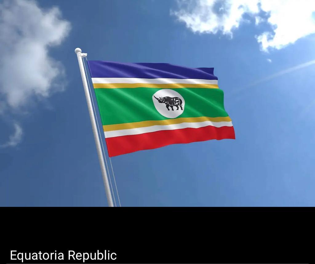
Equatoria is a region of southern South Sudan, along the upper reaches of the White Nile. Originally a province of Anglo-Egyptian Sudan, it also contained most of northern parts of present-day Uganda, including Lake Albert and West Nile. It was an idealistic effort to create a model state in the interior of Africa that never consisted of more than a handful of adventurers and soldiers in isolated outposts. Equatoria was established by Samuel Baker in 1870. Charles George Gordon took over as governor in 1874, followed by Emin Pasha in 1878. The Mahdist Revolt put an end to Equatoria as an Egyptian outpost in 1889. Later British Governors included Martin Willoughby Parr. Important settlements in Equatoria included Lado, Gondokoro, Dufile and Wadelai. The last two parts of Equatoria, Lake Albert and West Nile are now situated in Uganda. Under Anglo-Egyptian Sudan, most of Equatoria became one of the eight original provinces. The region of Bahr el Ghazal was split from Equat ... [...More Info...] [...Related Items...] OR: [Wikipedia] [Google] [Baidu] |
Mahdist War
The Mahdist War ( ar, الثورة المهدية, ath-Thawra al-Mahdiyya; 1881–1899) was a war between the Mahdist Sudanese of the religious leader Muhammad Ahmad bin Abd Allah, who had proclaimed himself the "Mahdi" of Islam (the "Guided One"), and the forces of the Khedivate of Egypt, initially, and later the forces of Britain. Eighteen years of war resulted in the nominally joint-rule state of the Anglo-Egyptian Sudan (1899–1956), a ''de jure'' condominium of the British Empire and the Kingdom of Egypt in which Britain had ''de facto'' control over the Sudan. The Sudanese launched several unsuccessful invasions of their neighbours, expanding the scale of the conflict to include not only Britain and Egypt but also the Italian Empire, the Congo Free State and the Ethiopian Empire. The British participation in the war is called the Sudan campaign. Other names for this war include the Mahdist Revolt, the Anglo–Sudan War and the Sudanese Mahdist Revolt. Background Followi ... [...More Info...] [...Related Items...] OR: [Wikipedia] [Google] [Baidu] |


.jpg)

.jpg)

