|
Yariguí
The Yariguí people were an Indigenous Colombian tribe that gave their name to a mountainous area they once inhabited in the Andean cloud forest. It has been said that they committed mass suicide instead of submitting to Spanish colonial rule. Territory The Indigenous nation of the Yariguies was located in an extensive forested area of the Magdalena River Valley, in the western portion of the current department of Santander in Colombia. The approximate boundaries of their Indigenous territory were the Minero River to the south, the Sogamoso River to the north, the Magdalena River to the west, and the Cordillera Oriental to the east. They lived, then, in a region of woodland and rainforest, a land of high temperatures and great humidity, which made life difficult for the inhabitants. Language and culture Belonging to the Carib language family, the Yariguies were a people formed essentially of nomadic hunters and gatherers. They were divided into five independent clans: the ... [...More Info...] [...Related Items...] OR: [Wikipedia] [Google] [Baidu] |
Yariguies Brush-finch
The Yariguies brush finch (''Atlapetes latinuchus yariguierum'') is a subspecies of the yellow-breasted brush finch, discovered in 2004 in Colombia. Description The feathers of the breast, abdomen, and throat are yellow; those of the coverts, primaries, secondaries, scapulars, auriculars, lores, and tail are black; the crown feathers are russet. It is unique among its conspecifics because it has a jet black back, wing and tail. Species discovery The bird has been discovered in the remote Yariguies mountains in an expedition co-led by Thomas Donegan of Fundación ProAves and Blanca Huertas, a curator at the Natural History Museum in London. According to the researchers, the region was so little explored that several more hitherto undescribed birds and butterflies are found there (Donegan & Huertas, 2006). Huertas, a lepidopterologist by training, found several taxa of butterflies new to science (Huertas & Arias 2007). Further information about the biological exploration of t ... [...More Info...] [...Related Items...] OR: [Wikipedia] [Google] [Baidu] |
Yariguí Language
The following purported languages of South America are listed as unclassified in Campbell (2012), Loukotka (1968), ''Ethnologue'', and ''Glottolog''. Nearly all are extinct. It is likely that many of them were not actually distinct languages, only an ethnic or regional name. Campbell & Grondona (2012) Campbell & Grondona (2012:116–130) lists the following 395 languages of South America as unclassified. Most are extinct.Campbell, Lyle, and Verónica Grondona (eds). 2012. ''The indigenous languages of South America: a comprehensive guide''. Berlin: De Gruyter Mouton. Many were drawn from Loukotka (1968)Loukotka, Čestmír. 1968. ''Classification of South American Indian Languages'' Los Angeles: Latin American Studies Center, UCLA. and Adelaar & Muysken (2004). The majority are not listed in ''Ethnologue''. The list is arranged in alphabetical order. *Aarufi – Colombia *Aburuñe – Bolivia *Acarapi – Brazil * Aconipa (Tabancal, Tabancara) – Ecuador; only 5 words known ... [...More Info...] [...Related Items...] OR: [Wikipedia] [Google] [Baidu] |
Cordillera Oriental (Colombia)
The Cordillera Oriental () is the widest of the three branches of the Colombian Andes. The range extends from south to north, dividing from the Colombian Massif in Huila Department to Norte de Santander Department where it splits into the Serranía del Perijá and the Cordillera de Mérida in Venezuelan Andes. The highest peak is Ritacuba Blanco at in the Sierra Nevada del Cocuy. Geography The western part of the Cordillera Oriental belongs to the Magdalena River basin, while the eastern part includes the river basins of the Amazon River, Orinoco River, and Catatumbo River. Within it, the Altiplano Cundiboyacense and the Sierra Nevada del Cocuy (with the only snowy peaks in this mountain range) stand out. The mountain range contains the most páramos in the world. The Cordillera Oriental montane forests ecoregion An ecoregion (ecological region) is an ecological and geographic area that exists on multiple different levels, defined by type, quality, and ... [...More Info...] [...Related Items...] OR: [Wikipedia] [Google] [Baidu] |
Magdalena River Valley
The Magdalena River (, ; less commonly ) is the main river of Colombia, flowing northward about through the western half of the country. It takes its name from the biblical figure Mary Magdalene. It is navigable through much of its lower reaches, in spite of the shifting sand bars at the mouth of its river delta, delta, as far as Honda, Tolima, Honda, at the downstream base of its rapids. It flows through the Magdalena River Valley. Its drainage basin covers a surface of , which is 24% of the country's area and where 66% of its population lives. Course The Magdalena River is the largest river system of the northern Andes, with a length of 1,612 km. Its headwaters are in the south of Colombia, where the Andes, Andean subranges Cordillera Central (Colombia), Cordillera Central and Cordillera Oriental, Colombia, Cordillera Oriental separate, in Huila Department. The river runs east then north in a great valley between the two cordilleras. It reaches the coastal plain at about 9 ... [...More Info...] [...Related Items...] OR: [Wikipedia] [Google] [Baidu] |
Carib Languages
The Cariban languages are a family of languages Indigenous to north-eastern South America. They are widespread across northernmost South America, from the mouth of the Amazon River to the Colombian Andes, and they are also spoken in small pockets of central Brazil. The languages of the Cariban family are relatively closely related. There are about three dozen, but most are spoken only by a few hundred people. Macushi is the only language among them with numerous speakers, estimated at 30,000. The Cariban family is well known among linguists partly because one language in the family— Hixkaryana—has a default word order of object–verb–subject. Prior to their discovery of this, linguists believed that this order did not exist in any spoken natural language. In the 16th century, Cariban peoples expanded into the Lesser Antilles. There they killed or displaced, and also mixed with the Arawak peoples who already inhabited the islands. The resulting language— Kalhíphona o ... [...More Info...] [...Related Items...] OR: [Wikipedia] [Google] [Baidu] |
Carare River
Carare River is a river of northern Colombia. It flows into the Caribbean Sea. See also *List of rivers of Colombia Atlantic Ocean Amazon River Basin * Amazon River ** Guainía River or Negro River *** Vaupés River or Uaupés River **** Papuri River **** Querary River *** Isana River or Içana River **** Cuiari River *** Aquio River ** Caquetá Ri ... References *Rand McNally, The New International Atlas, 1993. Rivers of Colombia Magdalena River {{Colombia-river-stub ... [...More Info...] [...Related Items...] OR: [Wikipedia] [Google] [Baidu] |
Indigenous Peoples In Colombia
Indigenous Colombians (), also known as Native Colombians (), are the ethnic groups who have inhabited Colombia before the Spanish colonization of Colombia, in the early 16th century. Estimates on the percentage of Colombians who are indigenous vary, from 3% or 1.5 million to 10% or 5 million. According to the 2018 Colombian census, they comprise 4.4% of the country's population, belonging to 115 different tribes, up from 3.4% in the 2005 Colombian census. However, a Latinobarómetro survey from the same year found that 10.4% of Colombian respondents self-identified as indigenous. The most recent estimation of the number of indigenous peoples of Colombia places it at around 9.5% of the population. This places that Colombia as having the seventh highest percentage of Indigenous peoples in the Americas with Bolivia, Chile, Ecuador, Guatemala, Peru, and Panama having a higher estimated percentage of Indigenous peoples than Colombia. The percentage of Indigenous peoples has bee ... [...More Info...] [...Related Items...] OR: [Wikipedia] [Google] [Baidu] |
Guane People
The Guane people of Colombia in South America live mainly in the cities of Santander, Bucaramanga and Barichara. A population estimate made by DANE(Departamento Administrativo Nacional de Estadística) in 2005, was that around 812 people in Santander identified as Guane, with 409 being men and 403 being women. Etymology The etymology of the word Guane is not known with certainty. The most prominent reasoning states that it came from the Muisca people, the Guane’s neighbors, who referred to them as ‘Guatas’ which means ‘tall’ in the Musyccubun language. It evolved to become ‘Guates’ and then eventually Guanes. Guane people from this time period were reported to be as tall as 1.76m, taller than most other native groups at the time. Pre-colonial Guane people Before European-contact the Guane People lived in the area of Santander and north of Boyacá, both departments of present-day central-Colombia. They were farmers cultivating cotton, pineapple and other crop ... [...More Info...] [...Related Items...] OR: [Wikipedia] [Google] [Baidu] |
Muzo People
The Muzo people are a Cariban languages, Cariban-speaking Indigenous group who inhabited the western slopes of the eastern Colombian Andes. They were a highly war-like tribe who frequently clashed with their neighbouring Indigenous groups, especially the Muisca. The Muzo inhabited the right banks of the Magdalena River in the lower elevations of western Boyacá Department, Boyacá and Cundinamarca Department, Cundinamarca and were known as the Emerald People, thanks to their exploitation of the gemstone in Muzo. During the time of Spanish conquest of the Muisca, conquest, they resisted heavily against the Spanish invaders taking twenty years to submit the Muzo. Knowledge about the Muzo people has been provided by List of Muisca and pre-Muisca scholars, chroniclers Gonzalo Jiménez de Quesada, Pedro Simón, Juan de Castellanos, Lucas Fernández de Piedrahita and others. Muzo territory The Muzo were inhabiting the lower-elevation northwestern areas of the Cundinamarca departmen ... [...More Info...] [...Related Items...] OR: [Wikipedia] [Google] [Baidu] |
Muisca People
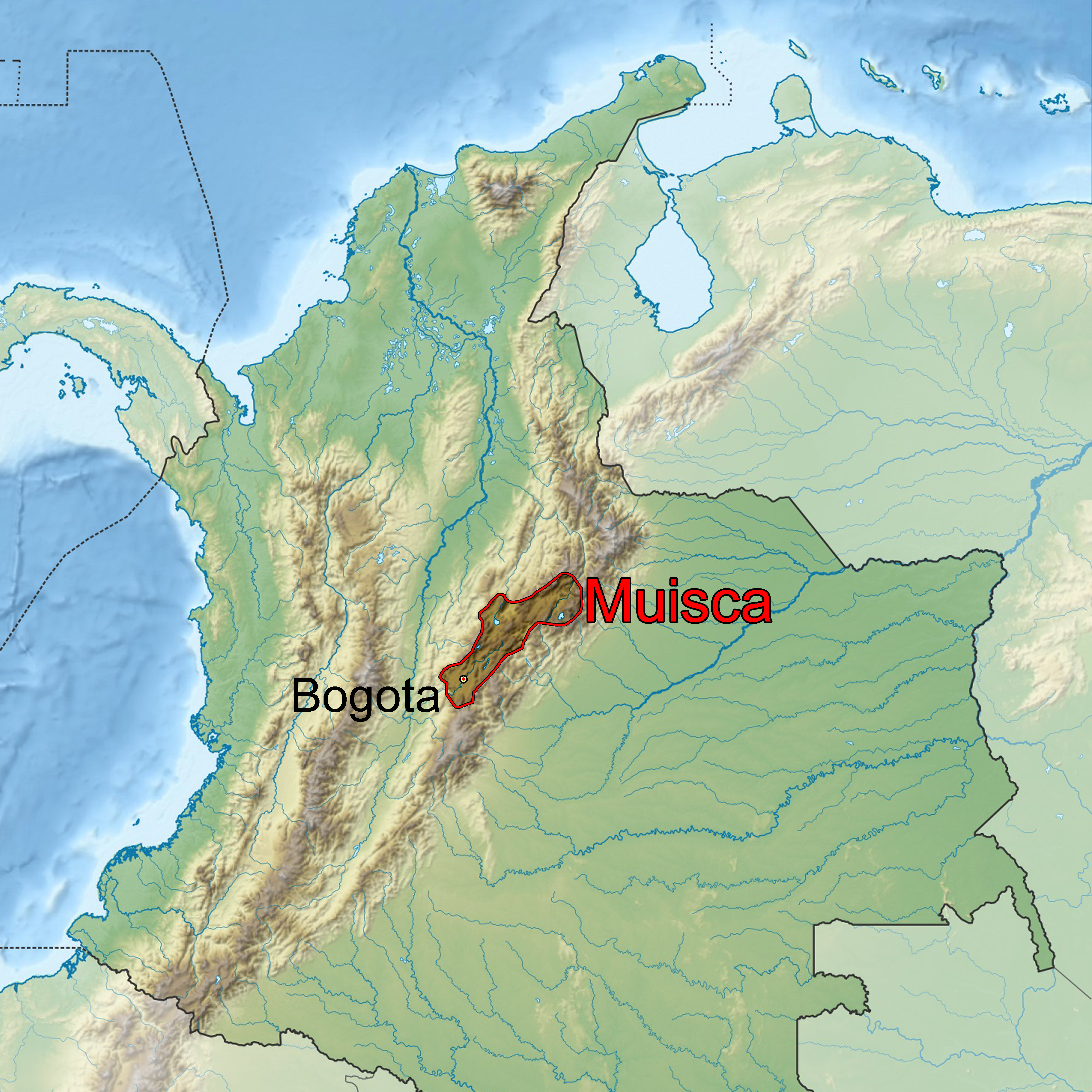
The Muisca (also called the Chibcha) are indigenous peoples in Colombia and were a Pre-Columbian culture of the Altiplano Cundiboyacense that formed the Muisca Confederation before the Spanish colonization of the Americas. The Muisca speak Muysccubun, a language of the Chibchan language family, also called ''Muysca'' and ''Mosca''. The first known contact with Europeans in the region was in 1537 during the Spanish conquest of New Granada. In New Spain, Spanish clerics and civil officials had a major impact on the Muisca, attempting to Christianize and incorporate them into the Spanish Empire as subjects. Postconquest Muisca culture underwent significant changes due to the establishment of the New Kingdom of Granada. Sources for the Muisca are far less abundant than for the Aztec Empire of Mesoamerica or the Inca Empire and their incorporation to the Spanish Empire during the colonial era. In the New Kingdom of Granada and into the colonial era, the Muisca became " ... [...More Info...] [...Related Items...] OR: [Wikipedia] [Google] [Baidu] |
Measles
Measles (probably from Middle Dutch or Middle High German ''masel(e)'', meaning "blemish, blood blister") is a highly contagious, Vaccine-preventable diseases, vaccine-preventable infectious disease caused by Measles morbillivirus, measles virus. Other names include ''morbilli'', ''rubeola'', ''9-day measles, red measles'', and ''English measles''. Symptoms usually develop 10–12 days after exposure to an infected person and last 7–10 days. Initial symptoms typically include fever, often greater than , cough, Rhinitis, runny nose, and conjunctivitis, inflamed eyes. Small white spots known as Koplik's spots, Koplik spots may form inside the mouth two or three days after the start of symptoms. A red, flat rash which usually starts on the face and then spreads to the rest of the body typically begins three to five days after the start of symptoms. Common complications include diarrhea (in 8% of cases), Otitis media, middle ear infection (7%), and pneumonia (6%). These occur i ... [...More Info...] [...Related Items...] OR: [Wikipedia] [Google] [Baidu] |


