|
Wisconsin Highway 54
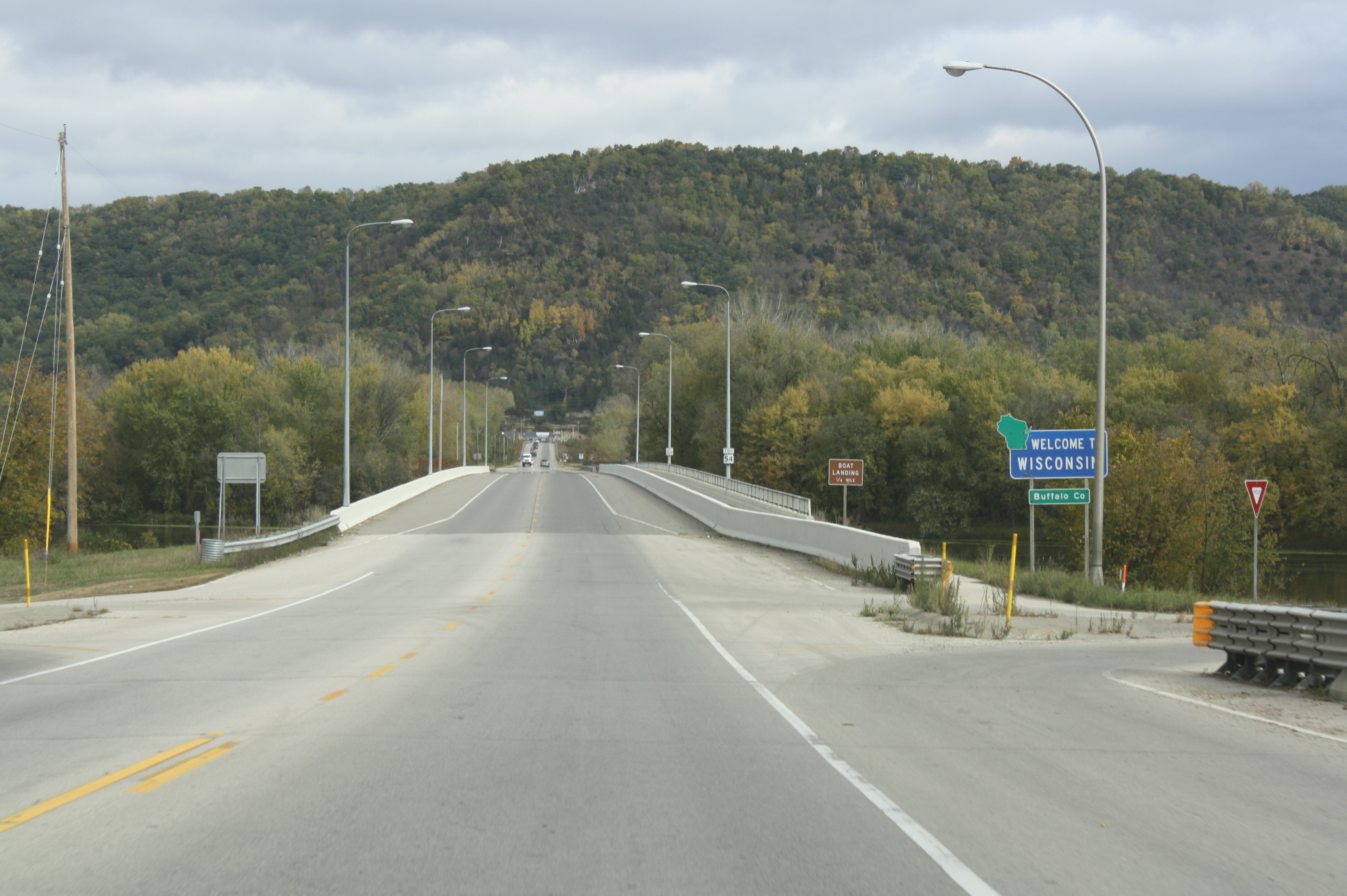
State Trunk Highway 54 (often called Highway 54, STH-54 or WIS 54) is a Wisconsin state highway running east–west across central Wisconsin. It is in length. Route description Minnesota state line to Plover WIS 54 begins at the western terminus. It crosses through the Minnesota state line at Winona, Minnesota via the North Channel Bridge. At this bridge, MN 43 ends there. After crossing the bridge, it soon turns east via WIS 35/Great River Road. In Centerville, WIS 35, as well as the Great River Road, turn southward; leaves the concurrency. At the same junction, WIS 93 joins the concurrency eastward. Further east, they then start to run concurrently with US 53 in Galesville. However, as they travel eastward, WIS 54 turns northeast, leaving the concurrency. At Butman Corners, WIS 54 then turns east again. After leaving Butman Corners, it closely parallels the Black River just south of the route. Then, it meanders eastward towards ... [...More Info...] [...Related Items...] OR: [Wikipedia] [Google] [Baidu] |
Marshland, Wisconsin
Marshland is an unincorporated community located in the town of Buffalo, in Buffalo County, Wisconsin, United States. Marshland is located on Wisconsin Highway 35 and Wisconsin Highway 54 east-southeast of Fountain City. History The La Crosse, Trempealeau & Prescott Railroad chartered to build from a point across the river from Winona to connect with the Chicago, Milwaukee and St. Paul railroad at Winona Junction in Wisconsin near La Crosse. This was completed in 1870 with tracks in Marshland. The Green Bay & Minnesota Railroad laid tracks from Merrillian Junction to join with the La Crosse, Trempealeau, & Prescott Railroad at Marshland in 1873. That railroad was built to reach Winona, Minnesota and the Winona and St. Peter Railroad. This became part of the Green Bay and Western Railroad The Green Bay and Western Railroad served central Wisconsin for almost 100 years before it was absorbed into the Wisconsin Central in 1993. For much of its history the railroad was also ... [...More Info...] [...Related Items...] OR: [Wikipedia] [Google] [Baidu] |
Wisconsin State Highway System
The Wisconsin State Trunk Highway System is the state highway system of the U.S. state of Wisconsin, including Wisconsin's segments of the Interstate Highway System and the United States Numbered Highway System, in addition to its other state trunk highways. These separate types of highways are respectively designated with an ''I''-, ''US'', or ''STH-'' (or ''WIS'') prefix. The system also includes minor roads designated as Scenic Byways, four routes intended to promote tourism to scenic and historic areas of the state; and as Rustic Roads, lightly-traveled and often unpaved local roads which the state has deemed worthy of preservation and protection. The state highway system, altogether totaling across all of Wisconsin's 72 counties, is maintained by the Wisconsin Department of Transportation (WisDOT). Highway systems Interstate and U.S. highways The state of Wisconsin is served by eight Interstate Highways, consisting of five primary routes and three auxiliary routes. The ... [...More Info...] [...Related Items...] OR: [Wikipedia] [Google] [Baidu] |
Door Peninsula
The Door Peninsula is a peninsula in eastern Wisconsin, separating the southern part of the Green Bay (Lake Michigan), Green Bay from Lake Michigan. The peninsula includes northern Kewaunee County, Wisconsin, Kewaunee County, northeastern Brown County, Wisconsin, Brown County, and the mainland portion of Door County, Wisconsin, Door County. It is on the western side of the Niagara Escarpment. Well known for its cherry and apple orchards, the Door Peninsula is a popular tourism destination. With the 1881 completion of the Sturgeon Bay Ship Canal, the northern half of the peninsula became an island. Limestone outcroppings of the Niagara Escarpment are visible on both shores of the peninsula, but are larger and more prominent on the Green Bay side as seen at the Bayshore Blufflands. Progressions of dunes have created much of the rest of the shoreline, especially on the east side. Flora along the shore demonstrate plant ecological succession, succession during periods of low ... [...More Info...] [...Related Items...] OR: [Wikipedia] [Google] [Baidu] |
Oneida Nation Of Wisconsin
The Oneida Nation is a federally recognized tribe of Oneida people in Wisconsin. The tribe's Indian reservation, reservation spans parts of two counties west of the Green Bay, Wisconsin, Green Bay metropolitan area. The reservation was established by treaty in 1838, and was allotted to individual New York Oneida tribal members as part of an agreement with the U.S. government. The land was individually owned until the tribe was formed under the Indian Reorganization Act of 1934. Under the Dawes Act, the land was allotted in 1892 to individual households. The nation kept control of most of the land until sales were allowed in the early 20th century, when members were often tricked out of their property. They used the land for farming and harvesting timber. As of 2010, the nation controlled about 35 percent of the land within its reservation and is working to reacquire the rest. In 1988 the nation established the state's first modern lottery, known as Big Green. Since the late 20th ... [...More Info...] [...Related Items...] OR: [Wikipedia] [Google] [Baidu] |
Newton Blackmour State Trail
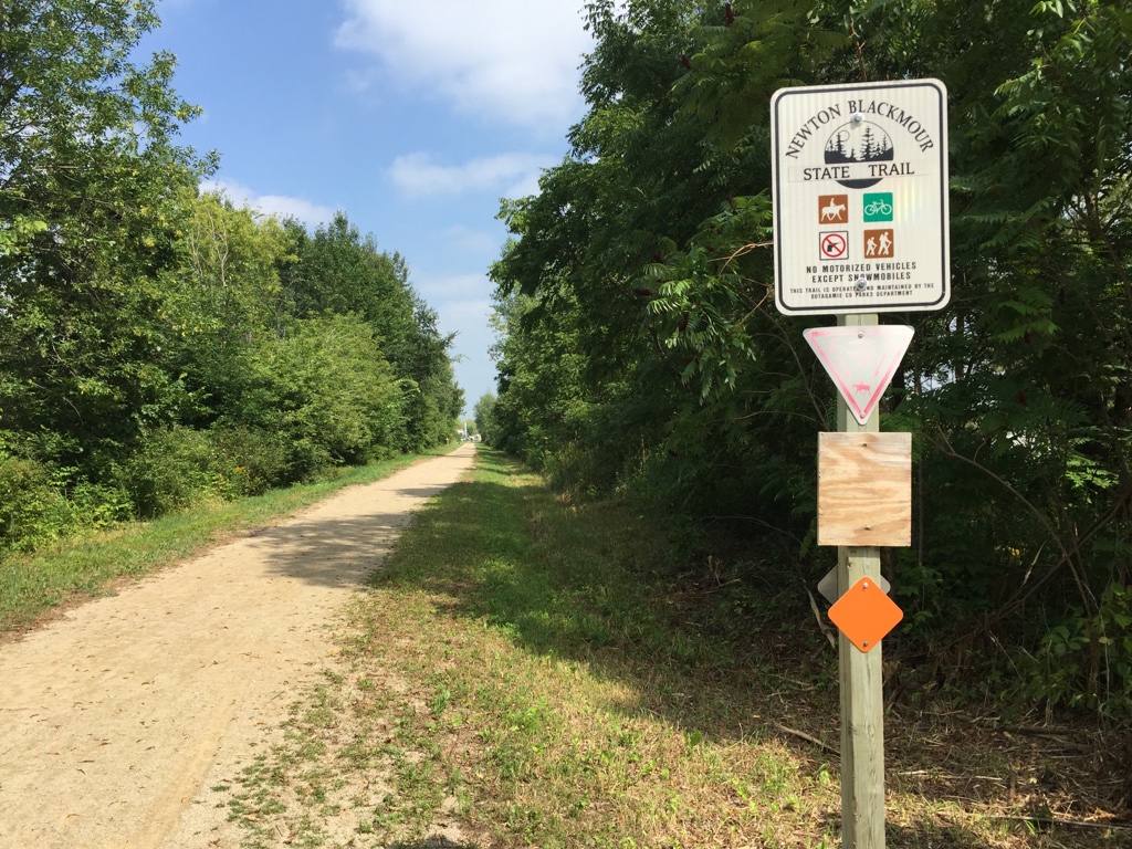
The Newton Blackmour State Trail is a crushed limestone trail in northern Outagamie County in Wisconsin. The trail spans on a former rail corridor. Its name is derived from the four communities the trail passes through: New London, Shiocton, Black Creek and Seymour. The trail's eastern end in Seymour connects to the Duck Creek Trail, which travels east through the Oneida Nation of Wisconsin and ends in the Village of Oneida. With the connection to the Duck Creek Trail, the combined trails are over long. The combined trails extend from the Village of Oneida to New London. Access The trail is open to bicyclists, walkers, joggers, horseback riders, and pets on leashes. In the winter the trail is open to cross-country skiing, snowshoeing, and snowmobiling. Amenities In the west end of the trail in New London there are hotels, campgrounds, and bike shops. Twenty minutes east of the trail in Ashwaubenon, there are also hotels and bike shops. In each of the communities the t ... [...More Info...] [...Related Items...] OR: [Wikipedia] [Google] [Baidu] |
Waupaca Municipal Airport
Waupaca Municipal Airport is a city owned public use airport located three nautical miles (6 km) southeast of the central business district of Waupaca, a city in Waupaca County, Wisconsin, United States. The airport is also known as Brunner Field. It is located adjacent to U.S. Route 10. It is included in the Federal Aviation Administration (FAA) National Plan of Integrated Airport Systems for 2021–2025, in which it is categorized as a local general aviation facility. Although most U.S. airports use the same three-letter location identifier for the FAA and IATA, this airport is assigned PCZ by the FAA but has no designation from the IATA. Facilities and aircraft Waupaca Municipal Airport covers an area of at an elevation of 840 feet (256 m) above mean sea level. It has two asphalt paved runways: 10/28 is 5,200 by 100 feet (1,585 x 30 m) with approved GPS approaches and 13/31 is 3,899 by 75 feet (1,188 x 23 m). KlattAero, LLC. is the fixed-base operator and also provi ... [...More Info...] [...Related Items...] OR: [Wikipedia] [Google] [Baidu] |
Robinson Park
Robinson Park is an urban park located in and administered by the city of Wisconsin Rapids, Wisconsin. The park was named after Dr. F. Byron Robinson, the original owner of the site. The park has an area of . Amenities include a picnic shelter and volleyball, horseshoe A horseshoe is a fabricated product designed to protect a horse hoof from wear. Shoes are attached on the palmar surface (ground side) of the hooves, usually nailed through the insensitive hoof wall that is anatomically akin to the human toen ... and basketball courts. References Wisconsin Rapids, Wisconsin Geography of Wood County, Wisconsin Parks in Wisconsin {{WoodCountyWI-geo-stub ... [...More Info...] [...Related Items...] OR: [Wikipedia] [Google] [Baidu] |
Wisconsin River
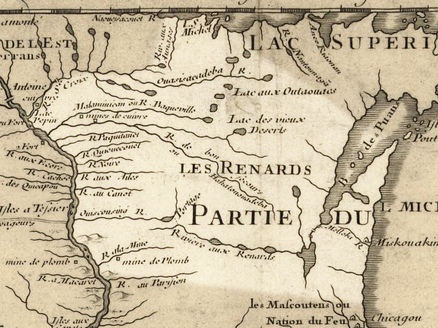
The Wisconsin River is a tributary of the Mississippi River in the U.S. state of Wisconsin. At approximately 430 miles (692 km) long, it is the state's longest river. The river's name, first recorded in 1673 by Jacques Marquette as "Meskousing", is rooted in the Algonquian languages used by the area's American Indian tribes, but its original meaning is obscure. French explorers who followed in the wake of Marquette later modified the name to "Ouisconsin", and so it appears on Guillaume de L'Isle's map (Paris, 1718). This was simplified to "Wisconsin" in the early 19th century before being applied to Wisconsin Territory and finally the state of Wisconsin. The Wisconsin River originates in the forests of the North Woods Lake District of northern Wisconsin, in Lac Vieux Desert near the border of the Upper Peninsula of Michigan. It flows south across the glacial plain of central Wisconsin, passing through Wausau, Stevens Point, and Wisconsin Rapids. In southern Wisconsin it en ... [...More Info...] [...Related Items...] OR: [Wikipedia] [Google] [Baidu] |
Black River (Wisconsin)
The Black River is a river in west-central Wisconsin and tributary of the Mississippi River. The river is approximately long.U.S. Geological Survey. National Hydrography Dataset high-resolution flowline dataThe National Map, accessed October 5, 2012 During the 19th century, pine logs were rafted down the Black, heading for sawmills at La Crosse and points beyond. Geography The river begins in central Wisconsin, rising in Taylor County at approximately west of the village of Rib Lake. It flows south-southwest through Medford, Greenwood, Neillsville and Black River Falls. The Black River first mingles with the Mississippi River in Lake Onalaska in the Upper Mississippi River National Wildlife and Fish Refuge. The lower of the river channel have been absorbed by Lake Onalaska, an impoundment of the Mississippi River formed by Lock and Dam No. 7 at Onalaska. The river exits Lake Onalaska through a channel between French Island and the city of Onalaska and rejoins the Miss ... [...More Info...] [...Related Items...] OR: [Wikipedia] [Google] [Baidu] |
North Channel Bridge
The North Channel Bridge crosses the north channel of the Mississippi River between Latsch Island (part of Winona, Minnesota) and Buffalo County, Wisconsin. The bridge has a street setup, with one lane in either direction. It carries Minnesota State Highway 43 and WI 54 in either direction. Immediately to the southwest is the Main Channel Bridge. Images File:BuffaloCountyWisconsinWIS54WestTerminusBridge.jpg, Looking southwest along the center line File:North Channel Bridge centerline on Mississippi River from Buffalo County WI toward Winona MN.jpg, Looking northeast along the centerline See also * List of bridges documented by the Historic American Engineering Record in Minnesota *List of crossings of the Upper Mississippi River This is a list of all current and notable former bridges or other crossings of the Upper Mississippi River which begins at the Mississippi River's source and extends to its confluence with the Ohio River at Cairo, Illinois. Crossings Minneso ... [...More Info...] [...Related Items...] OR: [Wikipedia] [Google] [Baidu] |
Winona, Minnesota
Winona is a city in and the county seat of Winona County, in the state of Minnesota. Located in bluff country on the Mississippi River, its most noticeable physical landmark is Sugar Loaf. The city is named after legendary figure Winona, who some sources claimed was the first-born daughter of Chief Wapasha of the Dakota people. The population was 25,948 at the 2020 census. History The city of Winona began on the site of a Native American village named Keoxa. The seat of the Wapasha dynasty, Keoxa was home to a Mdewakanton band of the eastern Sioux. European immigrants settled the area in 1851 and laid out the town into lots in 1852 and 1853. The original settlers were immigrants from New England.Minnesota: A State Guide page 263 The population increased from 815 in December, 1855, to 3,000 in December, 1856. In 1856 German immigrants arrived as well. The Germans and the Yankees worked together planting trees and building businesses based on lumber, wheat, steamboa ... [...More Info...] [...Related Items...] OR: [Wikipedia] [Google] [Baidu] |


