|
West Hampton Dunes, New York
West Hampton Dunes is an incorporated village in the Town of Southampton on Westhampton Island, in Suffolk County, in New York, United States, off the South Shore of Long Island. The population was 55 at the 2010 census. History West Hampton Dunes is located on a barrier island in the Town of Southampton. The barrier island was part of Fire Island until a nor'easter in 1931 split the island creating Moriches Inlet. The inlet created a geographic oddity whereby the town of Brookhaven actually has jurisdiction on land immediately west of West Hampton Dunes although Brookhaven land access to it involves a nearly drive through Southampton. The village incorporated in 1993 in attempt to have more control over its precarious state since it was obliterated in the Great Hurricane of 1938, 1991 Halloween Nor'easter ("The Perfect Storm") and again in a 1992 nor'easter. Specifically, the village wanted to have a say in U.S. Army Corps of Engineers handling of the barrier beach—p ... [...More Info...] [...Related Items...] OR: [Wikipedia] [Google] [Baidu] |
Village (New York)
The administrative divisions of New York are the various units of government that provide local services in the State of New York. The state is divided into boroughs, counties, cities, townships called "towns", and villages. (The only boroughs, the five boroughs of New York City, have the same boundaries as their respective counties.) They are municipal corporations, chartered (created) by the New York State Legislature, as under the New York Constitution the only body that can create governmental units is the state. All of them have their own governments, sometimes with no paid employees, that provide local services. Centers of population that are not incorporated and have no government or local services are designated hamlets. Whether a municipality is defined as a borough, city, town, or village is determined not by population or land area, but rather on the form of government selected by the residents and approved by the New York Legislature. Each type of local govern ... [...More Info...] [...Related Items...] OR: [Wikipedia] [Google] [Baidu] |
New York (state)
New York, officially the State of New York, is a state in the Northeastern United States. It is often called New York State to distinguish it from its largest city, New York City. With a total area of , New York is the 27th-largest U.S. state by area. With 20.2 million people, it is the fourth-most-populous state in the United States as of 2021, with approximately 44% living in New York City, including 25% of the state's population within Brooklyn and Queens, and another 15% on the remainder of Long Island, the most populous island in the United States. The state is bordered by New Jersey and Pennsylvania to the south, and Connecticut, Massachusetts, and Vermont to the east; it has a maritime border with Rhode Island, east of Long Island, as well as an international border with the Canadian provinces of Quebec to the north and Ontario to the northwest. New York City (NYC) is the most populous city in the United States, and around two-thirds of the state's popul ... [...More Info...] [...Related Items...] OR: [Wikipedia] [Google] [Baidu] |
Coastal Erosion
Coastal erosion is the loss or displacement of land, or the long-term removal of sediment and rocks along the coastline due to the action of waves, currents, tides, wind-driven water, waterborne ice, or other impacts of storms. The landward retreat of the shoreline can be measured and described over a temporal scale of tides, seasons, and other short-term cyclic processes. Coastal erosion may be caused by hydraulic action, abrasion, impact and corrosion by wind and water, and other forces, natural or unnatural. On non-rocky coasts, coastal erosion results in rock formations in areas where the coastline contains rock layers or fracture zones with varying resistance to erosion. Softer areas become eroded much faster than harder ones, which typically result in landforms such as tunnels, bridges, columns, and pillars. Over time the coast generally evens out. The softer areas fill up with sediment eroded from hard areas, and rock formations are eroded away. Also erosion comm ... [...More Info...] [...Related Items...] OR: [Wikipedia] [Google] [Baidu] |
Shinnecock Inlet
Shinnecock Inlet is the easternmost of five major inlets connecting bays to the Atlantic Ocean through the narrow Outer Barrier that stretches from New York City to Southampton, New York on the south shore of Long Island. It splits Westhampton Island from the peninsula extending from Southampton Village. The inlet was formed by the Great Hurricane of 1938, which killed several people when it permanently broke through the island in Hampton Bays, New York. The name comes from the Shinnecock Indian Nation. Maintenance of the inlet has been controversial. It saves boaters in the Hamptons several miles in access to the Atlantic Ocean. The inlet is almost directly lined up with the Shinnecock Canal between Shinnecock Bay and the Peconic Bay, which allows a shortcut to the ocean for boaters on the north fork of Long Island. Consequently, management has been geared to keep the inlet dredged and open. However, the inlet has interrupted the flow of sand (which normally flows east to we ... [...More Info...] [...Related Items...] OR: [Wikipedia] [Google] [Baidu] |
Groyne
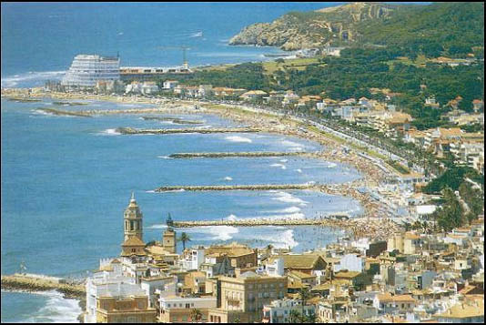
A groyne (in the U.S. groin) is a rigid hydraulic structure built perpendicularly from an ocean shore (in coastal engineering) or a river bank, interrupting water flow and limiting the movement of sediment. It is usually made out of wood, concrete, or stone. In the ocean, groynes create beaches, prevent beach erosion caused by longshore drift where this is the dominant process and facilitate beach nourishment. There is also often cross-shore movement which if longer than the groyne will limit its effectiveness. In a river, groynes slow down the process of erosion and prevent ice-jamming, which in turn aids navigation. Groynes run generally perpendicular to the shore, extending from the upper foreshore or beach into the water. All of a groyne may be underwater, in which case it is a ''submerged groyne''. They are often used in tandem with seawalls and other coastal engineering features. Groynes, however, may cause a shoreline to be perceived as unnatural. Groynes are generally ... [...More Info...] [...Related Items...] OR: [Wikipedia] [Google] [Baidu] |
1991 Halloween Nor'easter
The 1991 Perfect Storm, also known as The No-Name Storm (especially in the years immediately after it took place) and the Halloween Gale/Storm, was a nor'easter that absorbed Hurricane Grace, and ultimately evolved into a small unnamed hurricane itself late in its life cycle. The initial area of low pressure developed off the coast of Atlantic Canada on October 28. Forced southward by a ridge to its north, it reached its peak intensity as a large and powerful cyclone. The storm lashed the east coast of the United States with high waves and coastal flooding before turning to the southwest and weakening. Moving over warmer waters, the system transitioned into a subtropical cyclone before becoming a tropical storm. It executed a loop off the Mid-Atlantic states and turned toward the northeast. On November 1, the system evolved into a full-fledged hurricane, with peak sustained winds of 75 miles per hour (120 km/h), although the National Hurricane Center left it unnamed t ... [...More Info...] [...Related Items...] OR: [Wikipedia] [Google] [Baidu] |
Great Hurricane Of 1938
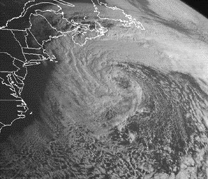
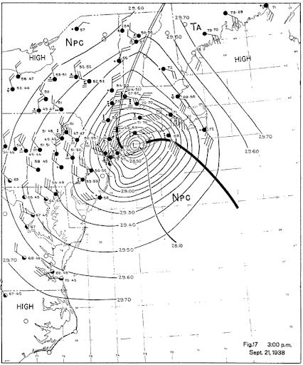
The 1938 New England Hurricane (also referred to as the Great New England Hurricane and the Long Island Express Hurricane) was one of the deadliest and most destructive tropical cyclones to strike Long Island, New York, and New England. The storm formed near the coast of Africa on September 9, becoming a Category 5 hurricane on the Saffir–Simpson hurricane scale, before making landfall as a Category 3 hurricane on Long Island on Wednesday, September 21. It is estimated that the hurricane killed 682 people, damaged or destroyed more than 57,000 homes, and caused property losses estimated at $306 million ($4.7 billion in 2017). Multiple other sources, however, mention that the 1938 hurricane might have really been a more powerful Category 4, having winds similar to Hurricanes Hugo, Harvey, Frederic and Gracie when it ran through Long Island and New England. Also, numerous others estimate the real damage between $347 million and almost $410 million. Damaged trees and buildings ... [...More Info...] [...Related Items...] OR: [Wikipedia] [Google] [Baidu] |
Brookhaven, New York
The Town of Brookhaven is the most populous of the ten towns of Suffolk County, New York, United States. Part of the New York metropolitan area, it is located approximately 50 miles from Manhattan. It is the largest of the state of New York's 932 towns by area (when water area is included), and the second most populous after the Town of Hempstead. The first settlement in what is now Brookhaven was known as Setauket. Founded as a group of agricultural hamlets in the mid-17th century, Brookhaven first expanded as a major center of shipbuilding in the 19th century. Its proximity to New York City facilitated the establishment of resort communities, followed by a post-war population boom. In the 2020 census record, Brookhaven contained 485,773 people. The township is home to two renowned research centers, Stony Brook University and Brookhaven National Laboratory. Combined these two research centers are approximately 50% of the Town's top ten employer's employee count. Tourism ... [...More Info...] [...Related Items...] OR: [Wikipedia] [Google] [Baidu] |
Moriches Inlet
Moriches Inlet ( ) is an inlet connecting Moriches Bay and the Atlantic Ocean. The name Moriches comes from Meritces, a Native American who owned land on Moriches Neck.The Indian Place-Names on Long Island and Islands Adjacent, with Their Probably Significations. Tooker, William Wallace. pp 144-14/ref> It forms the eastern border of Fire Island, New York and the western border of the barrier island on which West Hampton Dunes, New York is the closest community. The inlet was present on Fire Island until it closed up during the 1800s. The inlet which split West Hampton from Fire Island was reformed by a Nor'easter in 1931. The 1931 storm created a geographic quirk for the western tip of the West Hampton island which is in the town of Brookhaven but in order to access it via land from Brookhaven a person must go through several miles of Southampton (town), New York. Between 1933 and 1938 Moriches Inlet widened to wide and deepened with sand being deposited on both the bay a ... [...More Info...] [...Related Items...] OR: [Wikipedia] [Google] [Baidu] |
Nor'easter
A nor'easter (also northeaster; see below), or an East Coast low is a synoptic-scale extratropical cyclone in the western North Atlantic Ocean. The name derives from the direction of the winds that blow from the northeast. The original use of the term in North America is associated with storms that impact the upper north Atlantic coast of the United States and the Atlantic Provinces of Canada. Typically, such storms originate as a low-pressure area that forms within of the shore between North Carolina and Massachusetts. The precipitation pattern is similar to that of other extratropical storms. Nor'easters are usually accompanied by heavy rain or snow, and can cause severe coastal flooding, coastal erosion, hurricane-force winds, or blizzard conditions. Nor'easters are usually most intense during winter in New England and Atlantic Canada. They thrive on converging air masses—the cold polar air mass and the warmer air over the water—and are more severe in winter whe ... [...More Info...] [...Related Items...] OR: [Wikipedia] [Google] [Baidu] |
Fire Island
Fire Island is the large center island of the outer barrier islands parallel to the South Shore of Long Island, in the U.S. state of New York. Occasionally, the name is used to refer collectively to not only the central island, but also Long Beach Barrier Island, Jones Beach Island, and Westhampton Island, since the straits that separate these islands are ephemeral. In 2012, Hurricane Sandy once again divided Fire Island into two islands. Together, these two islands are about long and vary between wide. The land area of Fire Island is .Consisting of the Fire Island CDP plus the villages of Saltaire and Ocean Beach: Fire Island is part of Suffolk County. It lies within the towns of Babylon, Islip, and Brookhaven, containing two villages and a number of hamlets. All parts of the island not within village limits are part of the Fire Island census-designated place (CDP), which had a permanent population of 292 at the 2010 census, though that expands to thousands of re ... [...More Info...] [...Related Items...] OR: [Wikipedia] [Google] [Baidu] |
Barrier Island
Barrier islands are coastal landforms and a type of dune system that are exceptionally flat or lumpy areas of sand that form by wave and tidal action parallel to the mainland coast. They usually occur in chains, consisting of anything from a few islands to more than a dozen. They are subject to change during storms and other action, but absorb energy and protect the coastlines and create areas of protected waters where wetlands may flourish. A barrier chain may extend uninterrupted for over a hundred kilometers, excepting the tidal inlets that separate the islands, the longest and widest being Padre Island of Texas, United States. Sometimes an important inlet may close permanently, transforming an island into a peninsula, thus creating a barrier peninsula, often including a beach, barrier beach. The length and width of barriers and overall morphology of barrier coasts are related to parameters including tidal range, wave energy, sediment supply, sea-level trends, an ... [...More Info...] [...Related Items...] OR: [Wikipedia] [Google] [Baidu] |


