|
Wacissa River
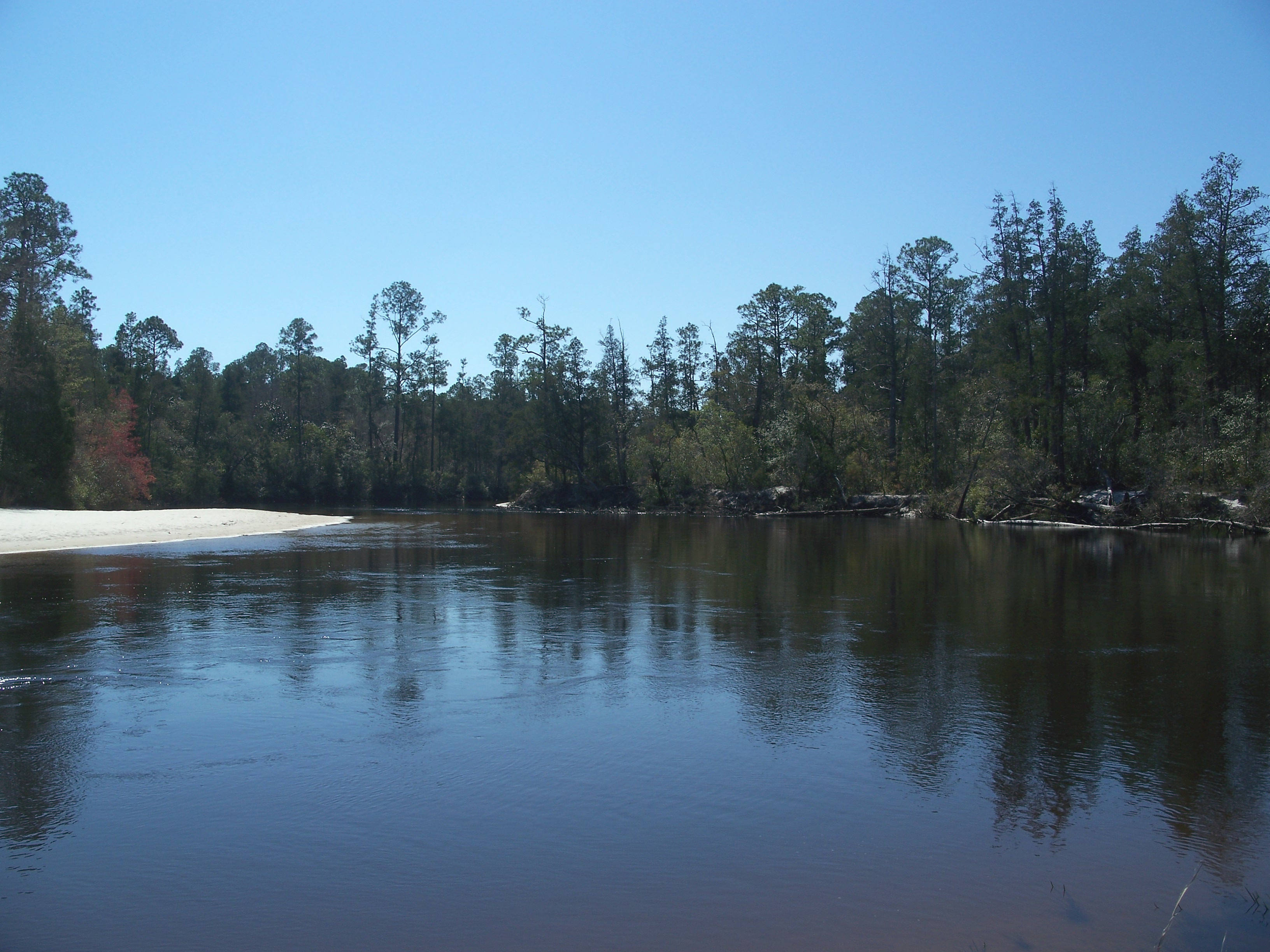
The Wacissa River is a large, spring-fed stream located in south-central Jefferson County, Florida. Its headwaters are located about a mile south of the town of Wacissa, where the river emerges crystal clear from a group of large limestone springs. From its headsprings, the river flows approximately south through a broad cypress swamp before breaking into numerous braided channels which join the Aucilla River a few miles further south. The river is managed by the Florida Fish & Wildlife Conservation Commission as part of the Aucilla Wildlife Management Area, and has been declared an Outstanding Florida Waterway by the Florida Department of Environmental Protection. The Wacissa Springs The springs that feed the Wacissa River emerge in a bottomland forest below the Cody Scarp, a relic marine terrace marked by a line of hills to the north. According to the Florida Bureau of Geology,Rosenau, et al., pp. 190 - 195 the group of springs consist of at least 12 known springs scatte ... [...More Info...] [...Related Items...] OR: [Wikipedia] [Google] [Baidu] |
Outstanding Florida Waters
Outstanding Florida Waters are rivers, lakes and other water features designated by the Florida Department of Environmental Protection (DEP) under authority of Section 403.061 (27), Florida Statutes as "worthy of special protection because of their natural attributes." Outstanding Florida Waters have special restrictions on any new activities that would lower water quality or otherwise degrade the body of water. The Outstanding Florida Water designation has been applied to all bodies of water in national parks, national wildlife refuges, national seashores, national preserves, national marine sanctuaries and estuarine research reserves, state parks and recreation areas, state preserves and reserves, state ornamental gardens and botanical sites, environmentally endangered lands programs, conservation and recreation lands programs, Save Our Coast program acquisitions, state aquatic preserves, scenic and wild rivers (both national and state), and certain waters in national forests. ... [...More Info...] [...Related Items...] OR: [Wikipedia] [Google] [Baidu] |
Rivers Of Florida
This is a list of streams and rivers in the U.S. state of Florida. With one exception, the streams and rivers of Florida all originate on the Coastal plain. That exception is the Apalachicola River, which is formed by the merger of the Chattahoochee River, which originates in the Appalachian Mountains, and the Flint River, which originates in the Piedmont. Most streams and rivers in Florida start from swamps, while some originate from springs or lakes. Many of the streams and rivers are underground for part of their courses. The Everglades, sometimes called the "river of grass", is a very wide and shallow river that originates from Lake Okeechobee. Most of Florida's streams and rivers drain into the Gulf of Mexico. Drainage on the east coast of Florida is dominated by the St. Johns River, which, with the swamps that form its headwaters, extends parallel to the coast from inland of Fort Pierce, Florida, Fort Pierce to Jacksonville, Florida, Jacksonville. By drainage basin Atlantic ... [...More Info...] [...Related Items...] OR: [Wikipedia] [Google] [Baidu] |
Ivory-billed Woodpecker
The ivory-billed woodpecker (''Campephilus principalis'') is a possibly extinct woodpecker that is native to the bottomland hardwood forests and temperate coniferous forests of the Southern United States and Cuba. Habitat destruction and hunting have reduced populations so thoroughly that the species is listed by the International Union for Conservation of Nature (IUCN) on its Red List as critically endangered, and by the American Birding Association as "definitely or probably extinct". The last universally accepted sighting of an American ivory-billed woodpecker occurred in Louisiana in 1944, and the last universally accepted sighting of a Cuban ivory-billed woodpecker occurred in 1987, after the bird's rediscovery there the prior year. Sporadic reports of sightings and other evidence of the persistence of the species have continued since then. The bird's preferred diet consists of large beetle larvae, particularly wood-boring Cerambycidae beetles, supplemented by vegetable mat ... [...More Info...] [...Related Items...] OR: [Wikipedia] [Google] [Baidu] |
George L
George may refer to: People * George (given name) * George (surname) * George (singer), American-Canadian singer George Nozuka, known by the mononym George * George Washington, First President of the United States * George W. Bush, 43rd President of the United States * George H. W. Bush, 41st President of the United States * George V, King of Great Britain, Ireland, the British Dominions and Emperor of India from 1910-1936 * George VI, King of Great Britain, Ireland, the British Dominions and Emperor of India from 1936-1952 * Prince George of Wales * George Papagheorghe also known as Jorge / GEØRGE * George, stage name of Giorgio Moroder * George Harrison, an English musician and singer-songwriter Places South Africa * George, Western Cape ** George Airport United States * George, Iowa * George, Missouri * George, Washington * George County, Mississippi * George Air Force Base, a former U.S. Air Force base located in California Characters * George (Peppa Pig), a 2-year-old pig ... [...More Info...] [...Related Items...] OR: [Wikipedia] [Google] [Baidu] |
Hydrilla
''Hydrilla'' (waterthyme) is a genus of aquatic plant, usually treated as containing just one species, ''Hydrilla verticillata'', though some botanists divide it into several species. It is native to the cool and warm waters of the Old World in Asia, Africa and Australia, with a sparse, scattered distribution; in Australia from Northern Territory, Queensland, and New South Wales.Flora Europaea''Hydrilla''/ref>Flora of Taiwan''Hydrilla''Australian Plant Name Index''Hydrilla''/ref> The stems grow up to 1–2m long. The leaves are arranged in whorls of two to eight around the stem, each leaf 5–20 mm long and 0.7–2 mm broad, with serrations or small spines along the leaf margins; the leaf midrib is often reddish when fresh. It is monoecious (sometimes dioecious), with male and female flowers produced separately on a single plant; the flowers are small, with three sepals and three petals, the petals 3–5 mm long, transparent with red streaks. It reproduces primarily ... [...More Info...] [...Related Items...] OR: [Wikipedia] [Google] [Baidu] |
Water Hyacinth
''Pontederia crassipes'' (formerly ''Eichhornia crassipes''), commonly known as common water hyacinth is an aquatic plant native to South America, naturalized throughout the world, and often invasive outside its native range.''Pontederia crassipes'' Kew Royal Botanic Gardens Plants of the World Online. Accessed April 19, 2022.''Eichhornia crassipes'' Kew Royal Botanic Gardens Plants of the World Online. Accessed April 19, 2022. June 15, 2016. Flora of Banglade ... [...More Info...] [...Related Items...] OR: [Wikipedia] [Google] [Baidu] |
Cody Scarp
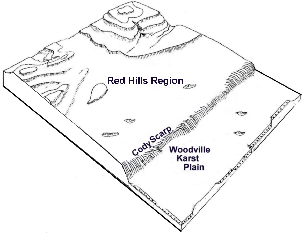
The Cody Scarp or Cody Escarpment is located in north and north central Florida United States. It is a relict scarp and ancient persistent topographical feature formed from an ancient early Pleistocene shorelines of ~1.8 million to 10,000 years BP during interglacial periods. The Cody Scarp has a slope of 5% to 12%. The Cody Scarp runs from just east of the Apalachicola River to Alachua County. It is the boundary over that range between the Gulf Coastal Lowlands and the Northern Highlands of Florida. The Gulf Coast Lowlands have only a thin layer of soil over limestone, while the Northern Highlands consist of plateaus of sand, clay and carbonate rock. The scarp rises about from the Gulf Coastal Lowlands to the Northern Highlands. The Cody Scarp and the Gulf Coastal Lowlands are karst landscapes, with many sinkholes, springs, underground streams, and related features. The scarp, at 42.6 meters (140 feet) to 45.7 meters (150 feet) above sea level, is most prominent in ... [...More Info...] [...Related Items...] OR: [Wikipedia] [Google] [Baidu] |
Aucilla Wildlife Management Area
Aucilla Wildlife Management Area conserves 50,549 acres of hydric hammock, mesic flatwoods, upland forest, and spring-run river twelve miles southeast of Tallahassee in Jefferson and Taylor Counties in Florida. Fauna The expanse of Aucilla WMA and its diversity of habitats provides a home to a large diversity of animal species. Mammals range from Florida black bears and bobcats to North American river otters and white-tailed deer. The property is part of the Great Florida Birding and Wildlife Trail due to its abundance of warblers, limpkins and wood storks, along with many other migratory and resident bird species. Reptiles and amphibians are represented by species such as eastern diamondback rattlesnakes, gopher tortoises and American alligators. History Evidence of Aucilla Wildlife Management Area's history dates back at least 12,000 years. Bones of prehistoric mammals such as mastodons and giant ground sloths have been found in the Wacissa River, Aucilla River and sinkho ... [...More Info...] [...Related Items...] OR: [Wikipedia] [Google] [Baidu] |
Jefferson County, Florida
Jefferson County is a county located in the Big Bend region in the northern part of the U.S. state of Florida. As of the 2020 census, the population was 14,510. Its county seat is Monticello. Jefferson County is part of the Tallahassee, FL Metropolitan Statistical Area but is the 3rd most rural county in Florida. There are no traffic signals within the entire county. History Jefferson County was created in 1827. It was named for Thomas Jefferson, third president of the United States, who had died the year before the county's establishment. Forts of Jefferson County * Fort Roger Jones (1839), Aucilla (Ocilla Ferry), north of US 90. * Fort Noel (1839–1842), south of Lamont on the Aucilla River, six miles (10 km) northwest of Fort Pleasant in Taylor County. Also known as Fort Number Three (M). * Camp Carter (1838), near Waukeenah. * Fort Welaunee (1838), a settlers' fort on the Welaunee Plantation near Wacissa. Fort Gamble (1839–1843) was later established here. * Fort ... [...More Info...] [...Related Items...] OR: [Wikipedia] [Google] [Baidu] |
Florida Fish & Wildlife Conservation Commission
The Florida Fish and Wildlife Conservation Commission (FWC) is a Florida government agency founded in 1999 and headquartered in Tallahassee. It manages and regulates the state's fish and wildlife resources, and enforces related laws. Officers are managers, researchers, and support personnel, and perform law enforcement in the course of their duties. History In 1998, an amendment to the Florida Constitution approved the establishment of the FWC with a headquarters in Tallahassee, the state capital, on July 1, 1999. It resulted from a merger between three former offices, namely the Marine Fisheries Commission, Division of Marine Resources, the former Florida Marine Patrol, and the Division of Law Enforcement of the Florida Department of Environmental Protection, and all of the employees and commissioners of the former Florida Game and Freshwater Fish Commission. The Florida Department of Environmental Protection since then serves as the environmental regulatory agency for the ... [...More Info...] [...Related Items...] OR: [Wikipedia] [Google] [Baidu] |
Aucilla River
The Aucilla River rises in Brooks County, Georgia, USA, close to Thomasville, and passes through the Big Bend region of Florida, emptying into the Gulf of Mexico at Apalachee Bay. Some early maps called it the Ocilla River. It is long and has a drainage basin of . Tributaries include the Little Aucilla and Wacissa Rivers. In Florida, the Aucilla River forms the eastern border of Jefferson County, separating it from Madison County on the northern part, and from Taylor County to the south. During the first Spanish period in Florida the Aucilla River was the boundary between the Apalachee people and the Timucua-speaking Yustaga (or Uzachile) people. The name "Aucilla" refers to an old Timucua village. Course and features The Aucilla River flows across a karst landscape, disappearing underground and then reappearing, first at Howell Sinks near Boston, Georgia, and then approximately 30 times in the area known as the ''Aucilla River Sinks'' on the lower part of the ri ... [...More Info...] [...Related Items...] OR: [Wikipedia] [Google] [Baidu] |
.jpg)


