|
Woodvale, Merseyside
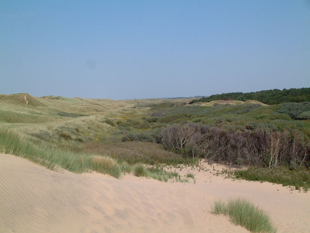
Woodvale is the southernmost suburb of the town of Southport, Merseyside, England. It is situated between Formby and Ainsdale, to the north of RAF Woodvale. References Towns and villages in the Metropolitan Borough of Sefton Southport {{Merseyside-geo-stub ... [...More Info...] [...Related Items...] OR: [Wikipedia] [Google] [Baidu] |
Metropolitan Borough Of Sefton
The Metropolitan Borough of Sefton is a metropolitan borough of Merseyside, England. It was formed on Local Government Act 1972, 1 April 1974, by the amalgamation of the county boroughs of Bootle and Southport, the municipal borough of Crosby, Merseyside, Crosby, the Urban district (Great Britain and Ireland), urban districts of Formby and Litherland, and part of West Lancashire Rural District. It consists of a Sefton Coast, coastal strip of land on the Irish Sea which extends from Southport in the north to Bootle in the south, and an inland part to Maghull in the south-east, bounded by the city of Liverpool to the south, the Metropolitan Borough of Knowsley to the south-east, and West Lancashire to the east. It is named after Sefton, Sefton, Sefton, near Maghull. When the borough was created, a name was sought that would not unduly identify the borough with any of its constituent parts, particularly the former county boroughs of Bootle and Southport. The area had strong links w ... [...More Info...] [...Related Items...] OR: [Wikipedia] [Google] [Baidu] |
Merseyside
Merseyside ( ) is a ceremonial counties of England, ceremonial and metropolitan county in North West England. It borders Lancashire to the north, Greater Manchester to the east, Cheshire to the south, the Wales, Welsh county of Flintshire across the Dee Estuary to the southwest, and the Irish Sea to the west. The largest settlement is the city of Liverpool. The county is highly urbanised, with an area of and a population of 1.42 million in 2007. After Liverpool (552,267), the largest settlements are Birkenhead (143,968), St Helens, Merseyside, St Helens (102,629), and Southport (94,421). For Local government in England, local government purposes the county comprises five metropolitan boroughs: Metropolitan Borough of Knowsley, Knowsley, Metropolitan Borough of St Helens, St Helens, Metropolitan Borough of Sefton, Sefton, Metropolitan Borough of Wirral, Wirral, and Liverpool. The borough councils, together with that of Borough of Halton, Halton in Cheshire, collaborate through th ... [...More Info...] [...Related Items...] OR: [Wikipedia] [Google] [Baidu] |
Southport (UK Parliament Constituency)
Southport is a List of United Kingdom Parliament constituencies, constituency in Merseyside which has been represented in the House of Commons of the United Kingdom, House of Commons of the Parliament of the United Kingdom, UK Parliament since 2024 by Patrick Hurley (British politician), Patrick Hurley of the Labour Party (UK), Labour Party. Boundaries Historic 1885–1918: The Borough of Southport, the Sessional Division of Southport, and the parishes of Blundell, Great and Little Crosby, Ince, and Thornton. 1918–1983: The County Borough of Southport. 1983–2024: The Metropolitan Borough of Sefton wards of Ainsdale, Birkdale, Cambridge, Dukes, Kew, Meols, and Norwood. Current Further to the 2023 Periodic Review of Westminster constituencies which came into effect for the 2024 United Kingdom general election, 2024 general election, the constituency was defined as being composed of the following as they existed on 1 December 2020: * The Metropolitan Borough of Sefton ... [...More Info...] [...Related Items...] OR: [Wikipedia] [Google] [Baidu] |
Sefton Central (UK Parliament Constituency)
Sefton Central is a constituency represented since its creation in 2010 by Bill Esterson of the Labour Party. Boundaries 2010-2024 The constituency was created for the 2010 general election, replacing much of Crosby along with part of Knowsley North and Sefton East.The constituency comprised the following electoral wards of the Metropolitan Borough of Sefton: *Blundellsands * Harington * Manor * Molyneux *Park * Ravenmeols * Sudell Current Further to the 2023 Periodic Review of Westminster constituencies which came into effect for the 2024 general election, the constituency is composed of the following wards of the Metropolitan Borough of Sefton (as they existed on 1 December 2020): * Ainsdale; Blundellsands; Harington; Manor; Molyneux (polling districts C1, C2 and C3); Park; Ravenmeols; Sudell. ''The Ainsdale ward was transferred from Southport, offset by the loss of the Aintree district in the Molyneux ward to Liverpool Walton.'' The constituency covers Merseys ... [...More Info...] [...Related Items...] OR: [Wikipedia] [Google] [Baidu] |
Southport
Southport is a seaside resort, seaside town in the Metropolitan Borough of Sefton in Merseyside, England. It lies on the West Lancashire Coastal Plain, West Lancashire coastal plain and the east coast of the Irish Sea, approximately north of Liverpool and southwest of Preston, Lancashire, Preston. At the United Kingdom Census 2021, 2021 census, Southport had a population of 94,421, making it the List of North West England cities and metropolitan areas by population, eleventh most populous settlement in North West England and the third most populous settlement in the Liverpool City Region. The town was founded in 1792 by William Sutton (Southport), William Sutton, an innkeeper from Churchtown, Merseyside, Churchtown, who built a bathing house at what is now the south end of Lord Street, Southport, Lord Street.''North Meols and Southport – a History'', Chapter 9, Peter Aughton (1988) The area was previously known as South Hawes, and was sparsely populated and dominated ... [...More Info...] [...Related Items...] OR: [Wikipedia] [Google] [Baidu] |
Formby
Formby is a town and Civil parishes in England, civil parish in the Metropolitan Borough of Sefton, Merseyside, England. Historic counties of England, Historically in Lancashire, three manors are recorded in the Domesday Book of 1086 under "Fornebei", Halsall, Walton and Poynton. Cockle (bivalve), Cockle raking and shrimp fishing lasted into the 19th century. By 1872, the township and sub-district was made up of two chapelries (St Peter's Church, Formby, St Peter's and St Luke's Church, Formby, St Luke's), Birkdale township, the hamlets of Ainsdale and Raven-Meols and Altcar parish. The Section dedicated to Formby. Formby was built on the plain adjoining the Irish Sea coast a few miles north of the Crosby, Merseyside, Crosby channel. A commuter town for Liverpool, Formby is also a tourist destination with Day-tripper, day trippers attracted to its beaches, sand dunes and wildlife, particularly the endangered red squirrel and natterjack toad. The area is conserved by the Nati ... [...More Info...] [...Related Items...] OR: [Wikipedia] [Google] [Baidu] |
Ainsdale
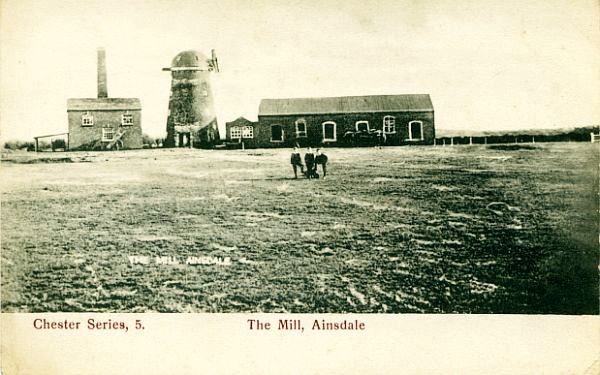
Ainsdale is a village near Southport, in the Metropolitan Borough of Sefton, Sefton district, in Merseyside, England, situated three miles south of the centre of Southport. Originally in the Historic counties of England, historic county of Lancashire, at the United Kingdom Census 2001, 2001 Census it had a population of 12,723. By the time of the 2011 census, only figures for Ainsdale (ward) were available. It makes up the southern edge of the town, separated from neighbouring Formby by RAF Woodvale. The village and roads leading to the beach are middle class areas, with some new modern developments around the station, including the addition of the private estate Village Row in 2006, and the Belway estate in 2013. History Prior to 1600 Ainsdale was listed in the ''Domesday Book'' as ''Einulvesdel''. Deriving from Old Norse name ''Einulfsdalr'', this apparently was the valley occupied by a Scandinavian by the name of Einulf. 1600–present Ainsdale formed part of Sir Cuthbert Ha ... [...More Info...] [...Related Items...] OR: [Wikipedia] [Google] [Baidu] |
RAF Woodvale
Royal Air Force Woodvale or more simply RAF Woodvale is a Royal Air Force Station located next to the towns of Formby and Ainsdale in an area called Woodvale which is located to the south of Southport, Merseyside. Woodvale was constructed as an all-weather night fighter airfield for the defence of Liverpool. However, it did not open until 7 December 1941 which was just after the Liverpool Blitz which peaked in May of that year. History Second World War Woodvale opened in December 1941, six months after the end of the Liverpool Blitz. It was used for short periods by RAF squadrons that were rotated out of the zones in southern of England closest to German-occupied Europe. During their time at Woodvale, squadrons defended Merseyside. Polish 308 (Krakowski) Squadron was the first to arrive, on 12 December 1941, from RAF Northolt before leaving on 1 April 1942. Squadrons were rotated regularly. Several were Polish, including 315 (Dęblinski) Squadron and 317 (Wilenski) Squad ... [...More Info...] [...Related Items...] OR: [Wikipedia] [Google] [Baidu] |
Towns And Villages In The Metropolitan Borough Of Sefton
A town is a type of a human settlement, generally larger than a village but smaller than a city. The criteria for distinguishing a town vary globally, often depending on factors such as population size, economic character, administrative status, or historical significance. In some regions, towns are formally defined by legal charters or government designations, while in others, the term is used informally. Towns typically feature centralized services, infrastructure, and governance, such as municipal authorities, and serve as hubs for commerce, education, and cultural activities within their regions. The concept of a town varies culturally and legally. For example, in the United Kingdom, a town may historically derive its status from a market town designation or royal charter, while in the United States, the term is often loosely applied to incorporated municipalities. In some countries, such as Australia and Canada, distinctions between towns, cities, and rural areas are base ... [...More Info...] [...Related Items...] OR: [Wikipedia] [Google] [Baidu] |


