|
Woodlawn, Nova Scotia
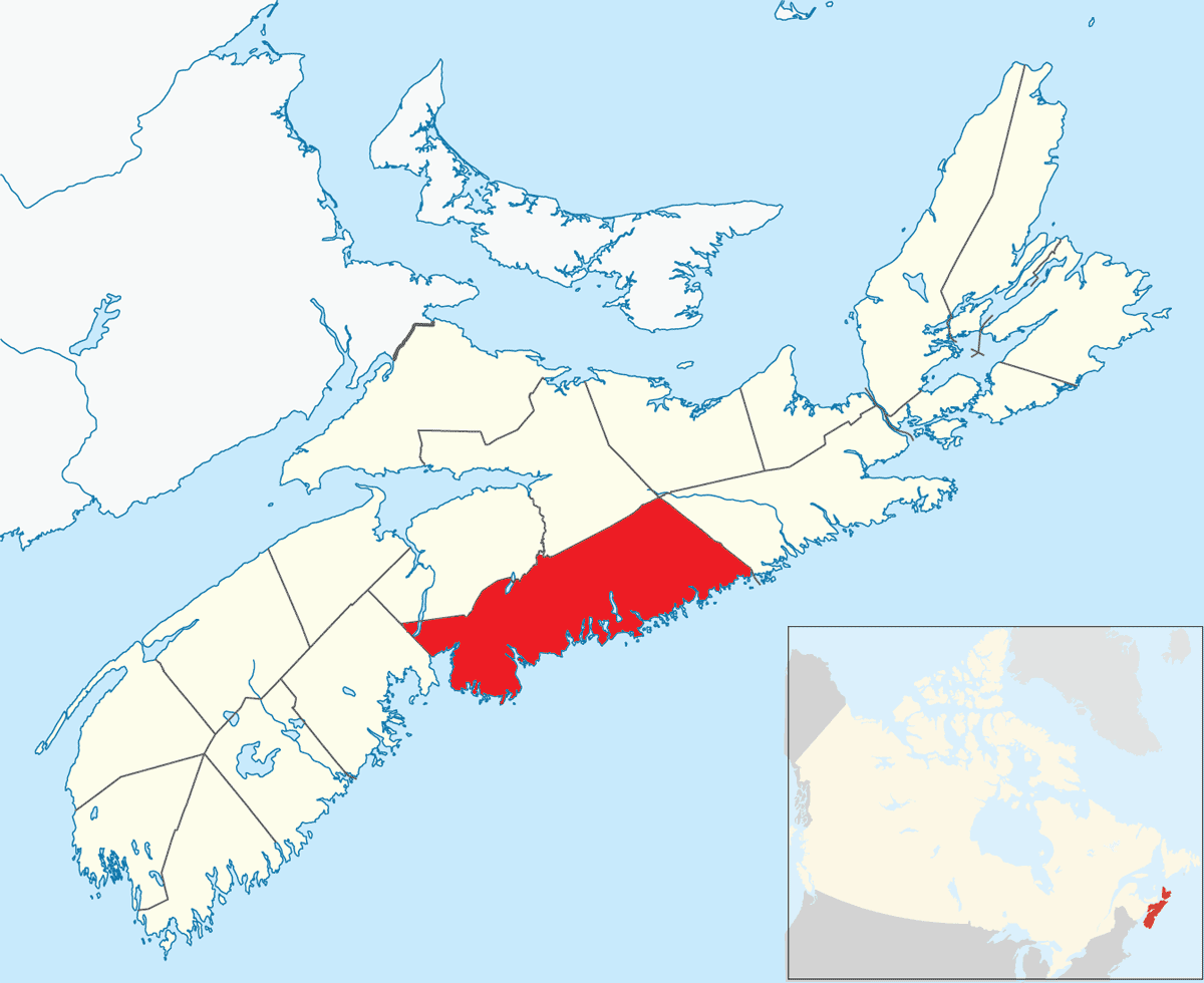
Woodlawn is an area of eastern Dartmouth, Nova Scotia in the Halifax Regional Municipality, Nova Scotia that is mainly residential and retail. It is situated within an area with Highway 111 on the west, Portland Street ( Route 207) on the east and Main Street ( Trunk 7) on the North side. The first three digits of the postal code are B2W. History Settlement in the Woodlawn area began as early as 1754 when the road between the Dartmouth ferry and the community of Lawrencetown was under construction. Some of the first settlers were United Empire Loyalists who moved to Nova Scotia after the American Revolution. The area initially got its name from the Woodlawn Cemetery, established by Ebenezer Allen in the late 1700s for local residents. Among those buried in the graveyard are Jane and Margaret Meagher, otherwise known as the "Babes in the Woods", who disappeared from their home in 1842. After an exhaustive search of the surrounding woods, they were found dead several days later a ... [...More Info...] [...Related Items...] OR: [Wikipedia] [Google] [Baidu] |
Locality (settlement)
In geography, statistics and archaeology, a settlement, locality or populated place is a community of people living in a particular place. The complexity of a settlement can range from a minuscule number of dwellings grouped together to the largest of cities with surrounding urbanized areas. Settlements include homesteads, hamlets, villages, towns and cities. A settlement may have known historical properties such as the date or era in which it was first settled or first settled by particular people. A number of factors like war, erosion, and the fall of great empires can result in the formation of abandoned settlements which provides relics for archaeological studies. The process of settlement involves human migration. In the field of geospatial predictive modeling, settlements are "a city, town, village or other agglomeration of buildings where people live and work". A settlement conventionally includes its constructed facilities such as roads, enclosures, field s ... [...More Info...] [...Related Items...] OR: [Wikipedia] [Google] [Baidu] |
Lawrencetown, Halifax County, Nova Scotia
Lawrencetown (1986 population: 2,680) is a Canadian rural community in the Halifax Regional Municipality in Nova Scotia, Canada. The settlement was established during the eve of Father Le Loutre's War and at the beginning of the French and Indian War. History Father Le Loutre's War began when Edward Cornwallis arrived to establish Halifax with 13 transports on June 21, 1749. To guard against Mi'kmaq, Acadian and French attacks on the new Protestant settlements, British fortifications were erected in Halifax (1749), Bedford ( Fort Sackville) (1749), Dartmouth (1750), Lunenburg (1753) and Lawrencetown (1754). In 1754, Nova Scotia's Lieutenant Governor Charles Lawrence, offered land grants to twenty families, who referred to their settlement as Lawrence's Town, which became Lawrencetown. The Acadians and natives resisted the British occupation of Nova Scotia and Acadia by raiding the various communities. In late April 1754, at the outbreak of the French and Indian War, Jos ... [...More Info...] [...Related Items...] OR: [Wikipedia] [Google] [Baidu] |
Eric Graves Memorial Junior High School
The Halifax Regional Centre for Education (formerly the Halifax Regional School Board) is the public school district responsible for 136 elementary, junior high, and high schools located in the Halifax Regional Municipality. The current Regional Executive Director is Steve Gallagher. The district's office is on Spectacle Lake Drive in Dartmouth. The district's stated vision is "to provide a high quality education to every student every day". On January 24, 2018, the provincial government announced that the Halifax Regional School Board would be dissolved and that kindergarten to grade 12 education services in Halifax would administered by an appointed provincial council. The Halifax Regional School Board was dissolved on March 31, 2018. History The Halifax Regional School Board was created in 1996 with the amalgamation of three school boards that had jurisdiction over the former components of the Halifax Regional Municipality, which was created at the same time. Board elections ... [...More Info...] [...Related Items...] OR: [Wikipedia] [Google] [Baidu] |
Portland Estates, Nova Scotia
Portland Estates is a suburban neighbourhood in Woodlawn, an area of eastern Dartmouth in the Halifax Regional Municipality, Nova Scotia. It reaches from Eisener Blvd. in the west, all the way to Portland Hills in the east, and is located to the south of Portland Street ( Route 207). Geography A relatively small neighbourhood, the size of Portland Estates is about . Transportation Portland Estates is served by Metro Transit - Bus #57. One of the municipality's new bus rapid transit routes has a terminus in Portland Hills. Shopping Adjacent to Portland Estates *Real Atlantic Superstore Within a couple kilometres *Woodlawn Shopping Centre *Penhorn Plaza Schools *Elementary (grades primary to 6) - Portland Estates Elementary School *Junior High (grades 7-9) -- Ellenvale Junior High School *High Schools (grades 10-12) **English, with optional International Baccalaureate (IB) Diploma program - Woodlawn High School **French Immersion - Dartmouth High School **French Immersi ... [...More Info...] [...Related Items...] OR: [Wikipedia] [Google] [Baidu] |
Greenough Settlement, Nova Scotia
Greenough is a mostly-residential neighbourhood in Dartmouth, Nova Scotia Nova Scotia is a Provinces and territories of Canada, province of Canada, located on its east coast. It is one of the three Maritime Canada, Maritime provinces and Population of Canada by province and territory, most populous province in Atlan .... It is located in the east end of Dartmouth in the Woodlawn area. References Communities in Halifax, Nova Scotia Dartmouth, Nova Scotia {{HalifaxNS-geo-stub ... [...More Info...] [...Related Items...] OR: [Wikipedia] [Google] [Baidu] |
Ellenvale, Nova Scotia
Ellenvale is a mostly residential neighbourhood in the Dartmouth area of Halifax Regional Municipality, Nova Scotia. It is located in the east end of Dartmouth in the Woodlawn area. History Along with other residential subdivisions in the Woodlawn area, the Ellenvale subdivision was established in the mid-1950s. By 1955, 400 building lots had been set aside. In 1967, Ellenvale Junior High School was established, followed by Brookhouse Elementary School in the subsequent year. Geography Ellenvale is a relatively small neighbourhood A neighbourhood (Commonwealth English) or neighborhood (American English) is a geographically localized community within a larger town, city, suburb or rural area, sometimes consisting of a single street and the buildings lining it. Neighbourh ... of . Schools * Brookhouse Elementary School * Ellenvale Junior High School References Communities in Halifax, Nova Scotia Dartmouth, Nova Scotia {{HalifaxNS-geo-stub ... [...More Info...] [...Related Items...] OR: [Wikipedia] [Google] [Baidu] |
Commodore Park, Nova Scotia
Commodore Park is a mostly residential neighbourhood in the Dartmouth community of the Halifax Regional Municipality, Nova Scotia. It is located in the east end of Dartmouth in the Woodlawn area. Prince Andrew High School is located within this area. History Commodore Park was established as a subdivision during the general housing boom in Dartmouth in the 1950s. By 1955, 200 building lots had been set aside and 50 houses had been built. The subdivision was developed by Commodore Company Limited. The land comprising the area was originally owned by various landowners, including Bert C. Farquharson and Allison R. Morash. Their names are reflected in the area's Farquharson Street and Morash Pond. Prince Andrew High School was built in 1960, shortly before the town and county areas of Dartmouth (including Woodlawn) were amalgamated into the City of Dartmouth in 1961. Street names Many of the streets in Commodore Park were named for Canadian naval ships that were lost during t ... [...More Info...] [...Related Items...] OR: [Wikipedia] [Google] [Baidu] |
Bel Ayr Park, Nova Scotia
Bel Ayr Park is a mostly residential neighbourhood in the Dartmouth community of Halifax Regional Municipality, Nova Scotia, Canada. It is located in the east end of Dartmouth in the Woodlawn area. The houses in this area mostly made of brick A brick is a type of construction material used to build walls, pavements and other elements in masonry construction. Properly, the term ''brick'' denotes a unit primarily composed of clay. But is now also used informally to denote building un .... References External linksmap Communities in Halifax, Nova Scotia Dartmouth, Nova Scotia {{HalifaxNS-geo-stub ... [...More Info...] [...Related Items...] OR: [Wikipedia] [Google] [Baidu] |


