|
Wollaston Lake
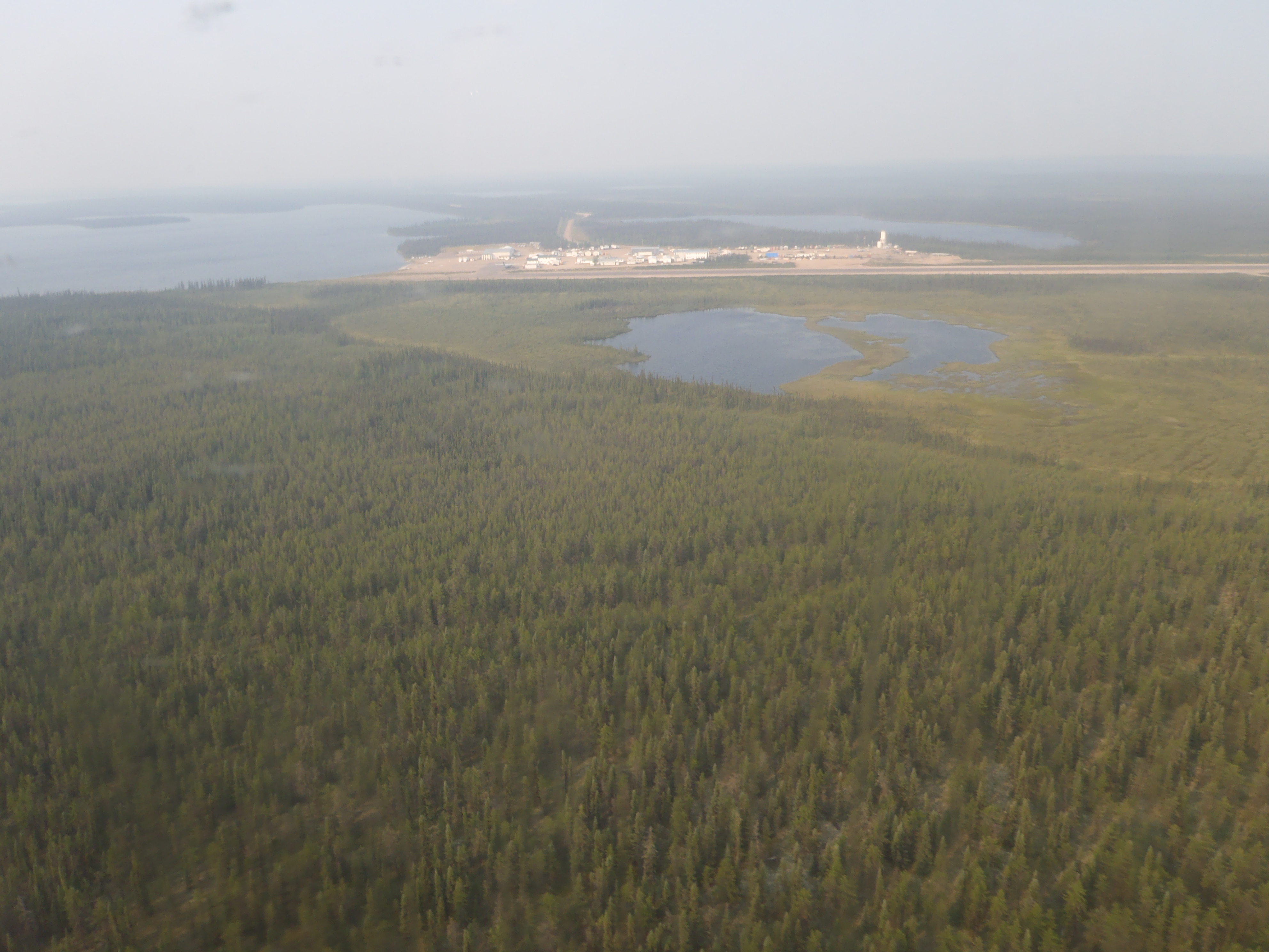
Wollaston Lake () is a lake in the north-eastern part of the Canadian province of Saskatchewan. It is about north-east of Prince Albert. With a surface area of (excluding islands; if islands are included), it is the largest bifurcation lake in the world — that is, a lake that drains naturally in two directions. About 10% of the lake's water drains into the Fond du Lac River, which flows out of the lake to the north-west, where it drains into Lake Athabasca, which ultimately drains into the Arctic Ocean via the Mackenzie River system. The rest of the water drains into the Cochrane River, which flows out of the north-eastern side of the lake and into Reindeer Lake, which drains via the Churchill River system into Hudson Bay. Wollaston Lake's main inflow is the Geikie River which flows from the south-west into the south-west section of the lake. If Hudson Bay is considered an arm of the Atlantic Ocean, then the Geikie is the largest river in the world to flow naturally ... [...More Info...] [...Related Items...] OR: [Wikipedia] [Google] [Baidu] |
NASA
The National Aeronautics and Space Administration (NASA ) is an independent agencies of the United States government, independent agency of the federal government of the United States, US federal government responsible for the United States's civil list of government space agencies, space program, aeronautics research and outer space, space research. National Aeronautics and Space Act, Established in 1958, it succeeded the National Advisory Committee for Aeronautics (NACA) to give the American space development effort a distinct civilian orientation, emphasizing peaceful applications in space science. It has since led most of America's space exploration programs, including Project Mercury, Project Gemini, the 1968–1972 Apollo program missions, the Skylab space station, and the Space Shuttle. Currently, NASA supports the International Space Station (ISS) along with the Commercial Crew Program and oversees the development of the Orion (spacecraft), Orion spacecraft and the Sp ... [...More Info...] [...Related Items...] OR: [Wikipedia] [Google] [Baidu] |
Reindeer Lake
Reindeer Lake is a large lake in Western Canada located on the border between north-eastern Saskatchewan and north-western Manitoba, with the majority in Saskatchewan. The name of the lake appears to be a translation of the Algonquian name. It is the 21st largest lake in the world by area, as well as being the second-largest lake in Saskatchewan and the ninth largest in Canada. Eight percent of the lake lies in Manitoba while 92% of the lake is in Saskatchewan. Access to the lake is from Saskatchewan's Highways 102 and 994 and Manitoba's Highway 394. Highway 102 ends at the community of Southend at Reindeer Lake's southern end. Highway 394 ends at the Saskatchewan border and carries on as Highway 994 for into Kinoosao on the eastern shore. Geography Reindeer Lake has a heavily indented shoreline and contains numerous small islands. On its eastern shore is the community of Kinoosao, at its northern end Brochet, Manitoba; and at its southern end, Southend, Saskatchewa ... [...More Info...] [...Related Items...] OR: [Wikipedia] [Google] [Baidu] |
Points North Landing
Points North Landing is a camp settlement in northeastern Saskatchewan, Canada. It is 355 kilometres north-east of La Ronge, on Highway 905 and has an airport and a water aerodrome, with almost daily flights provided by West Wind Aviation and Transwest Air. Gasoline, diesel, mechanics, a lumber yard, and accommodations are available. University of Waterloo The University of Waterloo (UWaterloo, UW, or Waterloo) is a Public university, public research university located in Waterloo, Ontario, Canada. The main campus is on of land adjacent to uptown Waterloo and Waterloo Park. The university also op ... student Kenton Carnegie was killed by timber wolves within this region on November 8, 2005. It is used as a staging area and logistics area for a variety of activities in northern Saskatchewan. All-weather roads connect the location to the south and temporary winter roads are constructed from Points North Landing to various communities in the North. Several uranium mines are ... [...More Info...] [...Related Items...] OR: [Wikipedia] [Google] [Baidu] |
Wollaston Barge Ferry
The Wollaston Lake Barge Ferry is a barge ferry that operates in the Canadian province of Saskatchewan in the Northern Saskatchewan Administration District of the province. The ferry crosses Wollaston Lake, providing a link between Highways 905 and 995 and the community of Wollaston Lake, Saskatchewan. The barge is operated by the Hatchet Lake Dene Nation under contract to the Government of Saskatchewan. The barge has tolls and operates twice per day during the ice-free season while an ice-road is used during part of the winter. Passage must be pre-booked. The ferry has a length of , a width of , and a load limit of . It is the only non-cable ferry in the province. See also *Transportation in Saskatchewan Saskatchewan has a transportation infrastructure system of roads, highways, freeways, airports, ferries, pipelines, trails, waterways, and railway systems serving a population of approximately 1,132,505 (according to 2021 census) inhabitants year ... References F ... [...More Info...] [...Related Items...] OR: [Wikipedia] [Google] [Baidu] |
La Ronge
La Ronge is a List of municipalities in Saskatchewan, northern town in the boreal forest of Canada, boreal forest of Saskatchewan, Canada. The town is also the namesake of the larger #Population centre, La Ronge population centre, the largest in northern Saskatchewan, comprising the Northern village (Saskatchewan), Northern Village of Air Ronge, and the Kitsakie 156B and Lac La Ronge 156 Indian reserve, reserves of the Lac La Ronge First Nation. The town is located approximately north of Prince Albert, Saskatchewan, Prince Albert and lies on the western shore of Lac la Ronge, is adjacent to Lac La Ronge Provincial Park, and is on the edge of the Canadian Shield. History The name "La Ronge" comes from the lake itself, although the actual origin of the name is uncertain. The French language, French verb ''ronger'' translates as "to gnaw", with at least one explanation theorising that 17th- and 18th-century Canadian fur trade, French fur traders referred to the lake as ''la r ... [...More Info...] [...Related Items...] OR: [Wikipedia] [Google] [Baidu] |
Saskatchewan Highway 905
Highway 905 is a provincial highway in the far north region of the Canadian province of Saskatchewan. It runs from Highway 102 to Stony Rapids. It is about long and is entirely unpaved. A section between Points North Landing and Black Lake is a seasonal winter road. History Highway 905 was originally designated as Highway 105, but was renumbered in the early 1980s as part of the establishment of the 900-series highways. In the late 1990s, the winter road between Points North Landing Black Lake was constructed, resulting Highway 964 being renumbered and Highway 905 ending at Stony Rapids. Route description Highway 905 begins at Highway 102, about southwest of Southend. The highway heads in a northerly direction passing by, and providing access to, Davin Lake Recreation Site, Courtenay Lake Recreation Site, Geikie River Recreation Site, Wollaston Lake Barge Ferry at Hidden Bay on Wollaston Lake, and Wollaston Lake Recreation Si ... [...More Info...] [...Related Items...] OR: [Wikipedia] [Google] [Baidu] |
Wollaston Lake Airport
Wollaston Lake Airport is located adjacent to Wollaston Lake in Saskatchewan, Canada on the Hatchet Lake Dene Nation. The airport consists of one runway (17/35) and a single apron. Transwest Air maintained a terminal, a fuel tank and a hangar at the airport. Pronto Airways maintains a terminal. Airlines and destinations Charter air service was provided by Transwest Air's (Piper PA-31 Navajo based in Wollaston Lake), West Wind Aviation, Osprey Wings and Courtesy Air. Passenger See also *List of airports in Saskatchewan This is a list of airports in Saskatchewan. It includes all Nav Canada certified and registered water and land airports, Aerodrome#Canada, aerodromes and heliports in the Provinces and territories of Canada, Canadian province of Saskatchewan. Air ... References External links * Certified airports in Saskatchewan {{Saskatchewan-airport-stub ... [...More Info...] [...Related Items...] OR: [Wikipedia] [Google] [Baidu] |
Dene
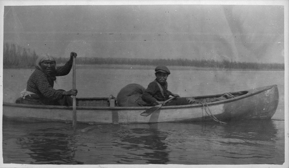
The Dene people () are an Indigenous group of First Nations who inhabit the northern boreal, subarctic and Arctic regions of Canada. The Dene speak Northern Athabaskan languages and it is the common Athabaskan word for "people". The term ''"Dene"'' has two uses: Most commonly, ''"Dene"'' is used narrowly to refer to the Athabaskan speakers of the Northwest Territories in Canada who form the Dene Nation: the Chipewyan (Denesuline), Tłı̨chǫ (''Dogrib''), Yellowknives (T'atsaot'ine), Slavey (Deh Gah Got'ine or Deh Cho), Sahtu (Sahtúot’ine), and Gwichʼin (Dinjii Zhuh). ''"Dene"'' is sometimes also used to refer to all Northern Athabaskan speakers, who are spread in a wide range all across Alaska and northern Canada. The Dene people are known for their oral storytelling. Location Dene are spread through a wide region. They live in the Mackenzie Valley (south of the Inuvialuit), and can be found west of Nunavut. Their homeland reaches to western Yukon, and ... [...More Info...] [...Related Items...] OR: [Wikipedia] [Google] [Baidu] |
William Hyde Wollaston
William Hyde Wollaston (; 6 August 1766 – 22 December 1828) was an English chemist and physicist who is famous for discovering the chemical elements palladium and rhodium. He also developed a way to process platinum ore into malleable ingots,Melvyn C. UsselmanWilliam Hyde WollastonEncyclopædia Britannica, retrieved 31 March 2013 patented the camera lucida, and made contributions in electricity and spectroscopy. Life He was born in East Dereham in Norfolk, the son of the Francis Wollaston (1737–1815), a noted amateur astronomer, and his wife Althea Hyde. He was one of 17 children, but the family was financially well-off and he enjoyed an intellectually stimulating environment. He was educated privately (and remotely) at Charterhouse School from 1774 to 1778 then studied Sciences at Gonville and Caius College, Cambridge. In 1793 he obtained his doctorate (MD) in medicine from Cambridge University, and was a Fellow of his college from 1787 to 1828. He worked as a ph ... [...More Info...] [...Related Items...] OR: [Wikipedia] [Google] [Baidu] |
Peter Fidler (explorer)
Peter Fidler (16 August 1769 – 17 December 1822) was a British surveyor, map-maker, fur trader and explorer who had a long career in the employ of the Hudson's Bay Company (HBC) in what later became Canada. He was born in Bolsover, Derbyshire, England and died at Fort Dauphin in present-day Manitoba. He married Mary (Methwewin) Mackagonne, a Cree woman, and together they had 14 children. Career Fidler joined the Hudson's Bay Company as a labourer at London and took up his post at York Factory in 1788. He was promoted to clerk and posted to Manchester House and South Branch House in what later became Saskatchewan within his first year. In 1790, he was transferred to Cumberland House and given training in surveying and astronomy by Philip Turnor who also trained David Thompson. On 23 December 1788, Thompson had seriously fractured his leg, forcing him to spend the next two winters at Cumberland House convalescing which gave Fidler the opportunity to accompany Turnor on an exp ... [...More Info...] [...Related Items...] OR: [Wikipedia] [Google] [Baidu] |
David Thompson (explorer)
David Thompson (30 April 1770 – 10 February 1857) was an English Canadians, Anglo-Canadian fur trader, Surveying, surveyor, and Cartography, cartographer, known to some native people as "Koo-Koo-Sint" or "the Stargazer". Over Thompson's career, he travelled across North America, mapping of the continent along the way. For this historic feat, Thompson has been described as the "greatest practical land geographer that the world has produced". Early life David Thompson was born in Westminster, Middlesex, to recent Welsh people, Welsh migrants from Radnorshire David and Ann Thompson. They changed their family name from ap Thomas to Thompson. When Thompson was two, his father died. Due to his widowed mother not having financial resources, she placed Thompson, 29 April 1777, the day before his seventh birthday, and his older brother in the Grey Coat Hospital, a school for the disadvantaged of Westminster. Thompson graduated to the Grey Coat mathematical school, well known for te ... [...More Info...] [...Related Items...] OR: [Wikipedia] [Google] [Baidu] |
Samuel Hearne
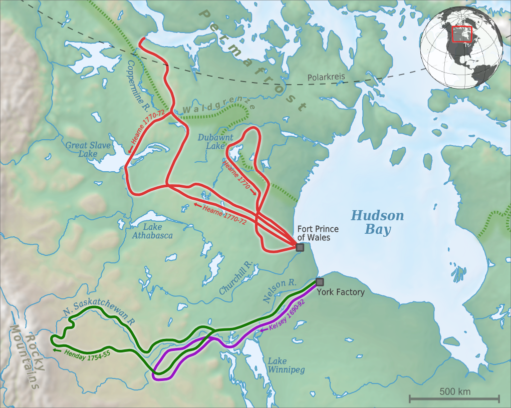
Samuel Hearne (February 1745 – November 1792) was an English explorer, fur-trader, author and naturalist. He was the first European to make an overland excursion across northern Canada to the Arctic Ocean, specifically to Coronation Gulf, via the Coppermine River. In 1774, Hearne built Cumberland House for the Hudson's Bay Company, its second interior trading post after Henley House and the first permanent settlement in present Saskatchewan. Biography Samuel Hearne was born in February 1745 in London. Hearne's father was Secretary of the Waterworks of London Bridge, died in 1748. His mother's name was Diana, and his sister Sarah was three years younger than him. Samuel Hearne joined the British Royal Navy in 1756 at the age of 11 as midshipman under the fighting captain Samuel Hood. He remained with Hood during the Seven Years' War, seeing considerable action during the conflict, including the bombardment of Le Havre in 1759. At the end of the war, having served in the E ... [...More Info...] [...Related Items...] OR: [Wikipedia] [Google] [Baidu] |


